Prague 13
| Prague 13 | |||
|---|---|---|---|
|
|||
| Basic data | |||
| State : |
|
||
| Region : | Hlavní město Praha | ||
| Municipality : | Praha | ||
| Area : | 1249 ha | ||
| Geographic location : | 50 ° 3 ' N , 14 ° 19' E | ||
| Residents : | 61,627 (December 31, 2015) | ||
| Postal code : | 155 00, 158 00 | ||
| structure | |||
| Status: | District ( městská část ) | ||
| administration | |||
| Mayor : | David Vodrážka ( ODS ) (as of 2016) | ||
| Address: | Sluneční nám. 13 158 00 Prague 5 |
||
| Website : | www.praha13.cz | ||
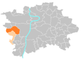
Prague 13 is an administrative district and a district of the Czech capital Prague . The district is in the west of the city.
structure
The Prague 13 administrative district comprises the two districts Prague 13 (1249 ha) and Řeporyje (987 ha).
The Prague 13 district in turn includes most of the cadastral communities Stodůlky and Třebonice and the Nová věs settlement of the Jinonice cadastral community, which otherwise belongs to Prague 5 . A small uninhabited area of the cadastral municipality Řeporyje does not belong to the district of the same name, but also to Prague 13.
development
The area of the Prague 13 district has been part of the Prague metropolitan area since 1974. The original municipalities of Stodůlky , Velká Ohrada , Malá Ohrada and Třebonice formed part of the Prague 5 district. In 1978, an archaeological investigation discovered a burial ground of the Aunjetitz culture .
The completion of metro line B to Zličín resulted in an upgrading of the area and a phase of construction and urban development that continues to this day began. The large residential complex Jihozápadní město ("southwest town") was gradually built, which today has over 50,000 inhabitants. In the center there is an extensive park that is part of a green corridor . In 2007 the construction of another complex called Západní město ("West Town") began.
The headquarters of the domestic intelligence service BIS


