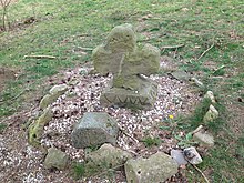
Quentel (Hessisch Lichtenau)
|
Quentel
City of Hessisch Lichtenau
Coordinates: 51 ° 11 ′ 57 ″ N , 9 ° 38 ′ 46 ″ E
|
|
|---|---|
| Height : | approx. 340 (325–355) m above sea level NHN |
| Area : | 8.24 km² |
| Residents : | 542 (Nov. 15, 2011) |
| Population density : | 66 inhabitants / km² |
| Incorporation : | 1st January 1974 |
| Postal code : | 37235 |
| Area code : | 05602 |
Quentel is a district of Hessisch Lichtenau in the Werra-Meißner district in northern Hesse .
Geographical location
Quentel lies between the Melsunger Bergland in the south and the Söhre in the north. Near the Geo-Naturpark Frau-Holle-Land (Werratal.Meißner.Kaufunger Wald) it is - viewed counterclockwise - 5.2 km west of the core city of Hessisch Lichtenau, 2.3 km southwest of the Hessisch Lichtenau district of Fürstenhagen , 2, 1 km south of the St. Ottilien district of Helsa , 4 km east-northeast of the Söhrewald district of Eiterhagen and 3.5 km north-northwest of the Melsungen district of Günsterode .
Due to the 325 to 355 m above sea level. NHN- lying village flows approximately in an east-west direction an upper course section of the Fulda tributary Mülmisch . Mountains in the vicinity are in the northeast of the Koppe ( 456.4 m ) and in the southeast of Breitenberg ( 513.2 m ) to the east of it something situated Breiter Berg ( 533.2 m ). A few kilometers away are the Kaufunger Wald (max. 643.4 m ) in the north-northeast and the Hohe Meißner (max. 753.6 m ) in the east.
history
In 1321 the village was first mentioned as Quentayl . In 1322 the place name was Quental . The village came in 1530, in exchange for Vockerode-Dinkelberg , Schnellrode and Weidelbach from office Spangenberg for office Lichtenau to which it belonged until the 1,821th During the French occupation, the place belonged to the canton of Kaufungen in the Kingdom of Westphalia (1807-1813). In 1817 the church was built on the foundation of a previous building. The school was added in 1913. Today it is the village community center .
The medieval Franzosenstrasse runs past the village to the east and the salt trade route Sälzer Weg , which already existed before Christ's birth and is used today as a forest and hiking trail, runs south .
On January 1, 1974, was in the course of administrative reform in Hesse until then the district Witzenhausen belonging municipality powerful state law in the city of Hessisch Lichtenau in the newly formed Werra-Meissner incorporated .
Population development
| year | Ew. | year | Ew. | year | Ew. |
|---|---|---|---|---|---|
| 1680 | 157 | 1939 | 462 | 1970 | 550 |
| 1850 | 450 | 1960 | 570 | 1981 | 617 |
| 1895 | 393 | 1961 | 551 | 2011 | 542 |
traffic
Coming from the federal road 7 ( Kassel - Eisenach ) in Fürstenhagen leads gradually through Quentel and then on to Eiterhagen in east-north-east-west-south-west direction the state road 3228.
Individual evidence
- ↑ a b Quentel, Werra-Meißner district. Historical local dictionary for Hessen. (As of November 11, 2014). In: Landesgeschichtliches Informationssystem Hessen (LAGIS).
- ↑ Facts & Figures. In: Internet presence. City of Hessisch Lichtenau, archived from the original on April 12, 2013 ; accessed in October 2018 .
- ↑ Map services of the Federal Agency for Nature Conservation ( information )
- ↑ Law on the reorganization of the districts of Eschwege and Witzenhausen (GVBl. II 330-21) of September 28, 1973 . In: The Hessian Minister of the Interior (ed.): Law and Ordinance Gazette for the State of Hesse . 1973 No. 25 , p. 353 , §§ 8 and 13 ( online at the information system of the Hessian Landtag [PDF; 2,3 MB ]).
- ^ Federal Statistical Office (ed.): Historical municipality directory for the Federal Republic of Germany. Name, border and key number changes in municipalities, counties and administrative districts from May 27, 1970 to December 31, 1982 . W. Kohlhammer, Stuttgart / Mainz 1983, ISBN 3-17-003263-1 , p. 410 .
- ↑ a b c d e f Quentel , on hessisch-lichtenau.de
- ↑ Population from 1970 based on census , according to Quentel , on hessisch-lichtenau.de
Web links
- Quentel , on hessisch-lichtenau.de
- Quentel, Werra-Meißner district. Historical local dictionary for Hessen. (As of November 11, 2014). In: Landesgeschichtliches Informationssystem Hessen (LAGIS).
- Literature on Quentel in the Hessian Bibliography

