
Świerklaniec
| Świerklaniec | |||
|---|---|---|---|

|
|
||
| Basic data | |||
| State : | Poland | ||
| Voivodeship : | Silesia | ||
| Powiat : | Tarnowskie Góry | ||
| Geographic location : | 50 ° 27 ′ N , 18 ° 56 ′ E | ||
| Residents : | 3600 | ||
| Postal code : | 42-622 | ||
| Telephone code : | (+48) 32 | ||
| License plate : | STA | ||
| Economy and Transport | |||
| Street : | Tarnowskie Góry - Siewierz | ||
| Rail route : |
Bytom – Tarnowskie Góry Nakło Śląskie station |
||
| Next international airport : | Katowice | ||
| Gmina | |||
| Gminatype: | Rural community | ||
| Gmina structure: | 4 localities | ||
| 4 school offices | |||
| Surface: | 44.26 km² | ||
| Residents: | 12,328 (Jun. 30, 2019) |
||
| Population density : | 279 inhabitants / km² | ||
| Community number ( GUS ): | 2413072 | ||
| Administration (as of 2015) | |||
| Community leader : | Marek Cyl | ||
| Address: | ul. Młyńska 3 42-622 Świerklaniec |
||
| Website : | www.swierklaniec.i-gmina.pl | ||


Świerklaniec ( German : Neudeck ) is a village and seat of a rural municipality in the Silesian Voivodeship in southern Poland . Świerklaniec is about 30 km away from Katowice . The municipality of Świerklaniec consists of four districts and has around 11,000 inhabitants on an area of 44.3 km², while around 3,500 people live in the village itself. The main sights are the partially preserved Neudeck Castle and the castle in the Nakło district.
geography

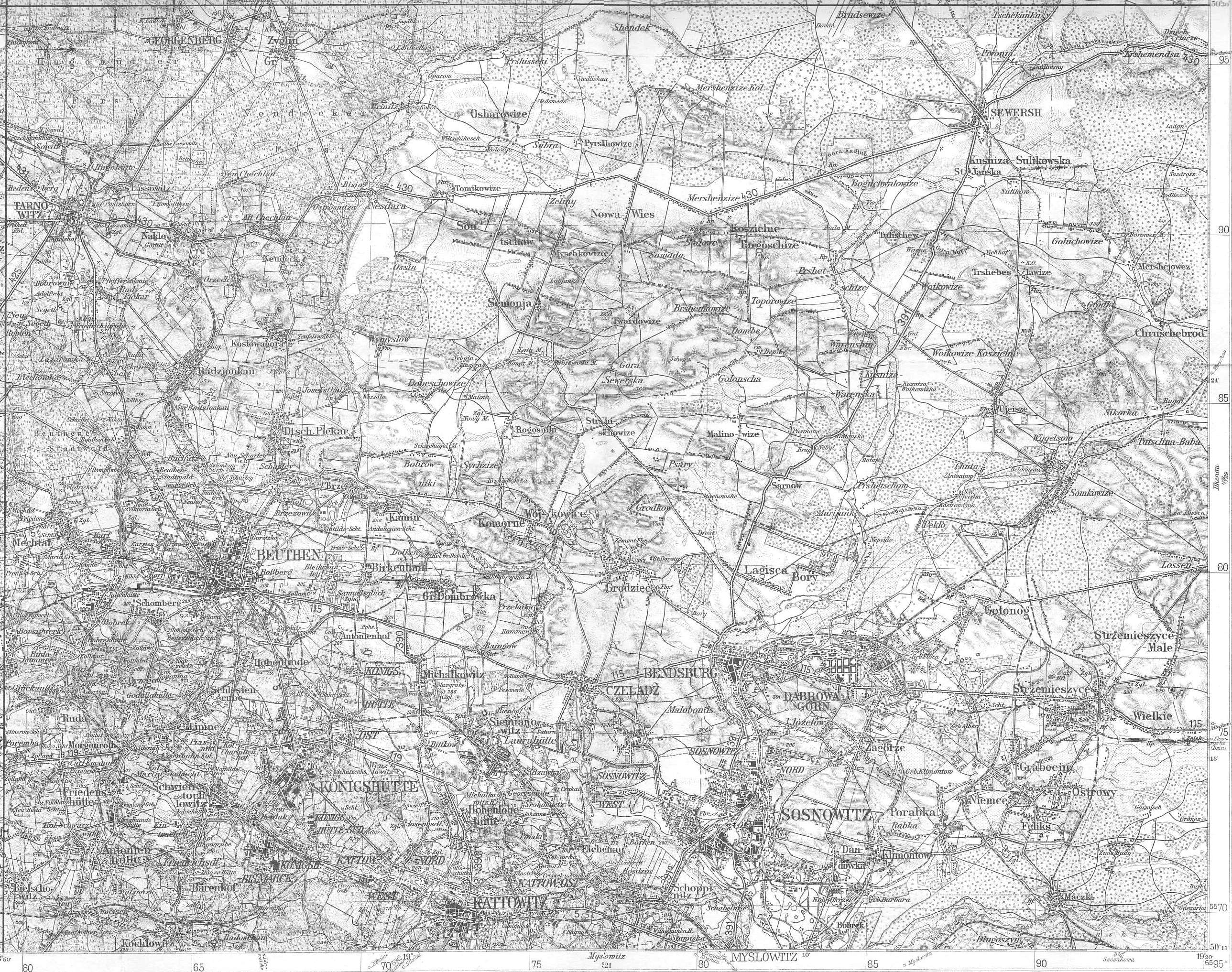
Świerklaniec is located on the northern edge of the Upper Silesian Plate 5 km north of Piekary Śląskie and 7 km east of the district town of Tarnowskie Góry. The Kozłowa Góra reservoir extends east of Świerklaniec and, together with the Brynica ( Brinitza ), marks the eastern border of the municipality and historic Upper Silesia . The community has an area of 44.3 km² and 43% of it is covered by forest (mainly pine ).
history
See Neudeck Castle
The history of Świerklaniec is closely linked to that of the local castle. A first mansion was built in the 11th century. In 1477 the name of the border castle Swiklenczy is mentioned for the first time. The place was owned by the Hohenzollern from 1532 to 1621. Since 1629, Świerklaniec was the ancestral seat of a line of the noble family of Henckel von Donnersmarck ; when they received the town as a pledge, the name Neudeck was first mentioned.
Prussian since 1742, the place was attached to the Tarnowitz district on March 27, 1873 . Neudeck was a manor that stretched south of the Tarnowitz – Siewierz road and south-west of the palace gardens. In 1885 it had 551 inhabitants. Gut Neudeck also formed an administrative district , which most recently comprised the rural communities of Alt Chechlau, Brinitz, Koslowagora, Neu Chechlau and Orzech and the manor districts of Alt Chechlau, Koslowagora, Neudeck and Orzech.
Today Świerklaniec has over 3500 inhabitants - the development extends mainly north of the Tarnowskie Góry – Siewierz state road. However, this area actually represents the place Alt Chechlau (1910: 1438 inhabitants), which extended north of the actual, much smaller Gutsdorf Neudeck (1910: 503 inhabitants) and has now merged into the same.
While in the referendum in Upper Silesia in 1921 on Gut Neudeck, 279 or almost 80% of the valid votes were cast in favor of remaining with Germany, 63% in Alt Chechlau and over 80% in the other districts voted in favor of joining Poland. In 1922 Neudeck and its surrounding area were renamed part of Poland and Świerklaniec . The castle and the place were still owned by the Donnersmarck family until 1945. In the interwar period, the President of the Mixed Commission for Upper Silesia, Felix Calonder, lived here and, as an independent observer, ensured that the rights of the German minority were observed. A Catholic Curate Świerklaniec was established in 1929, which was elevated to an independent parish in 1931. Only a wooden church served as the church, which was replaced in 1989 by the parish church "Christ König". A reservoir (Kozłowa Góra) was built on the municipal area from 1935 to 1939 to supply water. In 1945 the new and old locks burned down and both were later demolished. An artificial lake was created in 1973 in Nakło-Chechło, which on the one hand is also a water reservoir and on the other hand is now used for recreational purposes.
Between 1954 and 1972 the village belonged to the Gromada Świerklaniec and from 1975 to 1998 to the Katowice Voivodeship .

politics
Community leader
The head of the municipal administration is the municipality leader . Currently this is Marek Cyl, who is running with his own election committee. The regular election in October 2018 led to the following result.
- Marek Cyl (Marek Cyl Election Committee) 58.9% of the vote
- Izabela Domagała (Election Committee "Domagała - Flakus - Gerlich - Łężak - Nowak - Żmuda") 31.6% of the vote
- Krystian Podzymski ( Prawo i Sprawiedliwość ) 5.1% of the vote
- Henryk Baron (Election Committee “Solidarity Community”) 4.4% of the vote
Cyl was re-elected as community leader in the first ballot.
Municipal council
The municipal council consists of 15 members and is directly elected by the population in single-person constituencies. The 2018 municipal council election led to the following result:
- Electoral Committee Marek Cyl 47.2% of the vote, 8 seats
- Election committee “Domagała - Flakus - Gerlich - Łężak - Nowak - Żmuda” 29.8% of the votes, 5 seats
- Election committee “Solidarity Community” 8.9% of the votes, no seat
- Prawo i Sprawiedliwość (PiS) 7.9% of the votes, 1 seat
- Firefighters Election Committee 4.2% of the vote, 1 seat
- Remaining 2.0% of the vote, no seat
Personalities
Sons and daughters of the place
A line of the Donnersmarck family was based in Neudeck ; some representatives of the house were also born here.
- Elias Maximilian Henckel von Donnersmarck (1748–1827), major general
- Carl Lazarus Henckel von Donnersmarck (1772–1864), industrialist
- Anton Rosen (1892–1979), teacher and local history researcher
- Hermann Junack (1912–1992), forester
- Augustinus Heinrich Henckel von Donnersmarck (1935–2005), Roman Catholic theologian and business ethicist
- Tomasz Wylenzek (* 1983), German canoeist of Polish origin
- Dominika Wylężek (* 1987), soccer player
- Dawid Jarka (* 1987), football player
Personalities associated with the place
- Felix Calonder (1863–1952), former Swiss Federal President, lived in the Kavalierspalast from 1924 to 1937
- Guido Henckel von Donnersmarck (1830–1916), builder of the local castles
Others
The Neudecker Weg in the Neukölln district of Rudow was named on March 19, 1938 after the German place name of Świerklaniec.
local community
The rural municipality Świerklaniec comprises four districts on an area of 44.26 km²:
- Świerklaniec (Neudeck)
- Nakło Śląskie (Naklo)
- Nowe Chechło (New Chechlau)
- Orzech (Orzech)
Web links
Individual evidence
- ↑ population. Size and Structure by Territorial Division. As of June 30, 2019. Główny Urząd Statystyczny (GUS) (PDF files; 0.99 MiB), accessed December 24, 2019 .
- ^ Website of the municipality, Wójt Gminy , accessed on March 13, 2015
- ^ Michael Rademacher: German administrative history from the unification of the empire in 1871 to the reunification in 1990. sch_tarnowitz.html. (Online material for the dissertation, Osnabrück 2006).
- ↑ See territorial.de , accessed on November 27, 2019.
- ↑ See gemeindeververzeichnis.de , accessed on November 27, 2019, and the following map , accessed on November 27, 2019.
- ↑ Ordinance No. 23/54 of the Wojewódzkiej Rady Narodowej w Stalinogrodzie of 5 October 1954 on the division of the Gromadas in the Powiat Tarnogórski (Dziennik Urzędowy Wojewódzkiej Rady Narodowej w Stalinogrodzie z dnia 1 grudnia 1954).
- ↑ Dz.U. 1975 no 17 poz. 92 (Polish) (PDF; 802 kB)
- ^ Result on the website of the election commission, accessed on August 27, 2020.
- ^ Result on the website of the election commission, accessed on August 27, 2020.
Kalety (Kalet) - city | Krupski Młyn (Kruppa Mill) | Miasteczko Śląskie (Georgenberg) - town | Ożarowice (Ozarowice) | Radzionków (Radzionków) - City | Świerklaniec (Neudeck) | Tarnowskie Góry (Tarnowitz) - City | Tworóg (Tworog) | Zbrosławice (Broslawitz)