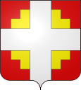
Thusy
| Thusy | ||
|---|---|---|

|
|
|
| region | Auvergne-Rhône-Alpes | |
| Department | Haute-Savoie | |
| Arrondissement | Annecy | |
| Canton | Rumilly | |
| Community association | Rumilly Terre de Savoie | |
| Coordinates | 45 ° 57 ' N , 5 ° 57' E | |
| height | 377-728 m | |
| surface | 10.74 km 2 | |
| Residents | 1,101 (January 1, 2017) | |
| Population density | 103 inhabitants / km 2 | |
| Post Code | 74150 | |
| INSEE code | 74283 | |
| Website | http://www.thusy.fr/ | |
 Saint-Jean-Baptiste church |
||
Thusy is a French commune in the department of Haute-Savoie in the region of Auvergne Rhône-Alpes .
geography
Thusy is located at 575 m , about 15 kilometers west-northwest of the city of Annecy (as the crow flies). The farming village extends from a promising location in the northern Albanais , on a slope sloping to the west high above the valley of the Morge, in the hill country between the valleys of Fier and Usses.
The area of the 10.74 km² municipal area includes a section of the Genevois . The western border runs along the Morge , a right side stream of the Fier. From the course of the brook, the community area extends eastward over a gently rising slope to the plateaus of Thusy and Saint-Eusèbe and to the northeast into the headwaters of the Morge. While the heights are mostly made up of meadows, there are larger forest areas in the valleys. At 728 m , the highest point in Thusy is reached on the wooded height of Sallongy.
In addition to the actual town center, Thusy also includes various hamlet settlements and farms, including:
- Le Châtelard ( 420 m ) in the valley of the Morge
- Charrière ( 500 m ) on the eastern slope of the Morge valley
- Aux Clozets ( 634 m ) at the height east of the village
- Le Pezay ( 650 m ) on a hill in the headwaters of the Morge
- Croisonnaz ( 550 m ) in the headwaters of the Morge
- Les Coutasses ( 580 m ) in the headwaters of the Morge
- Sallongy ( 625 m ) at an altitude in the headwaters of the Morge
The neighboring communities of Thusy are Menthonnex-sous-Clermont and Chilly in the north, Sillingy and Vaulx in the east, Saint-Eusèbe in the south and Versonnex in the west.
history
The municipality of Thusy was already settled in Roman times. In the 19th century, a Roman coin treasure from the 3rd century was found.
Thusy was first mentioned in a document in the 9th century.
population
With 1101 inhabitants (as of January 1, 2017) Thusy is one of the small communities in the Haute-Savoie department. In the course of the 19th and 20th centuries, the population decreased continuously due to strong emigration (in 1861, Thusy still had 1080 inhabitants). Since the mid-1970s, however, a significant increase in population has been recorded.
| Population development | |||||||
|---|---|---|---|---|---|---|---|
| year | 1962 | 1968 | 1975 | 1982 | 1990 | 1999 | 2009 |
| Residents | 518 | 443 | 451 | 619 | 842 | 844 | 894 |
Attractions
The village church of Saint-Jean-Baptiste was built in 1825 on the site of an earlier church; the bell tower (1663) still comes from the old church. At the site of the former Sallongy chapel, which was destroyed in 1720, there is now a cross. In the area of Thusy there are several mansions, including the one in Charrière-Bas from the 13th century and the Maison du Châtelard, which in its current state dates from the 19th century, but z. T. on remains that date back to the 13th century.
Economy and Infrastructure
Thusy is still today a predominantly agricultural village. There are also some local small businesses. Many workers are commuters who go to work in the larger towns in the area, especially in the Annecy area.
The village is located away from the larger thoroughfares. The main access is via a road that branches off from the D910 (Rumilly-Frangy). Local road links exist with Saint-Eusèbe and La Balme-de-Sillingy .
