Alcochete (Município)
| Alcochete County (Município) | |||||
|---|---|---|---|---|---|
|
|||||
| Residents: | 17,569 (as of June 30, 2011) | ||||
| Surface: | 128.36 km² (as of January 1, 2010) | ||||
| Population density : | 137 inhabitants per km² | ||||
| Number of municipalities : | 3 | ||||
| administration | |||||
| Administration address: | Câmara Municipal de Alcochete (Município) Largo de S. João 2894-001 Alcochete |
||||
| President of the Câmara Municipal: | Luís Miguel Carraça Franco ( CDU ) | ||||
| Website: | www.cm-alcochete.pt | ||||
Alcochete is a district town ( Vila ) and a Portuguese district ( concelho ) in the Setúbal district with 17,569 inhabitants (as of June 30, 2011).
geography
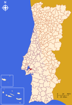
Alcochete is located on the southeast bank of the Tejo Bay, in the greater Margem Sul do Tejo area . Opposite is the Portuguese capital Lisbon , from which Alcochete is 17 km away by ferry.
history
It is assumed that the settlement of Alcochete can be traced back to the Moors, as the name can be derived from Al Caxete (oven). But even under the Romans , the area around Alcochete played a role as a pottery center for the production of amphorae, which were needed for the storage and transport of food (e.g. fish oil, salt etc.). Excavations in nearby Porto dos Cacos have found three ceramic kilns , a large number of amphorae and a necropolis .
The construction of the main church dates back to the 14th century. Alcochete received city rights in 1515 . In the 20th century, Alcochete became a residential suburb of the capital because of its proximity to Lisbon . Especially after the Tejob bridge Vasco da Gama connected the eastern bank directly with the center of the capital. Nevertheless, Alcochete still has the historical structures of a small town or fishing village.
Religions
In Alcochete there are the following religious buildings:
- Igreja Matriz , a church built in the Gothic style
- Igreja da Misericórdia (Church)
- Capela de Nossa Senhora da Vida
- Ermida de Nossa Senhora dos Matos , (located near Samouco )
- Capela de Santo António da Ussa ,
Culture and sights
Museums
The Museu Municipal de Alcochete is the only museum on site. It offers permanent exhibitions at three different locations on the following topics:
Buildings
Special structures in Alcochete are:
- A Ponte Cais , the pier on the banks of the Tagus Bay
- O Edifício dos Paços do Concelho , a neoclassical style building located on Largo de São João
- Edifício do Lar Barão de Samora Correia , a building which is located on the Rossio
- Palacete do Marquês de Soydos
Economy and Infrastructure
traffic
bus
The bus company TST operates 7 bus routes that run through Alcochete.
- 410 Alcochete (Freeport) - Barreiro train station
- 412 Alcochete (Freeport) - Montijo ferry port
- 413 Alcochete (Freeport) - Setúbal
- 419 Alcochete - Lagoa da Cheia
- 431 Lisbon - Montijo
- 432 Atalaia - Lisbon
- 437 Lisbon - Montijo
Airport
The closest airport is Lisbon-Portela International Airport . It is located 15 km as the crow flies from Alcochete.
Since 2008 there have been plans to build a new international airport for Lisbon on the Campo de Tiro site.
Street
The N119 road leads into the city from São Francisco and out of the city to the east. To the east, this then leads to the IC3 and the Vasco da Gama bridge .
The road Rua do 25 Abril then becomes the M501 at the end of the village and leads to Samouco .
retail trade
In Alcochete there are branches of the supermarket chains Intermarché , Lidl , Pingo Doce and Minipreço .
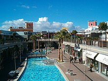
The Freeport Design Outlet opened its doors in summer 2004.
media
The newspaper Jornal do Alcochete is published in Alcochete . The radio station EcoFM broadcast its program on FM 104.8.
education
In Alcochete there are five kindergartens, three primary schools, one secondary school and one vocational school.
administration
circle
Alcochete is the administrative seat of a district of the same name. The neighboring districts are (starting clockwise in the north): Benavente , Palmela and Montijo .
The following municipalities ( Freguesias ) are in the Alcochete district:
| local community | Population (2011) |
Area km² |
Density of population / km² |
LAU code |
|---|---|---|---|---|
| Alcochete | 12,239 | 119.44 | 102 | 150201 |
| Samouco | 3.143 | 4.76 | 660 | 150202 |
| Sao Francisco | 2,187 | 4.16 | 526 | 150203 |
| Alcochete district | 17,569 | 128.36 | 137 | 1502 |
Population development
| Population in Alcochete County (1801–2011) | ||||||||||
|---|---|---|---|---|---|---|---|---|---|---|
| 1801 | 1849 | 1900 | 1930 | 1960 | 1981 | 1991 | 2001 | 2011 | ||
| 2 256 | 3,097 | 6 088 | 6 656 | 9 270 | 11 246 | 10 169 | 13 010 | 17 565 | ||
Municipal holiday
- June 24th
Town twinning
-
 : Waudo , South Korea (since 1992)
sons and daughters of the town
- Dom Manuel I (1469–1521), Manuel the Lucky, 16th King of Portugal
- Manuel Rodrigues, one of the Forty Martyrs of Brazil
- Ciprião de Figueiredo e Vasconcelos († 1606), Governor of the Azores, defender of Terceira Island as the seat of King António of Crato (1580–1583)
- António Luís Pereira Coutinho (1818–1908), noble politician
- Carlos Ferreira Prego (1857–1902), agricultural entrepreneur and philanthropist
- Francisco Rodrigues da Cruz (1859–1948), Jesuit, clergyman known as Padre Cruz
- Raul Carapinha (1876–1957), architect and painter
- Pedro Marques (* 1976), politician
Web links
- Official website ( Memento of October 31, 2015 in the Internet Archive )
- Photos from Alcochete on Flickr
Individual evidence
- ↑ www.ine.pt - indicator resident population by place of residence and sex; Decennial in the database of the Instituto Nacional de Estatística
- ↑ Overview of code assignments from Freguesias on epp.eurostat.ec.europa.eu
- ^ TST company website of Transportes Sul do Tejo (accessed on September 9, 2010).
- ^ City of Alcochete ( Memento from May 15, 2015 in the Internet Archive ), Câmera Municipal de Alcochete (Portuguese, accessed on September 9, 2010).
- ↑ www.anmp.pt , accessed on February 3, 2013


