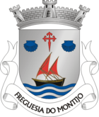
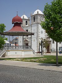
Montijo (Portugal)
| Montijo | ||||||
|---|---|---|---|---|---|---|
|
||||||
| Basic data | ||||||
| Region : | Lisboa | |||||
| Sub-region : | Lisbon metropolitan area | |||||
| District : | Setubal | |||||
| Concelho : | Montijo | |||||
| Coordinates : | 38 ° 42 ′ N , 8 ° 58 ′ W | |||||
| Residents: | 30.004 (as of June 30, 2011) | |||||
| Surface: | 27.25 km² (as of January 1, 2010) | |||||
| Population density : | 1101 inhabitants per km² | |||||
| Height: | 10 m | |||||
| Postal code : | 2870 | |||||
| politics | ||||||
| Mayor : | José Francisco dos Santos | |||||
| Address of the municipal administration: | Junta de Freguesia de Montijo Av. dos Pescadores, nº 78 2870-114 Montijo |
|||||
| Website: | www.jfmontijo.pt | |||||
| Montijo district | ||||||
|
||||||
| Residents: | 51,222 (as of June 30, 2011) | |||||
| Surface: | 348.62 km² (as of January 1, 2010) | |||||
| Population density : | 147 inhabitants per km² | |||||
| Number of municipalities : | 5 | |||||
| administration | ||||||
| Administration address: | Câmara Municipal de Montijo Edifício dos Paços do Concelho Rua Manuel Neves Nunes de Almeida 2870-352 Montijo |
|||||
| President of the Câmara Municipal: | Maria Amélia Antunes ( PS ) | |||||
| Website: | www.mun-montijo.pt | |||||
Montijo [ mõˈtiʒu ] is a municipality and city in the Setúbal district and the Lisbon region in Portugal . Until 1930 the place was called Aldeia Galega do Ribatejo .
Montijo is known as the land of bullfights , good food (especially fish dishes) and fado .
history
The history of Montijo and the surrounding villages is closely linked to the Tagus . Archaeological finds prove a settlement since the Paleolithic .
In the course of the Reconquista , Aldeia Galega became independent in the young Kingdom of Portugal in the 12th century . The place developed as a supplier of salt, fruit and wine to Lisbon. It also became an important inland port, not least because of the regular ferry service for freight, especially for firewood. On September 15, 1514, King Manuel I gave Aldeia Galega its first city rights. For unknown reasons, the king issued a new city charter on January 17, 1515, with which two places were granted city rights, Aldeia Galega do Ribatejo and Alcochete. In 1533 Aldeia Galega became the headquarters of the southern section of the post office, as the main traffic point for travelers from Lisbon and the west of the country to the south and Spain.
In the course of the 18th century, in addition to the traditional sources of income in connection with the river, there was also trade and production, especially the processing of pork. However, its strategic geographical importance remained. In the national traffic planning under Queen Dona Maria II., In addition to the Lisbon-Porto connection, the Montijo- Caia connection (near Elvas , on the border with Spain) was given top priority. As part of these plans, a 315 meter long quay was built here in 1852 . The fertile soils of the district continued to provide wine, grain and fruit, and Aldeia Galega's importance as a trading center grew. The emerging rail connections in the second half of the 19th century then slowed down further development. This economic slump was compensated for by increased trade and increased pig breeding. In addition, industrialization began, especially in cork processing .
By law of July 6, 1930, Aldeia Galega was renamed Montijo. The district consisted of the three parishes Montijo, Sarilhos Grandes and Canha. In 1957 the parish of Santo Isidro de Pegões was created by splitting off from the parish of Canha. In 1985 the newly created communities Atalaia, Pegões and Alto Estanqueiro-Jardia followed, and on August 24, 1989 Afonsoeiro was finally added.
On August 14, 1985, the previous small town ( Vila ) Montijo was elevated to a city ( Cidade ).
administration
circle
The district of Montijo was divided into eight municipalities until the administrative reorganization in 2013. It is one of the few counties in Portugal that is territorially disjointed (the others are Oliveira de Frades , Soure and Vila Real de Santo António ). The main part, in which the city itself is located, is the smallest part and is bounded northeast by Alcochete , Palmela in the southwest and in the southeast by Moita . The secondary eastern part is about 20 km away, bounded by Coruche to the northeast, Montemor-o-Novo to the east, Vendas Novas to the southwest, and Palmela and Benavente to the southwest.
The following municipalities are in the Montijo district:
| local community | Population (2011) |
Area km² |
Density of population / km² |
LAU code |
|---|---|---|---|---|
| Atalaia e Alto Estanqueiro-Jardia | 5,085 | 13.65 | 373 | 150709 |
| Canha | 1,689 | 211.97 | 8th | 150701 |
| Montijo e Afonsoeiro | 37.111 | 31.46 | 1,180 | 150710 |
| União das Freguesias de Pegões | 3,913 | 79.77 | 49 | 150711 |
| Sarilhos Grandes | 3,424 | 11.77 | 291 | 150704 |
| Montijo district | 51,222 | 348.62 | 147 | 1507 |
With the administrative reorganization of 2013, the municipalities of Atalaia and Alto Estanqueiro became the new municipality of União das Freguesias de Atalaia e Alto Estanqueiro-Jardia , the municipalities of Afonsoeiro and Montijo became the new municipality of União das Freguesias de Montijo e Afonsoeiro , and the municipalities of Santo Isidro de Pegões and Pegões combined to form the new municipality of União das Freguesias de Pegões .
Population development
Due to the shorter travel time over the Vasco da Gama Bridge to Lisbon, the population development has skyrocketed in recent years. Over 51,000 people now live here.
| Population in the Montijo district (1801–2011) | |||||||||
|---|---|---|---|---|---|---|---|---|---|
| 1801 | 1849 | 1900 | 1930 | 1960 | 1981 | 1991 | 2001 | 2008 | 2011 |
| 2676 | 5869 | 10,504 | 14,832 | 30,217 | 36,849 | 36,038 | 39,168 | 41,432 | 51,308 |
Municipal holiday
- June 29th
Town twinning
-
 Cape Verde : São Filipe
-
 Sao Tome and Principe : Água Grande
-
 Cape Verde : Santa Catarina
-
 Bulgaria : Swoge
-
 Brazil : Luís Eduardo Magalhães
-
 Cape Verde : Tarrafal
Economy and Transport
The Tagus River formed the livelihood of people for centuries. The main sources of income were deep-sea fishing , salt production and viticulture . Even if trade and industry have increased in importance especially since the second half of the 20th century, the former main sources of income in the district continue to contribute to the local economy.
The new bridge over the Tejo , the Vasco da Gama Bridge , was inaugurated in March 1998 for the Expo 98 in Lisbon with the link between Sacavém and Montijo. With a catamaran of Transtejo Montijo is about 20 minutes by the Cais do Sodre connected in Lisbon.
Thanks to its strategic location, Montijo is an important transport hub and the headquarters of numerous companies in Portugal. Montijo also has a supraregional significant shopping center with 10,000 square meters of retail space directly on the A12 motorway , the Forum Montijo. The A12 connects Setúbal with Lisbon and runs directly through Montijo.
There is a military airfield to the west of the village . In a few years, the new Lisbon international airport will be built in the Montijo district .
The Lisbon – Madrid high-speed line is planned to connect Portugal to the European high-speed rail network . It will also connect the new airport with the greater Lisbon area and the rest of Portugal. Work on the two major projects has currently (as of 2011) been temporarily postponed due to the financial crisis in Portugal as a result of the international banking crisis in 2007 .
The Ramal do Montijo railway line was closed in 1987 by the Portuguese railway company CP .
sons and daughters of the town
- Fernanda Seno (1942 - 1996), Portuguese poet and writer
- Elisabete Jacinto (* 1964), rally driver
- Paulo Futre (* 1966), Portuguese soccer player
- Dulce Pontes (* 1969), Portuguese fado singer
- Ricardo (* 1976), Portuguese football goalkeeper
- Paulo Vintém (* 1979), pop singer
Web links
- Map of the Freguesia Montijo (Portugal) at the Instituto Geográfico do Exército
- Official website ( Memento of March 17, 2015 in the Internet Archive ) (Portuguese)
- Forum Montijo website (Portuguese)
Individual evidence
- ↑ www.ine.pt - indicator resident population by place of residence and sex; Decennial in the database of the Instituto Nacional de Estatística
- ↑ a b Overview of code assignments from Freguesias on epp.eurostat.ec.europa.eu
- ↑ www.ine.pt - indicator resident population by place of residence and sex; Decennial in the database of the Instituto Nacional de Estatística
- ↑ Resenha Histórica do Concelho ( memento of April 24, 2015 in the Internet Archive ) on the district administration's website, accessed on June 18, 2014
- ↑ Map with the parts of the community ( Memento of the original from January 3, 2011 in the Internet Archive ) Info: The archive link has been inserted automatically and has not yet been checked. Please check the original and archive link according to the instructions and then remove this notice. (PDF) p. 36
- ↑ Publication of the administrative reorganization (PDF) in the Diário da República law gazette of January 28, 2013, accessed on June 18, 2014
- ^ List of partnerships Montijo , Association of Portuguese District Governments (ANMP), accessed on January 5, 2019
- ↑ High-speed railway axis in south-west Europe (PDF; 503 kB) EU website on expansion in south-west Europe
- ↑ Major projects in Portugal put to the test . In: NZZ , July 9, 2009


