
Office close
| coat of arms | Germany map | |
|---|---|---|

|
Coordinates: 51 ° 43 ' N , 13 ° 23' E |
|
| Basic data | ||
| State : | Brandenburg | |
| County : | Elbe Elster | |
| Area : | 210.82 km 2 | |
| Residents: | 5267 (Dec. 31, 2019) | |
| Population density : | 25 inhabitants per km 2 | |
| License plate : | EE, FI, LIB | |
| Office key : | 12 0 62 5209 | |
| Office structure: | 5 municipalities | |
| Office administration address : |
Herzberger Strasse 7 04936 Schlieben |
|
| Website : | ||
| Office Director : | Andreas Polz | |
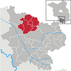
| Location of the office in Schlieben in the Elbe-Elster district | ||
  |
||

The Schlieben office is an office in the Elbe-Elster district of the state of Brandenburg that was formed in 1992. At first, 16 communities in the former Herzberg district (now in the Elbe-Elster district) were combined into an administrative association. The official seat is the city of Schlieben . Due to community mergers and integrations, the office currently has only five communities.
Geographical location
The office of Schlieben is located in the northern part of the Elbe-Elster district and borders in the north-west on the non-governmental town of Schönewalde , in the north on the Dahme / Mark district ( Teltow-Fläming district ), and in the northeast on the non-governmental municipality Heideblick ( Dahme-Spreewald district ) , in the east to the unofficial city of Sonnewalde , the unofficial city of Doberlug-Kirchhain in the south and to the unofficial city of Herzberg (Elster) in the west. While the landscape in the west merges into the Elbe-Elster-Land , the borders in the north represent the Fläming and in the east the Niederlausitz border wall . The latter also serves to demarcate the region from the Niederlausitz region .
Municipalities and districts
The office of Schlieben currently administers five municipalities:
- Spruce forest with the districts of Hillmersdorf , Naundorf and Stechau
- Hohenbucko with the districts Hohenbucko and Proßmarke
- Kremitzaue with the districts Kolochau , Malitschkendorf and Polzen
- Lebusa with the districts of Freileben , Körba and Lebusa
- Schlieben (city) with the districts of Frankenhain , Jagsal , Oelsig , Wehrhain and Werchau
history
In an announcement dated July 9, 1992, the Minister of the Interior of the State of Brandenburg gave his consent to the formation of the office of Schlieben. July 21, 1992 was set as the date of establishment of the office. The city of Schlieben was designated as the official seat . It initially consisted of 16 communities in what was then the Herzberg district : Frankenhain, Freileben, Hillmersdorf, Hohenbucko, Jagsal, Kolochau, Körba, Lebusa, Malitschkendorf, Naundorf, Oelsig, Proßmarke, Stechau, Wehrhain, Werchau and the city of Schlieben.
On November 1, 2001, the Ministry of the Interior approved the formation of a new town of Schlieben from the municipalities of the Office of Schlieben Frankenhain, Jagsal, Oelsig, Wehrhain, Werchau and the city of Schlieben.
On December 15, 2001, the approval for the formation of a new municipality Lebusa from the municipalities of the office Schlieben Freileben, Körba and Lebusa was granted. On December 31, 2001 Hohenbucko and Proßmarke merged to form the new community Hohenbucko. Also on December 31, 2001, the communities Kolochau, Malitschkendorf and Polzen merged to form the new community Kremitzaue. The amalgamation of the communities of Hillmersdorf, Naundorf and Stechau to form the new community of Fichtwald took effect on December 31, 2001. This reduced the number of municipalities belonging to the office to five.
The historical scope of the Schliebener Land extends far beyond the current boundaries of the office and corresponds to the official area in the Electorate of Saxony . Accordingly, there were once 35 villages in the administrative area. To this day there is lively contact and the willingness to return to the common history, although some area reforms have changed the administration.
Population development
|
|
|
Territory of the respective year, number of inhabitants: as of December 31, from 2011 based on the 2011 census
Office Director

- 1992–2014: Iris Schülzke
- since 2014: Andreas Polz
Polz was born on November 6, 2014 by the Office Committee elected for a term of eight years.
tourism
The official area is now marketed for tourism under the name “Schliebener Land”. The region represents a transition area between the highlands and the plains. The foothills of the adjacent ridges have a strong influence on the landscape around Schlieben. Numerous cycle paths, including those with a connection to the Fläming-Skate , offer tourists excursions close to nature.
literature
- Sybille Gramlich, Irmelin Küttner: Monument topography Federal Republic of Germany . Monuments in Brandenburg 7.1 = The city of Herzberg / Elster and the offices of Falkenberg / Uebigau, Herzberg, Schlieben and Schönewalde . Wernersche Verlagsgesellschaft , Worms 1998. ISBN 978-3-88462-152-3
Web links
Individual evidence
- ↑ Population in the State of Brandenburg according to municipalities, offices and municipalities not subject to official registration on December 31, 2019 (XLSX file; 223 KB) (updated official population figures) ( help on this ).
- ^ Website of the office of Schlieben
- ↑ Formation of the offices of Vetschau, Schlieben, Angermünde-Land, Grünheide-Großräschen, Lübbenau, Unteres Dahmeland and Calau. Announcement by the Minister of the Interior of June 30, 1992. Official Gazette for Brandenburg - Joint Ministerial Gazette for the State of Brandenburg, Volume 3, Number 54, July 31, 1992, p. 968/9.
- ↑ Announcement of the Ministry of the Interior of September 7, 2001 formation of a new town Schlieben. Official Journal for Brandenburg Common Ministerial Gazette for the State of Brandenburg, Volume 12, 2001, Number 44, Potsdam, October 30, 2001, pp. 694/5, PDF
- ^ Formation of a new community in Lebusa. Announcement of the Ministry of the Interior of September 5, 2001 Official Gazette for Brandenburg Common Ministerial Gazette for the State of Brandenburg, Volume 12, 2001, Number 44, Potsdam, October 30, 2001, p. 695, PDF
- ^ Formation of a new community in Hohenbucko. Announcement of the Ministry of the Interior from October 19, 2001 Official Gazette for Brandenburg Common Ministerial Gazette for the State of Brandenburg, Volume 12, 2001, Number 47, Potsdam, November 21, 2001, p. 786, PDF
- ^ Formation of a new community in Kremitzaue. Announcement of the Ministry of the Interior of December 4, 2001 Official Journal for Brandenburg Common Ministerial Gazette for the State of Brandenburg, Volume 12, 2001, Number 52, Potsdam, December 27, 2001, p. 895, PDF
- ^ Formation of a new community in Fichtwald. Announcement of the Ministry of the Interior of October 9, 2001 Official Gazette for Brandenburg Common Ministerial Gazette for the State of Brandenburg, Volume 12, 2001, Number 44, Potsdam, October 30, 2001, p. 696, PDF
- ↑ Historical municipality register of the state of Brandenburg 1875 to 2005. Elbe-Elster district . Pp. 12-13
- ↑ Population in the state of Brandenburg from 1991 to 2017 according to independent cities, districts and municipalities , Table 7
- ^ Office for Statistics Berlin-Brandenburg (Ed.): Statistical report AI 7, A II 3, A III 3. Population development and population status in the state of Brandenburg (respective editions of the month of December)
- ↑ Turn 17 into 5 - The young history of the office. on www.amt-schlieben.de
- ↑ Andreas Polz is the new official director in Schlieben . In: Lausitzer Rundschau , November 8, 2014