
Auw on the Kyll
| coat of arms | Germany map | |
|---|---|---|

|
Coordinates: 49 ° 54 ' N , 6 ° 37' E |
|
| Basic data | ||
| State : | Rhineland-Palatinate | |
| County : | Eifel district Bitburg-Prüm | |
| Association municipality : | Storage | |
| Height : | 166 m above sea level NHN | |
| Area : | 0.98 km 2 | |
| Residents: | 119 (Dec. 31, 2019) | |
| Population density : | 121 inhabitants per km 2 | |
| Postal code : | 54664 | |
| Area code : | 06562 | |
| License plate : | BIT, PRÜ | |
| Community key : | 07 2 32 006 | |
| LOCODE : | DE A88 | |
| Association administration address: | Bahnhofstrasse 36 54662 memory |
|
| Website : | ||
| Local Mayor : | Günter Kirsch | |
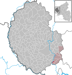
| Location of the local community Auw an der Kyll in the Eifel district of Bitburg-Prüm | ||
  |
||


Auw an der Kyll is a municipality in the Eifelkreis Bitburg-Prüm in Rhineland-Palatinate . It belongs to the collective municipality of Speicher .
geography
The municipality is located in the Kylltal of the South Eifel , a small tributary valley of the Moselle , near the district town of Bitburg .
Neighboring places
| Trimport , Dahlem | Storage | Praises |
| Idenheim |
.svg)
|
Orenhofen |
| Idesheim | Hosting | Zemmer |
history
Wall remains of a Roman refuge between Auw and Preist show that the Romans already settled in the region around Auw. The place Auw was first mentioned in a document in the 13th century as Ouve , in 1565 and 1606 as Auwe . The name could come from the Old High German owa , awa , Middle High German owe , awe , then uwe , au = island, land surrounded by water. These words are closely related to the Latin aqua , the Gothic ahva for water. In the 18th century the place appears as Avia vel Auw .
On January 1, 1971, after the districts of Bitburg and Prüm were merged, the additional designation "an der Kyll" was adopted - to distinguish it from the municipality of the same name Auw near Prüm.
- Population development
The development of the population of Auw an der Kyll, the values from 1871 to 1987 are based on censuses:
|
|
politics
Municipal council
The council in Auw an der Kyll consists of six council members, who in the local elections on May 26, 2019 in a majority vote were elected, and the honorary mayor as chairman.
coat of arms
|
|
Blazon : "Diagonally left divided by silver and blue, above a red winged dragon growing out of the division, below a silver lily ." |
|
Founding of the coat of arms: Historically, Auw was part of the Scharfbillig rule in the Duchy of Luxembourg until the French Revolution . For this reason, silver and blue were chosen as the main colors.
In terms of local history, the later Counts of Kesselstatt owned the place. Your coat of arms, a red dragon in silver, stands as a symbol for the former landlord and has therefore been included in the upper part. The lily in the lower coat of arms relates to an old legend of the area: three virgins jumped with a donkey from a rock over the Kyll , but only thanks to the Virgin Mary they safely got to the other bank of the river, the place of today's Auw. The lily is the symbol of virginity as well as of Mary. Auw has also been a well-known Marian pilgrimage site for over 300 years . |
Culture and sights
;_Drei_Jungfrauenkreuz_a.jpg)
Buildings
- Catholic parish church of the Assumption from 1739
- Auw an der Kyll station from 1871
- Old rectory from 1786
- Three virgin cross - a shaft cross with the image of the three virgins Irmina, Adela and Klotildis from the 19th century.
See also: List of cultural monuments in Auw an der Kyll
Green spaces and recreation
- Kylltal and Schalbachtal with near-natural, stream-accompanying floodplain forests
- Hiking in and around Auw an der Kyll
Regular events
- Annual fair or parish fair is celebrated on the weekend after August 15th (Krautwischtag)
- Traditional rattling or rattling on Good Friday and Holy Saturday
- Hut burning on the first weekend after Ash Wednesday (so-called Scheef Sunday)
Local associations
Auw an der Kyll has had a volunteer fire brigade since 1955 , which organizes the fire brigade festival under the chestnut trees every year on the first weekend in July, and a sports club , FSG Auw an der Kyll, which organizes a sports festival on the sports field every year and which also has a fitness room maintains in the parish hall built in 1980.
Economy and Infrastructure

Rail transport
The station Auw an der Kyll is located on the Eifel circuit ( Cologne - Euskirchen - Gerolstein - Trier ) on which the rail passenger transport under the brand name Vareo run the following features:
| line | designation | Line course | Clock frequency |
|---|---|---|---|
| RB 22 | Eifel Express |
Cologne Fair / Deutz - Cologne - Euskirchen - Jünkerath - Gerolstein - Bitburg-Erdorf - Auw an der Kyll - Ehrang - Trier (Cologne Fair / Deutz - Gerolstein asRE 22) |
60 min (in the HVZ amplifier Gerolstein – Trier) |
Vehicles from the 620 and 622 series are used.
For local public transport (ÖPNV) the tariff of the Verkehrsverbund Region Trier (VRT) applies
The listed entrance building on the Eifel route Trier - Cologne was built around 1870. At the same time, an outbuilding was built right next to it, which was used as a toilet and stable. It is - seen from the village - on the other side of the track, between Kyll and the railway line. It could be reached through a level crossing until 1985. From 1995, a narrow path along the Kyll and the railway line connects it with the town's road network.
The station buildings correspond in many parts to the other reception buildings on the Eifelbahn in the Kylltal, such as in Philippsheim or Trier-Ehrang . Only a later, single-storey extension to accommodate the signal box distinguishes it from many of its kind. Common to all train stations in the Kylltal is the facing with red sandstone blocks (the building corners are mostly rusticated) and the dominance of Gothic architectural elements (doors, windows, gables, bay windows, etc.), partly mixed with those of the German Renaissance.
In 1985 the buildings were abandoned by the Deutsche Bundesbahn and slowly crumbled. From 1995 to 1999 the building was gutted, completely renovated and used as a single-family house ever since. The station building. Retrieved February 11, 2020 (private website).
Bus transport
Auw is connected to Speicher and Bitburg by bus routes 326 and 403 . The rail bus or later RMV line 6279 to Trier was discontinued at the end of the 1990s.
Personalities
- Andreas Heinz (* 1941), Catholic theologian
literature
- Ernst Wackenroder (arr.): The art monuments of the Bitburg district (= Paul Clemen [Hrsg.]: The art monuments of the Rhine province . Volume 12 / I ). Trier 1983, ISBN 3-88915-006-3 , p. 24–26 (315 p., With 12 plates and 227 illustrations in the text. Reprinted by the Schwann edition, Düsseldorf 1927).
Web links
- Official website of the municipality of Auw an der Kyll
- Auw an der Kyll on the website of the Verbandsgemeinde Speicher
- To search for cultural assets of the local community Auw an der Kyll in the database of cultural assets in the Trier region .
- Brief portrait of Auw an der Kyll ( memento from August 7, 2015 in the web archive archive.today ) on Hierzuland , SWR television
Individual evidence
- ↑ a b State Statistical Office of Rhineland-Palatinate - population status 2019, districts, municipalities, association communities ( help on this ).
- ↑ State Statistical Office Rhineland-Palatinate (ed.): Official directory of the municipalities and parts of the municipality. Status: January 2019 [ Version 2020 is available. ] . S. 105 (PDF; 3 MB).
- ↑ Official municipality directory (= State Statistical Office of Rhineland-Palatinate [Hrsg.]: Statistical volumes . Volume 407 ). Bad Ems February 2016, p. 186 (PDF; 2.8 MB).
- ↑ State Statistical Office Rhineland-Palatinate: My village, my city. Retrieved February 11, 2020 .
- ^ The Regional Returning Officer Rhineland-Palatinate: Local elections 2019, city and municipal council elections.
- ↑ Description of the coat of arms. Verbandsgemeinde Speicher, accessed on February 11, 2020 .
- ↑ Old rectory. Retrieved February 6, 2018 .
- ↑ NaturWanderPark delux: Kylltaler red sandstone route. Retrieved February 6, 2018 .
- ↑ Kylltaler Buntsandsteinroute Auw ad Kyll. Retrieved February 6, 2018 .
- ↑ Hut Sunday in Malberg Weich. Retrieved August 6, 2018 .
- ↑ Hüttenbrennen in the Eifel. Retrieved May 1, 2016 .
- ↑ Hut Sunday in the Eifel. Retrieved August 10, 2017 .
Auw on the Kyll | Beilingen | Herforst | Hosting | Orenhofen | Philippsheim | Prices | Spangdahlem | Speicher (Eifel)