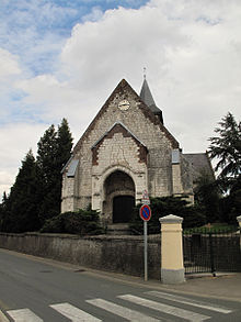
Buire-le-Sec
| Buire-le-Sec | ||
|---|---|---|

|
|
|
| region | Hauts-de-France | |
| Department | Pas-de-Calais | |
| Arrondissement | Montreuil | |
| Canton | Auxi-le-Château | |
| Community association | Sept Vallées | |
| Coordinates | 50 ° 23 ′ N , 1 ° 50 ′ E | |
| height | 38-93 m | |
| surface | 13.36 km 2 | |
| Residents | 777 (January 1, 2017) | |
| Population density | 58 inhabitants / km 2 | |
| Post Code | 62870 | |
| INSEE code | 62183 | |
 Town Hall (Mairie) and School of Buire-le-Sec |
||
Buire-le-Sec is a French commune with a population of 777 (as at 1st January 2017) in the department of Pas-de-Calais in the region of Hauts-de-France . It belongs to the arrondissement of Montreuil and the canton of Auxi-le-Château (until 2015: canton of Campagne-lès-Hesdin ).
geography
Buire-le-Sec is about 18 kilometers east of the coast of the English Channel . Neighboring municipalities of Buire-le-Sec are Campagne-lès-Hesdin in the north and east, Saint-Rémy-au-Bois in the south-east, Maintenay in the south, Roussent in the south-west and Boisjean in the west and north-west.
Population development
| year | 1962 | 1968 | 1975 | 1982 | 1990 | 1999 | 2006 | 2012 |
| Residents | 643 | 604 | 543 | 551 | 663 | 788 | 798 | 799 |
| Source: Cassini and INSEE | ||||||||
Attractions
- Saint-Maurice church from the 12th / 13th centuries Century, largely from the 16th century
- Romont Castle
Web links
Commons : Buire-le-Sec - collection of images, videos and audio files


