
Royon
| Royon | ||
|---|---|---|

|
|
|
| region | Hauts-de-France | |
| Department | Pas-de-Calais | |
| Arrondissement | Montreuil | |
| Canton | Fruges | |
| Community association | Haut Pays du Montreuillois | |
| Coordinates | 50 ° 28 ′ N , 2 ° 0 ′ E | |
| height | 54-160 m | |
| surface | 7.49 km 2 | |
| Residents | 135 (January 1, 2017) | |
| Population density | 18 inhabitants / km 2 | |
| Post Code | 62990 | |
| INSEE code | 62725 | |
 rebuilt castle |
||

Royon is a French municipality with 135 inhabitants (at January 1, 2017) in the department of Pas-de-Calais in the region of Hauts-de-France .
geography
Royon is 16 kilometers east of Montreuil on the D130 road in the valley of the Créquoise River .
population
| 1962 | 1968 | 1975 | 1982 | 1990 | 1999 | 2006 |
| 113 | 133 | 135 | 127 | 117 | 103 | 115 |
(Numbers from INSEE )
history
The mountain slopes were bordered by thorny hedges. The fruit-bearing hedges were called 'Royons'.
The first time Royon was mentioned according to the Gallia Christiana 893. In 1641 it became 'Roion' and became 'Royon' in 1804


Attractions
The Louis XV castle was destroyed in May 1944, rebuilt and is now the seat of local government. The 16th century church of Saint-Germain is still in the village .

Louis XV château before 1939

Saint Germain Church
Gravestone of the de Bryas family

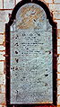
Tomb of the de Bryas de Royon family


Web links
Individual evidence
- ↑ E. Balandra: Les rideaux ou royons picards aux XIIIe et XIVe. In: Bull. Soc. d 'emulation d'Abbeville. 1980-XXIV, pp. 757-763.
- ^ Gallia Christiana. XIV, p. 413, col A.
- ^ A. Dufetelle: Le Marquenterre, Monographie de Quend. Imp. Nouvelle, Abbeville 1907.
- ↑ R. Rodière: Dictionnaire du épigraphique Pas de Calais. Sède Ed., Arras 1937.