Herly (Pas-de-Calais)
| Herly | ||
|---|---|---|

|
|
|
| region | Hauts-de-France | |
| Department | Pas-de-Calais | |
| Arrondissement | Montreuil | |
| Canton | Lumbres | |
| Community association | Haut Pays du Montreuillois | |
| Coordinates | 50 ° 33 ' N , 1 ° 59' E | |
| height | 110-199 m | |
| surface | 16.3 km 2 | |
| Residents | 313 (January 1, 2017) | |
| Population density | 19 inhabitants / km 2 | |
| Post Code | 62650 | |
| INSEE code | 62437 | |
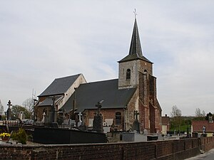
 Saint-Pierre church |
||
Herly is a commune in the French department of Pas-de-Calais in the region of Hauts-de-France (before 2016 Nord-Pas-de-Calais ). It belongs to the arrondissement of Montreuil and the canton of Lumbres (until 2015 Hucqueliers ).
Neighboring municipalities of Herly are Ergny and Aix-en-Ergny in the north, Rumilly in the northeast, Verchocq in the east, Créquy in the southeast, Rimboval in the south, Quilen and Saint-Michel-sous-Bois in the southwest, Maninghem in the west and Avesnes in the northwest.
Population development
| year | 1962 | 1968 | 1975 | 1982 | 1990 | 1999 | 2007 | 2014 |
| Residents | 425 | 407 | 404 | 413 | 326 | 333 | 324 | 338 |
Attractions
- Saint-Pierre church
- War memorial
Web links
Commons : Herly - collection of images, videos and audio files
