
Courtételle
| Courtételle | |
|---|---|
 |
|
| State : |
|
| Canton : |
|
| District : | Delémont |
| BFS no. : | 6710 |
| Postal code : | 2852 |
| Coordinates : | 590 994 / 243430 |
| Height : | 441 m above sea level M. |
| Height range : | 422–1135 m above sea level M. |
| Area : | 13.56 km² |
| Residents: | 2612 (December 31, 2018) |
| Population density : | 193 inhabitants per km² |
| Website: | www.courtetelle.ch |
| Location of the municipality | |
  |
|
Courtételle is a municipality in the Delémont district in the canton of Jura in Switzerland . The former German place name Cortittel is no longer used today.
geography

Courtételle is 441 m above sea level. M. , 3 km southwest of the canton capital Delémont . Most of the clustered village extends to the right of the Sorne in the plain in the central part of the Delsberg basin , a wide depression in the Jura .
The area of the 13.6 km² municipal area comprises a section in the central part of the intensely agriculturally used plain of the Delsberg basin. In the south, the municipality extends to the ridge of the Jura chain Le Mont (up to 1133 m above sea level ). Its steep northern slope is densely forested ( Forêt de Vainé and Montenol ) and has several small erosion valleys in the hard limestone cover layer . Courtételle extends north to the height of Sur Chaux ( 614 m above sea level ), an isolated elevation in the Delsberg basin. Below the village, the Le Bie stream flows into the Sorne, and this drains the municipality to the east to the Birs . In 1997, 7% of the municipal area was accounted for by settlements, 36% for forests and woodlands and 57% for agriculture.
Courtételle includes Courtemelon ( 433 m above sea level ), the farm settlements Métairie de Chaux and Sainte Fontaine on the slopes of Sur Chaux, as well as several individual farms. Courtételle's neighboring municipalities are Develier , Delémont , Rossemaison , Châtillon and Haut-Sorne.
population
| Population development | |
|---|---|
| year | Residents |
| 1850 | 698 |
| 1900 | 1037 |
| 1910 | 1234 |
| 1930 | 1290 |
| 1950 | 1412 |
| 1960 | 1618 |
| 1970 | 1864 |
| 1980 | 1991 |
| 1990 | 2089 |
| 2000 | 2180 |
With 2612 inhabitants (as of December 31, 2018) Courtételle is one of the larger municipalities in the canton of Jura. 91.7% of the residents are French-speaking, 2.6% Italian-speaking and 2.1% German-speaking (as of 2000). Courtételle's population increased continuously over the course of the 20th century.
economy
Courtételle has developed into an industrial village since the second half of the 19th century. The manufacture of watch cases was particularly important. However, with the crisis in the watch industry in 1975, numerous jobs were lost. Today the local industry offers jobs in the fields of metal construction and precision mechanics . Many employees work abroad, especially in nearby Delémont. Because of the fertile soil in the region, agriculture still has a certain importance.
education
The cantonal agricultural school has been located in Courtemelon since 1927. It was renamed Institut agricole du Jura in 1989.
traffic
The community has good transport links. It is located on the thoroughfare from Delémont to La Chaux-de-Fonds and had a lot of through traffic until the opening of the Delémont - Porrentruy section of the A16 motorway . On October 15, 1876, the Delémont – Glovelier railway line was opened with a station in Courtételle. Courtételle is served by two post bus lines, each with Bassecourt and Delémont.
history
The area around Courtételle was settled very early, as evidenced by the finds of pottery from the Iron Age and other finds from the La Tène and Roman times. The village was first mentioned in 1178 as Curtetele . As one of the 13 free villages of the Delsberg domain, Courtételle came to the Principality of Basel in 1271 . From 1793 to 1815 it belonged to France and was initially part of the Département du Mont-Terrible , from 1800 connected to the Département Haut-Rhin . By decision of the Congress of Vienna , the place came to the canton of Bern in 1815 and on January 1, 1979 to the newly founded canton of Jura.
During archaeological excavations at the site of the former Saint-Maurice basilica, which was demolished in 1740, foundations of a church from the 10th to 13th centuries and the remains of a fortified courtyard were found.
Attractions
The parish church of Saint-Sixte was built in 1727–1729. The town center has several typical farms from the 17th and 18th centuries. The Courtételle mill with late Gothic windows was built in 1623 and rebuilt in 1805.
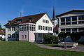
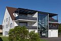
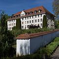
photos

railway station

Primary school building
Local government
Catholic parish
Fondation Rurale Interjurassienne


Web links
- Official website of the municipality of Courtételle
- François Kohler: Courtételle. In: Historical Lexicon of Switzerland .
Individual evidence
- ↑ Permanent and non-permanent resident population by year, canton, district, municipality, population type and gender (permanent resident population). In: bfs. admin.ch . Federal Statistical Office (FSO), August 31, 2019, accessed on December 22, 2019 .
Boécourt | Bourrignon | Châtillon | Courchapoix | Courrendlin | Courroux | Courtételle | Delémont | Develier | Ederswiler | Haute-Sorne | Mervelier | Mettembert | Movelier | Pleigne | Rossemaison | Saulcy | Soyhières | Val Terbi
Former municipalities: Bassecourt | Corban | Courfaivre | Glovelier | Montsevelier | Rebeuvelier | Soulce | Undervelier | Vellerat | Vermes | Vicques
Canton of Jura | Districts of the Canton of Jura | Municipalities of the Canton of Jura