
Corban
| Corban | ||
|---|---|---|
 |
||
| State : |
|
|
| Canton : |
|
|
| District : | Delémont | |
| Municipal municipality : | Val Terbi | |
| Postal code : | 2826 | |
| former BFS no. : | 6705 | |
| Coordinates : | 602 959 / 244134 | |
| Height : | 525 m above sea level M. | |
| Area : | 7.87 km² | |
| Residents: | 481 (December 31, 2017) | |
| Population density : | 61 inhabitants per km² | |
| Website: | www.val-terbi.ch | |
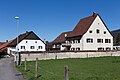
 Entrance to the village of Corban |
||
| map | ||
|
||


Corban was a municipality in the Delémont district of the canton of Jura in Switzerland until December 31, 2017 . The former German name Battendorf is only used sporadically today.
geography

Corban lies at 525 m above sea level. M. , ten kilometers east of the canton capital Delémont (straight line). The former street and stream line village extends along the Scheltenbach (French La Scheulte ) in the wide hollow of the Val Terbi , the easternmost part of the Delsberg basin .
The area of the 7.9 km² municipal area comprises a section in the east of the agriculturally intensively used depression of the Delsberg basin. The central part of the municipality is occupied by the lowlands of the two parallel streams La Scheulte and Montsevelier. These are separated from each other by a low knoll and drain the area west to the Birs . To the north, the municipality extends to the Jura ridge of the Fringelikette, whose steep southern slope is covered by the forest of Les Champés . Here lies at 913 m above sea level. M. the highest point in the municipality of Corban. In the south, the area extends to the level of Plain Fayen and Les Faivelies ( 768 m above sea level ), which form a northern fold of the Mont Raimeux chain . In 1997, 4% of the municipal area was in settlements, 33% in forests and woodlands, 62% in agriculture and less than 1% was unproductive land.
Several individual farms belong to Corban. The neighboring communities of Corban are Courchapoix , Vermes , Mervelier and Montsevelier in the canton of Jura and Bärschwil in the canton of Solothurn .
population
With 481 inhabitants (as of December 31, 2017), Corban was one of the smaller communities in the canton of Jura. 93.8% of the residents are French-speaking, 5.1% German-speaking and 0.5% Italian-speaking (as of 2000). The population of Corban was 392 in 1850 and 389 in 1900. In the course of the 20th century, the population always fluctuated between 390 and 450 people.
economy
Corban is still dominated by agriculture , but has also developed into a residential village in the second half of the 20th century. In the village there are only a few jobs outside of the agricultural sector. Many employees (around 60%) are therefore commuters and work mainly in the Delémont region.
traffic
Corban is located on the cantonal road from Delémont over the Schelten Pass to Mümliswil . It is connected to the train station in Delémont by a bus line that runs from the canton capital to Montsevelier .
history
A treasure with 104 Roman coins from the 1st and 2nd centuries AD, discovered in 1892, indicates that the area was already settled in Roman times.
Corban was first mentioned in 1184 under the German name Bathendorf . The French name Corpaon is documented from 1240 . The village of Corban belonged to the Moutier-Grandval provost and retained the Catholic faith even after the Reformation .
From 1797 to 1815 it belonged to France and was initially part of the Mont-Terrible department , but from 1800 it was linked to the Haut-Rhin department . By decision of the Congress of Vienna , the place came to the canton of Bern to the district of Moutier in 1815 . The residents of Corban voted in Juraplebisziten always for the creation of the Canton of Jura .
As a border municipality in the district of Moutier , Corban decided in the referendum of September 7, 1975 for the canton of Jura, transferred to the Delémont district in 1976 and joined the newly founded canton of Jura on January 1, 1979.
Attractions
The church of Saint-Blaise, which was built in 1683 and was able to retain its late Gothic elements despite later renovations, is slightly raised to the southeast of the village . Until the 17th century, Corban belonged to the parish of the southern neighboring parish of Vermes .
Personalities
- Henri Schaller (1886–1985), clergyman, journalist and newspaper publisher for the daily Le Pays.

View of the village

Saint Blaise Church

Interior of the church

St Blaise Church

Primary school and municipal administration
La Cure

Route Principale

local farmhouse


Web links
- François Kohler: Corban. In: Historical Lexicon of Switzerland .
Boécourt | Bourrignon | Châtillon | Courchapoix | Courrendlin | Courroux | Courtételle | Delémont | Develier | Ederswiler | Haute-Sorne | Mervelier | Mettembert | Movelier | Pleigne | Rossemaison | Saulcy | Soyhières | Val Terbi
Former municipalities: Bassecourt | Corban | Courfaivre | Glovelier | Montsevelier | Rebeuvelier | Soulce | Undervelier | Vellerat | Vermes | Vicques
Canton of Jura | Districts of the Canton of Jura | Municipalities of the Canton of Jura