Darß
The Darß is the middle part of the Fischland-Darß-Zingst peninsula , which lies on the southern Baltic coast near Ribnitz-Damgarten in Mecklenburg-Western Pomerania , Germany .
The Darß belongs to Western Pomerania , while Fischland historically belongs to the Mecklenburg part of the country . The border runs along the Grenzweg in Ahrenshoop .
Origin of name
The name Darß is derived from the old Slavic word dračĭ for thorn bush and means thorn place .
Location and nature


The Darß connects to the north-east of the Fischland and in turn merges into the Zingst peninsula in the east , the Prerower Strom forms the border here . In the north it is bordered by the Baltic Sea and in the south by the Saaler Bodden and Bodstedter Bodden , which belong to the Darß-Zingster Bodden chain . The Darß has a north-south extension and a west-east extension of ten to twelve kilometers each and includes the villages of Born a. Darß , Prerow and Wieck . The district of Ahrenshoop of the municipality of Ahrenshoop belongs to Vordarß, while the more southern districts of Ahrenshoops, Althagen and Niehagen belong to the Fischland.
Most of the Darß is covered by forest, the 5800 hectare Darß Forest . The lighthouse of the same name is located at the northern tip of the Darß, at Darßer Ort . The national park exhibition in Wieck a. Provides information about the geological development as well as the flora and fauna of the Vorpommersche Boddenlandschaft National Park. Darß and the Natureum attached to the Darßer Ort lighthouse as a branch of the Stralsund Marine Museum . In front of the Darßer Ort is an extensive chain of sandbanks in a northeastern direction. The entire area around the Darßer Ort and the northwestern part of the Darßwald belong to the protection zone I of the national park and may only be walked on signposted paths. The rest of the forest area is also part of the national park.
geology
The Darß was originally an island that emerged from an ice age island core. Geologically it is a very young landscape. The formation process began with the end of the Vistula Ice Age around 12,000 years ago. This left a young moraine landscape here . The thawing inland ice lifted the land below and the depressions were filled with water, creating the predecessor of the later Baltic Sea, the Ancylus Sea . So only the protruding ridges remained as islands. The large forms of the coasts in the southern area of the Baltic Sea were formed by the Littorina transgression about 7,000 to 2,500 years ago. About 5,000 years ago the sea level reached its present level, the cores of today's Darß and Zingst became islands. 4,500 years ago, the influx of salt water from the North Sea was severely restricted. The Baltic Sea has been slowly sweetening since then. Due to coastal erosion (land erosion , drifting and sedimentation), the islands of that time acquired their present shape over time. About 1,500 years ago, the increasingly longer spits cut off the bays behind them, so that the Darß-Zingster Boddenkette was created. At the end of the 14th century, the Darß became a peninsula, with occasional interruptions, when the estuary south and north of the Fischland was closed. In 1874 the Prerower Strom between the Darß and the Zingst was artificially closed.
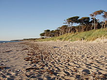
The land formation process continues in the east of the peninsula today. Even today you can see former beach ridges in east-west direction far inside the Darßes. At Darßer Ort is today the apex of the dynamic coastal formation typical of Darß: South of this point, land is being removed from Fischland and Darßer Weststrand, to the northeast, land is washed up. Consequences of these changes are the extensive sandy beaches on the north coast of Darß and the Zingst peninsula and the permanent creation of new land at Darßer Ort. On the west beach of the Darß are the Rehberge , which are seven meters above sea level .
history
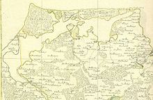
Historically, Darß and Zingst belong to Western Pomerania . The Darß bordered with the Vordarß at the southern end of today's district of Ahrenshoop on Mecklenburg . The border between Pomerania and Mecklenburg was on the Loop , which, as a connection between the Baltic Sea and Saaler Bodden on today's Grenzweg, made Darß an island until the Middle Ages. In 1392 or 1393, 1000 men from Rostock, whose patricians saw their trading privileges impaired by a seaport on the Darß, destroyed the port of Ahrenshoop and "damned" the loop. This was the first time that the Darß was connected to the Fischland peninsula. In the meantime there were repeated breakthroughs, but they did not last long, for example in 1625 (storm surge), 1761 (artificial opening according to map) and 1872/1874 (storm flood). The river, which has since silted up in 1872 and 1874, as well as the Grenzweg still bear these path names in the Ahrenshoop district. After the Thirty Years' War until 1815, the Darß was Swedish like all of Western Pomerania and, from 1715 to 1720, Danish for a short time. For a long time, the border on the former loop consisted of only one customs station, through which the village developed into the settlement of boatmen and fishermen in the 18th century and into the bathing and pensioner resort of Ahrenshoop in the 19th century.
In 1872 and finally in 1874, the Prerow River with its two outflow arms was first washed up and then artificially sealed off by the storm floods. Between 1880 and 1920, massive dykes and foredunes were created according to the respective measuring table sheets. Zingst was no longer an island and today's Fischland-Darß-Zingst peninsula was finally formed.
For a short time in 1941 , the SS maintained the Darß-Wieck concentration camp , a satellite camp of the Neuengamme concentration camp .
Forests, forests, hunting and nature conservation
One of the most famous so-called primeval forests of the German Empire was located on the Darß . However, it should not be regarded as an actual jungle, as it has been used for forestry with varying degrees of intensity since the Middle Ages. It was not until the establishment of the Vorpommersche Boddenlandschaft National Park that forestry use was ended, at least in the core zone in the northwest of the Darß Forest, in accordance with the national park motto "Let nature be nature". The traces of forest use can still be clearly seen in the Darßwald, one of the largest contiguous forests in Mecklenburg-Western Pomerania. The Darßwald was formerly a pasture forest. From this time the numerous, sometimes widely spaced and bizarre grown willow beeches remain. The Darßwald was particularly exploited by the Danish and French occupiers . For example, all the old yew trees fell victim to the short Danish period . They were used for the interior paneling of the Rosenborg and Amalienborg castles .
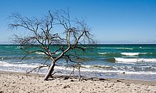
The heather landscape that had been left behind with mostly loose trees was gradually reforested by the Prussian foresters. Fast-growing softwood species were used. The spruce , European larch and Douglas fir , which are still widespread in the Darß Forest today, do not naturally occur there. The proportion that is taken up by the Scots pine today is also to be regarded as too high. Natural forest pine forests exist on the younger reefs, the former beach ridges, in the north. In the dune valleys, the Riegen, near-natural red alder forests have now developed . On the older reefs, naturally red beech forests with acidic soil can be expected. The natural tree line on the west beach of the Darß is also formed by the red alder. The strong royal fern growth in the undergrowth in the entire Darßwald is also striking .
Another indication of the intensive forestry use are the Harz puddles on many old pine trunks. They were carved into the trunk at an angle to extract resin. Even during the GDR era, it was used to extract raw materials for the chemical industry.
Until 1945, there were bison that lived in the Darßwald in the 1930s . Hermann Göring and later Erich Honecker held hunts here . Well-known foresters who worked on the Darß were Ferdinand von Raesfeld (from 1890 to 1913) and Franz Mueller-Darß (1925 to 1945). The strong red deer population is an attraction of the Darßwald, especially during the rutting season in late summer and autumn .
Tourism and mobility
The tourism plays on the Darss a very important role and is the most important economic factor for this region. The majority of tourist accommodation is made up of the type of holiday home and apartment, often privately owned. The campsites also have a large share in the tourist offer. There is only one larger hotel (Bernstein Hotel in Prerow), several medium-sized and small hotels and pensions. The four places on the Darß are all health resorts and therefore also entitled to collect visitor's tax from visitors. The tourist tax is the second major source of income for the municipalities alongside trade tax income.
The Darß can no longer be reached directly by train. The Usedomer Bäderbahn runs every hour from Velgast (direct connection from Rostock and Stralsund) via Saatel and Kenz to Barth . From Barth and Ribnitz-Damgarten there are daily buses of the Vorpommern-Rügen transport company across the peninsula.
The western edge of the abyss with the wind fluff ( west beach ) and the fine sandy beaches of Prerow ( north beach ) are popular. Another point of contact is the lighthouse at Darßer Ort with the Natureum information center of the Vorpommersche Boddenlandschaft National Park. The extensive Darßwald is closed to motorized traffic and is best explored with bicycles, which can also be rented in the holiday resorts. A hiking trail leads along the west beach. A circular hiking trail leads partly on wooden planks over pine forest , reed areas and dunes through the younger landings at Darßer Ort. Two massive oak plank towers also enable the observation of migratory birds in the offshore beach lakes as well as wild boar and red deer. The first German offshore wind farm Baltic 1 has been in operation since May 2, 2011, 16 kilometers north of the Darß peninsula .
literature
- History and culture
- Doris Pagel, Jörg Pagel, Holger Becker: The Darß (= pictures from the GDR ). Sutton, Erfurt 2006, ISBN 3-89702-952-9 .
- Gerta Anders: The Darß and Zingst peninsula. A home book. Edited by Käthe Miethe . Revised and expanded edition. Hinstorff, Rostock 1956 (photomechanical reprint. Ibid 2000, ISBN 3-356-00860-9 ).
- Gustav Berg: Contributions to the history of Darßes and Zingstes. Wielandhaus, Prerow (Darß) 1934 (2nd, improved and increased edition. (= Series of publications of the Association for the Promotion of Homeland Care and the Darß Museum eV .. No. 1). Scheunen Verlag, Kückenshagen 1999, ISBN 3-929370 -83-2 ).
- Wolfgang Frank : Horn and peal fade away. The chronicle of forester Franz Mueller-Darß . 17th edition. blv, Munich et al. 2001, ISBN 3-405-13176-6 .
- Waldemar Martens: Where eagles and storms still hunt ... Three decades of forester and hunter on the Darß. 5th edition. Neumann-Neudamm, Melsungen 2004, ISBN 3-7888-1012-2 .
- Antje Hückstädt, Klaus-Dieter Hoppe: The Darß Museum Prerow. A companion through history and exhibitions. Darß-Museum, Prerow 2003, ISBN 3-00-012662-7 .
- Johannes Segebarth : The Darßer smugglers . From the Low German by Dieter Karow. 2nd Edition. Scheunen-Verlag, Kückenshagen 2002, ISBN 3-934301-44-4 .
- Konrad Billwitz, Haik Thomas Porada (ed.): The peninsula Fischland-Darß-Zingst and the Barther country. A regional survey in the area of Wustrow, Prerow, Zingst and Barth (= Landscapes in Germany. Vol. 71). Böhlau, Cologne et al. 2009, ISBN 978-3-412-09806-3 .
- cards
- Cycling and hiking map. Fischland, Darss, Zingst. Dierhagen, Wustrow, Ahrenshoop, Born, Wieck, Prerow, Zingst, Barth. 1: 30,000. 8th, updated edition. Green Heart, Ilmenau 2007, ISBN 978-3-929993-33-2 .
- nature
- Harald Benke (Ed.): The Darß-Zingster Bodden. Monograph of a unique coastal landscape (= sea and museum. Vol. 16, ISSN 0863-1131 ). German Maritime Museum, Stralsund 2001.
- Günter Schlungbaum, Henning Baudler, Mathias Krech, Bernd Kwiatkowski: The Darß-Zingster Bodden. A study (= series of publications by the State Office for the Environment, Nature Conservation and Geology Mecklenburg-Western Pomerania. H. 2001, 1, ISSN 0944-0836 ). Corrected 2nd version from August / September 2000. State Office for the Environment, Nature Conservation and Geology Mecklenburg-Western Pomerania, Güstrow 2001.
- Travel guides and illustrated books
- Frank Thamm: Darß, Fischland and Zingst. 6th, updated edition. Ellert and Richter, Hamburg 2013, ISBN 978-3-89234-815-3 .
- Roland Buchwald: Fischland, Darß and Zingst. Travel and landscape guides. 4th, completely revised, expanded and redesigned edition. Grünes Herz, Ilmenau et al. 2010, ISBN 978-3-929993-52-3 .
- Waldemar Martens, Ralf Hausmann, Uwe Martens: Nature hiking guide Darß. With the forester through the woods and fields. The most beautiful walking and cycling tours on the Darß in the Vorpommersche Boddenlandschaft National Park. Bjoern-Verlag, Krefeld 2000, ISBN 3-922348-06-8 .
- Horst Prignitz, Thomas Grundner: Fischland, Darß, Zingst. 2nd, slightly revised edition. Carl Hinstorff, Rostock 2004, ISBN 3-356-01056-5 .
- Adventure Darß - travel report, rbb television from April 3, 2015 - http://www.rbb-online.de/doku/a/ablebnis-darss/ablebnis-darss.html
Web links
Individual evidence
- ^ Paul Kühnel: The Slavic place names in Meklenburg. In: Yearbooks of the Association for Mecklenburg History and Archeology. Vol. 46, 1881, ISSN 0259-7772 , pp. 3-168, here p. 38.
- ↑ Barthold 3, p. 539 ( Google Books )
- ↑ Bus timetables of the Vorpommern-Rügen transport company
Coordinates: 54 ° 25 ′ 0 ″ N , 12 ° 32 ′ 0 ″ E


