
Fallbach
|
Fallbach
|
||
|---|---|---|
| coat of arms | Austria map | |
 |
|
|
| Basic data | ||
| Country: | Austria | |
| State : | Lower Austria | |
| Political District : | Mistelbach | |
| License plate : | MI | |
| Surface: | 30.42 km² | |
| Coordinates : | 48 ° 39 ' N , 16 ° 25' E | |
| Height : | 248 m above sea level A. | |
| Residents : | 819 (January 1, 2020) | |
| Population density : | 27 inhabitants per km² | |
| Postal code : | 2133 | |
| Area code : | 02524 8466 | |
| Community code : | 3 16 09 | |
| NUTS region | AT125 | |
| Address of the municipal administration: |
Fallbach 30 2133 Fallbach |
|
| Website: | ||
| politics | ||
| Mayor : | Josef Kerbl ( ÖVP ) | |
|
Municipal Council : ( 2020 ) (15 members) |
||
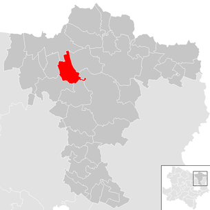
| Location of Fallbach in the Mistelbach district | ||
  |
||
| Source: Municipal data from Statistics Austria | ||

Fallbach is a municipality with 819 inhabitants (as of January 1, 2020) in the Mistelbach district in Lower Austria .
geography
Fallbach is located in the northern Weinviertel in the hills south of the Laaer Ebene in Lower Austria, about ten kilometers south-southeast of Laa an der Thaya .
The area of the municipality covers 30.42 square kilometers. 21.53 percent of the area is forested.
Community structure
The municipality includes the following five localities (population in brackets as of January 1, 2020):
- Fallbach (184)
- Friebritz (36)
- Hagenberg (196)
- Hagendorf (202)
- Loosdorf (201)
The community consists of the cadastral communities Fallbach, Friebritz, Hagenberg, Hagendorf and Loosdorf.
Neighboring communities
history
In the last days of the Second World War , between April 2 and April 20, 1945, Fallbach became the scene of violent and eventful battles between troops of the Wehrmacht and the Red Army , which took place between Fallbach and Altenmarkt . Several civilians were killed and numerous buildings destroyed or at least damaged. Fallbach was occupied by the Red Army on April 21, 1945. Infantry and tank battles took place over four days in Loosdorf before the Soviets took the village on April 22nd. However , a small unit of the Waffen SS was able to hold out on the ruins of Hanselburg until the Wehrmacht surrendered on May 8, 1945.
coat of arms
Blazon : "Above a blue corrugated shield base, inside three silver corrugated strips, split by gold and green, in front a conical red tower with five battlements, an open black arched gate and black window, behind five tied golden ears of corn."
Population development
In 1971 the place had 1,062 inhabitants, since then the number of inhabitants has decreased and in October 2008 it was only 826.
politics
The municipal council has 15 members.
- With the municipal council elections in Lower Austria in 1990, the municipal council had the following distribution: 13 ÖVP and 2 SPÖ.
- With the municipal council elections in Lower Austria in 1995, the municipal council had the following distribution: 13 ÖVP and 2 SPÖ.
- With the municipal council elections in Lower Austria in 2000, the municipal council had the following distribution: 13 ÖVP and 2 SPÖ.
- With the municipal council elections in Lower Austria in 2005 , the municipal council had the following distribution: 13 ÖVP and 2 SPÖ.
- With the municipal elections in Lower Austria in 2010 , the municipal council had the following distribution: 14 ÖVP and 1 SPÖ.
- With the municipal council elections in Lower Austria in 2015 , the municipal council had the following distribution: 14 ÖVP and 1 SPÖ.
- With the municipal council elections in Lower Austria 2020 , the municipal council has the following distribution: 14 ÖVP and 1 SPÖ.
- mayor
- until 2013 Karl Nagl (ÖVP)
- since 2013 Josef Kerbl (ÖVP)
Culture and sights


- Museums
- Hagendorf village museum
- Hagendorf turner's museum
economy
In 2001 there were 26 non-agricultural workplaces, and according to the 1999 survey there were 70 in agriculture and forestry. According to the 2001 census, the number of people in employment in the place of residence was 343. The employment rate in 2001 was 40.76%.
Sports
- The USC Fallbach is the sports club playing in Hagendorf with the tennis and soccer sections. The association was founded in 1970.
- The football team plays in the 2nd district class Pulkautal.
Personalities
- Alexander von Bach (1813-1893), Austrian politician
- Josef Eisenhut (1864–1928), Austrian politician
- Lambert Rohrböck (1917–2003), Austrian politician
- Horst von Wächter , lord of the castle, writer and painter
Web links
- 31609 - Fallbach. Community data, Statistics Austria .
Individual evidence
- ↑ Statistics Austria: Population on January 1st, 2020 by locality (area status on January 1st, 2020) , ( CSV )
- ^ Army History Museum / Military History Institute (HGM / MHI) , Military History Research Department (MilFoA), study collection, inventory 1945, box 5, fasc. 45/9, municipality reports Lower Austria, District Mistelbach
- ^ Result of the municipal council election 1995 in Fallbach. Office of the Lower Austrian State Government, March 30, 2000, accessed on March 19, 2020 .
- ^ Election result of the municipal council election 2000 in Fallbach. Office of the Lower Austrian State Government, February 4, 2005, accessed on March 19, 2020 .
- ^ Election result of the municipal council election 2005 in Fallbach. Office of the Lower Austrian State Government, March 4, 2005, accessed on March 19, 2020 .
- ^ Election result of the municipal council election 2010 in Fallbach. Office of the Lower Austrian State Government, October 8, 2010, accessed on March 19, 2020 .
- ^ Election result of the 2015 municipal council election in Fallbach. Office of the Lower Austrian State Government, December 1, 2015, accessed on March 19, 2020 .
- ↑ Results of the municipal council election 2020 in Fallbach. Office of the Lower Austrian State Government, January 26, 2020, accessed on March 19, 2020 .
- ↑ Entry about Schloss Hagenberg at Lower Austria Burgen online - Institute for Reality Studies of the Middle Ages and Early Modern Times, University of Salzburg

Altlichtenwarth | Asparn on the Zaya | Bernhardsthal | Bockfließ | Drasenhofen | Falkenstein | Fallbach | Gaubitsch | Gaweinstal | Gnadendorf | Großebersdorf | Grossengersdorf | Greater harras | Great Krut | Hausbrunn | Herrnbaumgarten | Hochleithen | Kreuttal | Kreuzstetten | Laa an der Thaya | Shop Village | Mistelbach | Neudorf im Weinviertel | Niederleis | Ottenthal | Pillichsdorf | Poysdorf | Rabensburg | Schrattenberg | Staatz | Stronsdorf | Ulrichskirchen-Schleinbach | Unterstinkenbrunn | Wildendürnbach | Wilfersdorf | Wolkersdorf
Cadastral communities: Fallbach | Friebritz | Hagenberg | Hagendorf | Loosdorf
Locations: Fallbach | Friebritz | Hagenberg | Hagendorf | Loosdorf
Villages: Fallbach | Friebritz | Hagenberg | Hagendorf | Loosdorf Other locations: Hanselburg ruins | Hagenberg Castle | Loosdorf Castle
Counting district: Fallbach | Hagenberg | Friebritz | Loosdorf | Hagendorf