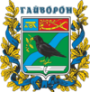
Hajworon
| Hajworon | ||
| Гайворон | ||

|
|
|
| Basic data | ||
|---|---|---|
| Oblast : | Kirovohrad Oblast | |
| Rajon : | Hajworon district | |
| Height : | 155 m | |
| Area : | Information is missing | |
| Residents : | 14,523 (2019) | |
| Postcodes : | 26300 | |
| Area code : | +380 5254 | |
| Geographic location : | 48 ° 20 ' N , 29 ° 52' E | |
| KOATUU : | 3521110100 | |
| Administrative structure : | 1 city | |
| Address: | вул. Кірова 30 26300 м. Гайворон |
|
| Website : | City council website | |
| Statistical information | ||
|
|
||
Hajworon ( Ukrainian Гайворон ; Russian Гайворон Gaiworon ) is a city on the left bank of the Southern Bug in the west of the Ukrainian Oblast Kirovohrad with about 14,500 inhabitants (2019).
The village was founded in 1796 on an already existing Cossack settlement, its center was originally a little northwest of today's city center. With the construction of several narrow-gauge lines from 1899, Hajworon became the center of today's Hajworon narrow-gauge network , and it has had city status since 1949.
The city lies at an altitude of 155 m near the border with Oblast Vinnytsia about 175 km west of the Oblastzentrum Kropywnyzkyj . The T-02-07 territorial road runs through the village . Many residents are mainly employed in the railway repair shop for the narrow-gauge railways.
Sons and daughters of the village
- Igor Jakowlewitsch Krutoi (* 1954), Russian singer and songwriter
- Jana Katschur (* 1997), sprinter
Web links
- Local history of Hajworon in the history of cities and villages of the Ukrainian SSR (Ukrainian)
Individual evidence
- ↑ Cities and Settlements of Ukraine on pop-stat.mashke.org ; accessed on May 9, 2020

