Hefel (Velbert)
|
Yeast
City of Velbert
Coordinates: 51 ° 21 ′ 35 ″ N , 7 ° 3 ′ 18 ″ E
|
||
|---|---|---|
| Height : | 125 m above sea level NHN | |
| Area : | 2 km² | |
| Residents : | 195 (May 9, 2011) | |
| Population density : | 98 inhabitants / km² | |
| Postal code : | 42551 | |
| Area code : | 02051 | |
|
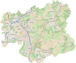
Location of Hefel in Velbert |
||
|
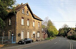
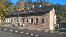
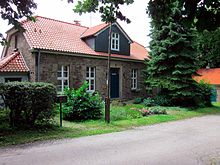
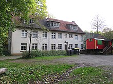
In addition to half-timbered houses, many buildings in the Hefel are made of Ruhr sandstone because of the quarries located here .
|
||
Hefel is a district of Velbert in the Mettmann district in North Rhine-Westphalia .
geography
Geographical location
The Hefel is located in the Niederbergisches Land on the northern edge of the urban area of Velbert in the valley of the Hesperbach . In terms of natural space, the entire district lies in the Ruhr stratified rib land (ordinal number 337 1 .14). The Hesperdach forms a breakthrough valley here , which runs in a north-south direction, while the rocks sweep from south-west to north- east .
The Hefeler Bach flows here as the left tributary, the Röbbeck and Willinghaus Beeke as the right tributaries , which together form a basin.
Due to its historical division, the Hefel is not clearly delineated as a district. The origin of the name goes back to the Großhefel farm, which was transferred to the valley and is still used today by the population and local businesses. In the Prussian new recording in 1892, the place is recorded as a "village without a church".
Neighboring districts
From west to south the Velberter neighborhoods bordering Long Horst , North City and Röbbeck at, in the east of the sparsely populated outskirts Rottberg , in the north the city is from food .
geology
The core of the Velberter Sattel south of the Hefel consists of chalky slate . Around the Velberter Sattel and grazing the Hefel lies the narrow Kulm coal-lime band , which is built up from a dense sequence of banky limestone , lime sandstone and alum slate . To the east and north, there is a zone of greywacke and quartzites of the empty carbon fiber , followed by an upstream zone of shale and sandstones with layers of lean coal. This great variety of geological conditions is particularly evident in the breakthrough valley of the Hesperbach and early on led to the formation of a diverse extraction of mineral resources.
climate
With western air currents, humid Atlantic air masses in the Bergisches Land encounter an obstacle for the first time and are dammed up ( windward position ). The consequence is incline rain , which here precipitation amounts of 900-1,000 mm p. a. bring. The valley of the Hesperbach shows very cool tendencies in summer and is of importance for air hygiene as a cold air collection area.
history
Affiliation
The history of the district is divided into three parts up to the 20th century: to the west of the Hesperbach, the Kleinumstand family belonged to the Werden abbey , as did the Rodberg family with the Friesenkotten and the Bernsmühle. In the 19th century, several rural communities were formed in the Essen district from the monuments of the former Reichsabbey of Werden . The seven honnships with Kleinumstand and Rodberg lying south of the Ruhr and east of the city of Werden formed the community of Siebenhonnschaften , which belonged to the mayor's office of Werden-Land. On January 15, 1875, the municipality of Kupferdreh was formed from the Honors Hinsbeck and Rodbeck. The municipality of Kupferdreh belonged to the Werden-Land mayor. On October 1, 1896, Kupferdreh was removed from the mayor's office in Werden-Land and made mayor's office. The Hefel was now even divided into four at times.
The part to the east of the Hesperbach in the Rottberg peasantry belonged to the Hardenberg rule . As a result of the French municipal reorganization of the Grand Duchy of Berg , the mayor's office of Hardenberg was created .
South of the Hefeler Bach and west of the Hesper Bach was the Honschaft Velbert which belonged to the Duchy of Berg . In 1806, the municipality or Mairie Velbert was created as part of the canton of Velbert in the Düsseldorf arrondissement . In 1816 the Mairie Velbert became the mayor's office of Velbert .
For more than seven hundred years, the triangle of territorial borders lay exactly in the center of the Hefel.
Incorporation
In 1913 the name "Velbert Land", to which the southern part of the Hefel had belonged since the establishment of the mayor's office , was dropped . In the city of Velbert , this part of the Hefel was now in the Feldmark (meaning the outside area ) Friedfeld.
In 1928 the Rottberg farming community was incorporated into the city of Velbert with all the farms east of the Hesperbach, Gut Sondern, the Plöger quarry and the Hesperbach valley .
In 1930 the parts of the Langernhorster forest belonging to the Honschaft Kleinumstand and the northern parts of the Hefel with the Bernsmühle and the large quarries belonging to the Honschaft Rodberg were incorporated by the city of Velbert. For the first time in history, the Hefel now only belongs to a local authority.
Population development
Due to the division into three administrative units, population statistics are not available. The Hefel was already the residence of Italian guest workers in the 19th century , who worked in the nearby quarries.
etymology
The Hefeler Busch was first mentioned around 1000 AD as Hevetagel . The farm established here was later called Hefftall 1499, Hetftell 1573, Hef (f) tel 1661, Häffel 1789, Hefthal 1798. Hefel or Hevel / Heven- is to be seen in a similar way to Havel (the umlaut to ä or e = Hefel always results from the following e or i), which in Lower Franconia means something like boggy, swampy-dirty water; so an old water body name.
Medieval settlement
The first development approaches in the area around the Hefel can be found at the Alteburg in Werden, an Iron Age ring wall system that dates back to the 3rd century BC. The Werden monastery was built here in 799, from which the settlement advances reached as early as 800 into the Hesper Valley. In a document from 875, the Werden Zeht district was confirmed with the "Villa Rottberg and Velbert" in which the Hefel was located. In the 11th century the Abbey of Werden lost the honor of Velbert to the Counts of Berg and in the 13th century the farmers of Rottberg to the County of Hardenberg. However, the Werden abbots continued to be landlords and shepherds in this region.
The Hefeler Busch (around 1000 Hevetagel) later belonged to the Velberter Oberhof, which suggests a settlement from the Velbert area. The Ellingrath and Sondern farms come from the late Middle Ages, the Hammerschmidt and Hefelschmidt mills from the 16th and 17th centuries. Century and the Kotten In der Kuhlen and Auf`m Broegel the 18./19. Century
Mining
The history of mining in the Hefel area began in the Middle Ages due to the special geological location . Alum slate , limestone, sandstones, coal and ores were mined here in a very short distance .
In 1578, the abbot Heinrich Duden granted mining rights for alum mining to the trades Georgh Schell zu Vechen, Rentmeister zu Hörde , Arnold Scholl, citizen of Cologne , Christoffer Scholl, Hogreven zu Schwelm , and Gerhardt Mylander, mayor of Elberfeld, in a loan letter . The subsequent abbot Conradt then pronounced a new loan for the trades Johann Hugenpoet zu Stockum and Voiswinkel, Dorst zu Hamm , Johann Schell zu Goltschmedinck and Wyrich von Witgenstein, Richter zu Castrop . In the Thirty Years War the alum mine came to a standstill. In 1698 Johann Christian Hermann von Neuhoff acquired the mining rights. These rights passed to the Düsseldorf merchant Egidius Micholtz in 1719. Finally, the mining commissioner Haardt was enfeoffed with the alum mine together with some other trades. In the letter of August 1798, this alum mine with attached alum factory was run under the name 'Aurora'. The operation or the exploitation ended around 1830.
In 1830 the Eduard III lead, copper and zinc ore mine was opened in the Hesper Valley above the Hefel . The owner was the Eduard III union, represented by the representative lawyer Dr. Müller in Velbert. However, the work was soon stopped again because an ore was not exposed.
On January 1, 1834, operations began at the only Klein Umstand coal mine, which was located and built exclusively in Velbert . In the Hesper Valley near the Friesekottens, a tunnel was excavated that was 33 m long on January 31, 1834. Between 1836 and 1841 there was only insignificant dismantling. It is not known when the final shutdown and the miners' de-registration took place.
In the middle of the 19th century, Josef Dinkloh dug a sandstone quarry on the Hefel street, immediately before the junction to Kupferdreh . Sandstone from this quarry was u. a. also delivered to the Essener Gruga . The quarry was last operated by the Bürger company. Operations ended in the late 1970s due to the construction of the A44 motorway.
Shortly after Dinkloh, the farmer Oberlühnschloß opened another sandstone quarry on the other side of the street, exactly opposite the Dinkloh quarry. This was operated by the architect Peter Groß until 1968 under the company name Hefeler Sandsteinwerke GmbH . From 1968 the quarry was backfilled for motorway construction.
At the end of the 1860s, the Sonnenschein limestone quarry was built in Hefel, south of the former alum mine , but older quarries are also used for limestone mining. To remove the limestone, a tunnel was driven, which was finally connected to the Hespertal Railway. Later the quarries were transferred to the Stolberg union.
In the mid-1870s, the Stolberg union acquired the rights to quarry limestone between the Im Sondern and Röbbeck farms. There were already smaller old stone quarries and lime kilns that had been set up by the farmers. The lime that was broken in the Plöger limestone quarry, which went into operation around 1877 , was first driven off with horse-drawn vehicles. Around 1890, the Röbbeck quarry was connected to the railway in Hefel via a Bremsberg.
In 1895 exploration work began on the United Glückauf lead ore mine south of the Hefel. The main shaft reached a depth of 252 m. The reason for the exploration work at this point was probably the proximity of the 'Helene' site in the Röbbecker (Plöger) quarry. In the quarry operated by the Stolberg trade union since the mid-1870s, the remains of an old, partially broken tunnel were found in an ore vein. In 1912, the 'Shaft 2' mine had been shut down for some time and should be demolished. However, shaft 2, which was only a few years old, collapsed due to the poor stability of the mountains with all buildings and conveyor systems.
After the narrow-gauge railway from Hefel via the Hesper Valley to Hesperbrück or up to the Richradt colliery was abandoned in 1916, the Röbbeck quarry and the other limestone quarries in the Hefel were also abandoned.
Development after 1945
Because of the historical tripartite division, the district could not form its own parish, as the parish members were oriented towards Velbert, Werden, Langenberg, Neviges or Dilldorf. Therefore, there was no denominational school either. The Rottberger Schule , a peasant school , closed in 1968. In contrast to other suburbs of Velbert, no industry could be established due to the lack of easily accessible building land. In the master plan of the city of Velbert from 1954, the Hefel no longer played a role as a district to be developed independently.
In 1954 buses still drove from Velbert over the Hefel to Essen, Kupferdreh and Hattingen. The shutdown of the last bus route 171 between Velbert and Essen- Kupferdreh took place on July 31, 2010, which meant that the Hefel was no longer served. A taxi bus line running on request should replace the line bus, but no longer to the S-Bahn to Kupferdreh.
In November 2015, the Technischen Betriebe Velbert decided to switch off the street lighting, consisting of 10 mast lights, when one of the masts needed repair. According to the TBV, the maintenance costs were € 100 p. a. However, as it is a state road, the TBV did not see their responsibility here. Streets.NRW, in turn, refused to accept the costs because street lighting was "not necessary for traffic safety reasons". The street lighting could only be switched on again when the TBV board of directors intervened.
The Bernsmühle, the former YMCA home, was temporarily used as a youth hostel by the city of Velbert, and most recently by a free church, was sold in 2018.
Culture and sights
Buildings
Aurora , (1828 alum factory) today Hefel 21, was the boiling plant of the alum mine, also known as the alum factory, which existed until 1830. The buildings have changed significantly and are now used as a residential building.
Bernsmühle (1499 Moelenbeek, around 1500 Der Mollenhe (e) spe 1512 Berndt in the Molenheespe; 1582 in the Verbven den moelen Heyßpe), today Hespertal 2, was a grinding mill founded in the area of the Reichsabbey Werden . In the 1920s, a youth rest home of the YMCA Essen was built on the mill site. The building still stands today and the name Bernsmühle was transferred to it. It had 180 beds and was generally used as a youth hostel. In the interwar period it had a swimming pool in summer and a toboggan run and ice skating in winter. The Bernsmühle was also made available to female Protestant youth on several Sundays from 1933 onwards. When the 10-18 year old members of the YMCA had to give up their membership in February 1934, the number of visitors declined because it was now part of everyday life in the Landheim that the HJ patrol service carried out controls there. The building was confiscated during World War II. On March 13, 1940, 80 soldiers move into the Bernsmühle. After their departure, the Velbert city administration confiscated the home to accommodate 100 French prisoners of war who worked in the neighboring farms and factories. A 2 m high barbed wire fence and bars in front of the windows marked the building. Since the nearby Krupp night light facility attracts bombing raids on the Hefel, the farmhouse belonging to the Bernsmühle is destroyed on January 4, 1943 and not rebuilt. After the invasion of American troops in April 1945, the home is looted by the residents.
Großhefel (1499 before the Heefftael, 1582 the Hofthal, 1874 Großhovel), today Hefel 23, was founded as the oldest farm in the Hefel in the Honschaft Klein circumstance in the Reichsabtei Werden.
In der Hefelschmitt (1355 and 1499 In der Smitten, 1508 Die Schmitte, 1582 village house in der Schmitten, 1602 In der Schmitten Vogelsangkotten, 1816 In der Hoefel Schmitt, 1844 Hefelschmidt) today Eintrachtstraße 4 and 8, is a Reckhammer built in the county of Hardenberg . The Reckhammer was an armory operated by Wilhelm Huffmann in 1804 in the Röbbeck valley .
In Hammerschmidt , today Hefel 13, there was also a Reckhammer.
In the Kuhlen , today Hefel 6, is a farm located in Hardenberg in 1355. Initially operated as a forge, Adolf Loos set up an inn here before 1804. In 1879 Eduard Thomas took over the "Bergisches Haus" and developed it into a popular restaurant. The inn, most recently "Thomas im Hefel", closed in the 1990s.
Kleinhefel (1499 Gut vor dem kleine Hefel, 1863 in Hefel) today Zechenweg 77-79 was founded as a split from Groß Hefel in the Honschaft Velbert. In 1913 the address was Röttgen 7-10.
The Royal Hesper Fulling Mill, located below the Bernsmühle, was demolished in the middle of the 19th century.
Stolberg , today Hefel 9, was built at the beginning of the 20th century and was the headquarters of the Stolberg mining company and is now the last restaurant in the upper Hesper Valley.
But , (1356 Gut und Gülte zu Sundert), today Zechenweg 40-42, was founded as an hereditary farm in the county of Hardenberg. The estate was a fief of the Werden Abbey and was given to their servants. But these were not sitting on the estate. It was true that only half of the property was mortgaged. It is not known where the other half belonged. The loan from 1402 always took place with the Kotten or Hof "in the Schmitten". today called Hefelschmitten. The current building status is from 1958, as the main building, a half-timbered house, burned down in the fall of 1957. The Leibzucht, a half-timbered house from 1713, was acquired by the city of Velbert, rented out and demolished in 2009 due to disrepair, although it was a listed building. Around 1970 there was still a bakery in the immediate area .
Green spaces and recreation
The Hefel is an old excursion area in the north of Velbert. It is nestled between the Langenhorster Forest (a forest area that the city had acquired before Klein was incorporated into the city in 1930) and the Nordpark (Velbert), which was created around 1930 by the Velbert Beautification Association and the Nordstädtischer Beautification Association as a job creation measure. The wooded heights of the Baldeneysee connect to the north and east .
The excursion area is made accessible through the Neanderlandsteig , the Bergischer Weg and the Harkortweg , a long-distance hiking trail of the Sauerland Mountain Association , which are concentrated in the Hefel, as well as numerous circular hiking trails .
Economy and Infrastructure
traffic
The swampy and traffic-hostile Hespertal was not developed until modern times. The Strata Coloniensis ran over the heights to the west and the Höhenstraße from Langenberg to Werden , today's Rottberger- / Ludscheidstraße, to the east over the Rottberg . Neighborhood paths branched off from these mountain roads and opened up the mills, mines and cottages of the Hesper Valley and the Hefel via the ridges between the small side valleys.
In 1874 the "Hefeler Weg" was expanded from Velbert to the Hesper Valley. Today it is called Hefeler Straße and Hefel (L 439).
From 1878 to 1891, the Werden-Land mayor's office expanded the Schwarzen-Hefeler Provinzialstraße. Today it bears the name Hespertal (L 438)
Between 1887 and 89 the first road construction in Kupferdreh-Hefel was carried out by the mayor's office in Kupferdreh. Today it bears the name Hefel (K 31).
In 1906 the mine management of the lead colliery Vereinigte Glückauf had today's 'Zechenweg' built through the undeveloped upper Hespertal from Hefel to Velbert in order to facilitate the delivery and removal of material.
It was not until 1930 that the Eintrachtstrasse was built in the previously undeveloped Röbbeck valley as a communal connection from Hefel to Nieding and to Langenberg .
After the Second World War, the highway connection from Velbert via the Hefel to Kupferdreh was upgraded to the federal road 227 and was the main connection from Velbert to the eastern Ruhr area . The volume of traffic reached considerable proportions. The hard coal production in the Hespertal also contributed to this. With the new construction of Autobahn 44 , which was approved in 1985 and spans the Hefel with a viaduct, the B227 from Velbert to Hefel and to Zum Schwarzen in Werden was downgraded to Landstrasse 439 or 439, and the section from Hefel in the direction of Kupferdreh was downgraded to District Road 31 . Since then, there has been almost no through traffic. Since then, the roads have become a popular excursion route with frequent and serious motorcycle accidents and considerable noise.
In order to manage the transport of the lime from Hefel to Hesperbrück, a narrow-gauge railway was built through the southern Hesper Valley to Hefel , as in 1870/71 , which is connected to the old towing railway at Oberhesperhof . It is the first to open up the limestone quarries of the Stolberg colliery in the western Hefelerbacht valley through a tunnel. Today the quarries are filled with a no longer used urban rubbish dump and built over by the A44. The Röbbeck quarry is connected with a branch line and a Bremsberg in 1890. In 1881, the district president in Düsseldorf granted permission to convert the narrow-gauge connecting line from Hefel-Hesperbrück into a steam-powered railway . In 1885 the railway from Hefel via Hesperbrück to Kupferdreh was re-licensed and now operated under the name " Hespertalbahn ". There is also public transport, which connects the Hefel to the rail network. In 1899, planning began again for a railway connection from Velbert to Kupferdreh through the Hesper Valley; however, the plans will soon be abandoned. In 1917 the railway was shut down. Visible evidence of the railway are two tunnels, a Bremsberg and some remains of the route.
From the 1950s the bus route DB 99, later VRR 199, ran from Velbert via the Hespertal to Schwarzen in Werden. It was discontinued on March 3, 1989.
Since the 1970s, bus route 141, later 171, has operated from Velbert via the Hefel to Kupferdreh. It was discontinued in 2010.
literature
- Horst Degen and Christoph Schotten (published for the Bergisches Geschichtsverein department Velbert / Hardenberg eV) Velbert - The history of three cities, JP Bachem Verlag, Cologne 2009
Web links
- Website of the Bergisches Weg
- Website of the Neanderlandsteig
- Website of the Wurzelzwerge forest kindergarten
Individual evidence
- ↑ a b residents of NRW - online calculator. Retrieved November 11, 2019 .
- ↑ Handbook of the natural spatial structure of Germany: Sheet 108/109: Düsseldorf / Erkelenz (Karlheinz Paffen, Adolf Schüttler, Heinrich Müller-Miny) 1963; 55 p. And digital version of the corresponding map (PDF; 7.4 MB)
- ↑ Topographic map 1892 Prussian new recording 1: 25,000, sheet 4608 Velbert
- ↑ P. Kukuk: Geology of the Lower Rhine-Westphalian Hard Coal Area, Berlin 1938, text volume p. 47
- ↑ 60 years of Velberter Wirteverein, DEHOGA 1954
- ↑ City Archeology Essen / Lower Monument Authority City of Essen
- ↑ Horst Degen and Christoph Schotten (published for the Bergisches Geschichtsverein department Velbert / Hardenberg eV) Velbert - The history of three cities, JP Bachem Verlag, Cologne 2009
- ^ Ritter, Gerd, Velbert Heiligenhaus Tönisheide, A. Henn-Verlag, Ratingen, 1965
- ↑ Journal 9, year book of the Mettmann district 1989–1990 01; The alum boilers in the Bergisches Land - mysterious stuff - by Manfred Schürmann
- ↑ Master plan of the city of Velbert 1954
- ↑ WAZ-Velbert from July 15, 2010 -Taxibus as a replacement for Velbert line 171 on: derwesten.de from July 15, 2010
- ↑ WAZ-Velbert from June 26, 2011 a call is sufficient to: derwesten.de from June 26, 2011
- ↑ WAZ-velbert from November 25, 2015 -Im Hefel is now against the light : derwesten.de from November 25, 2015
- ↑ WAZ-velbert from 09.26.2018- "Stadt Sells the Bernsmühle on: derwesten.de from September 26, 2019
- ^ Map of the Northern Bergisches Land by von Müffling 1824–1828, sheet 4608 Velbert
- ↑ Bernsmühle on: jugend1918-1945.de
- ↑ 1903–1953 CVJM Essen, anniversary booklet, p. 57ff.
- ↑ Topographic map 1840/43 Prussian first recording 1: 25,000, sheet 4608 Velbert
- ↑ Joachim Leitsch, Dirk Hagedorn: Coal, lime & ores. The history of the Hesper Valley Railway. 2nd Edition. Hespertalbahn eV, Essen 2008, p. 16.
- ↑ Velbert Beautification Association in the past, present and future on: velberter-platt.de
- ^ Rheinischer Städteatlas Velbert, Lfg. X No. 57, 1992, Rheinland-Verlag GmbH Cologne, commissioned by Rudolf Habelt Verlag Bonn, ISBN 978-3-7927-1271-9
- ↑ Stadtarchiv Essen: Holdings: Mayor's office in Kupferdreh (Rep 119), No. 1: 119, No. 2: 170, file title :, Trial of the municipality of Kupferdreh against Eberhard Bender zu Dilldorf because of the Kupferdreh-Hefel Chausseehaus from: 1887 Z: - to : 1889
- ↑ Stadtarchiv Essen: Holdings: Holdings: Street files, No. 1: 146, No. 2: 1278, old signature: Rep 119 No. 87, pre-provenance: Mayor's office Werden-Land; Mayor's office in Kupferdreh, title: Expansion of the Schwarzen-Hefeler Provinzialstraße in the Rodberg district
- ↑ Good luck, Velbert! The history of mining in and around Velbert and the mining area Werden, Ulrich Lütsch 2019, editors: Ulrich Lütsch, Josef Johannes Niedworok, Markus Reitz, Dirk Hagedorn, self-published ISBN 978-3-00-062319-6
- ↑ 75 years of the Hefel Richrath Rottberg Citizens' Association, Festschrift 1995
