Herøy (Nordland)
| coat of arms | map | |
|---|---|---|

|
|
|
| Basic data | ||
| Commune number : | 1818 | |
| Province (county) : | North country | |
| Administrative headquarters: | Silvalen | |
| Coordinates : | 65 ° 59 ′ N , 12 ° 17 ′ E | |
| Surface: | 64.46 km² | |
| Residents: | 1,777 (Feb 27, 2020) | |
| Population density : | 28 inhabitants per km² | |
| Language form : | Bokmål | |
| Website: | ||
| politics | ||
| Mayor : | Eldbjørg Larsen ( Ap ) (2019) | |
| Location in the province of Nordland | ||

|
||
Herøy is a Norwegian municipality in the province ( Fylke ) Nordland . It has 1777 inhabitants (as of February 27, 2020). The administrative seat of the municipality is the town of Silvalen.
In Norway there is a second municipality with the same name: Herøy in Fylke Møre og Romsdal .
geography
The municipality is spread over several islands. The islands of Nord-Herøy, Sør-Herøy, Tenna, Øksningan, Seløy and Staulen are connected by bridges and are more densely populated than other islands in the municipality. The islands of Brasøy, Prestøy, Husvær and Sandvær are sparsely populated. The municipality is connected to the northern island of Dønna by a bridge. The municipality can only be reached from the mainland via a ferry connection (to Herøy or Dønna). Ferries depart from Sandnessjøen and Søvik.
The municipality's islands are flat, the highest point in the municipality is Vardøyfjellet with a height of 118.9 moh.
The inhabitants of the municipality are called "Herøyfjerding". As in many municipalities in Nordland , the official written language is Bokmål , which is the more widespread of the two Norwegian language forms.
history
The municipality was founded in 1864 when Alstahaug was separated. In 1917 part of the island of Dønna was transferred to a separate municipality called Nordvik . In 1962 the rest of the Herøy area was separated and the Dønna municipality was created. Three years later, parts of the municipality of Alstahaug were given to Herøy.
From the 1940s the population began to decline. From 1950 to 2010 the number of citizens halved to around 1600 inhabitants. The falling numbers were mainly explained by a lack of jobs and the departure of the younger generation.
economy
The economy is geared towards fishing and other marine uses in many areas. There are several fish farms in the municipality. Agriculture is based on cattle and sheep breeding, but is becoming less important. The majority of the population (638 employees) worked in the municipality itself in 2019, only a small proportion was employed in neighboring municipalities such as Alstahaug (72 employees) or Dønna (12 employees).
Attractions
In Silvalen there is a department of the Helgeland Museum. There is also Herøy kirke, a Romanesque style church that was built around 1100.
coat of arms
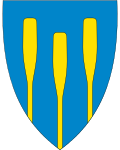
The coat of arms was officially recognized in 1987 and shows three golden oar blades.
Sons and daughters
- Jørgen Sverdrup (1732–1810), missionary in Greenland, provost and pastor
Web links
- Herøy in the store norske leksikon (Norwegian)
- Facts about Herøy from Statistisk sentralbyrå (Norwegian)
Individual evidence
- ↑ Statistisk sentralbyrå - Befolkning
- ↑ Høyeste fjelltopp i hver commune. In: Kartverket. September 1, 2015, accessed on July 6, 2020 (Bokmål in Norwegian).
- ↑ Innbyggjarnamn. In: Språkrådet. Retrieved July 6, 2020 (Norwegian Nynorsk).
- ↑ Forskrift om målvedtak i Kommunar og fylkeskommunar (målvedtaksforskrifta). In: Lovdata. January 6, 2020, accessed July 6, 2020 (Norwegian).
- ↑ a b c Geir Thorsnæs: Herøy - Nordland . In: Store norske leksikon . May 25, 2020 (Norwegian, snl.no [accessed July 6, 2020]).
- ↑ Pendlingsstrømmer. Statistics Norway, accessed July 6, 2020 (Norwegian).
- ↑ Om Herøy Bygdesamling. Helgeland Museum, accessed on July 6, 2020 (Bokmål in Norwegian).
