Hopptal
Coordinates: 51 ° 27 ′ 23 ″ N , 11 ° 19 ′ 7 ″ E
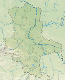
The Hopptal is a nature reserve in the town of Sangerhausen in the district of Mansfeld-Südharz in Saxony-Anhalt .
The nature reserve with the registration number NSG 0179 is around 21 hectares in size. It has been under protection since 1978 (date of regulation: July 1, 1998). The responsible lower nature conservation authority is the district of Mansfeld-Südharz.
The nature reserve is located southeast of Sangerhausen. It protects the Hopptal, which lies between the leg shoe and the vineyard, and consists of a mosaic of orchards , mesophilic grassland areas , semi- arid grassland , rock corridors and dry bush complexes. Furthermore, there are small, meanwhile weathered sandstone quarries in the nature reserve .
In the nature reserve, furrow feathers - feather twigs - semi-arid grass dominate. Here grow u. a. Eryngium Campestre , Yellow Pincushion flower , Middle Quaking , Linum Catharticum , dianthus carthusianorum , Hoary Plantain , cypress spurge , hill Meier and Haarpfriemengras , asparagus pea and serrated lettuce . In the weathered quarries come Breckland Thyme -Blauschwingel-corridors with spring cinquefoil , Rispenflockenblume and Genuine Schwafschwingel and Filzsegge ago.
The nature reserve offers a habitat for a diverse range of avifauna . Thus turncoat and Neuntöter typical representatives of Streuobst- and bushes complexes. The nightingale , field owl , blackcap and goldenhammer can often be found in the bushy areas . The dry areas are also home to various insects , including grasshoppers and butterflies .
The nature reserve is largely surrounded by agricultural land . With the “ Kirschberg und Handkante ” nature reserve to the east, it represents a biotope network in an otherwise cleared agricultural landscape .


