Issel (river)
|
Issel Oude IJssel |
||
|
Issel spring near Raesfeld |
||
| Data | ||
| Water code | EN : 928 | |
| location | Districts of Borken and Wesel ; North Rhine-Westphalia ( Germany ), Gelderland Province ( Netherlands ) |
|
| River system | Rhine | |
| Drain over | IJssel → IJsselmeer → North Sea | |
| River basin district | IJssel | |
| source | near Raesfeld ; Borken district ( D ) 51 ° 47 ′ 41 ″ N , 6 ° 49 ′ 50 ″ E |
|
| Source height | 55.5 m above sea level NHN | |
| muzzle | at Doesburg ; Gelderland ( NL ) in the IJssel (Geldersche IJssel) Coordinates: 52 ° 0 ′ 35 ″ N , 6 ° 7 ′ 44 ″ E 52 ° 0 ′ 35 ″ N , 6 ° 7 ′ 44 ″ E |
|
| Mouth height | 6.7 m NAP | |
| Height difference | 48.84 m | |
| Bottom slope | 0.6 ‰ | |
| length | 81.5 km - Germany: 55 km - Netherlands: 26.5 km |
|
| Catchment area | 1208 km² - Germany: 360.88 km² - Netherlands: 847.12 km² |
|
| Discharge at the Doesburg A Eo gauge : 1200 km² |
MQ Mq |
9.44 m³ / s 7.9 l / (s km²) |


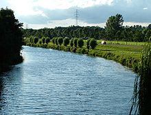
The Issel is an 81.5 km long river that has its source in Raesfeld , North Rhine-Westphalia , and flows into the IJssel (Geldersche IJssel) in Doesburg in the Dutch province of Gelderland as the Oude IJssel .
River name
In Germany, the river sections have several names: from the source to the so-called Möllmannsbrücke, the river is known as the Westphalian Issel . From there to the Bärenschleuse in the Wesel district of Lackhausen it is called Obere Issel . The Mittlere Issel extends from there to the confluence of the Kleine Issel . The following course of the river to the Dutch border is called the Lower Issel . These sections with the respective flood areas are administered by water and soil associations that are responsible for flood protection .
In the Netherlands the river is consistently referred to as the Oude IJssel .
geography
course
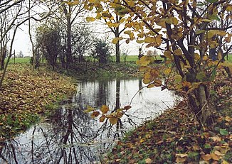
The Issel rises in the Borken district in the northwest of the Hohe Mark-Westmünsterland nature park . Its source is south of Borken in the sparsely populated northern part of the Raesfeld municipal area at 55.54 m above sea level. NHN .
First, the Issel flows through meadows and fields in a south-westerly direction through the gently undulating landscape of the nature park to near Wesel in the Wesel district , before turning almost at right angles to the direction of flow of the trench along the Drevenacker Landwehr to the north-west before the village at Bärenschleuse . Through Hamminkeln , after which it leaves the Wesel district, Isselburg and Anholt , both of which are in the Borken district, it reaches the Dutch border at Gendringen and forms the border river here on a short section. In the Netherlands it flows through the communities of Oude IJsselstreek and Doetinchem and flows into Doesburg at 6.7 m above sea level. NHN in the IJssel . The IJssel was created as a river bifurcation (branch) from the Pannerdens Canal , which connects the Rijn ( Rhine ) with the Nederrijn .
Catchment area and length
Up to the German-Dutch border the catchment area of the Issel is 360.88 km², and up to there the German section of the river is about 55 km long. The catchment area of the Oude IJssel on the other side of the border has an area of 847.12 km² up to the confluence with the IJssel in Doesburg, and the Dutch part of the river is 26.5 km long. From the Issel spring to the mouth of the Oude IJssel, the catchment area is a total of 1208 km², and the entire river is 81.5 km long. The total flow range of Issel and, from Doesburg, the IJssel to its confluence with the Ketelmeer is 178 km long (other claims to 177.8 kilometers), and this river has a 4,269.645 km² large catchment area.
The above-ground catchment area of the Issel does not always correspond to the hydrologically effective one, as in the western catchment area the groundwater flow is partly directed across the Issel towards the Rhine. As a result, the river loses its mean water flow.
Tributaries
In Germany the Drevenacker Landwehr, the Kleine Issel and the Wolfstrang flow to the Issel. In the Netherlands these are the Aa-Strang (lower reaches of the Bocholter Aa ) as well as Sloerstrank, Akkermansbeek, Bielheimerbeek , Waalse Water and Hoge Leiding. The most important tributary of these is the Bocholter Aa, which flows into the Issel in the Netherlands near Ulft , municipality of Oude IJsselstreek , as an Aa strand. This has a larger catchment area than the Issel (536 km² compared to 360.88 km²) and carries significantly more water than this (6.0 m³ / s compared to 3.0 m³ / s at the mouth). Nevertheless, the river downstream is still referred to as the Oude IJssel.
The Issel / Oude IJssel flows further to the northwest and marks the course of the Isselbruch, a former channel of the Rhine or the Lippe .
Sights and special features


The river forms the linguistic border between the Lower Rhine (Kleveland, south) and Westphalian (West Munsterland) language areas, thus the border between Lower Saxony and Lower Franconia. Historically, this was a border between Westphalia and the Rhineland, with frequent wars between the mansions, which was fueled by an eighty-year war between the Dutch and Spain.
There are sights along the river:
- Raesfeld Castle with gardens. The castle houses the Academy of Crafts as a further training facility for monument protection. There is an information and visitor center on the castle grounds.
- In the village of Erle , a part of Raesfeld's municipality, there is the Femeiche natural monument , which is estimated to be over 1,500 years old.
- Monastery church in Hamminkeln-Marienthal. The monastery was founded in 1258, the monastery church was built from 1345. Since 1986 brothers of the Carmelite Order have lived here again .
- Esselt House with Otto Pankok Museum in Hünxe-Drevenack
- The bear lock in Wesel-Lackhausen. From here, the fortress moats of the city of Wesel were flooded over the Esselgraben from the early 17th century .
- Arboretum “Grenzlust”, a collection of trees, bushes and perennials, often rare species from native and distant natural areas on the borders of Hamminkeln, Brünen and Wesel. With its listed buildings and structures from the early 18th century such as avenues, fish ponds and paths, it is set in an 8-hectare park.
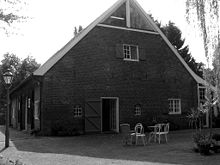
- Gut Bossigt in the Wesel district of Lackhausen, birthplace of Konrad Duden . The house serves as a conference hotel
- Humberghaus in Dingden , a museum about a former family of country Jews , with authentic rooms and objects and with the history of today's descendants in Canada
- Ringenberg Castle near Hamminkeln. Since its renovation in 1989, the castle has served as a registry office and houses the studio center of the Derick Baegert Society .
- City of Werth
- The old town of Anholt with preserved ramparts and moats, the historic town hall and the painted parish church of St. Pankratius
- Anholt Castle in Anholt. The castle of the princes Salm-Salm houses a museum with a porcelain collection, tapestries, furniture and paintings and has extensive parks
- The Landfort house in Megchelen
- In Megchelen the Museum De Moezeköttel , an emergency shelter on the D / NL border after World War II
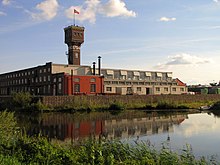
- DRU Cultuurfabriek in Ulft. The former ironworks was reopened in 2009 as a cultural center
- Kasteel Keppel in Laag-Keppel
A cycle path called the "ijssel route " leads near the river from Anholt via Gendringen , Doetinchem to Doesburg and further along the IJssel to Zutphen . The ijssel route is part of a cross-border cycle route network that also includes the aa , berkel and slinge routes . The cycle paths offer six round trips and can be combined with each other.
See also
literature
- Wilhelm Busch Heinrich Kreymann: The Issel and its fish fauna: explorations on a flowing water in North Rhine-Westphalia . Boss, Kleve 1994 ISBN 3-89413-998-6
Web links
References and comments
- ↑ a b c d e f g h i j Water profile Issel ( Memento from March 4, 2016 in the Internet Archive ), on daten.flussgebiete.nrw.de
- ↑ AHN (Actueel Hoogtebestand Nederland): Viewer ; Retrieved May 26, 2016, from ahn.maps.arcgis.com
-
↑ a b c Note on water lengths:
- 55 km (Issel; from the source to the German-Dutch border); according to the individual evidence mentioned
- 26.5 km (OudeIJssel; from the border to the confluence with the IJssel in Doesburg)
- 81.5 km (length from IJssel with the Oude IJssel to Doesburg); results from 55 + 26.5 km
- 178 km (total length; to the confluence with the Ketel Sea); results from 55 + 26.5 + 81.5 km
from 178 - 81.5 km results for the 123 km long IJssel from Doesburg in 96.5 km length -
↑ a b Note on catchment area and sub-catchment areas (EZG):
- 1208 km² (total catchment area from Issel and Oude IJssel to Doesburg); according to the individual evidence mentioned
- 360.88 km² (part of the Issel EZG; from the source to the German-Dutch border); according to the individual evidence mentioned
- 847.12 km² (part-EZG of the Oude IJssel from the border to Doesburg); results from 1208 - 360.88 km² - ↑ a b GRDC level data of the EWA stations. Retrieved May 26, 2016 . , (European Water Archive)
- ↑ The Kleine Issel rises in Hamminkeln on the street "Belenhorst" and flows into the main river in the Isselniederung, southern area of the Rodehorst in Bocholt , see Gut Rodehorst . It runs in wide meanders parallel to Issel.
- ↑ a b Water directory of the State Office for Nature, Environment and Consumer Protection NRW 2006 ( Memento from February 15, 2010 in the Internet Archive ) (PDF; 1.03 MB)
- ↑ Area discharge of the Isselburg and Rhedebrügge gauges based on the respective above-ground (partial) catchment area
- ↑ Welcome to the Arboretum Grenzenlust , accessed on August 23, 2019
- ↑ River landscape Achterhoek and Westmünsterland , on flusslandschaft.eu
- ↑ river landscape rivierenlandschap achterhoek · westmünsterland. (PDF; 5.3 MB) Four beautiful bike tours. Retrieved October 3, 2012 .

