Jerusalem (Colombia)
| Jerusalem | ||
|---|---|---|
|
Coordinates: 4 ° 34 ′ N , 74 ° 42 ′ W Jerusalem on the map of Colombia
|
||
|
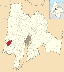
Location of the municipality of Jerusalem on the map of Cundinamarca
|
||
| Basic data | ||
| Country | Colombia | |
| Department | Cundinamarca | |
| City foundation | 1868 | |
| Residents | 2660 (2019) | |
| City insignia | ||
| Detailed data | ||
| surface | 236 km 2 | |
| Population density | 11 people / km 2 | |
| height | 357 m | |
| Time zone | UTC -5 | |
| City Presidency | María Eugenia Salguero Cruz (2016-2019) | |
| Website | ||
Jerusalén is a municipality ( municipio ) in the Colombian department of Cundinamarca .
geography
Jerusalem is located in the southwest of Cundinamarca in the province of Alto Magdalena at an altitude of about 357 meters 113 km from Bogotá. Most of the parish is mountainous. The municipality borders on Pulí and Quipile to the north, Apulo , Anapoima and Tocaima to the east, Nariño and Tocaima to the south and Guataquí and Beltrán to the west .
population
The municipality of Jerusalén has 2660 inhabitants, of which 584 live in the urban part (cabecera municipal) of the municipality (as of 2019).
history
Jerusalem was built around 1865 around the Casasviejas hacienda , which was on the way from Tocaima to Guataquí.
economy
The main industries in Jerusalem are agriculture (especially corn , sugar cane for panela , coffee , bananas and fruit ), animal husbandry and mining (especially coal ).
Web links
- Alcaldía Municipal Jerusalén Cundinamarca. Alcaldía de Jerusalén - Cundinamarca, accessed on June 9, 2019 (Spanish, website of the municipality of Jerusalén).
Individual evidence
- ↑ a b c Nuestro municipio. Alcaldía de Jerusalén - Cundinamarca, accessed on June 9, 2019 (Spanish, information on the municipality).
- ↑ ESTIMACIONES DE POBLACIÓN 1985 - 2005 Y PROYECCIONES DE POBLACIÓN 2005 - 2020 TOTAL DEPARTAMENTAL POR ÁREA. (Excel; 1.72 MB) DANE, May 11, 2011, accessed on June 9, 2019 (Spanish, extrapolation of the population of Colombia).


