Facatativá
| Facatativá | ||
|---|---|---|
|
Coordinates: 4 ° 49 ′ N , 74 ° 21 ′ W Facatativá on the map of Colombia
|
||
|
Location of the municipality of Facatativá on the map of Cundinamarca
|
||
| Basic data | ||
| Country | Colombia | |
| Department | Cundinamarca | |
| City foundation | 1600 | |
| Residents | 141,762 (2019) | |
| City insignia | ||
| Detailed data | ||
| surface | 158 km 2 | |
| Population density | 897 inhabitants / km 2 | |
| height | 2586 m | |
| Waters | Río Bojacá | |
| City Presidency | Guillermo Aldana Dimas (2020-2023) | |
| Website | ||
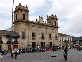
| Facatativá Cathedral | ||
| Facatativá from above | ||
| Piedras de Tunjo at Facatativá | ||
Facatativá is a municipality ( municipio ) in the department of Cundinamarca in Colombia , which for metropolitan Bogotá belongs.
The word Facatativá comes from the Muisca language, which belongs to the Chibcha language family and could be translated as Fort at the end of the plateau .
geography
Facatativá is located in Cundinamarca and is the capital of the province of Sabana Occidente . Facatativá is located at an altitude of about 2586 meters on the western edge of the Sabana de Bogotá , about 36 km from Bogotá . The municipality borders on Sasaima , La Vega and San Francisco to the north, Zipacón , Bojacá and Anolaima to the south, Madrid , El Rosal and Bojacá to the east and Anolaima and Albán to the west .
population
The municipality of Facatativá has 141,762 inhabitants, of whom 128,531 live in the urban part (cabecera municipal) of the municipality (as of 2019).
The Facatativá diocese has its seat in Facatativá .
history
Facatativá was officially founded on July 3, 1600 by Oidor Diego Gómez de Mena, who settled indigenous groups on the site of the present-day location.
As the end of the 19th century of Girardot up leading Girardot railway was built and the further Facatativá to Bogota Sabana Railway ( Ferrocarril de la Sabana , revived on a partial section 1993 as Tren Turístico de la Sabana ), the city reached a certain economic importance due to the fact that both routes had different gauges , as a result of which all goods had to be reloaded and this opened up the possibility of trading. So Facatativá became a sort of stacking place .
economy
The main industry is agriculture . Most of the employees are in the cultivation of ornamental plants . In addition, potatoes , peas , corn , vegetables , legumes and strawberries grown.
Sports
The Expreso Rojo football club , which plays in the Colombian second division , was based in Facatativá . However, the club moved to Girardot in early 2014 . Expreso Rojo played its home games at the Estadio Jorge Torres Rocha.
Personalities
- Wilson Marentes (* 1985), racing cyclist
- Fabio Duarte (* 1986), racing cyclist
Web links
- Alcaldía de Facatativá. Alcaldía de Facatativá - Cundinamarca, accessed on February 19, 2019 (Spanish, website of the municipality).
Individual evidence
- ↑ a b c Nuestro municipio. Alcaldía de Facatativá - Cundinamarca, accessed on February 19, 2019 (Spanish, information on the municipality).
- ↑ ESTIMACIONES DE POBLACIÓN 1985 - 2005 Y PROYECCIONES DE POBLACIÓN 2005 - 2020 TOTAL DEPARTAMENTAL POR ÁREA. (Excel; 1.72 MB) DANE, May 11, 2011, accessed on February 19, 2019 (Spanish, extrapolation of the population of Colombia).
- ↑ Konrad Beißwanger: In the land of the sacred lakes. Travel pictures from the homeland of the Chibcha Indians (Colombia) . Beißwanger, Nuremberg 1911, p. 61.


