Küblis
| Küblis | |
|---|---|
| State : |
|
| Canton : |
|
| Region : | Prättigau / Davos |
| BFS no. : | 3882 |
| Postal code : | 7240 |
| Coordinates : | 777 785 / 198555 |
| Height : | 814 m above sea level M. |
| Height range : | 799–2368 m above sea level M. |
| Area : | 8.14 km² |
| Residents: | 853 (December 31, 2018) |
| Population density : | 105 inhabitants per km² |
| Website: | www.kueblis.ch |
|
Küblis |
|
| Location of the municipality | |
Küblis (in the highest Alemannic local dialect Chüblisch, Rhaeto-Romanic ) is a political municipality in the Prättigau / Davos region of the Swiss canton of Graubünden .
coat of arms
Blazon : Half a black chamois in gold, armed in red.
Adopted from the family coat of arms of the Sansch family, whose ancestral castle, today's ruins of Kapfenstein Castle , was near Küblis. At the same time, the chamois is also an indication of the hunting right, which was acquired, among other things, in the Prättigau struggle for freedom.
geography
The community is located in central Prättigau near the confluence of the Schanielabach in the Landquart . In addition to the street village Küblis in the valley floor, it includes the hamlets of Pläviggin, Prada and Tälfsch .
Most of the municipality is in the sector between Landquart and Schanielabach. The border runs for around 4 km along the stream, and then leads up through the Horntobel to the Jägglisch Horn ( 2290 m above sea level ), a foothill of the Madrisa group . On the ridge between Jägglisch Horn and Saaser Calanda is the highest point in the municipality at 2371 m. To the south of the Landquart, Küblis only has a section of the slope that rises to around 1100 m.
Of the entire community area of 813 ha , 358 ha are agriculturally usable. However, this includes 208 hectares of alpine farms. An almost equally large area of 345 ha is covered by forest and wood. The remainder is 70 ha of unproductive area (mostly mountains) and 40 ha of settlement area.
Küblis borders on Conters in the Prättigau , Luzein and St. Antönien .
| Luzein | Luzein | Luzein |
| Luzein |

|
Klosters-Serneus |
| Conters in the Prättigau | Klosters-Serneus |
history
The place mentioned in 1351 as Cüblins belonged as part of the court of the monastery in the three leagues to the ten- court league . Under the influence of the Walser resident in Klosters , the community went in the 15th – 16th centuries. Century from the Romansh to the German language. The Romanesque place name is Cuvlignas .
population
Of the 853 residents at the end of 2019, 702 (= 82.30%) were Swiss citizens.
politics
The mayor is Töni Hartmann (as of 2010).
Economy, transport and education
The central location and the relatively small community area meant that agriculture lost its dominant position earlier than in the surrounding areas and a diverse small-scale structure developed. In 1922, the Küblis power plant of Bündner Kraftwerke (now Repower AG ) went into operation.
From the Küblis station on the Landquart – Klosters line ( Rhaetian Railway ) opened in 1889 , post bus lines run to St. Antönien , Conters and Fideris - Jenaz .
2016 is the opening of the bypass Kueblis on the motorway network belonging Hauptstrasse 28 planned.
The school house houses primary, secondary and secondary schools as well as a special education school for a larger catchment area.
tourism
Tourism benefits from the proximity to the well-known centers of Klosters and Davos . The 7.5 km longest slope in the Parsenn ski area ends in Küblis , a section of the classic Parsenn run , which has a height difference of over 2000 m from the Weissfluh summit to the valley. Hiking and mountain bike tours can be undertaken in summer and autumn. There are four hotels and a number of holiday apartments available.
Attractions
- The reformed Nikolaikirche , built at the end of the 15th century, is a uniform late Gothic building with star vaults and tracery windows in the choir . The glass paintings of the twelve apostles created Augusto Giacometti in the 1921st
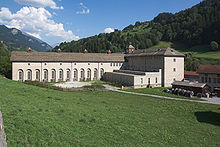
- Central Küblis of the Bündner Kraftwerke
- Above the village near the hamlet of Tälfsch are the ruins of Kapfenstein Castle
- In the hamlet of Dalvazza (politically part of the municipality of Luzein ) stands the Passagenhaus by the artist Peter Trachsel , with a cube-shaped main building, an archive container and two outdoor stages.
Personalities
- Nicolin Sererhard (1689 - 1756), reformed pastor and chronicler
- Nina Caprez (* 1986), sport climber
- Marc Wieser (* 1987), ice hockey player
- Dino Wieser (* 1989), ice hockey player
literature
- Erwin Poeschel : The art monuments of the canton of Graubünden II. The valley communities Herrschaft, Prättigau, Davos, Schanfigg, Churwalden, Albula valley. (= Art Monuments of Switzerland. Volume 9). Edited by the Society for Swiss Art History GSK. Bern 1937. DNB 811066703 .
Web links
- Official website of the municipality of Küblis
- Otto Clavuot: Küblis. In: Historical Lexicon of Switzerland .
Individual evidence
- ↑ Permanent and non-permanent resident population by year, canton, district, municipality, population type and gender (permanent resident population). In: bfs. admin.ch . Federal Statistical Office (FSO), August 31, 2019, accessed on December 22, 2019 .
- ↑ Headquarters Küblis of the Bündner Kraftwerke on www.graubuendenkultur.ch .


