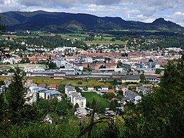
Cadastral parish St. Veit an der Glan
| St. Veit an der Glan ( cadastral municipality ) | ||
|---|---|---|
|
|
||
| Basic data | ||
| Pole. District , state | Sankt Veit an der Glan (SV), Carinthia | |
| Judicial district | Sankt Veit an der Glan | |
| Pole. local community | Sankt Veit an der Glan | |
| Coordinates | 46 ° 44 ′ 40 " N , 14 ° 18 ′ 42" E | |
| Area d. KG | 8.62 km² | |
| Statistical identification | ||
| Cadastral parish number | 74528 | |
 St. Veit an der Glan |
||
| Source: STAT : index of places ; BEV : GEONAM ; KAGIS | ||
The cadastral community of St. Veit an der Glan is one of seven cadastral communities in the municipality of Sankt Veit an der Glan in the district of Sankt Veit an der Glan in Carinthia . It has an area of 861.66 hectares.
The cadastral community belongs to the district of the Klagenfurt land surveying office.
location
The cadastral municipality is located in the north of the municipality of Sankt Veit an der Glan, in the south of the Sankt Veit an der Glan district. In terms of landscape, it encompasses the transition area from the Glantal to the Zollfeld and, with the part of the Muraunberg located on it, the edge of the Glantaler Bergland . The cadastral community extends over an altitude of 462 m above sea level. A. on the Glan up to 669 m above sea level. A. near the summit of the Muraunberg.
Localities
The majority of the village of Sankt Veit an der Glan is located in the area of the cadastral community of St. Veit an der Glan , namely its historic city center and the five former suburbs that were temporarily run as separate localities in the 19th century (Friesacher Vorstadt, Klagenfurt Vorstadt, Villacher Vorstadt, Völkermarkter Vorstadt, Weitensfelder Vorstadt). Only that part of the Glandorf settlement , which today belongs entirely to the locality of St. Veit an der Glan , which only fell to the municipality of St. Veit an der Glan in 1958 as part of a municipal merger, is located outside the area of the cadastral municipality of St. Veit an der Glan .
Surveying office district
The cadastral municipality has belonged to the district of the Klagenfurt land surveying office since January 1st, 1998. Before that, she was part of the district of the St. Veit an der Glan land surveying office.
history
At the end of the 18th century, the Carinthian tax communities (later: cadastral communities) were formed and assigned to tax districts. The St. Veit tax municipality became part of the St. Veit tax district .
In the course of the reforms after the revolution of 1848/49, the tax districts in Carinthia were dissolved and local communities were formed, each encompassing the area of one or more tax communities. The municipality of Sankt Veit an der Glan was established in the area of the tax and cadastral municipality of St. Veit. The size of the cadastral community was given in 1854 as 1,480 Austrian yokes and 592 fathoms (approx. 852 ha); at that time 1,575 people lived in the area of the cadastral community. In 1962 the cadastral community was enlarged by around 12 hectares; the affected area (today the area around the house Flussgasse 150), which until then had belonged to the cadastral community of Goggerwenig of the municipality of St. Georgen am Längsee , was only accessible from the St. Veiter area due to the Glan regulation.
The cadastral municipality of St. Veit an der Glan belonged to the political district of Sankt Veit an der Glan and the judicial district of Sankt Veit an der Glan from 1850 . From 1854 to 1868 it belonged to the mixed district of Sankt Veit an der Glan . Since the reform in 1868, it has again been part of the political district of Sankt Veit an der Glan and the judicial district of Sankt Veit an der Glan.

