
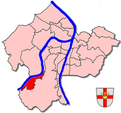
Koblenz-Lay
| Koblenz-Lay | |
|---|---|
  |
|
| Basic data | |
| District since: | 1970 |
| Area : | 2.55 km² |
| Residents : | 1745 (March 11, 2014) |
| Population density : | 686 inhabitants per km² |
| Postal code : | 56073 |
| Area code : | 02606 |
| License plate : |
KO
|
| District | |
| Mayor : | Gerd Baulig (SPD) |
Koblenz-Lay is a district of Koblenz . It lies on the Moselle and was incorporated in 1970 .
Despite being part of the city of Koblenz, the place has retained the character of a typical wine village on the Moselle. In the historic town center there are still some remarkable winegrowers' houses from the 15th to 18th centuries, such as the Marienstätter Hof (dated 1626). The layers of vineyards are called "Hamm" and "Hubertusborn".
The originally extensive orchards on the northern slope above Lay are now only relictly preserved and are becoming more bushy year after year. The slopes of Lay are today primarily a popular residential district with modern one and two-family houses and individually designed gardens.
geography
The Koblenz district of Lay is located to the right of the Moselle on a slope at the foot of the Hunsrück , and is surrounded by forest and vineyards . The so-called "Layer Kopf" (380 m) towers over the place. It is about 8 km from Lay to Koblenz city center. Up the Moselle, the distance to Cochem is around 43 km. To the south-west of the Moselle lies Winningen , downstream the Koblenz district Moselweiß and upstream Dieblich .
history

Lay's historical roots go back to Roman times, as is shown by the remains of a Roman villa rustica with bathing facilities from the 1st to 3rd centuries (21 × 35 m, rectangular with inner courtyard and columned hall, made of greywacke with interior decoration, today Sweden Path, discovered in 1985). From Frankish times , grave fields were discovered at the eastern entrance to the village and in the area of the Roman villa (5th to 7th centuries). 26 graves with grave goods (knives, lance tips, ceramics, glass, jewelry) covered with brick and slate plates were uncovered between 1985 and 1989.
The name of the place is derived from the word " Ley " and means rock or slate . Over the years, the name developed from "Leia" (1139) to "Leie" (1149), "Ley" (1261) and "Laye" (1473) to the current name "Lay" (since 1720).
The place "Leia" was first mentioned in 803 in a donation from vineyards to the Benedectine monastery Fulda . Emperor Heinrich II gave the place "Legia" in 1019 to the Kaufungen convent . The Benedictine Siegburg bought in 1095 part of the Salhofes of "Lys". In 1241 there was a dispute between the monasteries Kaufungen and Siegburg over the patronage right of the Church of St. Martinus . Archbishop Theodoric II von Wied settled this dispute to the effect that both monasteries should share the right of patronage. At the instigation of Nikolaus von Kues , Pope Eugene IV transferred the tithe and patronage rights to the Münstermaifeld monastery in 1440 , which it retained until the secularization of 1802.
Since the Middle Ages , some ecclesiastical and noble court estates can be identified in Lay. A Hofgut of the German Order Coming in Koblenz was mentioned as early as 1276. The monasteries St. Kastor , Münstermaifeld and the Abbey of Marienstatt also had farms in Lay. A ferry across the Moselle is occupied for the year 1320. From old documents a fortification with the driving gate and the Luckenpforte on the Moselle is handed down.
The village of Lay belonged to the Electorate of Koblenz from the 11th century . A separate lay judge's court, consisting of 7 lay judges and a mayor , has been in evidence since 1358. French revolutionary troops conquered the left bank of the Rhine in 1794 . Lay was slammed within the Arrondissement de Coblence of the Mairie Winningen in the canton of Rübenach. After the Prussians took over the Rhineland in 1815 ( Congress of Vienna ), it was assigned to the Koblenz district . The symbolic figure of the layer Kuoleroffer (= ball lapper) goes back to the Prussian period . Poor residents wandered to the Karthauser shooting range to collect bullets that had been shot and to sell the material on.
On November 7, 1970 Lay was incorporated into the city of Koblenz.
Attractions

- Catholic parish church of St. Martinus , 13th century
- Carola Tower
Among the late medieval half-timbered buildings, the building at Kaufunger Strasse 16 / corner Hirtenstrasse 1 with two floating gables on the main gable and mid-house is particularly noteworthy, which probably belonged to the estate of the Karthäuser on the Beatusberg (since 1469) and was owned by Layer Hofschultheißen in the 18th century Johann and Carl Martin Mader (father and son).
The half-timbered "old school" (originally a bakehouse) in Hirtenstrasse 7 dates from 1784 and was exposed to changing uses (school, town hall, poor house, community center, forced labor and emergency accommodation during World War II, privately owned since 1985)
Other listed houses - partly in half-timbered, partly solid - are located on the corner of Maistraße 1a / Kaufunger Straße 4 (winegrower's house with a statue of Mary as a console figure and winegrower's motifs as an ornamental half-timbered structure, around 1700), Kaufunger Straße 1 (1417), Kaufunger Straße 25 (16. Century) and Maistraße 8 (also a typical winegrower's house, 1562, still a winery today).
religion
A good three-quarters of the population of Lay is Catholic , 12% Protestant and 13% non-denominational . The silhouette of the Catholic parish church of St. Martinus is the largest and most distinctive building in the village. The late Romanesque, single-nave building with a choir tower dates from the 13th century and was extensively restored in 2004, largely through the work of the local associations.
politics
Local advisory board
A local district was formed for the Lay district . The local advisory board consists of seven advisory board members, the chair of the local advisory board is chaired by the directly elected mayor.
For the composition of the local council, see the results of the local elections in Koblenz .
Mayor
Mayor is Gerd Baulig (SPD). In the direct election on May 26, 2019, he prevailed against the previous incumbent Jörg Kreuser (CDU) with a share of the vote of 55.91%. Jutta Lewentz (SPD) was elected first deputy.
coat of arms
The coat of arms was approved on February 6, 1939 by decree of the Upper President of the Rhine Province .
 |
Blazon : "On a black shield a silver rose with golden lugs and green sepals, topped with a red three-lipped tournament collar." |
| Foundation of the coat of arms: On December 29, 1322, Heinrich von Leye, as Koblenz aldermen, sealed a certificate according to which Heinrich, called Heiden, and his wife Aleyde from "Gulse" ( Güls ) declared that the Commander and Brothers of the Teutonic Order in Koblenz had the island in them Moselstrom to "Wiss" ( Moselweiss ) in a long lease. The certificate is attached to the well-preserved seals of the lay judges “Godebertus” and “Henricus de Leyge”. The latter seal was chosen in 1938 by the Lay Municipality Council as a template for a coat of arms. Heinrich von Leye's seal shows a rose with a lump and sepals, above a three-lipped tournament collar. Since little is known about the family of this nobleman, it cannot be said today what significance these coats of arms had. The rose is an often used coat of arms image (one of the most frequently used main characters) and the tournament collar was often added as a distinguishing feature of the firstborn son compared to the father's coat of arms during his lifetime. The Austrian heraldist Georg Scheibelreiter also stated that the Lower Rhine nobility often wore the tournament collar (also called bank) as a sign of the exercise of jurisdiction. The assumption that the tournament collar here indicates the knightly descent of the family is therefore justified. |
Economy and Transport

As located in many villages on the Mosel, is also in Lay the wine an important economic factor. Looking down the Moselle, wine is grown in the two locations Layer Hubertusborn and Layer Hamm . Tourism is also not insignificant for Lay.
The B 49 runs along the Moselle . The Moselle ferry Koblenz-Lay took you to the other side of the Moselle. The ferry service was stopped in 2013, the ferry was removed on April 13, 2018.
Hiking trails
Via the Bergweg layer you can get to the Carolaturm and Remsteck (there connection to the Rheinburgenweg ). Another access to the Rheinburgenweg on the Karthause used to be the anchor path east of the town exit from the B 49, which climbs steeply through orchards on a rock wall made of sandy clay slate to the Moselle hill terrace . After the retaining wall on the valley side collapsed, this path was closed in February 2014.
literature
- Hedwig Herdes, Rolf Morbach and Richard Theisen (arr.): From the history of the place Lay on the Moselle. Local history contributions on the occasion of the 1200th anniversary in 2003, Koblenz-Lay 2003.
- Ulrike Weber (edit.): Cultural monuments in Rhineland-Palatinate. Monument topography Federal Republic of Germany. Volume 3.3: City of Koblenz. Districts. Werner, Worms 2013, ISBN 978-3-88462-345-9 .
Web links
- Historical information about Lay in: regionalgeschichte.net
- Literature about Koblenz-Lay in the Rhineland-Palatinate State Bibliography
Individual evidence
- ↑ Official municipality directory (= State Statistical Office of Rhineland-Palatinate [Hrsg.]: Statistical volumes . Volume 407 ). Bad Ems February 2016, p. 168 (PDF; 2.8 MB).
- ^ City of Koblenz: main statute. (PDF) § 9 to July 11, 2019, accessed on October 20, 2019 .
- ^ City of Koblenz: Mayor Lay 2019. Accessed on October 20, 2019 .
- ^ Citizen information system of the city of Koblenz - Mrs. Lewentz, Jutta. City of Koblenz, August 20, 2019, accessed on October 29, 2019 .
- ↑ Bernhard Peter: The tournament collar in heraldry. Retrieved February 22, 2018 (private website).
Coordinates: 50 ° 19 ′ 16 ″ N , 7 ° 32 ′ 23 ″ E

Old town | Arenberg | Arzheim | Asterstein | Bubenheim | Ehrenbreitstein | Gold mine | Güls | Horchheim | Horchheimer Höhe | Immendorf | Karthauser (Karthauser Nord, Karthauser Flugfeld and Karthauserhof area) | Kesselheim | Lay | Lützel | Metternich | Moselle white | Neuendorf | Niederberg | Oberwerth | Pfaffendorf | Pfaffendorfer Höhe | Rauental | Rübenach | Stolzenfels | Southern suburb ( center and south ) | Wallersheim