
List of architectural monuments in Weismain

|
Ensemble: Weismain old town Monuments by districts: Weismain • Altendorf • Arnstein • Buck village • Ehrhardsmühle • Erlach • Geutenreuth • Giechkröttendorf • Görau • United goats field • Herbstmühle • Kaspauer • Kleinziegenfeld • Krassach • Krass Acher mill • Main plug Forest (West) • Modschiedel • Mosenberg • Neudorf • Niesten • Upper hole • Schammendorf • Schwarzmühle • Seubersdorf • Siedamsdorf • Wallersberg • Waßmannsmühle • Weiden • Weihersmühle • Wohnsig • Wunkendorf |
The monuments of the Upper Franconian town of Weismain are compiled on this page . This table is a partial list of the list of architectural monuments in Bavaria . The basis is the Bavarian Monument List , which was first drawn up on the basis of the Bavarian Monument Protection Act of October 1, 1973 and has since been managed by the Bavarian State Office for Monument Preservation . The following information does not replace the legally binding information from the monument protection authority. This list reflects the update status of September 13, 2014 and contains 162 architectural monuments.
Ensembles
Ensemble Altstadt Weismain
The ensemble ( location ) encompasses the historical city center within its clearly understandable, late medieval fortification ring. A Carolingian settlement was archaeologically proven in 1972/73 west of the river of the same name, west of today's core city. East of the Weismain , the Andechs-Meranians , whose seat was the nearby Niesten Castle , built today's planned town in the early 13th century. The city, which has been fortified since the 13th century and also provided with a moat after the Hussite invasions in 1431, included the Palatinate of the Andechs-Meranians in the northwest. After this family died out, the Bamberg Monastery took control of the place, which was named as a city in 1313, at the latest in 1250. From the late 14th century to 1710 the official seat was at Niesten Castle, Kastenhof and Vogtei were in the city. The economic boom in the 16th and early 17th centuries, probably on the basis of wool and textile production, was followed by severe destruction in the Thirty Years' War with a 70 percent loss of residents; in addition, 60 percent of the houses and around 100 percent of the barns were lost. With the Bamberg Monastery, the city became part of the Kingdom of Bavaria in 1803 . The approaches to industrial development in the early 19th century were partially successful in the field of food production. Decreasing measures took place on a modest scale, such as the demolition of the city gate on Burgkunstädter Strasse in 1871. The city, which had not received a railway connection , lost its supra-local administrative functions by 1959. Within the fortification and green ring, around three quarters of which were preserved, the broad street area Am Markt forms the backbone of the planned city structure. The rows of houses on the west and south-east sides are closed, mainly two-story half-timbered buildings from the 16th to 18th centuries characterize the picture. Exceptions with an outstanding size of the building are the so-called Neydeckerhaus Am Markt 5 from 1590 and the town hall Am Markt 19, built around 1543. In the north-west is the parish church with a tower from the 15th / 16th. Century, the choir from 1538 and a nave from 1890/91. Behind the area of the church is the Kastenhof with baroque buildings. In the area of the church square and with individual representatives on the market, a number of relatively simply designed baroque houses can be found. On the south-east side of the market, historical adjustments were made to facades in individual cases in the second half of the 20th century. Von-Rudhart-Straße is the only parallel side street to the market area. Since the house plots run through the market to the street, it is essentially only built on one side. The historical significance of the cul-de-sac hell lies in the introduction of a tributary of the Weismain into the fortified city in this quarter. The silhouette of the town on the edge of the northern Franconian Jura is also dominated by the parish church and the two large secular buildings on the market as far as the Weismaintal. File number: Number = E-4-78-176-1.
City fortifications
The city fortifications consist of a simple bering with a city wall made of sandstone blocks, the core of which comes from the 14th century and was renewed and expanded in the 15th and 18th centuries. The associated moat, which was preserved in front of the south-west section and the north part of the north-east wall, is a 15th century system with a lining wall. File number: D-4-78-176-173.

City wall at Hell 10 ( location )

City wall at Kirchplatz 5 ( location )
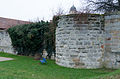
Half-shell tower on Festungsweg ( location )

City wall on the fortress path
City fortifications at Von-Rudhart-Straße 11 ( location )

City fortifications at Von-Rudhart-Straße 13 ( location )

City fortifications at Von-Rudhart-Straße 15 ( location )

City fortifications at Von-Rudhart-Straße 21 ( location )


| location | object | description | File no. | image |
|---|---|---|---|---|
| In Weismain ( location ) |
Round defense tower | Former shell tower , sandstone bossed square tower , probably from 1516, coat of arms of Bamberg Prince-Bishop Georg III. Limpurg inheritance gift , 18th century hood | D-4-78-176-3 |
 more pictures |
| Upper Gate 2 ( location ) |
Upper gate | Two-storey gate construction with hipped roof, sandstone cuboid, late medieval basement, upper floor late 18th century | D-4-78-176-1 |
 more pictures |
| Upper Gate 2 ( location ) |
Upper gate tower | Four-storey square sandstone block building with tent roof, 14./15. century | D-4-78-176-2 |
 more pictures |
Architectural monuments according to districts
Weismain
| location | object | description | File no. | image |
|---|---|---|---|---|
| Am Markt 3 ( location ) |
Residential and commercial building | Eaves side house, two-storey, first half of the 19th century | D-4-78-176-4 |
 more pictures |
| Am Markt 5 ( location ) |
So-called Neydeckerhaus | Three-storey gable-roof house with eaves, second floor plastered half-timbering, labeled "1590", remodeled by Johann Jakob Michael Küchel in 1742 | D-4-78-176-5 |
 more pictures |
| Am Markt 6 ( location ) |
Residential and commercial building | Two-storey hipped roof building, first half of the 19th century | D-4-78-176-6 |
 more pictures |
| Am Markt 7 ( location ) |
Residential and commercial building | Two-storey half-hipped roof corner house, probably 18th century, modern shop fitting on the ground floor | D-4-78-176-7 |
 more pictures |
| Am Markt 8 ( location ) |
Former Fuchs brewery inn | Two-storey saddle roof building, 17th century, inscribed "1796" | D-4-78-176-177 |
 more pictures |
| Am Markt 8 ( location ) |
Former Fuchs brewery inn | Associated outbuildings | D-4-78-176-177 |
 more pictures |
| Am Markt 9 ( location ) |
Residential and commercial building | Two-story hipped roof building in a corner, sandstone structures, second quarter of the 19th century, modern shop fitting on the ground floor | D-4-78-176-8 |
 more pictures |
| Am Markt 11 ( location ) |
Residential and commercial building | Two-storey, gable-independent gable roof construction in corner position, sandstone structures, around 1800 | D-4-78-176-9 |
 more pictures |
| Am Markt 13 ( location ) |
So-called sword maker house | Two-storey half-hipped roof building, half-timbered upper floor, core around 1600, half-timbered from the 17th / 18th centuries Century | D-4-78-176-10 |
 more pictures |
| Am Markt 15 ( location ) |
Residential and commercial building | Two-storey half-hipped roof building, plastered half-timbered upper floor, late 18th century, half-timbered from the 16th / 17th centuries. Century | D-4-78-176-12 |
 more pictures |
| Am Markt 16 a ( location ) |
So-called Dietzenhaus | Two-story saddle-roof house, ground floor sandstone cuboid, upper floor and gable exposed framework, 16./17. century | D-4-78-176-165 |
 more pictures |
| Am Markt 17 ( location ) |
Residential and commercial building | Two-storey half-hipped roof building, core around 1600, modern shop fitting on the ground floor | D-4-78-176-13 |

|
| Am Markt 18 ( location ) |
Residential and commercial building | Two-storey eaves-sided house, ground floor made of sandstone blocks, half-timbered upper floor, around 1600 | D-4-78-176-14 |
 more pictures |
| Am Markt 19 ( location ) |
town hall | Three-storey eaves gable roof building with stepped gables, roof turrets, two-storey rear building with gable roof, around 1543 | D-4-78-176-15 |
 more pictures |
| Am Markt 20 ( location ) |
Residential and commercial building | Two-storey eaves side house, ground floor made of sandstone blocks, half-timbered upper floor, around 1598 | D-4-78-176-16 |
 more pictures |
| Am Markt 22 ( location ) |
Residential and commercial building | Two-storey eaves side building, ground floor made of sandstone blocks, plastered half-timbered upper floor, probably from the late 16th century | D-4-78-176-17 |
 more pictures |
| Am Markt 23 ( location ) |
Residential and commercial building | Two-storey half-hipped roof, slated half-timbered upper storey, ground floor from the second half of the 16th century, ornamental framework from the 17th / 18th. Century | D-4-78-176-18 |
 more pictures |
| At the market ( location ) |
City fountain | Octagonal fountain basin made of sandstone, octagonal well pillar made of limestone and sandstone with column, fountain figure of an armored knight made of sandstone, 1572–1577, fountain figure copy from the second half of the 19th century (original figure 1572/77 probably by Pankraz Wagner today in the castle courtyard in Mitwitz ) , Fountain basin 1879 | D-4-78-176-73 |
 more pictures |
| Am Markt 24 ( location ) |
Residential and commercial building | Two-storey half-hipped roof building, 17th / 18th centuries Century, modern shop fitting on the ground floor, ground floor from 1610, built by furrier Otto Schönfelder. Upper and attic from the 17th / 18th centuries Century. In the town hall of Weismain there is an inscription plaque with the Schönfeld family coat of arms and the year 1610. It was probably once on the facade of the house. | D-4-78-176-19 |
 more pictures |
| Am Markt 25 ( location ) |
Residential and commercial building | Two-storey hipped roof house, probably from 1528, modern shop fitting on the ground floor, ground floor from 1528, damaged by over-restoration. | D-4-78-176-20 |
 more pictures |
| Am Markt 27 ( location ) |
Residential and commercial building | Two-storey half-hipped roof building, decorative framework on the upper floor, around 1700 | D-4-78-176-22 |
 more pictures |
| Am Markt 30 ( location ) |
Residential and commercial building | Two-story gable-roof house, half-timbered upper floor, inscribed "1693" | D-4-78-176-23 |
 more pictures |
| Am Markt 32 ( location ) |
Residential and commercial building | Two-storey saddle roof building in corner position, half-timbered upper floor, ground floor around 1600, ornamental framework from the early 18th century | D-4-78-176-25 |
 more pictures |
| Am Markt 35 ( location ) |
Residential and commercial building | Two-storey eaves saddle roof construction in corner position, half-timbered, 17th / 18th centuries century | D-4-78-176-26 |
 more pictures |
| Am Markt 36 ( location ) |
Residential and commercial building | Two-storey eaves side house with gable roof, second half of the 16th century | D-4-78-176-27 |
 more pictures |
| Am Markt 37 ( location ) |
Residential and commercial building | Two-storey eaves side house, 17th / 18th centuries century | D-4-78-176-28 |
|
| Am Markt 40 ( location ) |
Former Dietz brewery | Two-storey gable-roof house with eaves, half-timbered upper storey, courtyard entrance, inscribed "1696". The inscription on the lintel reads: "PETER PERTOLD CASTNER ALHIR BAVET MICH 1696". Former Bräustüberl of the Dietz brewery, which was founded in 1896 and ceased operations in 1981. | D-4-78-176-30 |
 more pictures |
| Am Markt 41 ( location ) |
Residential and commercial building | Two-storey gable roof house with eaves, slated half-timbered upper storey, 17th / 18th centuries century | D-4-78-176-31 |
 more pictures |
| Am Markt 45 ( location ) |
Residential and commercial building | Two-storey hipped roof building in a corner, half-timbered upper floor, labeled "1712", modern shop fitting on the ground floor | D-4-78-176-33 |
 more pictures |
| Am Markt 47, Von-Rudhart-Straße 33 ( location ) |
Residential and commercial building | Two-storey half-hipped roof building in corner position, plastered half-timbered upper floor, 17th / 18th centuries century | D-4-78-176-34 |
 more pictures |
| Nakedness, am Hohen Weg ( location ) |
Wayside shrine | Sandstone, base and top, 17th century | D-4-78-176-81 |
|
| Burgkunstadter Straße 1 ( location ) |
Hipped roof construction | 18./19. century | D-4-78-176-36 |
 more pictures |
| Burgkunstadter Straße 17 ( location ) |
Mill | Southern part with a two-storey saddle roof, first half of the 19th century | D-4-78-176-37 |
 more pictures |
| Near Burgkunstadter Strasse, in front of the city wall on Burgkunstadter Strasse ( location ) |
Wayside shrine | Sandstone, column with a four-sided top, 17th century | D-4-78-176-187 |
 more pictures |
| Burgleite, Eichleite, hop garden, hill meadow, Fürstenweg, on the road to Geutenreuth, 1 km from the outskirts ( location ) |
Wayside shrine | Sandstone, base and top from the 17th century | D-4-78-176-77 |
 more pictures |
| Burgweg 8 ( location ) |
Way of the Cross to the Chapel of the Cross, first stop | Wayside shrine, sandstone with pillar and four-sided attachment, 18th century, probably 1703 | D-4-78-176-43 |
 more pictures |
| Burgweg 8 ( location ) |
Way of the Cross to the Chapel of the Cross, second station | Wayside shrine, sandstone with pillars and four-sided top, 18th century | D-4-78-176-43 |
 more pictures |
| Burgweg 11 ( location ) |
Way of the Cross to the Chapel of the Cross, third station | Wayside shrine, sandstone with pillars and four-sided top, 18th century | D-4-78-176-43 |
 more pictures |
| Burgweg 15 ( location ) |
Way of the Cross to the Chapel of the Cross, fourth station | Wayside shrine, sandstone with pillars and four-sided top, 18th century | D-4-78-176-43 |
 more pictures |
| Burgweg 15 ( location ) |
Way of the Cross, fifth station | Wayside shrine, sandstone with pillars and four-sided top, 18th century | D-4-78-176-43 |
 more pictures |
| Burgweg 17 ( location ) |
Way of the Cross, sixth station | Wayside shrine, sandstone with pillars and four-sided top, 18th century | D-4-78-176-43 |
 more pictures |
| Burgweg 21 ( location ) |
Way of the Cross, seventh station | Wayside shrine, sandstone with pillars and four-sided top, 18th century | D-4-78-176-43 |
 more pictures |
| Burgweg 21 ( location ) |
Catholic Chapel of the Cross | Plastered building with sandstone structures and roof turrets, choir drawn in, probably by Hans Michael Schrimlinhard in 1702, with furnishings | D-4-78-176-43 |
 more pictures |
| Forstäcker, on the Geißberg ( location ) |
Wayside shrine | Sandstone, pillar with two-sided attachment, inscribed "PF 1703" | D-4-78-176-76 |
|
| Forstäcker, 1 km north of the city on the Krassach ( location ) |
Cross stone | Sandstone, 16./17. century | D-4-78-176-82 |
|
| Near Hollfelder Straße, 150 m in front of the Upper Gate ( location ) |
Wayside chapel | Sandstone block construction with a gable roof, 18th century, with equipment | D-4-78-176-70 |
|
| Hell 1 ( location ) |
Residential building | Two-storey corner house with a gable roof, mostly plastered half-timbered upper storey, marked "1745" | D-4-78-176-45 |
 more pictures |
| Hell 6 ( location ) |
Former tanner's house | Two-storey half-hipped roof structure, in the core probably late medieval | D-4-78-176-47 |
 more pictures |
| Hell 10 ( location ) |
Residential building | Two-storey saddle roof building, around 1800, the core probably 17th century | D-4-78-176-48 |
|
| Jahnstraße 6 ( location ) |
Mill | Two-storey hipped roof building, plastered half-timbered upper floor, early 19th century | D-4-78-176-50 |
 more pictures |
| Jahnstraße 16 ( location ) |
hospital | Two-storey hipped roof building with sandstone structures, 1771 by master mason Friedrich Jungwirth | D-4-78-176-51 |
|
| Kirchplatz 2 ( location ) |
Catholic parish church of Saint Martin | Three-aisled hall rebuilt in 1890/91, retracted choir and tower around 1500, with furnishings | D-4-78-176-52 |
 more pictures |
| Kirchplatz 4 ( location ) |
School and nurses house | Two-story two-wing hipped roof building, sandstone structures, east wing 1798, west wing 1886 | D-4-78-176-53 |
 more pictures |
| Kirchplatz 5 ( location ) |
Rectory | Two-storey sandstone block construction with a gable roof, sandstone structures, 1623 according to plans by Giovanni Bonalino , garden gate with four grooved sandstone pillars and spherical crowns | D-4-78-176-54 |
 more pictures |
| Kirchplatz 7, 9, 11, 13 ( location ) |
Formerly Kastenhof | Two-storey two-wing plastered building with hipped roof, sandstone structures, 1701 according to plans by Johann Leonhard Dientzenhofer , renewed and completed in 1751/52 according to plans by Johann Jakob Michael Küchel, the courtyard wall plastered against the churchyard, inscribed "1704", a round arched gate and pedestrian gate adjoining the courtyard wall Sandstone blocks, inscribed "1496" for the Bamberg prince-bishop Heinrich III. Groß von Trockau (ancestral sample: Groß von Trockau, von Lichtenstein, von Redwitz and von Künsberg) and “1565” for the Bamberg prince-bishop Veit II von Würtzburg . On the short wing facing the church square, the coat of arms of the Bamberg (and Mainz) Prince-Bishop Lothar Franz von Schönborn . | D-4-78-176-55 |
 more pictures |
| Kolpingplatz 3 ( location ) |
Residential building | Two-storey hipped roof building, slated half-timbered upper storey, around 1800 | D-4-78-176-56 |

|
| Kolpingplatz 5 ( location ) |
Residential building | Plastered half-timbered upper floor, around 1800 | D-4-78-176-57 |
 more pictures |
| Kolpingplatz 7 ( location ) |
Residential building | Two-story hipped roof building, plastered half-timbered upper floor, around 1800, modern shop fitting on the ground floor | D-4-78-176-58 |
 more pictures |
| Kolpingplatz 9 ( location ) |
Residential building | Two-story hipped roof building, plastered half-timbered upper floor, around 1800, modern shop fitting on the ground floor | D-4-78-176-59 |
 more pictures |
| Kolpingplatz 11 ( location ) |
Residential building | Two-story hipped roof building, plastered half-timbered upper floor, around 1800 | D-4-78-176-60 |
 more pictures |
| Krassacher Leite, Lange Äcker, on the way to Krassach ( location ) |
Wayside shrine | So-called three brothers torture, sandstone, column with Ionic capital, four-sided top, inscribed "1694" | D-4-78-176-79 |
 more pictures |
| Peunt, on the northwest slope of the Kalkberg ( location ) |
Wayside shrine | Sandstone, column with a four-sided attachment, 17th / 18th centuries century | D-4-78-176-80 |
|
| Peunt, on the forest path between Wohnsig and Erlach ( location ) |
Landmark | Sandstone, inscribed "1778" | D-4-78-176-204 |
|
| Upper Gate 3 ( location ) |
Cross bearer | Sandstone, inscribed "1714" | D-4-78-176-62 |
|
| Staatsstrasse 2191, on the road to Burgkunstadt ( location ) |
Wayside shrine | Sandstone column, lost essay, 17th century | D-4-78-176-75 |
|
| Unterer Rothebühl, on the road to Geutenreuth, 2.5 km from the outskirts ( location ) |
Wayside shrine | 19th century sandstone column, cast iron cross with body | D-4-78-176-78 |
 more pictures |
| Von-Rudhart-Strasse 1 ( location ) |
Former district court | Three-storey two-winged building, corner pilasters and window frames, portal aedicula, classicistic, around 1870 | D-4-78-176-172 |
 more pictures |
| Von-Rudhart-Strasse 11 ( location ) |
Former shepherd's house | Two-storey half-timbered building with hipped roof, probably from the 18th century | D-4-78-176-64 |
 more pictures |
| Von-Rudhart-Strasse 13 ( Location ) |
Residential building | Two-storey hipped roof building, marked "1778" | D-4-78-176-65 |
 more pictures |
| Von-Rudhart-Straße 15, 17 ( location ) |
Residential building | Two-story hipped roof building, 18th century | D-4-78-176-66 |
 more pictures |
| Von-Rudhart-Strasse 21 ( Location ) |
Residential building | Two-storey hipped roof building, sandstone structures, inscribed "1731" in the lintel, facade with sandstone structures. The builder was presumably Johann Reich, who wanted to build on the modern baroque architecture of the capital Bamberg. | D-4-78-176-67 |
 more pictures |
| Von-Rudhart-Strasse 25 ( location ) |
Rudhart's hermitage | Two-storey gable roof house with eaves, slated half-timbered upper storey, 17th / 18th centuries century | D-4-78-176-68 |
 more pictures |
| Von-Rudhart-Strasse 29 ( Location ) |
Residential building | Two-storey gable-roof house, half-timbered upper storey, first half of the 18th century | D-4-78-176-69 |
 more pictures |
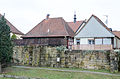
| Weismain, above the Förstmühle ( location ) |
Two-bay bridge over the Weismain | Sandstone block construction, marked "1844" | D-4-78-176-72 |
|
Altendorf
| location | object | description | File no. | image |
|---|---|---|---|---|
| In Altendorf ( location ) |
Holy Trinity Catholic Chapel | Half-timbered building with hipped roof and ridge turret, labeled "1811", with equipment | D-4-78-176-85 |

|
| Altitude north of the village, Kulm ( ) |
Two landmarks | Wayside shrine, sandstone, four parts, dated "1865"
Hall cross with assistant figures, cast iron on sandstone plinth, dated "1909", rebuilt in 2011 after damage |
D-4-78-176-178 |
Arnstein
| location | object | description | File no. | image |
|---|---|---|---|---|
| Arnstein 12 ( location ) |
Residential stable house | One storey, with saddle roof, half-timbered gable, 18th / 19th century century | D-4-78-176-88 |

|
| Arnstein 29 ( location ) |
Rectory | Two-storey hipped roof building, grooved corner pilasters, 18th century | D-4-78-176-89 |

|
| Arnstein 30 ( location ) |
Catholic Parish Church of Saint Nicholas | Plastered building with sandstone structures, four-story tower in the southeast, hall church with retracted choir, 1732–34 according to plans by the Balthasar Neumann School, with furnishings | D-4-78-176-86 |
 more pictures |
| Arnstein 32 ( location ) |
Residential stable house | Two-storey, with a gable roof (formerly tails) | D-4-78-176-90 |

|
| In Arnstein, on the road to Bojendorf, at house number 45 ( location ) |
Wayside shrine | Sandstone, column with a four-sided attachment, around 1700 | D-4-78-176-91 |

|
| Eichlein, approx. 300 m west of the village on a dirt road branching off the road to Bojendorf ( location ) |
Cast iron crucifix on a sandstone base | Probably the 19th century | D-4-78-176-193 |

|
Buckendorf
| location | object | description | File no. | image |
|---|---|---|---|---|
| Buckendorf 26 ( location ) |
Saint Sebastian Catholic Chapel | Plastered saddle roof building with roof turret, choir probably from 1491, nave 18th century, with furnishings | D-4-78-176-93 |

|
| In Buckendorf, on the road to Stadelhofen (district of Bamberg) ( location ) |
Wayside shrine | Sandstone, column with Ionic capital, four-sided top, around 1700 | D-4-78-176-94 |

|
Ehrhardsmühle
| location | object | description | File no. | image |
|---|---|---|---|---|
| Kleinziegenfeld 46 ( location ) |
Catholic chapel Maria Hilf | Neo-Gothic sandstone block with roof turret, 1868–1872, with furnishings | D-4-78-176-109 |
 more pictures |
Erlach
| location | object | description | File no. | image |
|---|---|---|---|---|
| Bölz ( location ) |
Catholic chapel Maria-Hilf | Plastered central building with open pillared vestibule, domed roof, neo-baroque, 1906/07 by Fritz Fuchsenberger , with furnishings | D-4-78-176-97 |

|
| Erlach 1, 100 m north of the hamlet ( location ) |
Wayside shrine | Sandstone, diamond-coated base with column, four-sided attachment with a flat pyramidal end, inscribed "1685" | D-4-78-176-95 |

|
| Peunt, on the road Weismain-Schammendorf ( location ) |
Wayside shrine | Sandstone, bulbous base, column, four-sided top with reliefs, 18th century | D-4-78-176-96 |

|
Geutenreuth
| location | object | description | File no. | image |
|---|---|---|---|---|
| Geutenreuth 17 ( location ) |
Residential stable house | Two-storey, with a gable roof, half-timbered upper floor, corner pilasters on the ground floor, rel. 1820 | D-4-78-176-99 |

|
| In Geutenreuth ( location ) |
Catholic branch church Sankt Erhard | Choir tower church with flat-roofed nave, in the core 12th / 13th centuries Century, 14th century choir, remodeled in 1742, with furnishings | D-4-78-176-98 |
 more pictures |
| Saß, 200 m north of the village ( location ) |
Wayside shrine | The base and four-sided attachment come from a sandstone marter that was built around 1700. There are angel heads in relief on the base. The top, which is closed with arched cornices , shows reliefs of the Archangel Michael to the east, the Protective Mother of God to the south, St. Andrew and other apostles to the west and the Coronation of Mary to the north. | D-4-78-176-100 |

|
| Sat, on the way to Prügel ( location ) |
Wayside shrine | The Ionic sandstone column has the designation 1714 on the shaft. Angel heads in relief are located on the base. The top, which is closed with arched cornices, shows reliefs of the Coronation of Mary, a group of crosses, an angel's head with fruit hangings and Saint Anthony of Padua . | D-4-78-176-101 |

|
Giechkröttendorf
| location | object | description | File no. | image |
|---|---|---|---|---|
| Giechkröttendorf 25 ( location ) |
lock | Three-storey mansard roof building with stair tower and corner tower, sandstone structures, 1571/1576 over the older core, park with fencing | D-4-78-176-102 |
Görau
| location | object | description | File no. | image |
|---|---|---|---|---|
| Görau 39, on the road to Niesten ( location ) |
Wayside shrine | Sandstone, column, four-sided top with reliefs, 17th century | D-4-78-176-103 |

|
Big goat field
| location | object | description | File no. | image |
|---|---|---|---|---|
| Mountain ( location ) |
Single arch sandstone bridge | Around 1800, next to the Großziegenfeld - Arnstein road | D-4-78-176-179 | |
| Large goat field 32, on the western outskirts ( location ) |
Sandstone figure of Saint John Nepomuk | Limestone base, third quarter of the 18th century | D-4-78-176-104 |

|
| In Großziegenfeld, opposite the local chapel ( location ) |
Well, so-called Marienbrunnen | Rectangular fountain trough with fountain column, crowned by a statue of the Virgin Mary, cast iron, inscribed "1871" | D-4-78-176-195 |

|
Autumn mill
| location | object | description | File no. | image |
|---|---|---|---|---|
| Neudorf 36 ( location ) |
Mill, so-called autumn mill | Two-storey stable house with hipped roof, half-timbered upper floor, first half of the 19th century | D-4-78-176-106 |
 more pictures |
| Long reason ( location ) |
Wayside chapel | Plastered sandstone block building with gable roof, 18th / 19th centuries century | D-4-78-176-107 |

|
Kaspauer
| location | object | description | File no. | image |
|---|---|---|---|---|
| In Kaspauer ( location ) |
St. George Catholic Chapel | Plastered building with hipped Saltteldach, roof turret, 1936 according to plans by Werner Ruff, with equipment | D-4-78-176-108 |

|
| Leite, on the way from Siedamsdorf to Kordigast ( location ) |
crucifix | With assistant figures, cast iron on sandstone plinth, inscribed "1903" | D-4-78-176-206 |
Small goat field
| location | object | description | File no. | image |
|---|---|---|---|---|
| Small goat field 4 ( location ) |
Mill, so-called Stoffelsmühle | Two-storey hipped roof house, plastered half-timbered upper storey, probably 16th century | D-4-78-176-167 |
 more pictures |
| Kleinziegenfeld 38 ( location ) |
Castle, former hunter's house | Two-wing plastered building on two floors with hipped and gable roof, sandstone structures, probably 16th century | D-4-78-176-110 |
 more pictures |
| Kleinziegenfeld 38, south of the castle ( location ) |
Remnants of a wall tower | 15./16. century | D-4-78-176-110 |
 more pictures |
| Kleinziegenfeld 56 ( location ) |
Economic building | Two-storey half-hipped roof building, half-timbered gable, round-arched courtyard gate, 17th century | D-4-78-176-110 | |
| Kleinziegenfeld 56 ( location ) |
Courtyard gate | Round arch, 17th century | D-4-78-176-110 |
 more pictures |
Krassach
| location | object | description | File no. | image |
|---|---|---|---|---|
| In Krassach ( location ) |
Catholic Chapel of the Holy Trinity | Built in 1938 on behalf of Heinrich Müller DJC. It is octagonal with a separate choir, roof turret and has several round windows decorated with stained glass, which were donated by various villagers. In 1996/97 the chapel building association Krassach carried out an extensive renovation of the chapel inside and outside. The roof was last re-covered in 2012. | D-4-78-176-112 |

|
Krassacher mill
| location | object | description | File no. | image |
|---|---|---|---|---|
| Krassacher Mühle 1 ( location ) |
Mill, so-called Krassacher mill | Two-story saddle roof building, half-timbered, inscribed "1799" | D-4-78-176-113 |
.JPG) more pictures
|
| Krassacher Mühle 1 ( location ) |
crucifix | Sandstone column, first half of the 19th century, with a newer iron crucifix on it | D-4-78-176-114 |

|
Mainecker Forest (West)
| location | object | description | File no. | image |
|---|---|---|---|---|
| Unterer Rothebühl, on the road to Geuthenreuth, 2 km from the town center ( location ) |
Two cross stones | Sandstone, probably 16th century | D-4-78-176-186 |

|
| Unterer Rothebühl, on the road to Geutenreuth, 2.5 km from the outskirts ( location ) |
Stone cross | Sandstone, probably medieval | D-4-78-176-185 |

|
Modschiedel
| location | object | description | File no. | image |
|---|---|---|---|---|
| Aasanger, through the Aasanger, approx. 1 km west of the village ( location ) |
Wayside shrine | Sandstone, column, four-sided attachment with gable-shaped ends, inscribed "1662" | D-4-78-176-121 |

|
| District road LIF 12, approx. 1 km south of the village ( location ) |
Cross stone | Sandstone slab with cross relief and the engraving “1534” on the reverse. The stone that leaned against the Schenk von Stauffschen Marter for many centuries probably dates back to before 1419, when it was first mentioned. It stands to reason that it was used as an escort marter back in the 13th century. | D-4-78-176-122 |

|
| District road LIF 12, approx. 1 km south of the village ( location ) |
Wayside shrine | Sandstone, column with two-sided top, inscribed "1693". Erected at the instigation of the Bamberg prince-bishop Marquard Sebastian Schenk von Stauffenberg . The obverse shows the relief of a crucifix; the reverse of St. Otto von Bamberg . The column presumably replaced an older, heavily weathered one, and probably comes from a Bamberg stonecutter. | D-4-78-176-120 |

|
| In Modschiedel ( location ) |
Catholic Parish Church of St. John Baptista | Retracted choir, choir tower, nave with two-storey gallery, nave essentially late medieval, choir and tower from 1494 to 1508, extension to the west in 1936 by Ludwig Fuchsenberger, with furnishings | D-4-78-176-115 |
 more pictures |
| In Modschiedel ( location ) |
Cemetery fortifications | Late medieval, with a southern portal from 1752 | D-4-78-176-116 |

|
| Modschiedel 1 ( location ) |
Rectory | Two-storey hipped roof building, upper storey slated, 18th century | D-4-78-176-117 |

|
| Modschiedel 30 1/2 ( location ) |
Residential building | Single-storey half-timbered house with a gable roof, 18th century | D-4-78-176-118 |
 more pictures |
| In Modschiedel ( location ) |
Four-sided attachment of a wayside shrine | Sandstone, made around 1600. The sides show the reliefs of a crucifix , the Sorrowful Mother of God and St. John , each with a gable top. | D-4-78-176-119 |

|
Mosenberg
| location | object | description | File no. | image |
|---|---|---|---|---|
| In Mosenberg, between house numbers 8 and 14 ( location ) |
Fountain | Rectangular fountain trough with fountain column, cast iron, inscribed "1895" | D-4-78-176-203 |

|
| In Mosenberg ( location ) |
18th century furnishings | In a Catholic chapel from 1961 | D-4-78-176-123 |

|
| In Mosenberg, opposite house number 8 ( location ) |
Wayside shrine | The torture is a sandstone column from the 18th century. The base is adorned with figures of saints, including St. Lawrence of Rome . The inscription "GOTT ALEIN SEY DIE EHR" is embedded on the shaft. The south side of the top of the column depicts a crucifixion group, the east side the Holy Trinity . On the north side there is an Immaculata representation of Saint Barbara with Saint Joseph and the west side shows John the Baptist with the Apostles Peter and Paul . | D-4-78-176-125 |

|
| Kalter Grund, on the road to Frankenberg ( location ) |
Wayside shrine | Sandstone, column with a four-sided attachment, 17th / 18th centuries Century. The base is decorated with angel heads. | D-4-78-176-126 |

|
Neudorf
| location | object | description | File no. | image |
|---|---|---|---|---|
| Hummerer, southwest of the church ( location ) |
Wayside shrine | Sandstone, column with four-sided top, inscribed "1703" | D-4-78-176-129 |

|
| Hummerer, From Krassach to Görau, Weingarten, on the way to Niesten ( location ) |
Wayside shrine | Sandstone, pillar with a roof-shaped top, crowned iron cross, late 19th century | D-4-78-176-130 |

|
| Kühbaum ( location ) |
Pillar shrine | Base, pillar and top made of sandstone, in the top presumably depictions of Saint George and the Trinity, in the pillar cross representations with a Franconian comb, in the base figurative representations, pillar probably a later addition or renewal, early 18th century | D-4-78-176-180 |
 more pictures |
| Neudorf 17 ( location ) |
Inn | Two-storey stable house with gable roof, half-timbered upper floor, gable slated, first half of the 19th century | D-4-78-176-127 |

|
| Neudorf, in front of No. 17 ( location ) |
Wooden crucifix | 19th century | D-4-78-176-127 |

|
| Neudorf 37 ( location ) |
Catholic branch church St. Johannes Baptista, pilgrimage church of St. Clement | Flat-roofed nave with retracted choir, sandstone block building with five-storey tower, 1734 by Johann Vogel, with furnishings | D-4-78-176-128 |
 more pictures |
| Neudorf 37 ( location ) |
Cemetery wall | Sandstone, probably 18th century | D-4-78-176-128 |

|
Sneezes
| location | object | description | File no. | image |
|---|---|---|---|---|
| Niesten 2 ( location ) |
Mill, so-called Niestener Mühle | Two-story hipped roof building with half-timbered upper floor, 17th century, well | D-4-78-176-131 |

|
| Petersäcker, near the mill ( location ) |
Catholic wayside chapel | Path chapel, plastered building with saddle roof, 19th century, with furnishings | D-4-78-176-132 |

|
| In Niesten ( location ) |
Catholic local chapel Sankt Josef | Plastered building with a gable roof and turret, windows and door in neo-Gothic shapes, early 20th century, with equipment | D-4-78-176-202 |

|
Upper hole
| location | object | description | File no. | image |
|---|---|---|---|---|
| Kulm, 200 m south of the hamlet ( location ) |
Wayside shrine | Sandstone, pillars, four-sided attachment with reliefs, inscribed "1715" | D-4-78-176-133 |

|
Schammendorf
| location | object | description | File no. | image |
|---|---|---|---|---|
| Au, west of the village ( location ) |
Fish hatchery | Base made of sandstone blocks, above brick, gable roof, around 1900 | D-4-78-176-169 |

|
| In Schammendorf ( location ) |
Catholic Chapel of St. Michael | Rectangular half-timbered building with tent roof, roof turret, early 19th century, with equipment | D-4-78-176-134 |

|
| In Schammendorf, at the playground ( location ) |
Wayside shrine | Sandstone, pillar with a rounded, closed top, inscribed "1761" | D-4-78-176-205 |

|
| Schammendorf 5 ( location ) |
Mill, so-called Schammendorfer Mühle | Two-storey saddle roof building with half-timbered upper storey, gable slated, inscribed "1733" and "1799" | D-4-78-176-135 |

|
| Schammendorf 15 ( location ) |
Former inn | Two-storey building with hipped roof, upper storey partially slated, early 19th century | D-4-78-176-136 |

|
| Schammendorf, at No. 15 ( location ) |
Wayside shrine | Sandstone, Ionic column, three-sided attachment with reliefs, inscribed "1694" | D-4-78-176-137 |

|
| Schammendorf, at No. 15 ( location ) |
Wayside shrine | Sandstone, pillars with Ionic capital, four-sided top with reliefs, inscribed "1741" | D-4-78-176-138 |

|
Schwarzmühle
| location | object | description | File no. | image |
|---|---|---|---|---|
| Gründlein, on the road to Weismain ( location ) |
Wayside shrine | Sandstone, column, four-sided attachment with curved crowns, inscribed "1700" | D-4-78-176-140 |

|
| Small goat field 3 ( location ) |
Mill, so-called black mill | Single-storey saddle roof building with decorative truss gable, marked "1728" | D-4-78-176-139 |
.jpg) more pictures |
Seubersdorf
| location | object | description | File no. | image |
|---|---|---|---|---|
| In Seubersdorf ( location ) |
St. Michael Catholic Chapel | Hall building, roof and gable turret slated, 1958/59 by Werner Ruff (Lichtenfels), with furnishings from the previous building from 1880 | D-4-78-176-141 |

|
| Seubersdorfer Teich, on the road to Modschiedel ( location ) |
Wayside shrine | Round-arched closed sandstone pillar, 19th century | D-4-78-176-142 |

|
Siedamsdorf
| location | object | description | File no. | image |
|---|---|---|---|---|
| Siedamsdorf 1 ( location ) |
Residential stable house | One-storey, with a hipped tailcoat roof, part of the roof that has been dragged down, broken in the manner of a mansard roof, half-timbered, partly solid, 1st half of the 19th century | D-4-78-176-143 | |
| In Siedamsdorf ( location ) |
Catholic chapel for the discovery of the cross | Plastered building with gable roof, roof turrets, corner pilasters, early 19th century | D-4-78-176-145 |

|
Wallersberg
| location | object | description | File no. | image |
|---|---|---|---|---|
| Geierleite, Wallersberg 14, Wallersberg 16, Wallersberg 17 ( location ) |
Hopper lock LIF 0025 | Prepared street blasting shaft for the case of a defense, three blasting shafts with cross covers arranged at a distance of 20 meters, associated cable pipe to the slope with closure box | D-4-78-176-182 | |
| Chapel corridor, northeast of the pilgrimage chapel ( location ) |
Wayside shrine | Sandstone, column, four-sided top with curved gables, 17th century | D-4-78-176-148 |

|
| Wallersberg 5 ( location ) |
Former brewery inn | Two-storey saddle roof construction, partially slated, around 1800, modified in 1907 | D-4-78-176-171 |

|
| Wallersberg 13 ( location ) |
House figure of Saint Lawrence | Early 16th century | D-4-78-176-147 | |
| Wallersberg 17½ ( location ) |
Catholic pilgrimage chapel of St. Catherine | Hall with retracted, just closed choir, plastered saddle roof building with ridge turret, 14th century core, renewed around 1700, porch made of sandstone blocks from 1913, with furnishings | D-4-78-176-146 |
 more pictures |
Wassmannsmühle
| location | object | description | File no. | image |
|---|---|---|---|---|
| Waßmannsmühle 1 ( location ) |
Mill, so-called Waßmannsmühle | Two-story hipped roof building, half-timbered upper floor, late 18th century | D-4-78-176-149 |

|
Pastures
| location | object | description | File no. | image |
|---|---|---|---|---|
| Bug, 400 m east of the village on the old church path to Modschiedel ( location ) |
Wayside shrine | Limestone column, base and four-sided top made of sandstone, around 1700 | D-4-78-176-153 |

|
| Hundslochweg, right on Marterweg, on the road to Kleinziegenfeld ( location ) |
Wayside shrine | Corinthian sandstone column, four-sided top with reliefs, around 1700 | D-4-78-176-154 |

|
| Goßnerberg, from Weiden to Modschiedel, on the road to Modschiedel ( location ) |
Field cross | Between two linden trees, limestone, inscribed "1919"
Diagonally opposite a round well shaft, limestone, 19th century |
D-4-78-176-170 |

|
| Weiden 21 ( location ) |
Residential stable house | Two-storey, with a gable roof, half-timbered upper floor, ground floor made of limestone blocks, inscribed "1845" | D-4-78-176-150 |

|
| Weiden 44 ( location ) |
Catholic branch church Sankt Andreas | Choir tower church, tower basement 12./13. Century, late medieval choir vault, nave 18th century with alterations from 1838, with furnishings | D-4-78-176-151 |

|
| Weiden 44 ( location ) |
Cemetery wall | With gate, limestone, 18th century | D-4-78-176-151 |

|
Weihersmühle
| location | object | description | File no. | image |
|---|---|---|---|---|
| Weihersmühle 1 ( location ) |
Mill, so-called Weihersmühle | Two-story saddle roof building, half-timbered upper floor, probably from the 17th century | D-4-78-176-155 |
 more pictures |
| Weihersmühle 2, In Weihersmühle ( location ) |
Inn | Two-storey hipped roof building, partly plastered and slated half-timbered upper floor, 1798, over an older core | D-4-78-176-156 |

|
| Weihersmühle 2, In Weihersmühle ( location ) |
Mill house | Associated with a mill wheel | D-4-78-176-156 |

|
Wohnsig
| location | object | description | File no. | image |
|---|---|---|---|---|
| Steintal, on the road to Weismain ( location ) |
Wayside chapel | Sandstone block construction with a hipped gable roof, marked "1853", with equipment | D-4-78-176-157 |

|
| Tipptal, approx. 700 m north of the village ( us ) |
Wayside shrine | Wooden column, 17th / 18th centuries Century; not re-qualified, not mapped in the Bavarian Monument Atlas | D-4-78-176-159 |

|
| Weismainer Gasse, approx. 500 m north of the village ( location ) |
Landmark | Sandstone, 1760 | D-4-78-176-160 |

|
| Weismainer Gasse, approx. 500 m north of the village ( location ) |
Wayside shrine | Sandstone, column with a four-sided attachment, 17th / 18th centuries century | D-4-78-176-158 |

|
Wunkendorf
| location | object | description | File no. | image |
|---|---|---|---|---|
| Hinteres Pöhlein, from Modschiedel to Weismain in the Wunkendorf corridor, on the old road to Modschiedel ( location ) |
Wayside shrine | Sandstone, column, four-sided attachment with reliefs, 17th / 18th centuries century | D-4-78-176-164 |

|
| Vorderes Pöhlein, on the southern outskirts ( location ) |
Wayside shrine, so-called Weismarter | Tuscan sandstone column, four-sided attachment, inscribed "1662" | D-4-78-176-163 |

|
| Wunkendorf 15 ( location ) |
Residential stable house | Two-storey, with a half-hipped roof, half-timbered upper storey, second quarter of the 19th century | D-4-78-176-161 |

|
Former architectural monuments
This section lists objects that were previously entered in the list of monuments.
| location | object | description | File no. | image |
|---|---|---|---|---|
| Weismain Am Markt 14 ( location ) |
Baker's mark | 1694 | D-4-78-176-11 | |
| Weismain Badegasse 1 ( location ) |
Hipped roof construction | First half of the 19th century | D-4-78-176-35 | |
| Weismain Hell 5 ( location ) |
Former town mill | Southern part of a gable roof with half-timbered gable, 18th century over an older core; northern part with hipped roof, second half of the 18th century | D-4-78-176-46 | |
| Weismain Kastanienweg (at No. 5) ( ) |
Memorial stone | Sandstone Pillar, 1732 | D-4-78-176-74 | |
| Weismain Oberes Tor 11 ( location ) |
Half hipped roof construction | Probably the 18th century | D-4-78-176-63 | |
| Weismain Von-Rudhart-Strasse 3 ( location ) |
Residential building | Two-storey, with a slated upper floor and a steep half-hipped roof, the core is late medieval | D-4-78-176-166 | |
| Mosenberg Mosenberg 8 ( location ) |
Housing construction | With tails, half-timbered partly 18th century | D-4-78-176-124 | |
| Niesten northeast above the village ( location ) |
Niesten Castle ruins | With ramparts and remains of walls, 12th – 16th centuries; listed as ground monument D-4-5933-0136 | D-4-78-176-168 |
.jpg) more pictures |
| Willows 100 m northeast of the church ( ) |
Torture | Base and top, around 1700 | D-4-78-176-152 |
Lost monuments
This section lists objects that were previously entered in the list of monuments, but no longer exist.
| location | object | description | File no. | image |
|---|---|---|---|---|
| Weismain Am Markt 28 ( location ) |
Mustard house | 1590s; Canceled in 1973 |
||
| Large goat field,
On the road to Moraviahüll |
Wayside shrine | Sandstone, column, top with deep niche, inscribed "1807"; not re-qualified, not mapped in the Bavarian Monument Atlas | D-4-78-176-105 |
|
| Wunkendorf 18 ( ) |
Residential stable house | One storey, with a gable roof, half-timbered, 18th century | D-4-78-176-162 |
See also
Remarks
- ↑ This list may not correspond to the current status of the official list of monuments. The latter can be viewed on the Internet as a PDF using the link given under web links and is also mapped in the Bavarian Monument Atlas . Even these representations, although they are updated daily by the Bavarian State Office for Monument Preservation , do not always and everywhere reflect the current status. Therefore, the presence or absence of an object in this list or in the Bavarian Monument Atlas does not guarantee that it is currently a registered monument or not. The Bavarian List of Monuments is also an information directory. The property of a monument - and thus the legal protection - is defined in Art. 1 of the Bavarian Monument Protection Act (BayDSchG) and does not depend on the mapping in the Monument Atlas and the entry in the Bavarian Monument List. Objects that are not listed in the Bavarian Monument List can also be monuments if they meet the criteria according to Art. 1 BayDSchG. Early involvement of the Bavarian State Office for Monument Preservation according to Art. 6 BayDSchG is therefore necessary in all projects.
Individual evidence
- ↑ a b c d Ruderich (1996), p. 110
- ↑ a b through the old town ( page no longer available , search in web archives ) Info: The link was automatically marked as defective. Please check the link according to the instructions and then remove this notice. , stadt-weismain.de, accessed on August 24, 2014
- ↑ Herbert Stumpf: Feldmartern in the district of Lichtenfels . Druckhaus Werner Hofmann, Sonnefeld 1995. p. 31
- ↑ Herbert Stumpf: Feldmartern in the district of Lichtenfels . Druckhaus Werner Hofmann, Sonnefeld 1995. p. 31
- ↑ a b Böhm (2000), p. 40
- ↑ Krassach , stadt-weismain.de, accessed on 26 December 2014
- ↑ a b c Martern ( Memento of the original from February 25, 2014 in the Internet Archive ) Info: The archive link was inserted automatically and has not yet been checked. Please check the original and archive link according to the instructions and then remove this notice. , modschiedel.de, accessed on August 24, 2014
- ↑ a b c d e Josef Urban: Leafed through the history books: Stations in the history of Wallersberg, Mosenberg and Weihersmühle . In: Markus Hatzold: Festschrift der Freiwilligen Feuerwehr Wallersberg-Mosenberg , Weismain 2009, pp. 65–71
literature
- Denis André Chevalley: Upper Franconia . Ed .: Michael Petzet , Bavarian State Office for the Preservation of Monuments (= Monuments in Bavaria . Volume IV ). Oldenbourg, Munich 1986, ISBN 3-486-52395-3 .
- Jutta Böhm: Mill bike tour. Routes: Kleinziegenfelder Tal and Bärental , Weismain environmental station in the Lichtenfels district, Weismain / Lichtenfels (Lichtenfels district), 2000, 52 pages (numerous illustrations, canton)
- Peter Ruderich: Weismain's history of art and architecture from the 13th to the 20th century . In: Günter Dippold (Ed.): Weismain , Volume 2, Weismain 1996, ISBN 3-9804106-0-9 , pp. 81-200
Web links
- Bavarian Monument Atlas (cartographic representation of the Bavarian architectural and ground monuments by the Bavarian State Office for Monument Preservation (BLfD) )
- List of monuments for Weismain (PDF) at the Bavarian State Office for Monument Preservation
