| Surname
|
image
|
Identifier
|
circle
|
details
|
position
|
Area
hectares
|
date
|
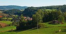
South Harz 
|

|
1
WDPA: 324908
|
Nordhausen district
|
|
⊙
|
11,509
|
1960
|
|
Old Stolberg
|
|
2
WDPA: 319557
|
Nordhausen district
|
|
⊙
|
4,322
|
1970
|
|
Helmestausee
|
BW
|
3
WDPA: 20787
|
Kyffhäuserkreis , Nordhausen district
|
|
⊙
|
1,794
|
1970
|
|
Hainleite
|
|
4
WDPA: 20781
|
Kyffhäuserkreis , Sömmerda district
|
|
⊙
|
8,676
|
1970
|
|
Dün-Helbetal
|
BW
|
5
WDPA: 320473
|
Eichsfeld district , Kyffhäuserkreis , Nordhausen district
|
|
⊙
|
5,600
|
1963
|
|
Bleicheröder Mountains
|
BW
|
6
WDPA: 20734
|
Eichsfeld district , the district Nordhausen
|
|
⊙
|
3,597
|
1970
|
|
Rusteberg
|
BW
|
11
WDPA: 324055
|
Eichsfeld district
|
|
⊙
|
16
|
1940
|
|
Mühlhäuser Stadtwald
|
BW
|
17
WDPA: 323089
|
Eichsfeld district , Unstrut-Hainich district
|
|
⊙
|
2,838
|
1970
|
|
Landscape parts, watercourses and broken meadow area Bad Tennstedt
|
BW
|
18
WDPA: 320122
|
Unstrut-Hainich district
|
|
⊙
|
10
|
1939
|
|
Unstruttal between Nägelstedt and Großvargula
|
BW
|
19
WDPA: 325302
|
District of Gotha , Unstrut-Hainich district
|
|
⊙
|
139
|
1939
|
|
Fahner height
|
BW
|
20
WDPA: 20762
|
Erfurt , district of Gotha , district of Sömmerda
|
|
⊙
|
4,950
|
1970
|
|
fin
|

|
21
WDPA: 320806
|
Sömmerda district
|
|
⊙
|
890
|
1960
|
|
Schoenen reason
|
BW
|
22
WDPA: 324258
|
Weimarer Land district
|
|
⊙
|
50
|
1970
|
|
Ilmtal from Oettern to Kranichfeld
|
BW
|
23
WDPA: 20791
|
Erfurt , Ilm district , Weimar , Weimarer Land district
|
|
⊙
|
19.209
|
1960
|
|
Steigerwald (Erfurt)
|

|
24
WDPA: 20880
|
Erfurt
|
|
⊙
|
1,188
|
1970
|
|
Parts of the landscape between Möbisburg and Egstedt
|
BW
|
25
WDPA: 322479
|
Erfurt
|
|
⊙
|
64
|
1939
|
|
Triple equals
|
BW
|
26
WDPA: 20749
|
District of Gotha , Ilm district
|
|
⊙
|
1,698
|
1960
|
|
Middle Saale valley between Camburg and Göschwitz
|

|
32
WDPA: 20826
|
Jena , Saale-Holzland district
|
|
⊙
|
16.602
|
1972
|
|
Hainspitzer See
|

|
33
WDPA: 20753
|
Saale-Holzland district
|
|
⊙
|
39
|
1950
|
|
Gera city forest
|
BW
|
34
WDPA: 321058
|
Gera , district of Greiz
|
|
⊙
|
1,575
|
1972
|
|
Hausberg (Gera)
|
BW
|
35
WDPA: 321443
|
Gera
|
|
⊙
|
28
|
1940
|
|
Zeitzgrund
|

|
37
WDPA: 20918
|
Saale-Holzland district
|
|
⊙
|
1,291
|
1958
|
|
Rotehofbachtal
|
BW
|
38
WDPA: 20863
|
Saale-Holzland-Kreis , Saale-Orla-Kreis
|
|
⊙
|
2,444
|
1964
|
|
Kemnatenberg and Spitalsberg
|

|
39
WDPA: 322086
|
Saale-Holzland district
|
|
⊙
|
58
|
1951
|
|
Rinne-Rottenbachtal
|

|
40
WDPA: 20860
|
District of Saalfeld-Rudolstadt , Ilm district
|
|
⊙
|
6,717
|
1972
|
|
Hermannstal
|
|
41
WDPA: 321564
|
District of Saalfeld-Rudolstadt
|
|
⊙
|
251
|
1939
|
|
Zechstein reefs in the Orlasenke
|
BW
|
42
WDPA: 325979
|
Saale-Orla district
|
|
⊙
|
410
|
1958
|
|
Dobritz caves
|

|
43
WDPA: 320380
|
Saale-Orla district
|
|
⊙
|
35
|
1958
|
|
Drommberg
|

|
44
WDPA: 320436
|
Saale-Orla district
|
|
⊙
|
26th
|
1958
|
|
Weidatalsperre
|

|
45
WDPA: 20911
|
District of Greiz
|
|
⊙
|
1,680
|
1961
|
|
Plothen pond area
|
|
46
WDPA: 20853
|
Saale-Orla district
|
|
⊙
|
1,896
|
1961
|
|
Steinicht
|

|
47
WDPA: 324823
|
District of Greiz
|
|
⊙
|
10
|
1943
|
|
Kulm
|
|
49
WDPA: 322362
|
District of Saalfeld-Rudolstadt
|
|
⊙
|
200
|
1938
|
|
Slide
|

|
50
WDPA: 321096
|
District of Saalfeld-Rudolstadt
|
|
⊙
|
123
|
1938
|
|
Upper hall
|

|
51
WDPA: 20840
|
Saale-Orla district , Saalfeld-Rudolstadt district
|
|
⊙
|
21,115
|
1965
|
|
Reichenfels castle ruins
|
|
52
WDPA: 320213
|
District of Greiz
|
|
⊙
|
45
|
1961
|
|
Zaufensgraben
|
|
54
WDPA: 325976
|
Gera
|
|
⊙
|
11
|
1952
|
|
Forests around Greiz and Werdau
|

|
55
WDPA: 325546
|
District of Greiz
|
|
⊙
|
3,270
|
1961
|
|
Hainbergsee Meuselwitz
|

|
56
WDPA: 321319
|
Altenburger Land district
|
|
⊙
|
24
|
1963
|
|
Sprottetal
|
|
57
WDPA: 20877
|
Altenburger Land district
|
|
⊙
|
1,100
|
1984
|
|
Kohrener Land
|
BW
|
58
WDPA: 322256
|
Altenburger Land district
|
|
⊙
|
8,241
|
1959
|
|
Kyffhauser
|

|
59
WDPA: 322381
|
Kyffhäuserkreis , Nordhausen district
|
|
⊙
|
5,475
|
1941
|
|
Thuringian Rhön
|
BW
|
60
WDPA: 20897
|
District of Schmalkalden-Meiningen , Wartburg district
|
|
⊙
|
532
|
1989
|
|
Kleiner Gleichberg, Hartenburg and Altenburg
|
BW
|
61
WDPA: 378501
|
Hildburghausen district
|
|
⊙
|
532
|
1939
|
|
Thuringian Forest
|
|
62
WDPA: 20896
|
Eisenach , district of Gotha , district of Hildburghausen
|
The nature reserve Thuringian Forest is located in the counties and independent cities Eisenach , district of Gotha , Hildburghausen , Saalfeld-Rudolstadt , Schmalkalden-Meiningen , district Sonneberg , Suhl and Wartburgkreis .
|
⊙
|
145,569
|
1963
|
|
Hildburghausen Forest
|
BW
|
63
WDPA: 20788
|
Hildburghausen district
|
|
⊙
|
5,250
|
1978
|
|
Esbachteich
|
BW
|
64
WDPA: 320698
|
Ilm district
|
|
⊙
|
9
|
1939
|
|
Thuringian Slate Mountains
|

|
76
WDPA: 378705
|
Saale-Orla district , Saalfeld-Rudolstadt district
|
|
⊙
|
26,512
|
2006
|
|
Area field
|

|
81
WDPA: 390325
|
Eichsfeld district , Unstrut-Hainich district
|
In 2009 the nature reserve "Obereichsfeld" (No. 81) was founded. The ten protected landscape areas "Das kleine Lichtenbühl" (No. 7), "Heiligenstädter Stadtwald" (No. 8), "Die Hörner" (No. 9), "Flinsberger Warte" (No. 10), "Rusteberg" ( No. 11), "Heuberg - Galgenberg" (No. 12), "Pfaffschwender Kuppe" (No. 13), "Hülfensberg" (No. 14), "Feuerkuppe - Rollsberg" (No. 15) and "Keudelskuppe with eastern edge der Plesse "(No. 16) rise. However, the LSG "Rusteberg" does not seem to have been incorporated.
|
⊙
|
38,496
|
2009
|
|
Unstrut-Triasland
|
BW
|
83
WDPA: 325304
|
Kyffhäuserkreis
|
|
⊙
|
616
|
1961
|
|
Beggar's wood
|
BW
|
84
WDPA: 319909
|
Ilm district
|
|
⊙
|
11
|
|
|
Saale valley in the corridors Göschwitz to Kahla
|

|
104
WDPA: 345190
|
Jena , Saale-Holzland district
|
|
⊙
|
1,431
|
1972
|
|
Triessnitz
|

|
105
WDPA: 345198
|
Jena
|
|
⊙
|
15th
|
1972
|
|
Oberaue
|

|
106
WDPA: 345186
|
Jena
|
|
⊙
|
59
|
1972
|
|
Unteraue
|
BW
|
107
WDPA: 345199
|
Jena
|
|
⊙
|
127
|
1972
|
| Legend for landscape protection area
|


