| Surname
|
image
|
Identifier
|
circle
|
details
|
position
|
Area
hectares
|
date
|
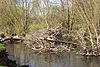
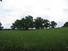
On the Gilderspfad 
|
BW
|
2531003
WDPA: 378395
|
District of Giessen
|
|
⊙
|
5.24
|
|
|
At the Wolfsgrube near Kerspenhausen
|
BW
|
2632013
WDPA: 378733
|
District of Hersfeld-Rotenburg
|
|
⊙
|
2.28
|
1967
|
|
Antrefftal
|
BW
|
2634004
WDPA: 378397
|
Vogelsbergkreis , Schwalm-Eder-Kreis
|
|
⊙
|
936.3
|
1972
|
|
Aschenberg near Remsfeld
|
BW
|
2634023
WDPA: 319672
|
Schwalm-Eder district
|
|
⊙
|
2,346.97
|
1974
|
|
Auenverbund Diemel
|

|
2633002
WDPA: 378399
|
District of Kassel
|
|
⊙
|
1,329.05
|
1994
|
|
Eder floodplain network
|

|
2634001
WDPA: 378400
|
Schwalm-Eder district , Waldeck-Frankenberg district
|
|
⊙
|
4,507.68
|
1993
|
|
Auenverbund Fulda
|
|
2631002
WDPA: 378401
|
District of Fulda , Vogelsbergkreis , District of Hersfeld-Rotenburg
|
+ Schwalm-Eder district
|
⊙
|
9,017.27
|
1993
|
|
Auenverbund Kinzig
|

|
2435005
WDPA: 378402
|
District of Fulda , Vogelsbergkreis , Wetteraukreis
|
+ Main-Kinzig district
|
⊙
|
12,902.47
|
1990
|
|
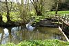
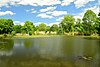
Lahn-Dill floodplain network
|

Lahnauen near Lahnau . In the background the district Atzbach
|
2531018
WDPA: 378403
|
Marburg-Biedenkopf , Gießen district , Limburg-Weilburg
|
+ Lahn-Dill district
|
⊙
|
6,728.93
|
1996
|
|
Lahn-Ohm floodplain network
|
BW
|
2534009
WDPA: 378404
|
Vogelsbergkreis , Waldeck-Frankenberg , Marburg-Biedenkopf
|
+ District of Giessen
|
⊙
|
5,915.4
|
1993
|
|
Alluvial meadows Schwalm
|

|
2634012
WDPA: 378405
|
Vogelsbergkreis , Schwalm-Eder-Kreis
|
|
⊙
|
4,510.06
|
1993
|
|
Auenverbund Untere Gersprenz
|

|
2432002
WDPA: 378406
|
Darmstadt-Dieburg district
|
A LSG consisting of almost 30 individual areas from floodplains and meadow areas of the Gersprenz and their inflows between Groß-Bieberau and the state border with Bavaria. The Gersprenz flowing into the Dieburger Bucht and its tributaries are a retreat, nesting and wintering area for birds and rare animal species. The white stork was able to make its home here in numerous breeding pairs.
|
⊙
|
2,451.58
|
1998
|
|
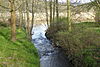
Werra floodplain network
|

Werraaue at Albungen.
|
2636002
WDPA: 378407
|
District of Hersfeld-Rotenburg , Werra-Meißner district
|
|
⊙
|
3,840.98
|
1992
|
|
Weser floodplain network
|
BW
|
2633003
WDPA: 378408
|
District of Kassel
|
|
⊙
|
1,069.74
|
1994
|
|
The Wetterau floodplain network
|

|
2440001
WDPA: 378409
|
District of Giessen , Main-Kinzig-Kreis , Wetteraukreis
|
Alluvial areas of Horloff , Nidda , Nidder , Wetter and Seemenbach characterized by wet meadows
|
⊙
|
7,369
|
2014
|
|
Bleichenbachtal between Bergheim and Bleichenbach
|
BW
|
2440004
WDPA: 378414
|
Wetteraukreis
|
|
⊙
|
19.23
|
1996
|
|
Bruchwiesen near Büttelborn
|
BW
|
2433026
WDPA: 378420
|
Groß-Gerau district
|
|
⊙
|
29.45
|
1997
|
|
Buchenbachtal near Christerode
|

|
2634042
WDPA: 378506
|
Schwalm-Eder district
|
|
⊙
|
189.06
|
1995
|
|
Büchenberg and Platzberg near Hesperinghausen
|
BW
|
2635011
WDPA: 32002
|
Waldeck-Frankenberg district
|
|
⊙
|
71.69
|
1993
|
|
Buchenberg, Grisselborn woods and Taftgrund near Soisdorf
|
BW
|
2631011
WDPA: 378422
|
District of Fulda
|
|
⊙
|
16.61
|
1994
|
|
Herzberg Castle
|
BW
|
2632024
WDPA: 378424
|
Vogelsbergkreis , Hersfeld-Rotenburg district
|
|
⊙
|
21.89
|
1953
|
|
Dattenbachtal between Kröftel and Vockenhausen
|
BW
|
2436002
WDPA: 378426
|
Rheingau-Taunus-Kreis , Main-Taunus-Kreis
|
|
⊙
|
14.31
|
1993
|
|
The Hegen near Ziegenhagen
|
BW
|
2636023
WDPA: 378428
|
Werra-Meißner district
|
|
⊙
|
46.53
|
1954
|
|
The Kesselgraben
|
BW
|
2632015
WDPA: 378498
|
District of Hersfeld-Rotenburg
|
|
⊙
|
1.36
|
1969
|
|
The Küppel
|
BW
|
2634006
WDPA: 378429
|
Schwalm-Eder district
|
|
⊙
|
139.45
|
1972
|
|
Dingel and Eberschützer cliffs
|
BW
|
2633017
WDPA: 378430
|
District of Kassel
|
|
⊙
|
33.04
|
1987
|
|
Dreienberg-Landecker
|
BW
|
2632016
WDPA: 378434
|
District of Hersfeld-Rotenburg
|
|
⊙
|
1,609.53
|
1970
|
|
Eckerich near Fritzlar
|
BW
|
2634008
WDPA: 378436
|
Schwalm-Eder district
|
|
⊙
|
39.71
|
1968
|
|
Efzepforte near Homberg
|
BW
|
2634026
WDPA: 378437
|
Schwalm-Eder district
|
|
⊙
|
348.86
|
1976
|
|
Efzetal between Holzhausen and Relbehausen
|

|
2634009
WDPA: 378438
|
Schwalm-Eder district
|
|
⊙
|
38.75
|
1990
|
|
Eisenberg
|
BW
|
2632001
WDPA: 378440
|
District of Hersfeld-Rotenburg , Schwalm-Eder district
|
|
⊙
|
582.36
|
1970
|
|
Eisenberg near Schlitz
|
BW
|
2535002
WDPA: 378441
|
Vogelsbergkreis
|
|
⊙
|
250.21
|
1990
|
|
Erlenberg near Weichersbach
|
BW
|
2435011
WDPA: 378448
|
Main-Kinzig district
|
|
⊙
|
66.19
|
1998
|
|
Flohrberg and Ohmsberg near Deisel
|
BW
|
2633025
WDPA: 378452
|
District of Kassel
|
|
⊙
|
67.81
|
1990
|
|
The rivers and streams of Fulda, Ulster, Haune, Bieber etc.
|
BW
|
2631008
WDPA: 555513809
|
District of Fulda , Vogelsbergkreis
|
|
⊙
|
474.59
|
|
|
Forehahi
|
BW
|
2431001
WDPA: 378453
|
Kreis Bergstraße , Groß-Gerau
|
|
⊙
|
9,527.26
|
1956
|
|
Frauenstein
|
BW
|
2631010
WDPA: 378454
|
District of Fulda
|
|
⊙
|
3,533.4
|
1968
|
|
Fuldatal near Konnefeld
|
BW
|
2634041
WDPA: 555547207
|
District of Hersfeld-Rotenburg , Schwalm-Eder district
|
|
⊙
|
68.15
|
1989
|
|
Gelstertal
|
|
2636030
WDPA: 555547210
|
Werra-Meißner district
|
|
⊙
|
219.34
|
|
|
Glauberg
|
BW
|
2440002
WDPA: 378459
|
Wetteraukreis
|
|
⊙
|
358.41
|
1996
|
|
Gras-Ellenbacher meadows
|
BW
|
2431023
WDPA: 378461
|
Bergstrasse district
|
|
⊙
|
19.48
|
1994
|
|
Ground and mountain meadows in the catchment area of Jossa and Sinn
|
BW
|
2435004
WDPA: 378466
|
Main-Kinzig district
|
|
⊙
|
2,935.43
|
1993
|
|
Gründaue near Niedergründau
|
BW
|
2435012
WDPA: 378467
|
Main-Kinzig district
|
|
⊙
|
91.36
|
1986
|
|
Frankfurt green belt
|
BW
|
2412001
WDPA: 378468
|
Frankfurt am Main
|
|
⊙
|
10,850.13
|
1972
|
|
Habichtstein and Warmetal near Ehlen
|
BW
|
2633016
WDPA: 378469
|
District of Kassel
|
|
⊙
|
63.48
|
1989
|
|
Hardtwasseraue
|
BW
|
2534011
WDPA: 321385
|
Marburg-Biedenkopf district
|
|
⊙
|
41.24
|
1996
|
|
Haugrund near Biedebach
|
BW
|
2632014
WDPA: 378471
|
District of Hersfeld-Rotenburg
|
|
⊙
|
90.78
|
1967
|
|
Heiligenberg
|

|
2634013
WDPA: 378473
|
Schwalm-Eder district
|
|
⊙
|
23.49
|
1950
|
|
Heisebachtal in Kassel
|
BW
|
2611001
WDPA: 378474
|
kassel
|
|
⊙
|
7.33
|
1990
|
|
Hessian Main meadows
|
BW
|
2436001
WDPA: 378476
|
Main-Kinzig district , Main-Taunus district , Groß-Gerau district
|
+ Offenbach district; Zone I with floodplain areas of the Main and stream valleys, Zone II with adjoining forests, vineyards and fields
|
⊙
|
2,574.12
|
1987
|
|
Hessian Rhön
|
|
2631001
WDPA: 378477
|
District of Fulda
|
|
⊙
|
41,031.72
|
1967
|
|
Hay break meadows near Eschenstruth
|
BW
|
2633013
WDPA: 378478
|
District of Kassel
|
|
⊙
|
40.28
|
1989
|
|
Hinterberger meadows
|
BW
|
2634003
WDPA: 378479
|
Schwalm-Eder district
|
|
⊙
|
123.53
|
1972
|
|
High Rhön
|

|
2631012
WDPA: 378482
|
District of Fulda
|
|
⊙
|
4,420.82
|
1997
|
|
Höllgraben in Fuldatal
|
BW
|
2633004
WDPA: 378485
|
District of Kassel
|
|
⊙
|
81.5
|
1991
|
|
In soaps
|
BW
|
2435003
WDPA: 321903
|
Main-Kinzig district
|
|
⊙
|
14.38
|
1999
|
|
Josbachtal near Lischeid
|
BW
|
2634005
WDPA: 378493
|
Schwalm-Eder district , Marburg-Biedenkopf district
|
|
⊙
|
33.91
|
1990
|
|
Kalkberge and Diebachsaue between Heiligenrode and Niederkaufungen
|
BW
|
2633006
WDPA: 378494
|
District of Kassel
|
|
⊙
|
75.23
|
1983
|
|
Limestone grasslands and Diemelaltwasser near Lamerden
|
BW
|
2633015
WDPA: 378495
|
District of Kassel
|
|
⊙
|
16.56
|
1986
|
|
Karlshagen near Melsungen
|
BW
|
2634010
WDPA: 378497
|
Schwalm-Eder district
|
|
⊙
|
53.35
|
1990
|
|
Kirdorfer Feld near Bad Homburg
|

|
2434002
WDPA: 378499
|
Hochtaunuskreis
|
|
⊙
|
79.15
|
1996
|
|
Köhlersgrund and Semgesgraben
|
BW
|
2632035
WDPA: 378505
|
District of Hersfeld-Rotenburg
|
|
⊙
|
2.98
|
1958
|
|
Kütte with standing water
|
BW
|
2632006
WDPA: 378510
|
District of Hersfeld-Rotenburg
|
|
⊙
|
0.16
|
1964
|
|
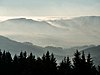
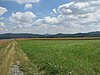
Lahn valley between Marburg and Giessen
|

View from Altenberg near Salzboden towards Marburg in the Lahn valley
|
2534012
WDPA: 378511
|
Marburg-Biedenkopf , Gießen district
|
|
⊙
|
742.72
|
|
|
Darmstadt district
|
BW
|
2432004
WDPA: 378512
|
Darmstadt district
|
|
⊙
|
565.82
|
1956
|
|
District of Dieburg
|

Middle area of the LSG: left Lützelforst , middle right: Mittelforst , right edge of the picture: part of Oberforst es
|
2432003
WDPA: 378513
|
Darmstadt-Dieburg district
|
6 protected forest areas:
- the largest, east and northeast of Babenhausen lying and by the Gersprenz separated into two parts forest area
- the smallest, a north-east to the residential community of Eppertshausen abutting Forest corner
- the split by a meadow and meadow area, upper and middle forest called Dieburger forest , bordered from Dieburg , Altheim , Richen and Semd
- as well as two other slightly smaller closed forest areas to the east, called as a whole Lützelforst and reaching as far as Langstadt .
The individual areas are each separated by narrow areas of the LSG Auenverbund Untere Gersprenz , but form an almost closed forest area between Dieburg, Groß-Umstadt and Babenhausen, which is under landscape protection .
|
⊙
|
2,022
|
1962
|
|
Offenbach district
|
BW
|
2438001
WDPA: 378514
|
Offenbach district
|
|
⊙
|
17,753.08
|
1961
|
|
Landscape components and landscape parts in the Hofgeismar district
|
BW
|
2633007
|
District of Kassel
|
The expulsion is void due to formal errors.
|
⊙
|
2,842.08
|
1938-2014
|
|
Landscape protection area Hessian Rhine bank landscape
|
|
2433001
WDPA: 378516
|
Kreis Bergstraße , Groß-Gerau
|
|
⊙
|
2,862.16
|
1978
|
|
Parts of the landscape in the Hersfeld district
|
BW
|
2632004
WDPA: 378458
|
District of Hersfeld-Rotenburg
|
|
⊙
|
90.94
|
1952
|
|
Landscape parts in the district of Melsungen (from 1969) / Melsungen (district)
|
BW
|
2634031
WDPA: 378621
|
Schwalm-Eder district
|
|
⊙
|
42.94
|
1969
|
|
Landscape parts in the district of Melsungen (from 1956)
|

|
2634043
WDPA: 378521
|
Schwalm-Eder district
|
|
⊙
|
57.62
|
1956
|
|
Parts of the landscape in the Grünberg district
|
BW
|
2531002
WDPA: 378520
|
District of Giessen
|
|
⊙
|
57.36
|
1962
|
|
Landscape parts of the city of Marburg
|
BW
|
2534004
WDPA: 390140
|
Marburg-Biedenkopf district
|
|
⊙
|
817.22
|
|
|
Lengelbachtal
|
BW
|
2635030
WDPA: 378523
|
Waldeck-Frankenberg district
|
|
⊙
|
30.69
|
1992
|
|
Lossetal near Fürstenhagen
|
BW
|
2636027
WDPA: 378524
|
Werra-Meißner district
|
|
⊙
|
17.32
|
1956
|
|
Loss meadows when buying down
|
BW
|
2633026
WDPA: 378525
|
District of Kassel
|
|
⊙
|
29
|
1996
|
|
Lützelstrauch near Oberellenbach
|
BW
|
2632010
WDPA: 378623
|
District of Hersfeld-Rotenburg
|
|
⊙
|
6.67
|
1978
|
|
Malchustal near Ersrode
|
BW
|
2632011
WDPA: 378626
|
District of Hersfeld-Rotenburg
|
|
⊙
|
112.76
|
1937
|
|
Middle Fulda valley
|

|
2633010
WDPA: 378631
|
Kassel , District of Kassel
|
|
⊙
|
106.99
|
1973
|
|
Mönchbruch and forests near Mörfelden-Walldorf and Groß-Gerau
|
BW
|
2433007
WDPA: 378633
|
Groß-Gerau district
|
|
⊙
|
4,114.33
|
2006
|
|
Limestone slopes Weimar
|
BW
|
2633012
WDPA: 378642
|
District of Kassel
|
|
⊙
|
55.69
|
1973
|
|
Upper Fulda valley
|

|
2633009
WDPA: 378649
|
Schwalm-Eder district , Kassel , Kassel district
|
|
⊙
|
702.21
|
1973
|
|
Upper Holzapetal
|
|
2633018
WDPA: 378650
|
District of Kassel
|
|
⊙
|
33.47
|
1993
|
|
Upper Niestetal
|
BW
|
2636022
WDPA: 378651
|
Werra-Meißner district
|
|
⊙
|
652.6
|
1990
|
|
Upper Rinnetal
|

|
2634025
WDPA: 378652
|
Schwalm-Eder district
|
|
⊙
|
2,185.07
|
1975
|
|
Ostheimer hats
|

|
2633014
WDPA: 378657
|
District of Kassel
|
|
⊙
|
22.97
|
1988
|
|
Rhoder Sommerhude
|
BW
|
2635007
WDPA: 378666
|
Waldeck-Frankenberg district
|
|
⊙
|
17.23
|
1967
|
|
Riedbachtal
|
BW
|
2636028
WDPA: 555547208
|
Werra-Meißner district
|
|
⊙
|
96.54
|
|
|
Rocklinghausen
|
BW
|
2635009
WDPA: 378668
|
Waldeck-Frankenberg district
|
|
⊙
|
2.8
|
1957
|
|
Rohrerlen at Werkel
|
BW
|
2634016
WDPA: 378669
|
Schwalm-Eder district
|
|
⊙
|
21.67
|
1990
|
|
Rothgrund near Besse
|
BW
|
2634011
WDPA: 378672
|
Schwalm-Eder district
|
|
⊙
|
68.69
|
1990
|
|
Schlossberg Homberg
|

|
2634024
WDPA: 378674
|
Schwalm-Eder district
|
|
⊙
|
15.94
|
1975
|
|
Schwadelsberg and Seiffertshain near Marborn
|
BW
|
2435013
WDPA: 378682
|
Main-Kinzig district
|
|
⊙
|
124.28
|
1989
|
|
Seemenbachtal near Rinderbügen
|
BW
|
2440003
WDPA: 378686
|
Wetteraukreis
|
|
⊙
|
72
|
1995
|
|
Seulingswald
|
BW
|
2632002
WDPA: 378688
|
District of Hersfeld-Rotenburg
|
|
⊙
|
3,026.56
|
1979
|
|
Soisberg
|
BW
|
2631004
WDPA: 378690
|
District of Fulda , District of Hersfeld-Rotenburg
|
|
⊙
|
372.13
|
1973
|
|
City of Darmstadt
|
BW
|
2411001
WDPA: 378691
|
Darmstadt
|
|
⊙
|
7,121.55
|
2004
|
|
City of Kassel
|
BW
|
2611002
WDPA: 378517
|
Kassel , District of Kassel
|
|
⊙
|
1,983.86
|
1995
|
|
City of Maintal
|
BW
|
2435014
WDPA: 555547205
|
Main-Kinzig district
|
|
⊙
|
1,182.66
|
|
|
City of Offenbach
|
BW
|
2413001
WDPA: 378692
|
Offenbach am Main
|
|
⊙
|
1,593.73
|
1980
|
|
City district of Fulda
|
|
2631009
WDPA: 378693
|
District of Fulda
|
|
⊙
|
203.28
|
1969
|
|
City of Hanau
|
BW
|
2435015
|
Main-Kinzig district
|
Zone I includes priority areas for biotope and species protection, Zone II the public and private green spaces
|
⊙
|
3,702
|
2013
|
|
Stahlberg and Hölleberg near Deisel
|
BW
|
2633019
WDPA: 378695
|
District of Kassel
|
|
⊙
|
44.45
|
1992
|
|
Stone chamber
|
BW
|
2631007
WDPA: 378698
|
District of Fulda
|
|
⊙
|
32.27
|
1969
|
|
Stoppelsberg with Ilmestal
|
BW
|
2631006
WDPA: 378699
|
District of Fulda , District of Hersfeld-Rotenburg
|
|
⊙
|
757.89
|
1972
|
|
Tannenberg Nentershausen
|

View from the "Schweinerevier" to the Tannenburg.
|
2632012
WDPA: 378703
|
District of Hersfeld-Rotenburg
|
|
⊙
|
46.52
|
1941
|
|
Totenberg
|

|
2531001
WDPA: 378706
|
District of Giessen
|
|
⊙
|
137.05
|
1964
|
|
Lower Fulda
|

|
2633011
WDPA: 378710
|
District of Kassel
|
|
⊙
|
1,347.83
|
1973
|
|
Lower Main Locks
|
BW
|
2433008
WDPA: 378711
|
Groß-Gerau district
|
|
⊙
|
194.16
|
2006
|
|
Urbach and Angersbach valleys
|
BW
|
2634002
WDPA: 378712
|
Schwalm-Eder district
|
|
⊙
|
447.61
|
1972
|
|
Lost brook
|
BW
|
2636029
WDPA: 555547209
|
Werra-Meißner district
|
|
⊙
|
36.9
|
|
|
Schwalm lowlands bird sanctuary near Schwalmstadt
|
BW
|
2634044
WDPA: 378713
|
Schwalm-Eder district
|
|
⊙
|
2,703
|
2006
|
|
Juniper heather
|
BW
|
2531004
WDPA: 378716
|
District of Giessen
|
|
⊙
|
1.84
|
1968
|
|
Weidenau from Hirschhorn
|
BW
|
2431009
WDPA: 378723
|
Bergstrasse district
|
|
⊙
|
29.45
|
1983
|
|
Werra valley between Blickershausen and Wendershausen
|
|
2636024
WDPA: 378725
|
Werra-Meißner district
|
|
⊙
|
960.82
|
1964
|
|
Werra valley between Oberrieden and Wenderhausen and Ludwigstein with hinterland
|

|
2636031
WDPA: 555547211
|
Werra-Meißner district
|
|
⊙
|
782.19
|
|
|
Weser old arm near Gieselwerder
|
BW
|
2633024
WDPA: 378508
|
District of Kassel
|
|
⊙
|
14.86
|
1989
|
|
Wickerbachaue from Flörsheim and Hochheim
|

|
2436003
WDPA: 378729
|
Main-Taunus-Kreis
|
|
⊙
|
53.41
|
1998
|
|
City of Wiesbaden
|

|
2414001
WDPA: 555513808
|
Wiesbaden
|
|
⊙50.082083333333 8.2413611111111
|
13,328.64
|
2010
|
|
Wingertsberg from Langstadt
|

|
2432001
WDPA: 378731
|
Darmstadt-Dieburg district
|
Former wine-growing area, today mostly orchards and lawns with bushes, between Langstadt and Schlierbach , in the middle but not including the street mill , south in the forest area of the LSG the castle stables of Schlierbach Castle
|
⊙
|
20.23
|
1987
|
|
Wünne near Viesebeck
|
|
2633020
WDPA: 378735
|
District of Kassel
|
|
⊙
|
30.87
|
1992
|
|
Zechstein slopes near Lieschensruh
|
BW
|
2635002
WDPA: 378737
|
Waldeck-Frankenberg district
|
|
⊙
|
48.41
|
1991
|
|
Zellerbruch from Seligenstadt and Zellhausen
|
BW
|
2438002
WDPA: 378738
|
Main-Kinzig district
|
|
⊙
|
32.56
|
1992
|
|
Keischel near Weimar
|
BW
|
2633027
WDPA: 378507
|
District of Kassel
|
|
⊙
|
22.67
|
1992
|
| Legend for landscape protection area
|

.jpg)


_(001).JPG)

.jpg)


,_2,_Malsfeld,_Schwalm-Eder-Kreis.jpg)


.jpg)
,_Schwalm-Eder-Kreis.jpg)


