
The castle
| coat of arms | Germany map | |
|---|---|---|

|
Coordinates: 49 ° 54 ' N , 8 ° 50' E |
|
| Basic data | ||
| State : | Hesse | |
| Administrative region : | Darmstadt | |
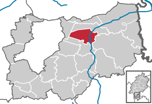
| County : | Darmstadt-Dieburg | |
| Height : | 143 m above sea level NHN | |
| Area : | 23.08 km 2 | |
| Residents: | 15,566 (Dec. 31, 2019) | |
| Population density : | 674 inhabitants per km 2 | |
| Postal code : | 64807 | |
| Area code : | 06071 | |
| License plate : | DA, TU | |
| Community key : | 06 4 32 004 | |
City administration address : |
Markt 4 64807 Dieburg |
|
| Website : | ||
| Mayor : | Frank House (independent) | |
| Location of the city of Dieburg in the Darmstadt-Dieburg district | ||
  |
||


Dieburg (in the local dialect: Dibborsch ) is a city and a medium-sized center in southern Hesse , about 15 km east of Darmstadt . Before 1977, Dieburg was the district town of the old district of Dieburg and is located in the eastern part of the Darmstadt-Dieburg district . The city is one of the locations of the Darmstadt University of Applied Sciences .
geography
Geographical location
Dieburg is located in southern Hesse , around 15 km east of Darmstadt in the extensive Gersprenz valley . Geologically, Dieburg is shaped by the Gersprenz valley. The soils consist mainly of tertiary deposits such as gravel , sand and clay covered by younger river deposits as well as loess and drifting sand covers . The city is located north of the low mountain range Odenwald in the Dieburger Bucht , which is a western branch of the Hanau-Seligenstädter Senke ( Hanau Basin or Eastern Lower Main Plain). To the north and west of the city lie extensive forest areas of the Dreieich . The highest point is the Mainzer Berg (also called Moret ) at 227 m above sea level. NN.
Neighboring communities
In the north, Dieburg borders on the municipality of Münster (Hesse) , in the east on the district of Münster-Altheim , in the southeast on the Groß-Umstädter district of Semd , in the south on the municipality of Groß-Zimmer and its district on Klein-Zimmer and in the west on the Grube Messel district of the municipality of Messel .
City structure
Dieburg officially only includes a district (Gmk.-Nr. 61067) and has no districts. Nevertheless, there are quarters for Dieburger that further subdivide the city. A border between Dieburg-Ost and Dieburg-West runs across the empty parking lot, the largest parking lot, west of the city center. The border line between Dieburg-Süd and Dieburg-Nord is the Aschaffenburg - Darmstadt Hbf railway line.
history
Prehistory and Antiquity
The settlement of the urban area extends into the Bronze Age . Whether the so-called ox figure from Dieburg from the Copper Age comes from the Dieburg area can no longer be clearly verified.
At the end of the Iron Age, the Auderiensier tribe settled in the area around the city. The fertile Dieburger Bucht was then incorporated into the province of Upper Germany of the Roman Empire in the years from 85–90 AD . Around 125 n. Chr. Of today's South Hesse has been in the field Civitas Auderiensium founded whose main place today Dieburg with the incomplete traditional name ... MED ... was. As a newly created, city-like settlement, the forum was located at the intersection of Frankfurterstrasse and Aschaffenburger Strasse. Numerous cult objects, including an important testimony of the Mithras cult , were excavated and can be seen today in the city museum .
Around 200 the settlement flourished. The Roman Dieburg was a vicus , albeit with an urban character. In the area , which is well suited for agriculture, numerous Villae Rusticae were built , which supplied MED ... and the troops on the nearby Limes as economic goods .
In the course of the 3rd century, however, robberies by the Alemanni from the area outside the Limes increased. Although the place, which far surpassed the later medieval city in its area, was secured with a city wall, it could not be prevented that the Roman Empire had to withdraw to the left bank of the Rhine in Germany from 260 AD ( Limesfall ). The fate of the city until the early Middle Ages is in the dark. A continuity of the settlement is very likely, albeit in a much simpler framework than before. Coin finds and signs of building indicate this. Today's pilgrimage church is located in the western area of the Roman forum; its floor plan is determined by previous Roman buildings. Presumably the remaining part of the Roman population, which was mainly of Germanic and Celtic origin, mixed with the incoming Alemanni who, as federates in the run-up to Roman Mainz ( Mogontiacum ), were still trading briskly with the empire.
middle Ages

After the Franks conquered the area, a royal court was installed in Dieburg and in nearby Groß-Umstadt . At that time the settlement was known as "Altenstadt" and was concentrated around the area of the pilgrimage church, the original building of which is Carolingian at the latest, but, as has already been said, also has a Roman predecessor, the purpose of which is unknown. The main street of this settlement still bears the name "Altstadt" today, although it was outside the walls of the medieval Dieburg.
The name Dieburg appears for the first time on a document from the Eberbach Monastery from 1207. The document reports on a legal act in which a "Judta de Dieburch" appears as a witness. From the following year 1208 there is another certificate with the seal of "Heinrich von Dieburg", the brother of Jutta von Dieburg. Dieburg is a city that was planned in the area between the moated castle in the Gersprenz and the "Altenstadt". It thus filled the space between the "Altenstadt", "Monfeld" and "Holzhausen" settlements and turned them into suburbs. Its exemplary floor plan with differentiated main and side streets, city wall with moats, castle, market and new parish church can still be seen in the city map today. Based on this urban complex, recent research assumes that the ruling imperial family of the Staufer Dieburg wanted to expand into an imperial city in order to improve their power base in today's Rhine-Main area. However, the city quickly became dependent on the Archdiocese of Mainz . After the city was founded, Altenstadt was retained as a suburb with the pilgrimage church. At that time the pilgrimage church was still the city church of St. Peter and Paul, it was not until the 16th century that the patronage was transferred to the current city church in the city, after which the church in the old town was renamed the pilgrimage church.
During this time in Dieburg was one of the 30 wild Huben the Wild spell Dreieich , which also belonged to the surrounding forests.
The city wall was built around 1220. From 1239 the lords of Munzenberg owned the castle. After they died out, Dieburg came into the possession of the Counts of Isenburg. In 1277 Rudolf von Habsburg granted the "oppidium Dippurch" at the request of Archbishop Werner von Eppstein of Mainz all freedom rights and confirmed the existing city rights. Between 1284 and 1294, the Archbishop of Mainz bought the shares in the castle and town from the Counts of Isenburg .
In 1310 Dieburg became completely Electoral Mainz and the residence of numerous noble families, who administered their surrounding estates from here. The castle of the von Fechenbach family has been preserved as a city museum, as well as the remains of the famous park of the previous Stockau castle of the von Groschlag family . The old castle was almost completely demolished around 1810, transformed into a castle of the Albini family ( Albinischloss ), came into the possession of the city in 1857 and, after some renovations, (still) serves as a district office today.
Archbishop Gerlach of Nassau has documented the granting of the right to mint to Henelin of Strasbourg in 1368 .
Historical forms of names
In historical documents the place is documented under the following place names (in brackets the year it was mentioned): Dieburch (1207); Ditburg (1208); Dipburg (1254); Dippurch (1262); Dipurg (1269); Diepurg (1276); Diepburg (1284); Dippurg (1286); Dyetburch (1291); Deypurg (1293); Dyburg (1297); Dypburg (1314); Dyppurg (1327); Dyepurck (1339); Ditpurg, Dytpurg (1354).
1500-1700

In the Middle Ages, Dieburg developed into an up-and-coming administrative and economic center, primarily due to its location as a stopover between the electoral residences of Mainz and Aschaffenburg. Since 1553 the Archbishop of Mainz held the land and market tariffs at Dieburg.
The first documentary mention of hospitality on Ash Wednesday in 1508 is considered the first evidence of the Dieburger Carnival.
Within the Mainzer Oberstift, Dieburg was a member of the Neunstädtebundes , with extensive privileges. In the Peasants' War the Bund sided with the rebels. After its suppression, these privileges were completely revoked by Elector Albrecht of Brandenburg in the city regulations of 1527. In the course of the peasant uprising in 1525 , the castle and the electoral storage cellar were looted. The rebellious peasants were beaten by a mercenary army in the Odenwald and on the Main .
In the middle of the 16th century, the majority of the citizens were Catholic. In the years 1582 to 1586 there were denominational disputes between the Protestant-dominated city council and the Catholic priest.
Around 1600 the (no longer preserved) Renaissance town hall was built in the middle of the market square. Between 1606 and 1613 the population suffered from a plague epidemic, during which the witch trials (from 1596) flared up again.
During the Thirty Years' War the Spaniards, Palatinate and Bavarians passed through. The plague was brought in again with the soldiers . In 1622 the Protestant military leader Ernst von Mansfeld set fire to the unprotected suburbs. The second wave of witch trials began in 1626. At the time of the peace agreement, Dieburg presented a bleak picture: the city was half disintegrated, the suburbs destroyed, the defenses desolate, the population decimated to just 500 inhabitants. The religious reconstruction and the revival of the pilgrimage followed (1675). With the newly built Stockau palaces, along with the spacious palace gardens (1699) and Fechenbach (1717), Baroque splendor also unfolded in Dieburg.
Witch trials in Dieburg 1600–1630
From 1600 to 1630, documents relating to the death of 1879 people as victims of witch persecution have been preserved for the Mainz Archbishopric . Around 60 people were killed at the stake in Dieburg.
The "Drache zu Dieburg" was the bell ringer and coppersmith Lorenz Drach from Dieburg. He was executed on April 18, 1603 in Aschaffenburg , Electoral Mainz, along with other men by dividing them into four. Because of the persecution of their wives, the men wrote a diatribe in which the archbishop's witch trials were denounced. They were charged with allegedly plotting to assassinate the archbishop.
In 1626, on his first visit to Dieburg , Elector Georg Friedrich von Greiffenclau was asked by the Zentmannschaft to order the necessary investigations to eradicate the vice of magic.
There were many people suspected of witchcraft in Dieburg and the people were very angry. To reassure the residents, a witch trial was started against the widow of Martin Padt, whose mother had been burned as a witch twenty years earlier. She was interrogated on June 26, 1627 and executed on July 7. The Padtin said many people were allegedly complicit, so that there were a series of new trials in Dieburg, Seligenstadt , Aschaffenburg , etc.
In the confessions extorted under torture, the following were named as alleged witches' dance places : the Eichwasen near Dieburg, the Humesbühl, the large formula, etc.
A defendant, Philipp Krämer from Dieburg, testified during interrogation that all testimony against him was false and that belief in witchcraft was nothing but superstition. For this he was beheaded on September 6, 1627 and his body burned.
According to the available files, 36 people were executed in Dieburg in 1627, and according to Pastor Laubenheimer even 85 "witches".
In November 1629, a new wave of trials began against 21 suspects, and entire families were almost completely exterminated.
19th century
French troops came to Dieburg several times during the Napoleonic Wars. At the beginning of the 19th century Dieburg, which was electoral Mainz for almost 500 years, became Hessian and the district town of the Dieburg district in the Starkenburg province in the Grand Duchy of Hesse . At times it was the seat of the Dieburg administrative district .
The statistical-topographical-historical description of the Grand Duchy of Hesse reports on Dieburg in 1829:
»Dieburg (L. Bez. Gl. N.) city; lies on both sides of the Gersprenz, in a large plain, and 3 hours northeast of Darmstadt. The city is partly still surrounded by a wall, has 3 suburbs, the old town, Mönfeld and Steinweg, 448 houses and 2,965 inhabitants, except for 62 Lutherans, 6 Reform. and 107 Jews are Catholic. There are 24 civil servants, 50 farmers, 358 tradesmen and 38 day laborers among the population. Dieburg is the seat of the district councilor and the tax inspector. The main buildings are: 1) the parish church, formerly the Minorite church and had 2 towers; the monastery buildings standing next to it gradually died down; 2) the pilgrimage church, also known as the Mother of God Chapel, is in the churchyard in the old town. In this church the Groschlage and Ullner had their hereditary funeral; 3) the rectory became; Built in 1740; 4) the hospital church; has been converted into a spacious and beautiful schoolhouse since 1816; 5) the former Kapucin monastery; was started in 1650; repealed in the most recent times; and now serves as a fruit store and hayloft; 6) the baron. from Albinian Castle; with beautiful garden facilities. The old castle, which belonged to the von Groschlag family, which died out in 1799, was presented by the Grand Duke to the now deceased Churmainzian Minister of State, Baron von Albini, as Allodium, who had it partially torn down and a new, more beautiful apartment built for it. Here stood the old royal castle and afterwards the Mainz castle. The whole is now in the possession of Baron von Uechtritz; 7) Stockau Castle; a property of those von Groschlag, who also built it. She came to the Count of Lerchenfeld through a Groschlagische heir daughter. In this castle there is a rather important library, and around it there are gardens which at the end of the last century were among the most excellent in Germany. This also includes a mill called the Stockauer Mühle. Nearby is an art ruin with several Roman stones brought there; 8) the town hall, built from scratch. There are also 5 grinding mills, 1 oil mill and 1 cardboard mill, 1 post office, an excellent steel and tin goods factory, red and white tanners, skilled hackers, hat makers, linen weavers, etc. and 1 pharmacy. Five grocer's markets are held annually. In the district is a peat digging. - Dieburg seems to be of Roman origin, and it is all the more likely that a respectable Roman stay should be sought here, as two Roman roads have crossed here. One came from Heidelberg, moved to Grersprenzthal, Umstadt and Dieburg, and the other from Mudau over the mountain heights to Obernburg, towards Mimlingen, Kleestadt, reached Dieburg, appeared at Eppertshausen and directed to Frankfurt. Many Roman coins, such as cinder urns and other Roman vessels, have been found near and in the city; a bath was also discovered in the old town. At the time when the area was still a royal domain, there was a royal castle here. A Hartmann was probably the first owner of Dieburg from 1076 to 1080, and since in the middle of the 13th century the female heirs of the old gräfl, who died out shortly before 1247 with Gerlach von Büdingen. Büdingen's male tribe in possession of the town and castle appear, the name Hartmann was almost universally introduced under this family, then that Hartmann was certainly a Büdinger. The aforementioned Gerlach had 5 daughters who were married to the houses of Isenburg, Hohenlohe, Kempnich, Breuberg and Trimperg. Ludwig von Isenburg, husband of Heilwig von Büdingen, sold part of his share of the city and castle to Archbishop Heinrich II of Mainz and in 1294 the remaining part to Archbishop Gerhard II of Mainz , at which time Dieburg appears as an oppidum . Finally, in 1310, Gottfried von Brauneck the Younger sold the Hohenlohic Share of Dieburg, inherited from his father, to Archbishop Peter von Mainz. Mainz had been in full possession of Dieburg since 1310. In 1377 Adolph I pledged the town and its affiliation to his bailiff of Dieburg, Heinrich vom Rhein, for a loan of 3,672 florins , just as Archbishop Conrad pledged the Dieburg winery to Lord von Frankenstein. The parish, which had 7 branches, is commemorated in 1284. The Minorites of Dieburg appear in 1291; their monastery was destroyed by the Reformation. The Kapucins did not get a monastery until 1692. Dieburg was already inhabited in old by many aristocrats, among whom the Groschlage and Ulner maintained first rank. In 1325 King Ludwig von Baiern granted the city the right to hold a fair; this was subsequently expanded and the city raised to a coinage city. The Dieburger Mark, which seems to have been part of the Dreieich Königsforst, included Dieburg, Holzhausen, Muenelt, Altenstadt, Münster, Werlach, Altheim small and large rooms, Spachbrücken, Georgenhausen, Zeilhardt, Dielshofen, Roßdorf and Gundernhausen. The Märker dish was cherished by the mill in Stockau and recognized Mainz as an Obermärker. The former villages of Altenstadt and Mönfeld are now suburbs of Dieburg. The nearby villages of Holzhausen, initially near the Steinweg suburb, and Werlachen, which still occur in 1429, have gone out. The city later belonged to the Mainz Oberamt Steinheim, which came to Hesse in 1802. «
Due to the early connection to the Hessian Ludwig Railway - the station was built in 1861 and completed in 1863 - Dieburg was also able to develop industrially. Around 200 craft businesses were also created. In 1895 Dieburg was connected to the Dreieichbahn .
20th century
In 1977 the district of Dieburg was combined with the district of Darmstadt to form the district of Darmstadt-Dieburg . Dieburg lost its county seat status. Since 2004, parts of the district office, which is partly still located in Dieburg, have been relocated to Darmstadt-Kranichstein (which does not belong to the district). The state department is concentrated in Dieburg (also for the western district). Due to the withdrawal of the cadastral, health and education authorities operated by the state government, the 1900-year-old central role in the administration of the region is further weakened for financial reasons. Meanwhile, two listed state properties from the early days (the old district court and the old police station, which was replaced by a new building on the outskirts) are empty.
In the course of the regional reform in Hesse , the city of Dieburg was not changed as one of only 31 municipalities in Hesse. the neighboring communities of Semd and Klein -zimmer tried to be incorporated in 1972, but the city of Dieburg refused.
see also Dieburger Siegel , Dieburg in the time of National Socialism
Territorial history and administration
The following list gives an overview of the territories in which Dieburg was located and the administrative units to which it was subordinate:
- before 1803: Holy Roman Empire , Kurmainz (Archbishopric), Upper Archbishopric, Oberamt Steinheim , Amtsvogtei Dieburg
- from 1803: Holy Roman Empire, Landgraviate of Hesse-Darmstadt (by means of the Reichsdeputationshauptschluss ), Principality of Starkenburg , District Bailiwick of Dieburg
- from 1806: Grand Duchy of Hesse , Principality of Starkenburg, Dieburg Office
- from 1815: German Confederation , Grand Duchy of Hesse, Province of Starkenburg , Dieburg Office
- from 1821: German Confederation, Grand Duchy of Hesse, Starkenburg Province, Dieburg District District (separation between justice ( Umstadt district court ) and administration)
- from 1832: German Confederation, Grand Duchy of Hesse, Province of Starkenburg, District of Dieburg
- from 1848: German Confederation, Grand Duchy of Hesse, Dieburg administrative region
- from 1852: German Confederation, Grand Duchy of Hesse, Province of Starkenburg, District of Dieburg
- from 1866: Grand Duchy of Hesse, Province of Starkenburg, District of Dieburg
- from 1871: German Empire , Grand Duchy of Hesse, Province of Starkenburg, District of Dieburg
- from 1918: German Empire, People's State of Hesse , Starkenburg Province, Dieburg District
- from 1938: German Empire, People's State of Hesse, District of Dieburg (In the course of the regional reform in 1938 , the three Hessian provinces of Starkenburg, Rheinhessen and Upper Hesse were dissolved.)
- from 1945: American zone of occupation , Greater Hesse , Darmstadt district, Dieburg district
- from 1949: Federal Republic of Germany , State of Hesse , Darmstadt district, Dieburg district
- from 1977: Federal Republic of Germany, State of Hesse, administrative district Darmstadt, administrative district Darmstadt-Dieburg in which the administrative districts of Dieburg and Darmstadt were dissolved in the course of the regional reform in Hesse .
population
Population structure
According to the 2011 census , Dieburg had 14,528 residents on May 9, 2011. These included 1381 (9.5%) foreigners of whom 483 came from outside the EU , 661 from other European countries and 237 from other countries. Of the German residents, 12.2% had a migration background . The inhabitants lived in 6214 households. 1951 of them were single households , 1728 couples without children and 1824 couples with children, as well as 535 single parents and 176 shared apartments .
Population development
Source: Historical local dictionary
| • 1485: | 40 farmsteads in Altenstadt and Minnefeld owned by Mainz, 11 houses on Steinweg |
| • 1508: | 341 families |
| • 1545: | 333 taxable heads of household |
| • 1618: | 1816 or 2600 inhabitants |
| • 1806: | 2216 inhabitants, 408 houses |
| • 1829: | 2965 inhabitants, 448 houses |
| • 1867: | 3617 inhabitants, 530 houses |
| Dieburg: Population from 1648 to 2015 | ||||
|---|---|---|---|---|
| year | Residents | |||
| 1648 | 500 | |||
| 1659 | 975 | |||
| 1663 | 1,185 | |||
| 1695 | 1,500 | |||
| 1730 | ? | |||
| 1770 | ? | |||
| 1806 | 2,216 | |||
| 1829 | 2,965 | |||
| 1834 | 3,042 | |||
| 1840 | 3,541 | |||
| 1846 | 3,602 | |||
| 1852 | 3,680 | |||
| 1858 | 3,707 | |||
| 1864 | 3,591 | |||
| 1871 | 3,736 | |||
| 1875 | 3,927 | |||
| 1885 | 4,160 | |||
| 1895 | 4,782 | |||
| 1905 | 5,557 | |||
| 1910 | 5,755 | |||
| 1925 | 6.139 | |||
| 1939 | 6,584 | |||
| 1946 | 7,884 | |||
| 1950 | 8,562 | |||
| 1956 | 8,979 | |||
| 1961 | 9,532 | |||
| 1967 | 10,629 | |||
| 1970 | 11,394 | |||
| 1972 | 12,267 | |||
| 1976 | 12,991 | |||
| 1984 | 12,987 | |||
| 1992 | 13,935 | |||
| 2000 | 15,100 | |||
| 2005 | 15,186 | |||
| 2010 | 15,228 | |||
| 2011 | 14,528 | |||
| 2015 | 15,320 | |||
| Data source: Historical municipality register for Hesse: The population of the municipalities from 1834 to 1967. Wiesbaden: Hessisches Statistisches Landesamt, 1968. Further sources:; 1972 :; 1976 :; 1984 :; 1992 :; 2000 :; 2005 :; 2010 :; 2011 census; 2015: | ||||
Religious affiliation
| • 1829: | 62 Lutheran (= 2.01%), 9 Reformed (= 0.20%), 107 Jewish (= 3.61%) and 2790 Catholic (= 94.10%) residents |
| • 1961: | 2252 Protestant (= 23.63%), 7094 Catholic (= 74.42%) residents |
| • 2011: | 3820 Protestant (= 26.6%), 6090 Catholic (= 42.4%), 160 Orthodox (= 1.1%), 350 non-believers (= 2.5%), 3790 other (= 26.4%) residents |
Gainful employment
The municipality in comparison with the district, administrative district Darmstadt and Hesse:
| year | local community | district | Administrative district | Hesse | |
|---|---|---|---|---|---|
| Employees subject to social security contributions | 2017 | 8.008 | 74,525 | 1,695,567 | 2,524,156 |
| Change to | 2000 | + 33.5% | + 21.1% | + 16.1% | + 16.0% |
| of which full-time | 2017 | 74.8% | 68.3% | 72.8% | 71.8% |
| of which part-time | 2017 | 25.2% | 31.7% | 27.2% | 28.2% |
| Only marginally paid employees | 2017 | 1.313 | 15.305 | 224.267 | 372.991 |
| Change to | 2000 | + 19.5% | + 14.4% | + 9.0% | + 8.8% |
| Branch | year | local community | district | Administrative district | Hesse |
|---|---|---|---|---|---|
| Manufacturing | 2000 | 17.5% | 41.1% | 27.0% | 30.6% |
| 2017 | *)% | 31.3% | 20.4% | 24.3% | |
| Commerce, hospitality and transport | 2000 | 43.7% | 26.1% | 26.4% | 25.1% |
| 2017 | 36.3% | 26.8% | 24.7% | 23.8% | |
| Business services | 2000 | 9.0% | 11.6% | 25.1% | 20.2% |
| 2017 | 17.9% | 17.1% | 31.6% | 26.1% | |
| other services | 2000 | 24.0% | 18.8% | 20.1% | 22.5% |
| 2017 | 18.9% | 23.6% | 23.0% | 25.4% | |
| Other (or without assignment) | 2000 | 5.8% | 2.4% | 1.4% | 1.5% |
| 2017 | 26.8% | 1.1% | 0.3% | 0.4% |
*) anonymized
politics
City Council
The city council is the highest body of the city. Its political composition is determined every five years in local elections by the city's electorate. Whoever has reached the age of 18 and is a German citizen within the meaning of the Basic Law or a citizen of one of the other member states of the European Union may vote. Everyone has to have been registered in the city for at least three months.
The local elections on March 6, 2016 produced the following results, compared to previous local elections:
| Nominations | CDU | SPD | Green g | FDP | UWD u | Distribution of seats | |
|---|---|---|---|---|---|---|---|
| 2016 | Voting share a | 38.8 | 22.3 | 16.9 | 11.6 | 10.4 |
 |
| Seats (of 37) | 15th | 8th | 6th | 4th | 4th | ||
| 2011 | Voting share a | 38.8 | 23.6 | 21.1 | 9.2 | 7.2 |
 |
| Seats (of 37) | 14th | 9 | 8th | 3 | 3 | ||
| 2006 | Voting share a | 45.7 | 21.9 | 12.8 | 11.0 | 8.5 |
 |
| Seats (of 37) | 17th | 8th | 5 | 4th | 3 | ||
| 2001 i | Voting share a | 47.3 | 28.0 | 10.1 | 9.2 | 5.3 |
 |
| Seats (of 37) | 18th | 10 | 4th | 3 | 2 | ||
| 1997 n | Voting share a | 49.6 | 23.9 | 10.9 | 6.4 | 5.9 |
 |
| Seats (of 37) | 19th | 9 | 4th | 3 | 2 | ||
| CDU | SPD | Green | FDP | UWD | Distribution of seats | ||
37 city councilors had to be elected for the legislative period from April 1, 2016 to March 31, 2021. Of the 11,868 eligible voters, 6,107 voted. As a result, voter turnout fell from 57.4% in 2011 to 51.5% in 2016.
mayor
Frank Haus has been mayor of Dieburg (independent) since August 9, 2017, after he was elected with 50.2 percent of the votes in the first ballot on March 12, 2017.
badges and flags

coat of arms
Blazon : "In blue St. Martin with a golden nimbus and golden armor on a silver horse striding to the left, dividing his red cloak with the sword held in his left hand with the beggar crouching at his feet."
The right to use a coat of arms was granted to the city of Dieburg in what was then the district of Dieburg on October 30, 1952 by the Hessian Minister of the Interior . In its present form it was designed by the heraldist Georg Massoth in 1950.
Saint Martin can be seen on the oldest known seals of the city from 1421. He is the patron saint of the diocese of Mainz and Kurmainz , to which Dieburg belonged until 1803. Only in 1712 did a seal of the city show a Latin D, surrounded by three stars, which were supposed to symbolize the suburbs.
flag
The flag was approved for the city on July 20, 1954 by the Hessian Ministry of the Interior and is described as follows:
Flag description: "The coat of arms of the district town of Dieburg on the white central panel of the blue-white-blue flag cloth."
Town twinning
Dieburg maintains partnerships with the following cities:
| Aubergenville , France , since 1975 | |
| Vielau , Saxony , since 1990 | |
| Mladá Boleslav , Czech Republic , since 1997 |
Culture and sights
Buildings
Dieburg, characterized by its numerous half - timbered houses , is worth seeing as a whole. Significant structures are:
- Capuchin monastery Dieburg
- Medieval bath house
- Fechenbach Castle (District and City Museum - Fechenbach Castle Museum )
- Mill tower
- Castle garden
- City and district museum
- classical town hall
- Wolfgangsee (walk)
- Dieburg Castle
- Pilgrimage church with Pietà
- Protestant church
- Capuchin monastery Dieburg
- cath. Parish Church of St. Peter and Paul, also called the City Church
- cath. Saint Wolfgang Church
- Rochus Chapel (in the St. Rochus Hospital)
- New Apostolic Church
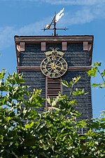
The Gaasbeck clock above the town hall

Market square in Dieburg

Medieval bath house

Zuckerstrasse in Dieburg

Pietà in the pilgrimage church

Mardi Gras fountain in Dieburg


Parks
- Park Fechenbach
- Castle garden
Nature and protected areas
Two wetlands are protected in the Dieburger area , the nature reserves " Das Großes Hörmes " and the " Foal pasture of Dieburg ". To the west of Dieburg is the FFH area "Sandmagerrasen am Spießfeld west of Dieburg" (DE6118302). To the south-west and north of the urban area are two parts of the landscape protection area "Auenverbund Untere Gersprenz" (WDPA 378406). In the east, forest stands belong to the "Landscape Protection Area Landkreis Dieburg" (WDPA 378513).
Regular events
- Blue Night (every two years - in years with an odd number - at the beginning of summer)
- Castle garden festival
- Pilgrimages (in September and May) to the Dieburg pilgrimage church
- Dieburger Castle Concerts
- Dieburger Trotting Day
- Martinsmarkt
- Carnival events in Dieburg
- May market
- Traffic Jam Festival
- Summer festival of nature lovers on the Moret (September)
- Glückstaler market (4 weekends before Christmas)
Sports
Sports facilities:
- Ludwig Steinmetz Bath
- Training pool Dieburg
- Trabrennbahn Dieburg
- Sports field at the castle garden
- Hassia soccer field
- DJK sports area
- Tennis court at the castle garden
- Skate park
The motorcycle and automobile races around the Dieburger Dreieck between 1948 and 1955 are of historical importance .
Economy and Infrastructure
Land use
The municipal area covers a total area of 2308 hectares, of which in hectares are:
| Type of use | 2011 | 2015 | |
|---|---|---|---|
| Building and open space | 376 | 346 | |
| from that | Living | 215 | 215 |
| Business | 37 | 70 | |
| Operating area | 45 | 33 | |
| from that | Mining land | 12 | 12 |
| Recreation area | 61 | 59 | |
| from that | Green area | 33 | 32 |
| traffic area | 212 | 212 | |
| Agricultural area | 480 | 467 | |
| from that | moor | 0 | 0 |
| pagan | 0 | 0 | |
| Forest area | 1080 | 1077 | |
| Water surface | 41 | 41 | |
| Other use | 13 | 13 | |
traffic
railroad
- KBS 647 route: Dreieichbahn Dieburg – Ober-Roden (you can change to the S 1 in the direction of Offenbach – Frankfurt city center – Wiesbaden) –Dreieich-Buchschlag (you can change to the S 3 and S 4 in the direction of Frankfurt City – Bad Soden / Kronberg): Mondays Trains run every hour from Dieburg to Frankfurt Hauptbahnhof and from Frankfurt Hauptbahnhof to Dieburg on Fridays.
- Line KBS 651: Rhein-Main-Bahn Wiesbaden – Mainz – Darmstadt – Dieburg – Babenhausen – Aschaffenburg
The station was expanded into a modern transport hub between bus and train by 2005.
Bus routes
| line | route | Remarks |
|---|---|---|
| GU2 | Dieburg-Semd-Groß-Umstadt-Mömlingen | Every day |
| 671 | Darmstadt – Dieburg – Groß-Umstadt – Wiebelsbach | Every day |
| 672 | Darmstadt – Roßdorf – Gundernhausen – Groß-Zimmer – Klein-Zimmer – Dieburg | Every day |
| 674 | Darmstadt – Dieburg – Münster – Eppertshausen – Ober Roden | Monday - Friday |
| 677 | Darmstadt – Dieburg – Babenhausen – Stockstadt – Aschaffenburg | Only in late traffic |
| 679 | Reinheim – Groß-Zimmer – Dieburg – Münster – Eppertshausen – Ober-Roden | Every day |
| MD | Münster – Dieburg | Monday - Friday |
There is a call taxi in Dieburg.
Cycle path network
Signposted cycle path network in the district on map L 6118.
Pedestrian zone
Zuckerstraße (pedestrian zone) in the old town center with shops and restaurants is about 400 meters long.
Parking spaces
Several signposted parking spaces in the city center, some of which are chargeable. Park & Ride parking lot at the train station as well as at the driveway to B 26 new (Sauerkreuzung).
Trunk roads
- B 26 west towards Darmstadt connection to A 5 (Basel – Karlsruhe – Frankfurt – Kassel) and A 67
- B 26 east towards Aschaffenburg connection to the A 3 (Cologne – Bonn – Frankfurt – Würzburg – Nürnberg – Passau)
- B 45 north towards Hanau connection to A 3 and A 45 (Hanau)
- B 45 north towards Frankfurt / Offenbach via B 486 and A 661 (Egelsbach – Frankfurt)
- B 45 south towards Michelstadt / Erbach
The four-lane sections of the B 26 and B 45 are now on the routes of the former A 680 and A 683 motorways .
education

For a few decades in the second half of the 20th century, Dieburg was closely interwoven with the Deutsche Bundespost , which had opened an engineering academy on the eastern edge in 1968 in order to be able to cover its needs for communications engineers. In 1971 the academy was converted into the state-recognized technical college of the Deutsche Bundespost with a degree in communications engineering. In 1979, the Post and Telecommunications Department of the Federal University of Applied Sciences for Public Administration (FH Bund) was also located on the campus, where prospective civil servants for the higher-level non-technical post and telecommunications service were trained. After the division and later privatization of the Deutsche Bundespost, the need for civil servants ceased and the department of the FH Bund was dissolved. The need for communications engineers also fell significantly, so that in 2000 the owner, Deutsche Telekom, handed over ownership to the State of Hesse, which set up a branch of the Darmstadt University of Applied Sciences in Dieburg (today's Dieburg campus).
Today the following educational institutions exist in Dieburg:
- Darmstadt University of Applied Sciences (h_da) Dieburg campus; College for Applied Sciences
- Gutenberg School; primary school
- Marienschule; primary school
- Goethe School; comprehensive school
- Alfred Delp School; Upper secondary school
- District Administrator Gruber School; Vocational school with a vocational high school
- Anne Frank School; Special school for learning assistance
- Gustav Heinemann School; Special school for mental development and physical and motor development.
- PTI-Dieburg; Private school
Personalities
sons and daughters of the town
The following list contains people born in Dieburg regardless of whether or not they later had their sphere of activity in Dieburg.
- Philipp Uebel (1864–1929), Member of the Reichstag and Landtag (center)
- Ludwig Reh (1867–1940), zoologist and long-time curator of the Zoological State Institute and Zoological Museum Hamburg
- Peter Keller (1906–1985), former member of the state parliament (CDU)
- Hans Steinmetz (1908–1987), co-founder of the CDU in Dieburg, Hesse
- Hugo J. Hahn (1927–2010), legal scholar
- Klaus Schrodt (* 1946), aerobatic pilot , various titles as German, European and world champion
- Trutz von Trotha (1946–2013), sociologist
- Christian Bieniek (1956–2005), German writer and children's book author
- Bertram Schmitt (* 1958), judge at the Federal Court of Justice and the International Criminal Court
- Willy A. Flegel (* 1960), German professor for transfusion medicine and immunohematology
- Jörg Roßkopf (* 1969), table tennis player, grew up in Münster (Hesse)
- Frank Weber (* 1969), politician (SPD), member of the Thuringian state parliament
- Christian Spieß (* 1970), professor of theology and social ethics
- Sven Kresin (* 1976), soccer player
- Hannes Blank (* 1983), professional cyclist
- Lucas Fassnacht (* 1988), author, literary cabaret artist and presenter
- Maurice Paul (* 1992), soccer goalkeeper
- Emil Ferrari (* 1995), comedian
- Marvin Schwänke (* 1995), soccer goalkeeper, U21 European champion
- Chantal Mantz (* 1996), table tennis player
- Törles Knöll (* 1997), soccer player
Personalities who worked in Dieburg
- Alfred Delp (1907–1945), Jesuit and resistance fighter against National Socialism, graduated from the Goethe School in Dieburg
- Paulus Terwitte (* 1959), headed the Capuchin Monastery in Dieburg from February 2006 to April 2009
literature
- Jürgen Heinel: Tour through the old Dieburg. Verlag Dieburger Anzeiger, Dieburg 1987, p. 6.
- Horst Heinrich Gebhard: Witch trials in the Electorate of Mainz in the 17th century. Aschaffenburg 1989, ISBN 3-87965-049-7 .
- Wilhelm Gottlieb Soldan, Henriette Heppe: History of the witch trials. Müller, Munich 1911, Vol. II, p. 45 ff. (Reprint: outlook Verlag, Bremen 2011, ISBN 978-3-86403-186-1 )
- Krešimir Matijević , Rainer Wiegels : Inscriptions and consecration monuments from the Roman Dieburg. Reinheim 2003, ISBN 3-9805719-8-X .
- Herbert Pohl: Faith in witches and the persecution of witches in the Electorate of Mainz. Stuttgart 1988, ISBN 3-515-05330-1 , pp. 118 f.
- Magistrate of the city of Dieburg (Hrsg.): Dieburg a chronicle. Dieburger Verlag, 2007, ISBN 978-3-00-023096-7 .
- Magistrate of the City of Dieburg (ed.): Dieburg as Kurmainzer Amtsstadt from 1310 to 1803. Museum Schloss Fechenbach, Dieburg 2010, ISBN 978-3-941823-06-8 .
- Literature about Dieburg in the Hessian Bibliography
- Literature by and about Dieburg in the catalog of the German National Library
Web links
- City of Dieburg. In: Website of the Darmstadt-Dieburg district .
- Dieburg, Darmstadt-Dieburg district. Historical local dictionary for Hessen. In: Landesgeschichtliches Informationssystem Hessen (LAGIS).
- Information on the community of Dieburg. In: Hessisches Gemeindelexikon. HA Hessen Agentur GmbH , 2016.
- Link catalog on Dieburg at curlie.org (formerly DMOZ )
References and comments
- ↑ Hessian State Statistical Office: Population status on December 31, 2019 (districts and urban districts as well as municipalities, population figures based on the 2011 census) ( help ).
- ^ Dieburger Fastnachtsseiten. (No longer available online.) In: www.dibborsch.de. Archived from the original ; accessed in February 2018 .
- ↑ Geology of the Odenwald in the Mineralienatlas. Private website, accessed November 2019 .
- ^ Rhein-Main-Tiefland structure. In: Environmental Atlas Hessen. Hessian State Office for Nature Conservation, Environment and Geology, accessed in November 2019 .
- ^ Günther Hoch: Reichsgut in Dieburg? In: The Odenwald - local history journal of the Breuberg Association. No. 2, 1955, pp. 55-56.
- ↑ a b c d e Dieburg, Darmstadt-Dieburg district. Historical local lexicon for Hesse (as of May 24, 2018). In: Landesgeschichtliches Informationssystem Hessen (LAGIS). Hessian State Office for Historical Cultural Studies (HLGL), accessed on June 4, 2018 .
- ↑ As an example of tyranny and arbitrariness of the authorities it is mentioned in: Anton Praetorius: Thorough report on magic. 1613 Preface, p. 20.
- ^ Herbert Pohl: Magic belief and fear of witches in the Electorate of Mainz. 2., revised. u. exp. Edition. Stuttgart 1998, p. 118 f.
- ^ A b c Georg Wilhelm Justin Wagner : Statistical-topographical-historical description of the Grand Duchy of Hesse: Province of Starkenburg . tape 1 . Carl Wilhelm Leske, Darmstadt October 1829, OCLC 312528080 , p. 45 ( online at google books ).
- ↑ Magistrat der Stadt Dieburg (ed.): Dieburg a chronicle. Dieburger Verlag, 2007, ISBN 978-3-00-023096-7 , pp. 64-166
- ^ Michael Rademacher: German administrative history from the unification of the empire in 1871 to the reunification in 1990. State of Hesse. (Online material for the dissertation, Osnabrück 2006).
- ^ Grand Ducal Central Office for State Statistics (ed.): Contributions to the statistics of the Grand Duchy of Hesse . tape 1 . Großherzoglicher Staatsverlag, Darmstadt 1862, DNB 013163434 , OCLC 894925483 , p. 43 ff . ( Online at google books ).
- ↑ a b List of offices, places, houses, population. (1806) HStAD inventory E 8 A No. 352/4. In: Archive Information System Hessen (Arcinsys Hessen), as of February 6, 1806.
- ^ Population according to nationality groups: Dieburg, Stadt. In: Zensus2011. Bavarian State Office for Statistics , accessed in May 2015 .
- ↑ Migration background in%: Dieburg, Stadt. In: Zensus2011. Bavarian State Office for Statistics , accessed in May 2015 .
- ^ Households by family: Dieburg, Stadt. In: Zensus2011. Bavarian State Office for Statistics , accessed in May 2015 .
- ^ Ph. AF Walther : Alphabetical index of the residential places in the Grand Duchy of Hesse . G. Jonghaus, Darmstadt 1869, OCLC 162355422 , p. 30 ( online at google books ).
- ^ Local elections 1972; Relevant population of the municipalities on August 4, 1972 . In: The Hessian Minister of the Interior (ed.): State Gazette for the State of Hesse. 1972 No. 33 , p. 1424 , point 1025 ( online at the information system of the Hessian state parliament [PDF; 5.9 MB ]).
- ↑ Local elections 1977; Relevant population figures for the municipalities as of December 15, 1976 . In: The Hessian Minister of the Interior (ed.): State Gazette for the State of Hesse. 1976 No. 52 , p. 2283 , point 1668 ( online at the information system of the Hessian state parliament [PDF; 10.3 MB ]).
- ^ Local elections 1985; Relevant population of the municipalities as of October 30, 1984 . In: The Hessian Minister of the Interior (ed.): State Gazette for the State of Hesse. 1984 No. 46 , p. 2175 , point 1104 ( online at the information system of the Hessian state parliament [PDF; 5.5 MB ]).
- ↑ local elections 1993; Relevant population of the municipalities as of October 21, 1992 . In: The Hessian Minister of the Interior (ed.): State Gazette for the State of Hesse. 1992 No. 44 , p. 2766 , point 935 ( online at the information system of the Hessian state parliament [PDF; 6.1 MB ]).
- ↑ a b municipality data sheet : Dieburg. (PDF; 222 kB) In: Hessisches Gemeindelexikon. HA Hessen Agency GmbH
- ^ The population of the Hessian communities (June 30, 2005). (No longer available online.) In: Hessisches Statistisches Landesamt . Archived from the original .
- ^ The population of the Hessian communities (June 30, 2010). (No longer available online.) In: Hessisches Statistisches Landesamt . Archived from the original .
- ^ Population figures : Dieburg, city. In: Zensus2011. Bavarian State Office for Statistics , accessed in May 2015 .
- ^ The population of the Hessian communities (June 30, 2015). (No longer available online.) In: Hessisches Statistisches Landesamt . Archived from the original .
- ^ Religious affiliation : Dieburg, city. In: Zensus2011. Bavarian State Office for Statistics , accessed in May 2015 .
- ^ Result of the municipal election on March 6, 2016. 432004 Dieburg, Stadt. Hessian State Statistical Office, accessed in April 2016 .
- ^ Result of the municipal election of March 27, 2011. 432004 Dieburg, Stadt. Hessian State Statistical Office, accessed in October 2019 .
- ^ Result of the municipal election of March 26, 2006. 432004 Dieburg, St. Hessisches Statistisches Landesamt, accessed in October 2019 .
- ↑ Results of the municipal elections of 2001 and 1997. (No longer available online.) Hessian State Statistical Office, archived from the original ; accessed in October 2019 .
- ^ Website of the Dieburg Independent Voting Association.
- ↑ Mayor election Dieburg 2017; Preliminary final result of March 12, 2017. In: Website. City of Dieburg, accessed November 2019 .
- ↑ Mayoral election in Dieburg, Stadt on March 13, 2017. Hessian State Statistical Office , accessed in November 2019 .
- ↑ HStAD inventory R 6 C No. 45 / 1-2 Dieburg, coat of arms and flag. In: Archive Information System Hessen (Arcinsys Hessen).
- ↑ Approval to carry a coat of arms to the city of Dieburg in the district of Dieburg, reg.-district Darmstadt from October 30, 1952 . In: The Hessian Minister of the Interior (ed.): State Gazette for the State of Hesse. 1952 No. 46 , p. 847 , item 1145 ( online at the information system of the Hessian state parliament [PDF; 5.3 MB ]).
- ^ Karl Ernst Demandt , Otto Renkhoff : Hessisches Ortswappenbuch. C. A. Starke Verlag, Glücksburg / Ostsee 1956, p. 84.
- ^ Approval of a flag for the city of Dieburg in the district of Dieburg, administrative district of Darmstadt, regional district of Darmstadt from July 20, 1954 . In: The Hessian Minister of the Interior (ed.): State Gazette for the State of Hesse. 1954 No. 32 , p. 780 , point 731 ( online at the information system of the Hessian state parliament [PDF; 2.8 MB ]).
- ↑ "Environmental Protection" map. BürgerGIS district of Darmstadt-Dieburg. Darmstadt-Dieburg district, accessed on June 10, 2020 .
- ↑ Lean sand lawn on the Spießfeld west of Dieburg. Federal Agency for Nature Conservation (BfN), accessed on June 10, 2020 .
- ^ Protected landscape area Auenverbund Untere Gersprenz. European Environment Agency (EEA), accessed June 10, 2020 .
- ↑ Landscape protection area of the district of Dieburg. European Environment Agency (EEA), accessed June 10, 2020 .
- ↑ Klaus Holde Fehr. In: Darmstädter Echo, Monday, June 17, 2019, p. 20.
- ↑ Darmstädter Echo, September 2, 2017, p. 18.
- ↑ Hessisches Statistisches Informationssystem In: Statistics.Hessen.

Alsbach cockerel | Babenhausen | Bickenbach | Dieburg | Eppertshausen | Erzhausen | Fischbachtal | Griesheim | Groß-Bieberau | Groß-Umstadt | Large rooms | Messel | Modautal | Mühltal | Münster (Hesse) | Ober-Ramstadt | Otzberg | Pfungstadt | Reinheim | Rossdorf | Schaafheim | Seeheim-Jugenheim | Weiterstadt