
Muhltal
| coat of arms | Germany map | |
|---|---|---|

|
Coordinates: 49 ° 49 ' N , 8 ° 42' E |
|
| Basic data | ||
| State : | Hesse | |
| Administrative region : | Darmstadt | |
| County : | Darmstadt-Dieburg | |
| Height : | 199 m above sea level NHN | |
| Area : | 25.34 km 2 | |
| Residents: | 13,844 (Dec. 31, 2019) | |
| Population density : | 546 inhabitants per km 2 | |
| Postal code : | 64367 | |
| Primaries : | 06151, 06154 and 06167 | |
| License plate : | DA, TU | |
| Community key : | 06 4 32 014 | |
| LOCODE : | DE COURAGE | |
| Community structure: | 6 districts | |
| Address of the municipal administration: |
Ober-Ramstädter Strasse 2 64367 Mühltal |
|
| Website : | ||
| Mayor : | Willi Muth ( FDP ) | |
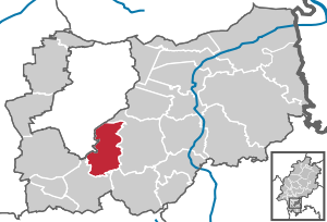
| Location of the community of Mühltal in the Darmstadt-Dieburg district | ||
  |
||

Mühltal is a municipality in the Vorderen Odenwald , southeast of Darmstadt in the Darmstadt-Dieburg district in southern Hesse . It was created in 1977 as part of the Hessian regional reform. The area, which has been settled since pre-Christian times, was characterized primarily by its mill locations until the beginning of the 20th century .
geography
The municipal area of Mühltal includes
- the lower section of the Modau valley before it leaves the Odenwald together with the Mühltaler municipality and enters the Upper Rhine Plain (Rhine Plain), and
- the side valleys of the Modau tributaries, which flow into the Modau in the Nieder-Ramstadt district. These are the valleys of the Waschenbach and the Mordach, which is called "Beerbach" in its upper reaches.
Overall, the Mühltal with its side valleys thus encompasses the natural area of the northwestern Odenwald and the northern section of the mountain road ridge with its chain of castles and palaces. The northernmost link is Frankenstein Castle on the "Langenberg" , which belongs to the Mühltal municipality. The valley and the community area are accessible via the A 5 (exit 27 Darmstadt-Eberstadt /… / Mühltal), the federal highways 426 and 449 , state and district roads, public transport connections in all directions and the Odenwaldbahn ( Darmstadt - Eberbach ).


Neighboring communities
In the north and east, Mühltal borders on the city of Ober-Ramstadt , in the southeast on the municipality of Modautal , in the southwest on the municipality of Seeheim-Jugenheim and in the west on the independent city of Darmstadt .
Church building
Mühltal was formed by the Hessian state law on the reorganization of the districts of Darmstadt and Dieburg and the city of Darmstadt on June 26, 1974 as part of the regional reform in Hesse on January 1, 1977 from the four independent municipalities Nieder-Ramstadt (seat of the municipal administration), Traisa , Nieder -Beerbach and Frankenhausen formed. In the local elections in 1977, as of June 1976, 12,052 inhabitants were taken as the basis. The municipality of Waschenbach , now part of Mühltal, was incorporated into Nieder-Ramstadt on April 1, 1972. In addition to these built-up areas also the settlement is today Trautheim named as the district in terms of the Hessian community order based on the then municipal area ( district ) Nieder-Ramstadt was born.
The district In der Mordach of the former municipality of Nieder-Ramstadt, formed on August 11, 1972 from the former residential areas of Burgwald , Waldhof and Ziegelei , is now part of the Nieder-Ramstadt district and not a separate district.
"Mühltal" got its new name because of the numerous grinding , grinding , cutting and hammer mills that were located on the Modau and its tributaries, because water levels, currents and gradients guaranteed favorable energy generation all year round.
population
Population structure
According to the 2011 census , there were 13,405 inhabitants in Mühltal on May 9, 2011. These included 888 (6.6%) foreigners of whom 458 came from outside the EU , 245 from other European countries and 185 from other countries. Of the German residents, 14.7% had a migration background . The inhabitants lived in 5975 households. 1987 were single households , 1810 couples without children and 1599 couples with children, as well as 444 single parents and 134 shared apartments . 6330 inhabitants belonged to the Protestant (48.8%) and 2450 inhabitants of the Catholic (18.9.2%) denomination. In addition, there were 250 members of Protestant free churches (1.9%) and 230 members of other religious communities (1.8%) as well as 3660 inhabitants who did not belong to any religious community (28.2%).
Population development
| Mühltal: Population from 1970 to 2015 | ||||
|---|---|---|---|---|
| year | Residents | |||
| 1970 | 10,589 | |||
| 1976 | 12,052 | |||
| 1984 | 12,945 | |||
| 1992 | 13,103 | |||
| 2000 | 13,600 | |||
| 2005 | 13,963 | |||
| 2010 | 13,893 | |||
| 2011 | 13,405 | |||
| 2015 | 13,518 | |||
| Sources: see the following list | ||||
- In 1970 the municipalities merged to form the municipality of Mühltal in 1977 had 10,589 inhabitants.
- In the local elections in 1977, as of June 1976, 12,052 inhabitants were taken as the basis.
- In the local elections in 1985, as of June 30, 1984, 12,945 inhabitants were assumed.
- In the local elections in 1993, as of March 31, 1992, 13,103 residents were assumed.
- The Hessian community encyclopedia names for the year 2000: 12,600 inhabitants.
- According to the Hessian State Statistical Office, 13,963 inhabitants lived in the Mühltal on June 30, 2005.
- The Hessian State Statistical Office reported for June 30, 2010: 13,893 inhabitants.
- The 2011 census counted 13,405 inhabitants.
- The Hessian State Statistical Office reports 13,518 inhabitants as of June 30, 2015.
Gainful employment
The municipality in comparison with the district, administrative district Darmstadt and Hesse:
| year | local community | district | Administrative district | Hesse | |
|---|---|---|---|---|---|
| Employees subject to social security contributions | 2017 | 4465 | 74,525 | 1,695,567 | 2,524,156 |
| Change to | 2000 | 46.4% | + 21.1% | + 16.1% | + 16.0% |
| of which full-time | 2017 | 58.6% | 68.3% | 72.8% | 71.8% |
| of which part-time | 2017 | 41.4% | 31.7% | 27.2% | 28.2% |
| Only marginally paid employees | 2017 | 567 | 15.305 | 224.267 | 372.991 |
| Change to | 2000 | + 18.1% | + 14.4% | + 9.0% | + 8.8% |
| Branch | year | local community | district | Administrative district | Hesse |
|---|---|---|---|---|---|
| Manufacturing | 2000 | 26.7% | 41.1% | 27.0% | 30.6% |
| 2017 | 18.5% | 31.3% | 20.4% | 24.3% | |
| Commerce, hospitality and transport | 2000 | 9.5% | 26.1% | 26.4% | 25.1% |
| 2017 | 8.7% | 26.8% | 24.7% | 23.8% | |
| Business services | 2000 | 11.0% | 11.6% | 25.1% | 20.2% |
| 2017 | 9.5% | 17.1% | 31.6% | 26.1% | |
| other services | 2000 | 38.7% | 18.8% | 20.1% | 22.5% |
| 2017 | 63.2% | 23.6% | 23.0% | 25.4% | |
| Other (or without assignment) | 2000 | 14.2% | 2.4% | 1.4% | 1.5% |
| 2017 | 0.8% | 0.1% | 0.3% | 0.4% |
religion
Mühltal is a traditionally strongly Christian local community. Historically, Mühltal was predominantly Protestant . Today there are five parishes of the Evangelical Church in Hesse and Nassau in the municipality , which are looked after by a total of four pastors. The Catholic Church in Nieder-Ramstadt is responsible for most of Mühltal and belongs to the diocese of Mainz . The Catholic Christians in Frankenhausen belong to Ober-Modau, the Nieder-Beerbach Catholics are attached to Eberstadt. This Christian character was further strengthened by the settlement of the Nieder-Ramstädter homes of the inner mission (today "Nieder-Ramstädter Diakonie", NRD).
In total there are more than ten individual churches and religious communities in Mühltal :
- Bahai community of Mühltal
- Christian Association of Young People
- Evangelical Church Nieder-Ramstadt with Trautheim and Waschenbach
- Evangelical Church Nieder-Beerbach
- Evangelical Church Frankenhausen (independent parishes with a common pastor)
- Evangelical parish of Traisa
- Evangelical Lazarus Church in the Nieder-Ramstädter Diakonie
- Evangelical Free Church Congregation Mühltal ( Baptists )
- Regional Church Community Nieder-Ramstadt e. V. (with EC Germany)
- Catholic Church of St. Michael
Many of these communities work closely with joint projects such as the holiday games, in which around 230 children can experience a 9-day play, fun, sports, handicrafts program each year under the supervision of around 50 volunteers.
politics
Community representation
The local elections on March 6, 2016 produced the following results, compared to previous local elections:
| Parties and constituencies | % 2016 |
Seats 2016 |
% 2011 |
Seats 2011 |
% 2006 |
Seats 2006 |
% 2001 |
Seats 2001 |
||
|---|---|---|---|---|---|---|---|---|---|---|
| CDU | Christian Democratic Union of Germany | 27.0 | 10 | 31.2 | 11 | 32.6 | 12 | 32.1 | 12 | |
| SPD | Social Democratic Party of Germany | 19.8 | 7th | 26.8 | 10 | 37.8 | 14th | 39.7 | 15th | |
| GREEN | Alliance 90 / The Greens | 14.4 | 5 | 26.8 | 10 | 20.0 | 7th | 19.7 | 7th | |
| DM | The Mühltaler | 10.2 | 4th | 8.0 | 3 | - | - | - | - | |
| FDP | Free Democratic Party | 10.0 | 4th | 7.2 | 3 | 9.6 | 4th | 8.6 | 3 | |
| LEFT | The left | 4.3 | 2 | - | - | - | - | - | - | |
| FOX | Fuchs-Mühltal | 14.3 | 5 | - | - | - | - | - | - | |
| total | 100.0 | 37 | 100.0 | 37 | 100.0 | 37 | 100.0 | 37 | ||
| Voter turnout in% | 56.5 | 56.3 | 50.5 | 57.6 | ||||||
mayor
Astrid Mannes (CDU) prevailed on July 1, 2007 in the second ballot with 59.1% of the votes against Eric Robert Bender (SPD). Gernot Runtsch (SPD) did not stand for re-election after 12 years.
For the election on June 9, 2013, Astrid Mannes (CDU) received 54.9%, Willi Muth 34.9% and Christoph Zwickler 10.2% of the votes. The turnout was 54.2%.
In the federal election on September 24, 2017, Astrid Mannes moved into the Bundestag for the CDU as a directly elected member of the Darmstadt constituency. In the new elections on January 21, 2018, Katharina Ebert (SPD) sat with 34.0% and Willi Muth (FDP) with 23.7% against Thomas Hölscher (CDU) 22.4%, Christoph Zwickler (FUCHS). 14.0% and Falko-Holger Ostertag (Die Mühltaler) 5.9%. The turnout was 56.3%. In the runoff election on February 18, 2018, Willi Muth (FDP) received 50.4% and Katharina Ebert (SPD) 49.6%, with a turnout of only 52.7%. Willi Muth is the first FDP mayor in the Darmstadt-Dieburg district .
| Term of office | Surname |
|---|---|
| 1985-1995 | Ansgar Rinder (CDU) |
| 1995-2007 | Gernot Runtsch (SPD) |
| 2007-2017 | Astrid Mannes (CDU) |
| since 2018 | Willi Muth (FDP) |
Districts
The following local districts with local advisory board and local councilor according to the Hessian municipal code exist in the municipality:
- Frankenhausen district (areas of the former municipality of Frankenhausen ). The local advisory board consists of five members.
- Nieder-Beerbach district (areas of the former Nieder-Beerbach community ). The local advisory board consists of five members.
- Nieder-Ramstadt district (areas of the former Nieder-Ramstadt municipality ). The local advisory board consists of five members.
- Traisa district (areas of the former Traisa municipality ). The local advisory board consists of five members.
- Frankenhausen district (areas of the former municipality of Frankenhausen ). The local advisory board consists of five members.
- Trautheim district (areas of the Trautheim district ). The local advisory board consists of five members.
- Waschenbach district (areas of the former municipality of Waschenbach ). The local advisory board consists of five members.
badges and flags

coat of arms
Blazon : "The municipal coat of arms shows three green acorns on a stem growing out of a red mill wheel on a gold background, accompanied by a red wolf iron and a red pretzel."
The coat of arms of the municipality of Mühltal was approved on March 8, 1979 by the Hessian Minister of the Interior . It was designed by the Bad Nauheim heraldist Heinz Ritt .
The individual elements of the coat of arms are based on the old coats of arms of the districts. The three green acorns are taken from the Frankenhausen coat of arms and show that they tower above the other elements, the location of Frankenhausen as the geographically highest part of the municipality. The wolf iron comes from the Nieder-Beerbach local coat of arms and indicates the former local rule of the Lords of Frankenstein. The fallen pretzel comes from the Nieder-Ramstädter and the Traisaer coat of arms, which reminds of the earlier importance of the common baker and miller guild. The mill wheel appears in the Waschenbach coat of arms as an icing on the local mill, but was also chosen as a talking , general symbol of Mühltal and refers to the historically very extensive milling industry in all districts.

Coat of arms of Frankenhausen

Coat of arms of Nieder-Beerbach

Coat of arms of Nieder-Ramstadt

Traisa coat of arms

Waschenbach coat of arms
.svg)


flag
The flag was approved by the Hessian Interior Minister on September 11, 1986 and is described as follows:
"The municipal coat of arms is placed on the red and white flag web in the upper half."
Town twinning
Mühltal has been twinning with Vingåker in Sweden since 1980 and with Nemours in France since 1981 .
![]() The city of Nemours with St.-Pierre-les-Nemours is located about 75 km south of Paris in the Île-de-France region . Both cities together have around 18,000 inhabitants.
The city of Nemours with St.-Pierre-les-Nemours is located about 75 km south of Paris in the Île-de-France region . Both cities together have around 18,000 inhabitants.
![]() Vingåker is located about 160 km west of Stockholm in the Sörmland region on the Tisnaren. With all districts it has about 10,000 inhabitants.
Vingåker is located about 160 km west of Stockholm in the Sörmland region on the Tisnaren. With all districts it has about 10,000 inhabitants.
Culture and sights
Buildings


In Mühltal there are some buildings that are more than 200 years old, including some half-timbered houses. The center of Nieder-Ramstadt, especially Ober-Ramstädter-Strasse, is partly under the supervision of the responsible monument authority. There are half-timbered houses in all districts.
The most famous sight in the area of the municipality of Mühltal is the ruin of Frankenstein Castle , which in the meantime has become known primarily through the annual Halloween festivals in Germany.
In the Traisa district, near the golf course, lies the Dippelshof estate, named after Johann Albert Dippel, the older brother of the German alchemist and doctor Johann Konrad Dippel . The Dippelhshof is a property built before the Thirty Years War. The estate was rebuilt in 1710 and was a popular destination in Darmstadt in the 19th century. 1911–1913 the manor was expanded for Friedrich Wilhelm Bullrich by the architect Edmund Körner , who was a member of the Darmstadt artists' colony at the time. Today the listed Dippelshof, renovated in the 1990s, houses a hotel and restaurant.
The site of the historic Wacker und Doerr factory (now the Wacker factory), which is used as a cultural, art and business center, is located on the border with Ober-Ramstadt. Annual theater days, exhibitions and art events take place there. A restaurant has also been set up to complete the ensemble . In addition, there are amateur theater groups that rehearse and perform in Mühltal.
Regular events
- The Frankenstein mountain gymnastics festival in the nature reserve near Frankenstein Castle in the Nieder-Beerbach district has been taking place every year since 1902 in August / September, the Frankenstein mountain gymnastics festival, which includes gymnastics and track and field competitions. The forest and long-distance runs are particularly popular. Children to seniors can take part.
- SV3sathlon , an annual triathlon that starts in Traisa and is organized by SV Traisa.
- Athletics Children's League Indoor Sports Festival : The TG 1879 Traisa e. V. has been organizing its indoor sports festival every year in March for over 26 years. Since 2014, the opening competition of the children's athletics league has been taking place on this date.
Natural monuments
The Magnetsteine , a geological natural monument, are located in the Nieder-Beerbach district . The geological natural monument Billersteine is located in the Waschenbach district . There are two other natural monuments in the municipality.
Economy and Infrastructure
Companies
Between Nieder-Beerbach, Waschenbach and Frankenhausen there are two opencast mines operated by Mitteldeutsche Hartstein-Industrie AG (MHI), in which gabbro is extracted. Before it became part of the MHI, the mining was carried out by the Odenwälder Hartstein-Industrie A.-Ges. (OHI) operated. A small commercial area with medium-sized companies and several supermarkets has emerged southwest of the Nieder-Ramstadt district.
The largest employer in Mühltal is the Nieder-Ramstädter Diakonie Foundation (NRD), which operates apartments and workshops for people with physical and mental disabilities and looks after them.
The theater publisher Reinehr, founded in 1987, is based in Mühltal-Traisa .
Land use
The municipality covers a total area of 2534 hectares, of which in hectares are:
| Type of use | 2011 | 2015 | |
|---|---|---|---|
| Building and open space | 325 | 330 | |
| from that | Living | 227 | 227 |
| Business | 29 | 37 | |
| Operating area | 24 | 26th | |
| from that | Mining land | 20th | 19th |
| Recreation area | 41 | 44 | |
| from that | Green area | 9 | 10 |
| traffic area | 139 | 140 | |
| Agricultural area | 876 | 867 | |
| from that | moor | 1 | 1 |
| pagan | 0 | 0 | |
| Forest area | 1071 | 1070 | |
| Water surface | 15th | 20th | |
| Other use | 41 | 37 | |
traffic

The buses N, NB, NE, O, K50 and 678 connect the community with Darmstadt, Ober-Ramstadt, Modautal and other communities in the vicinity.
In Mühltal there is a stop of the Odenwaldbahn , which has been operated since 2005 by VIAS GmbH as a railway company . There are train connections to Frankfurt am Main, Darmstadt, Erbach , Eberbach .
Mühltal is connected to Darmstadt via federal highway 449 and is located on federal highway 426 . Since the Nieder-Ramstadt district suffered heavily from through traffic in the past, a bypass of the B 426 was built and opened on June 29, 2007. The B 426 now leads over the Waschenbach valley bridge , the Griesbach valley bridge and through the Lohberg tunnel past Nieder-Ramstadt.
Personalities
- Rudolf von und zu Frankenstein (* 1523 at Frankenstein Castle, † 1560 in Lauterburg), Prince-Bishop of Speyer
- Johann Karl von und zu Franckenstein (* 1610 at Frankenstein Castle; † 1691 in Frankfurt am Main), Prince-Bishop of Worms
- Johann Konrad Dippel (* 1673 at Frankenstein Castle, † 1734 at Wittgenstein Castle in Bad Laasphe) was a German theologian, alchemist, anatomist and doctor.
- Karl Ferdinand Abt (* 1903 in Nieder-Ramstadt, † 1945 near Frauenfeld in Courland), politician
literature
- Literature about Mühltal in the Hessian Bibliography
- Literature from and about Mühltal in the catalog of the German National Library
Web links
- Mühltal community. In: Internet presence of the Darmstadt-Dieburg district .
- Local history of the Mühltal. History. In: Mühltal home history. Mühltal Local History Working Group
- Mühltal, Darmstadt-Dieburg district. Historical local dictionary for Hessen. In: Landesgeschichtliches Informationssystem Hessen (LAGIS).
- Information on the community of Mühltal. In: Hessisches Gemeindelexikon. HA Hessen Agency GmbH
- Link catalog on the subject of Mühltal at curlie.org (formerly DMOZ )
Individual evidence
- ↑ Hessian State Statistical Office: Population status on December 31, 2019 (districts and urban districts as well as municipalities, population figures based on the 2011 census) ( help ).
- ↑ Law on the reorganization of the districts of Darmstadt and Dieburg and the city of Darmstadt (GVBl. II 330–334) of July 26, 1974 . In: The Hessian Minister of the Interior (ed.): Law and Ordinance Gazette for the State of Hesse . 1974 No. 22 , p. 318 , § 7 ( online at the information system of the Hessian state parliament [PDF; 1.5 MB ]).
- ↑ Local elections 1977; Relevant population figures for the municipalities as of December 15, 1976 . In: The Hessian Minister of the Interior (ed.): State Gazette for the State of Hesse. 1976 No. 52 , p. 2283 , point 1668 ( online at the information system of the Hessian state parliament [PDF; 10.3 MB ]).
- ^ Federal Statistical Office (ed.): Historical municipality directory for the Federal Republic of Germany. Name, border and key number changes in municipalities, counties and administrative districts from May 27, 1970 to December 31, 1982 . W. Kohlhammer, Stuttgart / Mainz 1983, ISBN 3-17-003263-1 , p. 354 .
- ↑ Information on the community of Mühltal. In: Hessisches Gemeindelexikon. HA Hessen Agentur GmbH , accessed November 2019 .
- ↑ district of Nieder-Ramstadt with In Mordach In: website of the municipality Mühltahl and definitions for the Mühltaler main statute " § 5: Ortsbeirat " from 2015, accessed on 20 May 2015 (PDF; 126 kB)
- ↑ a b Population by nationality groups: Mühltal. In: Zensus2011. Bavarian State Office for Statistics , accessed in July 2015 .
- ↑ Migration background in%: Mühltal. In: Zensus2011. Bavarian State Office for Statistics , accessed in July 2015 .
- ^ Households by family: Mühltal. In: Zensus2011. Bavarian State Office for Statistics , accessed in July 2015 .
- ↑ Religious affiliation : Mühltal. In: Zensus2011. Bavarian State Office for Statistics , accessed in July 2015 .
- ^ Mühltal, community, Darmstadt-Dieburg district. Historical local dictionary for Hessen. (As of June 4, 2018). In: Landesgeschichtliches Informationssystem Hessen (LAGIS).
- ↑ Local elections 1977; Relevant population figures for the municipalities as of December 15, 1976 . In: The Hessian Minister of the Interior (ed.): State Gazette for the State of Hesse. 1976 No. 52 , p. 2283 , point 1668 ( online at the information system of the Hessian state parliament [PDF; 10.3 MB ]).
- ^ Local elections 1985; Relevant population of the municipalities as of October 30, 1984 . In: The Hessian Minister of the Interior (ed.): State Gazette for the State of Hesse. 1984 No. 46 , p. 2175 , point 1104 ( online at the information system of the Hessian state parliament [PDF; 5.5 MB ]).
- ↑ local elections 1993; Relevant population of the municipalities as of October 21, 1992 . In: The Hessian Minister of the Interior (ed.): State Gazette for the State of Hesse. 1992 No. 44 , p. 2766 , point 935 ( online at the information system of the Hessian state parliament [PDF; 6.1 MB ]).
- ↑ a b municipality data sheet : Mühltal. (PDF; 222 kB) In: Hessisches Gemeindelexikon. HA Hessen Agency GmbH
- ^ The population of the Hessian communities (June 30, 2005). In: Hessian State Statistical Office . Archived from the original .
- ^ The population of the Hessian communities (June 30, 2010). In: Hessian State Statistical Office . Archived from the original .
- ^ The population of the Hessian communities (June 30, 2015). In: Hessian State Statistical Office . Archived from the original .
- ^ Catholic parish St. Michael Nieder-Ramstadt. Website.
- ^ Result of the municipal election on March 6, 2016. 432014 Mühltal. Hessian State Statistical Office, accessed in April 2016 .
- ^ Result of the municipal election of March 27, 2011. 432014 Mühltal. Hessian State Statistical Office, accessed in November 2019 .
- ^ Result of the municipal election of March 26, 2006. 432014 Mühltal. Hessian State Statistical Office, accessed in November 2019 .
- ↑ Results of the municipal elections of 2001 and 1997. (No longer available online.) Hessian State Statistical Office, archived from the original ; accessed in October 2019 .
- ↑ Darmstädter Echo, Lokales from February 18, 2018: Rebecca Keller "The church stayed in the village" - votes for the election in Mühltal and Sabine Eisenmann: Willi Muth is the new mayor of Mühltal ; both accessed on February 20, 2018
- ↑ main statute. (PDF; 126 kB) §; 5. In: Website. Mühltal community, accessed November 2019 .
- ↑ Approval of a coat of arms of the municipality of Mühltal in the Darmstadt-Dieburg district of March 8, 1979 . In: The Hessian Minister of the Interior (ed.): State Gazette for the State of Hesse. 1979 No. 13 , p. 598 , point 341 ( online at the information system of the Hessian state parliament [PDF; 7.0 MB ]).
- ↑ http://www.muehltal-odenwald.de/geschich/mu/wappen.html Coats of arms tell a story - The Mühltaler coat of arms, the elements of the coat of arms; on muehltal-odenwald.de (accessed January 1, 2020)
- ↑ a b story. In: website. Turngemeinde 1879 Traisa.e. V., accessed November 2019 .
- ↑ Hessisches Statistisches Informationssystem In: Statistics.Hessen.

Alsbach cockerel | Babenhausen | Bickenbach | Dieburg | Eppertshausen | Erzhausen | Fischbachtal | Griesheim | Groß-Bieberau | Groß-Umstadt | Large rooms | Messel | Modautal | Mühltal | Münster (Hesse) | Ober-Ramstadt | Otzberg | Pfungstadt | Reinheim | Rossdorf | Schaafheim | Seeheim-Jugenheim | Weiterstadt
Frankenhausen | Nieder-Beerbach | Nieder-Ramstadt with In der Mordach | Traisa | Trautheim | Waschenbach