
Eppertshausen
| coat of arms | Germany map | |
|---|---|---|

|
Coordinates: 49 ° 57 ' N , 8 ° 51' E |
|
| Basic data | ||
| State : | Hesse | |
| Administrative region : | Darmstadt | |
| County : | Darmstadt-Dieburg | |
| Height : | 137 m above sea level NHN | |
| Area : | 13.11 km 2 | |
| Residents: | 6247 (Dec. 31, 2019) | |
| Population density : | 477 inhabitants per km 2 | |
| Postal code : | 64859 | |
| Area code : | 06071 | |
| License plate : | DA, TU | |
| Community key : | 06 4 32 005 | |
| LOCODE : | DE EPA | |
| Address of the municipal administration: |
Franz-Gruber-Platz 14 64859 Eppertshausen |
|
| Website : | ||
| Mayor : | Carsten Helfmann ( CDU ) | |
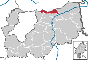
| Location of the municipality of Eppertshausen in the Darmstadt-Dieburg district | ||
  |
||


Eppertshausen is a municipality in the Darmstadt-Dieburg district in southern Hesse .
geography
location
Eppertshausen is located 15 km northeast of Darmstadt in the Lower Main Plain , north of the Odenwald . The highest elevations are the Messeler Höhe and the Dolmesberg in the Eichen Forest at 195 m and 187 m above sea level. NN . The lowest point in the community is 131 m above sea level. NN and means on the topmost high .
Waters
In the south of the municipality runs the Gersprenz , which partly forms the border with Münster (Hessen) , in the north the upper reaches of the Lache flows . In the Eichen forest there are two lakes, the old quarry and the new quarry , also called Aje lake . The Oberwald has three stagnant bodies of water, the Beckmann pond , the old clay pit and the Rallenteich nature reserve . Opposite the old quarry on Messler Chaussee is the Sellborn spring , another spring, the Eisenborn is on the Thomashüttenschneise.
geology
The forest oak (popularly: "the Aje"), located in the western district, is characterized by mixed forests and former quarries . There are some large meadows in the forest: the Höllwiese, the Langwiese and the Schmillenbruchwiese.
The Oberwald, also located in the western district, has high clay deposits that were mined until the 20th century. The remaining pits were then designated as a nature reserve. There are also some pastures for cattle in the Oberwald, for example the Hellwies.
The abbey forest, located in the eastern district, consists of mixed forest. The soil here is mainly sandy, like the soil of the adjacent Rodgau. The Brüchelswiese (behind the sports center) is also located in the eastern part of the area and is preferably used as a pasture due to the often wet soil.
The southern district is characterized by fields and pastures and has soils rich in humus. The cultivation of grain, maize and rapeseed is widespread. There are also several pastures for cattle and sheep.
Neighboring communities
Eppertshausen borders in the north on the towns of Rödermark and Rodgau (both districts Offenbach ), in the east on the town of Babenhausen , in the south on the municipality of Münster (Hessen) and in the west on the municipality of Messel .
Community structure
The municipality of Eppertshausen has no political subdivision and consists only of the single district (Gmk.-Nr. 61071) and the village of Eppertshausen. The residential area "Im Failisch", the industrial area East and some houses in the Oberwald are located outside the closed local area.
history
Territorial history and administration
Middle Ages and Early Modern Times
The oldest surviving mention of Eppertshausen comes from 836. At that time it belonged to the Benedictine Abbey of Seligenstadt .
In 1383 the tithe fell from the Rödern zu Eppertshausen to the " Babenhausen Castle ", that is to say to the Lords of Hanau . During this time the village belonged to the Mark Babenhausen . In 1438 Heinrich von Groschlag pledged Eppertshausen to Count Johann IV and Philipp von Katzenelnbogen . In 1546 the place was again owned by the Lords of Groschlag von Dieburg. The following are mentioned as landowners in the village: Heinrich von Wasen in 1348 and the branch of the Teutonic Order in Sachsenhausen in 1453 .
Modern times
In 1799, Friedrich Carl Willibald Freiherr von Groschlag zu Dieburg, the last male member of his family, died. Eppertshausen inherited his daughter, Anna Maria , married Countess von Lerchenfeld -Köfering (1775-1854). With the Rhine Confederation Act of 1806, state sovereignty over Eppertshausen fell to the Principality of Isenburg . Here the tiny territory was also known as "Grafschaft Lerchenfeld". At the Congress of Vienna (1815), the Principality of Isenburg itself lost its sovereignty and was mediated in favor of Austria . Austria passed the area on: it agreed in a state treaty with Prussia and the Grand Duchy of Hesse on June 30, 1816 that the Principality of Isenburg largely belonged to the Grand Duchy of Hesse. The Grand Duchy incorporated Eppertshausen into its Starkenburg province . In all of these transactions, Countess Lerchenfeld's traditional rights of rule were preserved. These rights also survived the administrative reform of 1821. In the Grand Duchy, jurisdiction and administration were separated at the lower level and the offices that the state could dispose of alone were dissolved. For the previously perceived by the offices administrative tasks were district districts created for the first-instance jurisdiction district courts.
Because of the transverse rights of Countess Lerchenfeld, Eppertshausen was assigned to the district of Langen in terms of its administration in 1821 , but still "with the reservation of the patrimonial police authority". The case law remained with the owner of the patrimonial jurisdiction. It was not until 1825 that the state and Countess Lerchenfeld agreed that she would cede her rights to the state. This now assigned Eppertshausen to the district court of Langen .
The statistical-topographical-historical description of the Grand Duchy of Hesse reports on Eppertshausen in 1829:
»Eppertshausen (L. Bez. Langen) cath. Parish village; is located far from the Gersprenz, 3 1 / 4 St. of long and has 103 houses and 891 inh., up to 3 Luth. and 64 Jews all cath. are. The place belongs to the Countess von Lerchenfeld, b. Baroness von Groschlag. You will find a beautiful church, newly built in 1828, 39 farmers, 56 day laborers, 46 craftsmen and, among the latter, a particularly large number of stoners . This place, which probably derives its name from Erbhart, belonged to the knightly canton of Odenwald and was centbar to the castle Stockau zu Dieburg, 1806 is under the sovereignty of the Prince of Isenburg-Birstein and in 1816 with part of the principality of Isenburg under Hess. Your Highness come. In 1825, patrimonial jurisdiction was ceded to the state via Eppertshausen. The place was a branch of Dieburg; but was separated from it in 1751, and the new parish was founded by the von Groschlag family. "
The following list gives an overview of the territories in which Eppertshausen was located and the administrative units to which it was subordinate:
- 1355: To the Mark Babenhausen
- before 1799: Holy Roman Empire , Kurmainz , rule of the Groschlag zu Dieburg
- from 1799: Holy Roman Empire, Kurmainz, County of Lerchenfeld
- from 1803: Holy Roman Empire, Principality of Isenburg-Birstein (through the main Imperial Deputation ),
- from 1806: Principality of Isenburg (through the Rhine Confederation Act )
- from 1816: German Confederation , Grand Duchy of Hesse (by state treaty with Austria and Prussia ), County of Lerchenfeld
- from 1820: German Confederation, Grand Duchy of Hesse, Province of Starkenburg , Patrimonial Court (Counts of Lerchenfeld until 1825)
- from 1821: German Confederation, Grand Duchy of Hesse, Starkenburg Province, Langen District District (1825: separation between justice ( Offenbach District Court ) and administration)
- from 1832: German Confederation, Grand Duchy of Hesse, Province of Starkenburg, Offenbach district
- from 1848: German Confederation, Grand Duchy of Hesse, Dieburg administrative region
- from 1852: German Confederation, Grand Duchy of Hesse, Province of Starkenburg, District of Dieburg
- from 1866: Grand Duchy of Hesse, Province of Starkenburg, District of Dieburg
- from 1871: German Empire , Grand Duchy of Hesse, Province of Starkenburg, District of Dieburg
- from 1918: German Empire, People's State of Hesse , Starkenburg Province, Dieburg District
- from 1938: German Empire, People's State of Hesse, District of Dieburg (In the course of the regional reform in 1938 , the three Hessian provinces of Starkenburg, Rheinhessen and Upper Hesse were dissolved.)
- from 1945: American zone of occupation , Greater Hesse , Darmstadt district, Dieburg district
- from 1949: Federal Republic of Germany , State of Hesse , Darmstadt district, Dieburg district
- from 1977: Federal Republic of Germany, State of Hesse, administrative district Darmstadt, administrative district Darmstadt-Dieburg in which the administrative districts of Dieburg and Darmstadt were dissolved in the course of the regional reform in Hesse .
Historical forms of names
In historical documents the place is under the following place names (in brackets the year of mentioning): Ecgiharteshuson (10th century); Ebrehtehusen (1292); Epphyrshusin (1348); Epprechteshusen (1355); Epsprechshusen (1385); Epperßhusen (2nd half of the 14th century); Ippershusen (1438); Opperßhusen (1440); Eppershusen (1453); Eppertshußen (1486); Eppershausen (1527).
History of clay processing
Clay processing goes back to the 17th century. The clay was mostly dug in the area around today's Thomashütte, an excursion restaurant. The mayor's office handed over a clay tax slip for one and two-horse hauls or wagons (10 tons) for a fee. A mine lease was also levied. In what is now a nature reserve , pools of water testify to collapsed clay holes and pits from the mining process at that time. The work of the Häfner (today potters ) with the clay from piercing , transporting, drying, shaping, decorating and firing up to the sale was very laborious. End products were versatile shapes of pots , bowls , jugs , jugs , plates and cups . There were also stove tiles , relief panels , wall plates , vases , roof turrets , fire-proof decorated with marbling and in decorative ceramics.
The goods were sold as Erdenes dishes not only at the “ Dibbemess ” in Frankfurt, but also in the wider area as far as the Spessart , Vogelsberg and down the Rhine , reloaded onto ships from Hanau or Offenbach am Main to Holland and up the Rhine to the Bodensee . The transport from Eppertshausen was done by horse-drawn vehicles, in which the pottery was packed in straw.
Between 1820 and 1830, thirteen Hafner worked in the trade in Eppertshausen. In 1850 there were also three brick factories that also processed the clay. In the second half of the 19th century, 34 potters worked in the village. The clay pits were opened up with a field railway. In 1900 there were 14 workshops with masters and journeymen. In 1925 the number of potters dropped to six. The industrial mass production of ceramics meant the end of many small workshops. Today there is only the Müller pottery , which continues the tradition.
population
Population structure
According to the 2011 census , there were 5960 inhabitants in Eppertshausen on May 9, 2011. 575 (9.6%) of them were foreigners, 160 of whom came from outside the EU , 216 from other European countries and 199 from other countries. The inhabitants lived in 2515 households. Of these, 652 were single households , 732 couples without children and 848 couples with children, as well as 211 single parents and 72 shared apartments .
Population development
| • 1829: | 891 inhabitants, 103 houses |
| • 1867: | 1030 inhabitants, 138 houses |
| Eppertshausen: Population from 1829 to 2015 | ||||
|---|---|---|---|---|
| year | Residents | |||
| 1829 | 891 | |||
| 1834 | 905 | |||
| 1840 | 1.002 | |||
| 1846 | 1,147 | |||
| 1852 | 1,155 | |||
| 1858 | 1,038 | |||
| 1864 | 1,075 | |||
| 1871 | 1,069 | |||
| 1875 | 1,142 | |||
| 1885 | 1,258 | |||
| 1895 | 1.313 | |||
| 1905 | 1,463 | |||
| 1910 | 1,583 | |||
| 1925 | 1,738 | |||
| 1939 | 1,964 | |||
| 1946 | 2,409 | |||
| 1950 | 2,576 | |||
| 1956 | 2,908 | |||
| 1961 | 3,254 | |||
| 1967 | 4.111 | |||
| 1970 | 4,662 | |||
| 1972 | 5.011 | |||
| 1976 | 4,902 | |||
| 1984 | 5,204 | |||
| 1992 | 5,386 | |||
| 2000 | 5,800 | |||
| 2005 | 5,786 | |||
| 2010 | 5,870 | |||
| 2011 | 5,960 | |||
| 2015 | 6.123 | |||
| Data source: Historical municipality register for Hesse: The population of the municipalities from 1834 to 1967. Wiesbaden: Hessisches Statistisches Landesamt, 1968. Further sources:; 1972 :; 1976 :; 1984 :; 1992 :; 2000 :; 2005 :; 2010 :; 2011 census; 2015: | ||||
Religious affiliation
| • 1829: | 824 (= 92.48%) Catholic, 64 Jewish (= 7.18%) and 3 Lutheran (= 0.34%) residents |
| • 1961: | 2805 inhabitants were Catholic (= 86.20%), 396 (= 12.17%) Protestant and 53 (= 1.63%) inhabitants without any religious information |
| • 2011: | 2103 (= 35.3%) residents belonged to another or no religious affiliation or did not provide any information, 2671 (= 44.8%) residents were Catholic and 1186 (= 19.9%) residents were Protestant. |
| • 2017: | 2769 (= 42.3%) residents belonged to any other or no religious affiliation, 2662 (= 40.6%) residents were Catholic and 1208 (= 18.2%) residents were Protestant. |
Gainful employment
The municipality in comparison with the district, administrative district Darmstadt and Hesse:
| year | local community | district | Administrative district | Hesse | |
|---|---|---|---|---|---|
| Employees subject to social security contributions | 2017 | 1,436 | 74,525 | 1,695,567 | 2,524,156 |
| Change to | 2000 | + 33.2% | + 21.1% | + 16.1% | + 16.0% |
| of which full-time | 2017 | 75.4% | 68.3% | 72.8% | 71.8% |
| of which part-time | 2017 | 24.6% | 31.7% | 27.2% | 28.2% |
| Only marginally paid employees | 2017 | 295 | 15.305 | 224.267 | 372.991 |
| Change to | 2000 | −2.3% | + 14.4% | + 9.0% | + 8.8% |
| Branch | year | local community | district | Administrative district | Hesse |
|---|---|---|---|---|---|
| Manufacturing | 2000 | 61.6% | 41.1% | 27.0% | 30.6% |
| 2017 | 53.8% | 31.3% | 20.4% | 24.3% | |
| Commerce, hospitality and transport | 2000 | 18.2% | 26.1% | 26.4% | 25.1% |
| 2017 | 25.0% | 26.8% | 24.7% | 23.8% | |
| Business services | 2000 | 9.4% | 11.6% | 25.1% | 20.2% |
| 2017 | 10.9% | 17.1% | 31.6% | 26.1% | |
| other services | 2000 | 10.7% | 18.8% | 20.1% | 22.5% |
| 2017 | *) | 23.6% | 23.0% | 25.4% | |
| Other (or without assignment) | 2000 | 0.2% | 2.4% | 1.4% | 1.5% |
| 2017 | 10.3% | 1.1% | 0.3% | 0.4% |
*) anonymized
politics
Community representation
The local elections on March 6, 2016 produced the following results, compared to previous local elections:
| Parties and constituencies |
% 2016 |
Seats 2016 |
% 2011 |
Seats 2011 |
% 2006 |
Seats 2006 |
% 2001 |
Seats 2001 |
||
|---|---|---|---|---|---|---|---|---|---|---|
| CDU | Christian Democratic Union of Germany | 72.2 | 19th | 59.7 | 16 | 60.9 | 16 | 44.3 | 14th | |
| SPD | Social Democratic Party of Germany | 27.8 | 8th | 37.6 | 10 | 35.0 | 10 | 47.0 | 14th | |
| FDP | Free Democratic Party | - | - | 2.7 | 1 | 4.1 | 1 | 8.7 | 3 | |
| total | 100 | 27 | 100 | 27 | 100 | 27 | 100 | 27 | ||
| Voter turnout in% | 52.2 | 50.9 | 45.7 | 55.5 | ||||||
mayor
- 1822–1830 Andreas Braunwarth
- 1830–1836 Peter Larem
- 1837–1843 Adam Gruber
- 1843–1848 Peter Larem
- 1848–1866 Michael Gruber II.
- 1866–1868 Franz Joseph Braunwarth
- 1868–1901 Peter Andreas Euler II.
- 1901–1919 Andreas Euler
- 1919–1924 Johann Michael Gotta
- 1925–1933 Peter Krickser
- 1933–1934 Otto Dewet Blaschek (as first alderman)
- 1934–1937 Otto Dewet Blaschek
- 1937–1941 Johannes Wilhelm Helfrich
- 1941–1945 Heinrich Eder (as first alderman)
- 1945–1945 Franz Gruber II.
- 1945–1948 Michael Scharf
- 1948–1961 Stephan Gruber
- 1961–1973 Peter Markus Larem
- 1973–1991 Peter Gruber
- 1991-2003 Herbert Weber
- 2003 – to date Carsten Helfmann
badges and flags

coat of arms
|
|
Blazon : "" In the blue a red and silver nested oblique left bar , accompanied above by a silver stork striding to the left with red reinforcement and below by golden clover leaves in two oblique left rows. ""
The coat of arms was approved by the Hessian Ministry of the Interior on February 20, 1958 . The municipal coat of arms was compiled by Mayor Stephan Gruber from parts of the coats of arms of the two knight families who once lived there. From the coat of arms of the actual landlords of the place, the Groschlag family, the blue basic color of the coat of arms and the chess bars was taken. The stork and the shamrocks come from the coat of arms of the Wasen, the second family of knights who owned properties there. It is very controversial whether the Wasen really used a stork as a heraldic bird. The stork for the municipal coat of arms was also chosen because a stork had its nest on the schoolhouse. |
flag
The flag of Eppertshausen was approved on July 11, 1984 and is described as follows: "The municipal coat of arms is placed on a white central strip between two red stripes in the upper half."
Community partnerships
Eppertshausen has had partnerships with the French municipality of Chaource near Troyes since 1990 and with the Italian municipality of Codigoro in the Po Valley since 2003. A sponsorship has existed with the municipality of Langenweißbach (Saxony) since 1989.
Culture and sights
Regular events
- September: Champagne Festival
- October: curb
- November / December: Christmas market
dialect
"Ebbetsshaus" is located in the Hessian dialect area, which belongs to the group of Rhine-Franconian dialects. The strong local character has given way to a southern Hessian colloquial language since the end of the Second World War . The reasons for this include: a. the strong influx of displaced persons , resettlers , former guest workers and people from other regions of Germany. The Ebbetshaiserisch spoken mainly by older residents. In December 2005 the second edition of the Small Eppertshausen dictionary , a collection of the Eppertshausen dialect, was published.
Churches
Valentinus Chapel

The chapel was built in 1440. It was dedicated to Saint Valentine and is now the oldest building in town. It owes its origin to a dispute resulting in death. The manslaughter was obliged to give money for the construction of the chapel for four years. The Valentinus Chapel, which replaced a forest chapel that already existed in the second half of the 13th century but has become too small, stands at the end of the old village center; it was a place of pilgrimage until around 1800 .
Parish church
The Roman Catholic parish church of Eppertshausen was initially the one in Dieburg, later that in Münster . In 1737 the Barons von Groschlag had their own parish church built at the southern end of the parish. It was consecrated to Saints Sebastian and Valentine. The church patronage was at St. Mariengraden in Mainz . The central church authority was the Archdeaconate of St. Peter and Alexander in Aschaffenburg, Landkapitel Montat .
The baroque church was demolished after about 100 years; Today's parish church was built at the same location from 1827 to 1832. The plans came from the state master builder Georg August Lerch , a student of the Darmstadt master builder Georg Moller .
Protestant church
Before 1945 there were very few Protestant Christians in Eppertshausen . By 1966 the number grew to around 600. In that year the Evangelical Church Community Eppertshausen was founded and for many years was a branch of the Church Community of Urberach . In 1993 the community became independent. A multi-purpose room in the parish hall built in 1966/67 serves as a church service room.
Nature and protected areas

The nature reserve " Rallenteich von Eppertshausen " is located at the northern edge of the district on the site of former clay pits . In the west of the district there are parts of the nature reserve " Neuwiese von Messel " with species-rich forest meadows. It is embedded in the Natura2000 area "Neuwiese and Wald northeast of Messel" (FFH area 6018-307). In the southeast, areas of the Natura2000 areas “Untere Gersprenz” (FFH area 6019-303) and “Untere Gersprenzaue” (EU bird sanctuary 6119-401) belong to the municipal area.
West of Eppertshausen in the forest is the extensive natural monument " Abandoned Quarry " with two ponds.
Economy and Infrastructure
Land use
The municipal area covers a total area of 1311 hectares, of which in hectares are:
| Type of use | 2011 | 2015 | |
|---|---|---|---|
| Building and open space | 139 | 140 | |
| from that | Living | 99 | 95 |
| Business | 17th | 20th | |
| Operating area | 2 | 3 | |
| from that | Mining land | 0 | 0 |
| Recreation area | 8th | 9 | |
| from that | Green area | 2 | 3 |
| traffic area | 69 | 69 | |
| Agricultural area | 245 | 243 | |
| from that | moor | 0 | 0 |
| pagan | 0 | 0 | |
| Forest area | 828 | 828 | |
| Water surface | 16 | 16 | |
| Other use | 4th | 4th | |
traffic
Eppertshausen has good transport links in all directions. Eppertshausen belongs to the Rhein-Main-Verkehrsverbund .
Road traffic
All locations in the Rhine-Main area can be reached by motor vehicle within an hour. The drive to Frankfurt Airport is around 30 minutes, to Autobahn 3 ( Cologne - Frankfurt am Main - Würzburg ) around 15 minutes and to Autobahn 5 ( Kassel –Frankfurt am Main– Heidelberg ) around 30 minutes.
Rail transport
The Eppertshausen stop is on the Rodgau Railway, which was opened in 1905. Once an hour, a railcar drives both in a northerly direction via Rödermark to Dreieich-Buchschlag and in a southerly direction to Dieburg. In rush hour there are additional direct connections to and from Frankfurt am Main. Freight traffic was stopped.
Educational institutions
Eppertshausen owns a primary school with the Stephan Gruber School . There is also a Catholic and a community kindergarten. The then independent speech therapy school "Am Amorbach", today " Mira-Lobe -Schule" and responsible for the entire east of the Darmstadt-Dieburg district, was relocated in summer 2011 from Klein-Umstadt to Eppertshausen, where it moved into its own building.
Personalities
Sons and daughters of the church
- Andreas Braunwart (1767–1830), politician, member of the 2nd Chamber of the Estates of the Grand Duchy of Hesse
- Reinhard Blickhan (* 1951), biologist, physicist and university professor
- Franz Gruber (1900–1957), politician and member of the state parliament
People who worked on site
- Leonhard Brockmann (1935–2015), politician and member of the state parliament, lived in Eppertshausen
- Ernes Erko Kalač (* 1964), martial arts trainer, founder of the Lotos Eppertshausen / Rödermark association
- Georg Moller (1784–1852), architect, St. Sebastian and Valentin in Eppertshausen
- Holger Schlageter (* 1973), author and founder of the institute, grew up in Eppertshausen
- Herbert Wehnert (* 1947), handball player and trainer at HSG Eppertshausen / Münster
- Kaspar Winter (1869–1950), politician and member of the state parliament, was a teacher in Eppertshausen
literature
in alphabetical order by authors / editors
- Carlo Blickhan, Claus Bernhard Blickhan, Norbert Anton: Small Eppertshausen dictionary . 2nd edition, 2005.
- Barbara Demandt: The medieval church organization in Hesse south of the Main (= writings of the Hessian State Office for historical regional studies 29). 1966, p. 105.
- Max Herchenröder : The art monuments of the district of Dieburg . 1940, p. 90ff.
- Wilhelm Körner: The Chronicle of Eppertshausen . 1995.
- Reinhold Karl Lahrem: Quo vadis Lerman . 2003.
- Karl J. Müller: "So that we don't forget them. - The fate of the Jewish citizens of Eppertshausen", self-published, Münster near Dieburg.
- Wilhelm Müller: Hessian place name book . Volume 1: Starkenburg. 1937, p. 159.
- Hans Georg Ruppel (edit.): Historical place directory for the area of the former Grand Duchy and People's State of Hesse with evidence of district and court affiliation from 1820 until the changes in the course of the municipal territorial reform (= Darmstädter Archivschriften 2). 1976, p. 82.
- Dagmar Söder: Cultural monuments in Hessen. Offenbach district. Monument topography Federal Republic of Germany. 1987, p. 160ff.
- Wolfgang von Stetten: The legal status of the direct free imperial knighthood, its mediatization and its position in the new lands - presented in the Franconian canton of Odenwald . Dissertation University of Würzburg 1973, p. 134 f., 189.
- Literature by and about Eppertshausen in the catalog of the German National Library
Web links
- Eppertshausen. In: Internet presence of the Darmstadt-Dieburg district . Retrieved February 18, 2018 .
- Eppertshausen, Darmstadt-Dieburg district. Historical local dictionary for Hessen. In: Landesgeschichtliches Informationssystem Hessen (LAGIS).
- Link catalog on the subject of Eppertshausen at curlie.org (formerly DMOZ )
Individual evidence
- ↑ Hessian State Statistical Office: Population status on December 31, 2019 (districts and urban districts as well as municipalities, population figures based on the 2011 census) ( help ).
- ↑ Hiking map Darmstadt - Messeler Hügelland, 1: 20000, publisher: Hess. Land survey office, 2002
- ↑ Art. 25 Federal Act on the Rhine .
- ^ Eppertshausen, Darmstadt-Dieburg district . In: LAGIS : Historical local dictionary ; As of October 16, 2018.
- ↑ Art. 52 main document of the Congress of Vienna .
- ↑ Art. 7 No. 1 of the State Treaty - Arthur Benno Schmidt : The historical foundations of civil law in the Grand Duchy of Hesse . Curt von Münchow, Giessen 1893, p. 42, note 135, no. 5 (p. 43).
- ^ Ordinance on the division of the country into districts and district courts of July 14, 1821 . In: Hessisches Regierungsblatt No. 33 of July 20, 1821, pp. 403ff.
- ^ Ordinance on the division of the country into districts and district courts of July 14, 1821 . In: Hessisches Regierungsblatt No. 33 of July 20, 1821, p. 405.
- ↑ The cession of the Graeflich Lerchenfeld jurisdiction at Eppertshausen to the state on July 25, 1825. In: Großherzoglich Hessisches Regierungsblatt No. 33, of August 26, 1825, p. 353.
- ^ A b c Georg Wilhelm Justin Wagner : Statistical-topographical-historical description of the Grand Duchy of Hesse: Province of Starkenburg . tape 1 . Carl Wilhelm Leske, Darmstadt October 1829, OCLC 312528080 , p. 59 ( online at google books ).
- ↑ a b c d Eppertshausen, Darmstadt-Dieburg district. Historical local dictionary for Hessen. (As of June 8, 2018). In: Landesgeschichtliches Informationssystem Hessen (LAGIS).
- ^ Michael Rademacher: German administrative history from the unification of the empire in 1871 to the reunification in 1990. State of Hesse. (Online material for the dissertation, Osnabrück 2006).
- ^ Grand Ducal Central Office for State Statistics (ed.): Contributions to the statistics of the Grand Duchy of Hesse . tape 1 . Großherzoglicher Staatsverlag, Darmstadt 1862, DNB 013163434 , OCLC 894925483 , p. 43 ff . ( Online at google books ).
- ↑ Reinhold Karl Lahrem: Quo vadis Lerman. 2003
- ↑ a b Population by nationality group: Eppertshausen. In: Zensus2011. Bavarian State Office for Statistics , accessed in May 2015 .
- ^ Households by family: Eppertshausen. In: Zensus2011. Bavarian State Office for Statistics , accessed in May 2015 .
- ^ Ph. AF Walther : Alphabetical index of the residential places in the Grand Duchy of Hesse . G. Jonghaus, Darmstadt 1869, OCLC 162355422 , p. 24 ( online at google books ).
- ^ Local elections 1972; Relevant population of the municipalities on August 4, 1972 . In: The Hessian Minister of the Interior (ed.): State Gazette for the State of Hesse. 1972 No. 33 , p. 1424 , point 1025 ( online at the information system of the Hessian state parliament [PDF; 5.9 MB ]).
- ↑ Local elections 1977; Relevant population figures for the municipalities as of December 15, 1976 . In: The Hessian Minister of the Interior (ed.): State Gazette for the State of Hesse. 1976 No. 52 , p. 2283 , point 1668 ( online at the information system of the Hessian state parliament [PDF; 10.3 MB ]).
- ^ Local elections 1985; Relevant population of the municipalities as of October 30, 1984 . In: The Hessian Minister of the Interior (ed.): State Gazette for the State of Hesse. 1984 No. 46 , p. 2175 , point 1104 ( online at the information system of the Hessian state parliament [PDF; 5.5 MB ]).
- ↑ local elections 1993; Relevant population of the municipalities as of October 21, 1992 . In: The Hessian Minister of the Interior (ed.): State Gazette for the State of Hesse. 1992 No. 44 , p. 2766 , point 935 ( online at the information system of the Hessian state parliament [PDF; 6.1 MB ]).
- ↑ a b municipality data sheet: Eppertshausen. (PDF; 222 kB) In: Hessisches Gemeindelexikon. HA Hessen Agency GmbH
- ^ The population of the Hessian communities (June 30, 2005). In: Hessian State Statistical Office . Archived from the original .
- ^ The population of the Hessian communities (June 30, 2010). In: Hessian State Statistical Office . Archived from the original .
- ^ The population of the Hessian communities (June 30, 2015). In: Hessian State Statistical Office . Archived from the original .
- ↑ Religion: Eppertshausen. In: Zensus2011. Bavarian State Office for Statistics , accessed in May 2015 .
- ^ Announcements from the mayor dated January 9 , 2018 , Eppertshausen municipality; accessed on August 19, 2020
- ^ Result of the municipal elections on March 6, 2016. 432005 Eppertshausen. Hessian State Statistical Office, accessed in April 2016 .
- ^ Result of the municipal elections of March 27, 2011. 432005 Eppertshausen. Hessian State Statistical Office, accessed in November 2019 .
- ^ Result of the municipal elections of March 26, 2006. 432005 Eppertshausen. Hessian State Statistical Office, accessed in November 2019 .
- ↑ Results of the municipal elections of 2001 and 1997. (No longer available online.) Hessian State Statistical Office, archived from the original ; accessed in October 2019 .
- ↑ Mayoral elections in Eppertshausen. Hessian State Statistical Office , accessed in November 2019 .
- ↑ Approval of a coat of arms for the municipality of Eppertshausen in the district of Dieburg, administrative district of Darmstadt from February 10, 1958 . In: State Gazette for the State of Hesse. 1958 No. 8 , p. 239 , point 205 ( online at the information system of the Hessian state parliament [PDF; 5.2 MB ]).
- ^ Wilhelm Körner: The Chronicle of Eppertshausen. 1995.
- ^ Approval of a flag for the municipality of Eppertshausen in the Darmstadt-Dieburg district of July 11, 1984 . In: State Gazette for the State of Hesse. 1984 No. 31 , p. 1431 , item 727 ( online at the information system of the Hessian state parliament [PDF; 4.5 MB ]).
- ↑ Darmstädter Echo, Saturday, August 19, 2017, p. 28.
- ↑ Darmstädter Echo , Monday, October 5, 2015, p. 21.
- ↑ Darmstädter Echo , Friday, December 11, 2015, p. 18.
- ^ Carlo Blickhan: Small Eppertshausen dictionary. Eppertshausen, 1999.
- ↑ a b Darmstadt-Dieburg district (ed.): Monuments in the Darmstadt-Dieburg district. 1982.
- ↑ Management plan (action plan) for FFH area 6018-307 "Neuwiese and Wald northeast of Messel". (PDF) Darmstadt Regional Council, December 20, 2011, accessed on July 24, 2020 .
- ↑ Management plan for the FFH and VS area "Untere Gersprenz-FFH / Untere Gersprenzaue-VSG-TR Hergershausen" (6019-303 / 6119-401). (PDF) Darmstadt Regional Council, December 16, 2010, accessed on July 24, 2020 .
- ↑ Horst Bathon, Georg Wittenberger: The natural monuments of the Darmstadt-Dieburg district with biotope tours , 2nd expanded and completely revised edition. In: Schriftenreihe Landkreis Darmstadt-Dieburg, (Ed.) District Committee of the District of Darmstadt-Dieburg - Lower Nature Conservation Authority, Darmstadt, 2016. ISBN 978-3-00-050136-4 . 243 pages. Pp. 48-52.
- ↑ Hessisches Statistisches Informationssystem In: Statistics.Hessen.

Alsbach cockerel | Babenhausen | Bickenbach | Dieburg | Eppertshausen | Erzhausen | Fischbachtal | Griesheim | Groß-Bieberau | Groß-Umstadt | Large rooms | Messel | Modautal | Mühltal | Münster (Hesse) | Ober-Ramstadt | Otzberg | Pfungstadt | Reinheim | Rossdorf | Schaafheim | Seeheim-Jugenheim | Weiterstadt