
Reinheim
| coat of arms | Germany map | |
|---|---|---|
.svg)
|
Coordinates: 49 ° 50 ' N , 8 ° 50' E |
|
| Basic data | ||
| State : | Hesse | |
| Administrative region : | Darmstadt | |
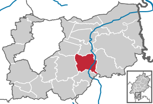
| County : | Darmstadt-Dieburg | |
| Height : | 158 m above sea level NHN | |
| Area : | 27.7 km 2 | |
| Residents: | 16,416 (Dec. 31, 2019) | |
| Population density : | 593 inhabitants per km 2 | |
| Postcodes : | 64354, 64395 (hundred acre ) |
|
| Area code : | 06162 | |
| License plate : | DA, TU | |
| Community key : | 06 4 32 019 | |
| LOCODE : | DE RHM | |
| City structure: | 5 districts | |
City administration address : |
Cestasplatz 1 64354 Reinheim |
|
| Website : | ||
| Mayor : | Manuel Feick ( SPD ) | |
| Location of the city of Reinheim in the Darmstadt-Dieburg district | ||
  |
||

Reinheim (in the local dialect: Roinem ) is a town in the Darmstadt-Dieburg district in Hesse .
geography
Reinheim is located in southern Hesse on the edge of the Rhine-Main area and in the heart of the Darmstadt-Dieburg district . Reinheim lies in the center of the Reinheim hill country and forms a "gateway to the Odenwald ".
Neighboring communities
Reinheim borders in the north on the municipality of Groß-Zimmer , in the east on the municipality of Otzberg , in the southeast on the municipality Brensbach ( Odenwaldkreis ), in the south on the town of Groß-Bieberau , in the west on the town of Ober-Ramstadt and in the northwest on the municipality Roßdorf .
City structure

Reinheim consists of the districts Georgenhausen , Reinheim, Spachbrücken , Ueberau and Zeilhard . Dilshofen (located on the Zeilhard district and the neighboring Ober-Ramstädter district), Hundertmorgen (Ueberauer district) and Illbach are small hamlets that belong to Reinheim.
history
Reinheim (city center)


Reinheim was founded in 1260 by the Counts of Katzenelnbogen , who built a no longer preserved moated castle there a few years later . Reinheim is mentioned as a town as early as 1318. The city coat of arms of Reinheim resembles that of the city Katzenelnbogen , the ancestral seat of the county.
From 1375 Werner Kalb von Reinheim went down in history as a robber baron. He was a vassal of Count Diether VIII von Katzenelnbogen and allegedly started his raids from the neighboring Nieder-Modau Castle . In 1382, in “Werner Kalbs Krieg”, travelers from the cities of Frankfurt, Mainz and Worms caused considerable damage in Nieder-Modau, Ober-Modau, Rohrbach, Wembach and on the Hofgut Illbach (Eulbach).
Reinheim's farm and castle were first mentioned in a document around 1276/77. Ueberau was first mentioned in a document in 1305, Georgenhausen in 1318, Zeilhard and Spachbrücken followed in 1323.
In the historical documents, Reinheim is documented with changing spellings of the place name over the centuries (the year of mention in brackets): Rinheim (1276–1277, 1286, 1326, 1330); Rinheym (1330); Ryneheim (1338); Rynhem (1427): Rynheym (1493); Reinheim (1516); Rheinheim (16th century); Reinheimb (1620); Rainheim (1679).
There are different assumptions about the origin of the name Reinheim. Some derive it from a personal name, such as Regino , others see a connection with the pre-Germanic word for river. A Franconian settlement emerged early on at the mouth of the Hohe Straße leading across the southwestern Odenwald into the Gersprenz valley . A church on the Friedhofsberg also belonged to it, which was probably consecrated to St. Nicholas in the 11th century. A legend is about a woman named Katharina the Pure. She is said to have cured a knight with a serious contagious disease. Out of gratitude, his father arranged for the city to be named after her. In the first mention in 1276, a Reinheim farm belongs to the Counts of Katzenelnbogen . In the 13th century the city was founded according to plan with a square floor plan and symmetrical layout by the Counts of Katzenelnbogen. In 1480, Landgrave Heinrich von Hessen confirmed the city's letter of freedom. In 1511, Elector Ludwig von der Pfalz enfeoffed Landgrave Wilhelm of Hesse with the Palatinate fiefdom owned by Count Philipp von Katzenelnbogen . The rule in Reinheim was from 1300 to 1479 by the Counts of Katzenelnbogen, from 1479 to 1567 by the Landgraves of Hesse and from 1567 by the Landgraves of Hesse-Darmstadt . Reinheim was in the judicial district of the district of Oberramstadt . The centering was divided into so-called "rice car," each of which a top magistrate board that the Zentgrafen were subordinated. This district had to provide a freight wagon ( rice wagon ) including draft animals and servants for campaigns. Reinheim belonged to the "Reinheim Reiswagen", which includes the town and the associated mills and farms as well as Ueberau . The entire district of Oberramstadt was assigned to the Lichtenberg office . This classification existed until the beginning of the 19th century.
The late 18th and early 19th centuries brought far-reaching changes to Europe. As a result of the Napoleonic Wars , the Holy Roman Empire (German Nation) was reorganized by the Reichsdeputationshauptschluss of 1803 and ceased to exist with the laying down of the imperial crown on August 6, 1806. In the Landgraviate of Hesse-Darmstadt, the judicial system was reorganized in an executive order of December 9, 1803. The “Hofgericht Darmstadt” was set up as a court of second instance for the Principality of Starkenburg . The jurisdiction of the first instance was carried out by the offices or the landlords . The court court was the second instance court for normal civil disputes, and the first instance for civil family law cases and criminal cases. The superior court of appeal in Darmstadt was superordinate . With this, the district of Oberramstadt and the district court associated with it had finally lost its function. In 1806 the Landgraviate of Hesse-Darmstadt was incorporated into the Grand Duchy of Hesse, which was formed under pressure from Napoleon . In 1811 the Lichtenberg office was divided into two legal offices and Reinheim became the seat of a legal officer. In 1821, as part of a comprehensive management reform the Official Vogteien in the provinces were Starkenburgring and Oberhessen dissolved the Grand Duchy and district districts inserted, Reinheim administrative seat of the same District district was. As part of this reform, regional courts were also created, which were now independent of the administration. The district court districts corresponded in scope to the district council districts and the district court of Lichtenberg was responsible as the court of first instance for the district of Reinheim . This reform also arranged the administrative administration at the municipal level. So the mayor's office in Reinheim was also responsible for uberau . According to the municipal ordinance of June 30, 1821, there were no longer appointments of mayors , but an elected local council, which was composed of a mayor, aldermen and council.
The statistical-topographical-historical description of the Grand Duchy of Hesse reports on Reinheim in 1829:
»Reinheim (L. Bez. Gl. N.) city; is 3 hours southeast of Darmstadt, on the Wembach and not far from the Gersprenz, as well as on the road from Darmstadt through the Odenwald. Reinheim consists of the actual city and the suburb, is partly still surrounded by walls and ramparts, has 190 houses and 1,196 inhabitants, who are Lutheran with the exception of 9 Catholics, 11 Mennonites and 59 Jews; among these are 106 farmers and 84 tradesmen. Here is the seat of the district councilor, and there is a church built in 1611, two parsonages, a town hall with which a school is connected, a noble apartment with garden-like facilities, a post office, a very western tower that is still originates from the old fortifications, 1 synagogue, 3 grinding mills, with which 2 oil mills are connected, 1 pharmacy and in the area there are significant fragments of spherical basalt. 4 grocer's markets are held annually. - The Counts of Katzenellenbogen. Diether III. [† 1276) and Eberhard I. († before 1312), both sons of Count Diether II, owned Reinheim in an undivided community, and the latter founder of the Neukatzenellenbogenschen (younger) line, must have brought the place completely on his line; for in 1318 his son, Berthold II, received the upper part, and Eberhard II, the last brother's son, the lower part of Reinheim zum Mutschar. At that time, Reinheim was specifically named a city. In the distribution of inheritance between Count Diether VI. and Gerhard, 1373, received the latter 1 / 4 of the city. There is also talk of a castle under the year 1383, and in 1440 the following castle men of the city and fortress Reinheim can be found: Echter, Geyling, Mosbach, Rorbach, Senolt, Schelm von Bergen, Womolt. In 1449 Philip the Younger received half of the town of Reinheim and its membership. The noble von Mosbach family had to give the altar to St. Maria in Reinheim, but in 1578 ceded this patronage to Landgrave Georg I. This family probably received most of their fiefs in Reinheim from the Reinheim calves. In the 30 Years War in 1634, 15 houses in the suburb were burned down. The fortifications gave protection and protection to many residents of the area until January 15, 1635, when the city was opened to the French. These were gradually followed by the Swedes, the Rheingräfl. Soldiers and the Croats, and the city was devastated by the end of 1635, and most of the inhabitants died. After the Lichtenberg office had been divided into two judicial offices in 1811, de Reinheim became the seat of the one judicial officer. "
From 1848 to 1968 Reinheim was the seat of a local court . After its abolition, the district court district was divided between the Darmstadt district court and the Dieburg district court , with the Dieburg district court becoming responsible for Reinheim.
Territorial reform
In the course of administrative reform in Hesse on 31 December 1971, the municipalities Ueberau, Spachbrücken and Zeilhard had with the city Reinheim voluntary for greater community city Reinheim by a marginal change in the contract together . On January 1, 1977, the municipality of Georgenhausen was incorporated by virtue of state law . The earlier municipalities carry their name on as a district designation. For the core town of Reinheim and the incorporated districts, local districts with local advisory council and local councilor were set up according to the Hessian municipal code, whereby the joint local district Georgenhausen-Zeilhard was established for the merged districts of Georgenhausen and Zeilhard .
Territorial history and administration
The following list gives an overview of the territories in which Reinheim was located and the administrative units to which it was subordinate:
- before 1479: Holy Roman Empire , County of Katzenelnbogen , Upper County of Katzenelnbogen
- from 1479: Holy Roman Empire, Landgraviate of Hesse , Upper County of Katzenelnbogen
- from 1567: Holy Roman Empire, Landgraviate of Hessen-Darmstadt , Upper County of Katzenelnbogen, (1783: Amt Lichtenberg , Cent. Oberramstadt , Reinheimer Reiswagen )
- from 1803: Holy Roman Empire, Landgraviate Hessen-Darmstadt, Principality of Starkenburg , Lichtenberg Office
- from 1806: Grand Duchy of Hesse , Principality of Starkenburg, Lichtenberg Office
- from 1815: German Confederation , Grand Duchy of Hesse, Province of Starkenburg , Lichtenberg Office
- from 1821: German Confederation, Grand Duchy of Hesse, Starkenburg Province, Reinheim District District (separation between justice ( Lichtenberg District Court ) and administration)
- from 1832: German Confederation, Grand Duchy of Hesse, Province of Starkenburg, District of Dieburg
- from 1848: German Confederation, Grand Duchy of Hesse, Dieburg administrative region
- from 1852: German Confederation, Grand Duchy of Hesse, Province of Starkenburg, District of Dieburg
- from 1866: Grand Duchy of Hesse, Province of Starkenburg, District of Dieburg
- from 1871: German Empire , Grand Duchy of Hesse, Province of Starkenburg, District of Dieburg
- from 1918: German Empire, People's State of Hesse , Starkenburg Province, Dieburg District
- from 1938: German Empire, People's State of Hesse, District of Dieburg (In the course of the regional reform in 1938 , the three Hessian provinces of Starkenburg, Rheinhessen and Upper Hesse were dissolved.)
- from 1945: American zone of occupation , Greater Hesse , Darmstadt district, Dieburg district
- from 1949: Federal Republic of Germany , State of Hesse , Darmstadt district, Dieburg district
- from 1977: Federal Republic of Germany, Land Hessen, administrative district Darmstadt, administrative district Darmstadt-Dieburg , in which the administrative districts Dieburg and Darmstadt were dissolved in the course of the regional reform in Hesse .
dishes
Reinheim belonged to the Oberramstadt district court . In the Landgraviate of Hesse-Darmstadt, the judicial system was reorganized in an executive order of December 9, 1803. The “Hofgericht Darmstadt” was set up as a court of second instance for the Principality of Starkenburg . The jurisdiction of the first instance was carried out by the offices or the landlords . The Lichtenberg Office was responsible for Reinheim. The court court was the second instance court for normal civil disputes, and the first instance for civil family law cases and criminal cases. The superior court of appeal in Darmstadt was superordinate . The main courts had lost their function.
With the formation of the regional courts in the Grand Duchy of Hesse, the regional court of Lichtenberg was the court of first instance from 1821 . It followed:
- from 1848: Regional Court of Reinheim (relocated from Lichtenberg)
- from 1879: Reinheim District Court (renamed); second instance district court Darmstadt
- from 1968: Dieburg District Court with the dissolution of the Reinheim District Court; second instance district court Darmstadt
population
Population structure
According to the 2011 census , there were 16,294 residents in the city of Reinheim on May 9, 2011. 1199 (7.4%) were foreigners of whom 539 came from other EU countries, 457 from other European countries and 203 from other countries. Of the German residents, 9.8% had a migration background . The inhabitants lived in 7017 households. Of these, 2000 were single households , 2253 were couples without children and 2037 were couples with children, as well as 579 single parents and 148 shared apartments .
Population development
| • 1791: | 1059 inhabitants (with Ueberau) |
| • 1800: | 1173 inhabitants (with Ueberau) |
| • 1806: | 1497 inhabitants, 234 houses (with Ueberau) |
| • 1829: | 196 inhabitants, 190 houses |
| • 1867: | 1324 inhabitants, 217 houses |
| Reinheim: Population from 1791 to 2015 | ||||
|---|---|---|---|---|
| year | Residents | |||
| 1791 | 1,059 | |||
| 1800 | 1,173 | |||
| 1829 | 1,324 | |||
| 1834 | 2.016 | |||
| 1840 | 2.121 | |||
| 1846 | 2.168 | |||
| 1852 | 2,282 | |||
| 1858 | 2.151 | |||
| 1864 | 1,365 | |||
| 1871 | 1,411 | |||
| 1875 | 1,505 | |||
| 1885 | 1,716 | |||
| 1895 | 1,723 | |||
| 1905 | 2,073 | |||
| 1910 | 2,209 | |||
| 1925 | 2,361 | |||
| 1939 | 2,767 | |||
| 1946 | 3,665 | |||
| 1950 | 4.010 | |||
| 1956 | 3,892 | |||
| 1961 | 4.123 | |||
| 1967 | 4,663 | |||
| 1970 | 5,139 | |||
| 1972 | 10,369 | |||
| 1976 | 14,191 | |||
| 1984 | 16,222 | |||
| 1992 | 16,909 | |||
| 2000 | 18,100 | |||
| 2005 | 17,660 | |||
| 2010 | 17,069 | |||
| 2011 | 16,294 | |||
| 2015 | 16,231 | |||
| Data source: Historical municipality register for Hesse: The population of the municipalities from 1834 to 1967. Wiesbaden: Hessisches Statistisches Landesamt, 1968. Further sources:; 1972 :; 1976 :; 1984 :; 1992 :; 2000 :; 2005 :; 2010 :; 2011 census; 2015: From 1972 including the towns incorporated into Hesse as part of the regional reform . | ||||
Religious affiliation
| • 1829: | 1157 Lutheran (= 93.39%), 11 Mennonite (= 0.92%), 59 Jewish (= 4.93%) and 9 Catholic (= 0.75%) residents |
| • 1961: | 3135 Lutheran (= 76.04%), 791 Roman Catholic (= 19.19%) inhabitants |
| • 2011: | 8560 Protestant (= 52.6%), 2960 Catholic (= 18.2%), 500 non-believers (= 3.1%), 4150 other (= 25.5%) residents |
Gainful employment
The municipality in comparison with the district, administrative district Darmstadt and Hesse:
| year | local community | district | Administrative district | Hesse | |
|---|---|---|---|---|---|
| Employees subject to social security contributions | 2017 | 2,285 | 74,525 | 1,695,567 | 2,524,156 |
| Change to | 2000 | −21.6% | + 21.1% | + 16.1% | + 16.0% |
| of which full-time | 2017 | 65.2% | 68.3% | 72.8% | 71.8% |
| of which part-time | 2017 | 34.8% | 31.7% | 27.2% | 28.2% |
| Only marginally paid employees | 2017 | 652 | 15.305 | 224.267 | 372.991 |
| Change to | 2000 | −19.3% | + 14.4% | + 9.0% | + 8.8% |
| Branch | year | local community | district | Administrative district | Hesse |
|---|---|---|---|---|---|
| Manufacturing | 2000 | 46.7% | 41.1% | 27.0% | 30.6% |
| 2017 | 38.9% | 31.3% | 20.4% | 24.3% | |
| Commerce, hospitality and transport | 2000 | 12.3% | 26.1% | 26.4% | 25.1% |
| 2017 | 20.5% | 26.8% | 24.7% | 23.8% | |
| Business services | 2000 | 19.8% | 11.6% | 25.1% | 20.2% |
| 2017 | 13.6% | 17.1% | 31.6% | 26.1% | |
| other services | 2000 | 20.0% | 18.8% | 20.1% | 22.5% |
| 2017 | 25.8% | 23.6% | 23.0% | 25.4% | |
| Other (or without assignment) | 2000 | 1.2% | 2.4% | 1.4% | 1.5% |
| 2017 | 0.8% | 1.2% | 0.3% | 0.4% |
Georgenhausen

The focal point of Georgenhausen are the estate and the church. The predecessor of today's church, built in 1792, is said to have been donated by the knights of Rodenstein , who also owned the estate. It was built in 1250 when the surrounding towns ( Roßdorf , Spachbrücken) separated from the association of the old Dieburg parish. The church consecrated to St. George also gave the place its name, which was first mentioned in 1318 as Gorienhusen .
The name first appeared in a division agreement between Count Bertolf and Count Eberhard von Katzenelnbogen on August 26, 1318. This document shows that Katzenelnbogen had possessions in the area around Groß-Gerau , in the northern Odenwald and near Auerbach . Georgenhausen was not one of them; the counts only received their tithes from there .
Georgenhausen was not a closed village at that time, but consisted of several large farms: the Rodensteinischer Hofgut, the Großer Hof owned by the Palatinate and the Beunenhof owned by the Rabenold von Tannenberg family . These three stately courtyards have probably joined together to form a community on the occasion of the church building and adopted the common name "Georgenhausen - the community of the Georgskirche". The original names of the three farms have been lost.
Spachbrücken and Zeilhard belonged to the Lords of Bickenbach from at least 1323 , to the Erbach taverns from 1360 and to the Löwensteiners from 1528 to 1805 . Georgenhausen is not listed with these two locations in any document before 1398, so it had a different fate before that. It was not until 1398 that the Palatinate became the owner of Georgenhausen. Since the Palatinate owned a farm in Georgenhausen, which was still lent in 1503 under Fulda law , they will have bought the farm and the rights to the village from the Fulda Abbey in 1390 together with the bankruptcy estate of the Zent Umstadt .
The Palatinate lent Spachbrücken, Zeilhard and Georgenhausen to Erbach in 1398, which was confirmed in the documents until 1482. In 1482 Habitzheim was pledged to the Lord von Scharfeneck (later: Löwenstein). It is questionable whether Georgenhausen belonged to this office, but in any case it was Palatine property. In 1611, the Georgenhäuser had to perform labor services for Count Löwenstein Scharfeneck . Georgenhausen was therefore subject to the Löwensteiners from 1482 to 1611.
The Rabenolds' farm was sold to the Walbrunn zu Ernsthofen family in 1460 , who had also acquired the estate in 1618, which until then had been in the hands of the Fechenbach family . Around 1600 the Walbrunns also provided the pastor, so they were the secular and spiritual head of Georgenhausen by 1618 at the latest. In 1629, even in embarrassing criminal court cases, the Georgenhäuser were no longer subordinate to the court in Lichtenberg or Groß-Umstadt , but to local rule.
In 1649, after the Thirty Years' War , Walbrunn was so in debt that he had to sell Georgenhausen to the " war profiteer " Kamptz zu Godow. Haxthausen inherited the estate and power in Georgenhausen from him in 1671 .
In 1732 the widowed Albertina Charlotte von Haxthausen moved to the estate and ruled with her son Christian Rudolf Anton until 1811 according to the motto: "I am the state!" External influence. Only after the dissolution of the Holy Roman Empire in 1806 was the no man's land Georgenhausen incorporated into the newly created Grand Duchy of Hesse . As a substitute for the lost sovereignty, the baron still had the lower jurisdiction and the right to fill pastors' posts until 1821. This later passed to Count Görtz von Schlitz , he kept the patronage over the parish until the legal waiver in 1968; it has since been perceived by the regional church itself.
In 1836 the estate and the patrimonial rights were transferred to Count Görtz von Schlitz. The estate remained under his tenants until it was sold to the Nassau Settlement Society in the middle of the 20th century.
The municipality of Georgenhausen maintained its municipal independence until 1977, although the neighboring towns of Zeilhard and Spachbrücken merged with Reinheim at the end of 1971. There are four church institutions in Georgenhausen: the Protestant Georgskirche, the Catholic Chapel of St. Elisabeth, the Kingdom Hall of Jehovah's Witnesses and the New Apostolic Church.
Language bridges

Spachbrücken has been documented since May 17, 1323. The first houses were right next to the Dilsbach. For the construction of a simple bridge over the small stream, birch trunks (= Spachen) were placed in the stream, larger ones at the bottom to ensure the flow of water, and smaller and smaller at the top so that carts could drive over it unhindered.
The local political history was largely identical to Zeilhard over the centuries and is explained in more detail there.
The Spachbrücken ancestors were probably converted to Christianity by monks from the Fulda monastery, which was founded by Boniface in 744 AD. They belonged to the then very large parish of Dieburg. In 1400 there was the first branch church, which was consecrated to St. Anthony. With the Reformation, which took place there before 1526, Spachbrücken became a branch municipality of Roßdorf. In contrast to many neighboring communities, Spachbrücken was spared any further religious changes and has always been Evangelical-Lutheran ever since. In 1585 Spachbrücken became an independent parish, to which Habitzheim also belonged. Instead of the old dilapidated church, a new church was built and consecrated on July 6, 1755. During the renovation from 1970 to 1972, it received a new roof with a stork's nest as a landmark of the Spachbrücken. During the interior renovation, the valuable baroque organ by Johann Christian Dauphin from 1760 was also restored.
In 1635, Spachbrücken was abandoned by the last inhabitants because of the plague. Around 1640 some survivors returned and after 1650 Saxons, Flemings and Swiss recruited by the Landgrave in Darmstadt settled there. The pottery and button-making trade flourished until the First World War in 1914. The Häfner Jakob Neuroth and his son Georg delivered their goods to the Grand Duke in Darmstadt and to the court of the Tsars in Petersburg.
Since the First World War, the employment situation of most of the Spachbrückers slowly changed from handicraft and agriculture to industrial work. Most Spachbrückers find their existence in the industrial companies and administrations in Darmstadt and the surrounding area. This development continued even more after 1945.
Exceedingly

At the site of the Hundertmorgen district, which belongs to Ueberau, there was a Roman settlement, as can be deduced from soil finds. Ueberau was first mentioned in a document from Count Eberhard von Katzenelnbogen dated July 24, 1305 with the name "Ubera" and probably means "Obere Aue" or "Over the Aue" (the lake meadows). That Ueberau is even older than the 700 years celebrated in 2005 is proven by statements in a document from 1316 and investigations on the oldest parts of the church, which confirm that they date from the end of the 12th century.
With the County of Katzenelnbogen , Ueberau fell to the Landgraviate of Hesse in 1479 . The Reformation was introduced in 1527 . At the end of the Thirty Years War , the place was almost extinct. Later immigrants from Switzerland were settled.
In 1718 the first school was founded in Ueberau.
With the construction of the railroad around 1870 and the associated industrialization , the labor movement grew stronger and stronger, as it did in all of Germany, including in Ueberau. In particular, workers from the Frohmann Granitwerke company settled in Ueberau. Most of these workers were unionized and belonged to the Social Democratic Party of Germany (SPD), which founded a local association in 1903. Due to the political changes during and after the First World War, local associations of the Independent Social Democratic Party of Germany (USPD) and the Communist Party of Germany (KPD) were established in 1919 . In the 1928 Reichstag election , the KPD won more votes than the SPD for the first time.
After the Second World War, the community remained a communist stronghold; in the region, Ueberau is also known as the "Red Village". From 1948 the communist Adam Büdinger officiated as mayor of the then still independent municipality of Ueberau. In the municipal council elections in 1952, seven out of twelve mandates went to the KPD. In the run-up to the KPD ban in August 1956, communists and non-party voters formed the Independent Voting Association (UWG), which in October 1956 achieved an absolute majority with seven seats. Mayor Büdinger remained in office. On October 14, 1960, nine days before the local elections, the UWG was banned by the Hessian Interior Minister . Mayor and aldermen were removed. Büdinger's call to vote invalid in the upcoming election was followed by around a third of the voters. In the local elections in 1968, 38% of the votes went to the German Peace Union (DFU). From 1972 the German Communist Party (DKP) was continuously represented in the local advisory board of Ueberau, which was now incorporated into Reinheim. In the local elections in 2006, she achieved two out of five seats on the local council. The communist Manfred Büdinger, son of the above-mentioned Adam Büdinger, was then elected mayor.
Today there is a rich, intact community life in Ueberau with many events. One example of this is participation in the competition Our village has a future (formerly: Our village should be more beautiful) since 2008. In the 2013 federal decision, Ueberau received the gold medal with eight other villages from all over Germany.
Zeilhard


The oldest surviving documentary mention of Zylhart dates from May 17, 1323. The villages of Zeilhard, Spachbrücken and Habitzheim an den Schenken zu Erbach came through the inheritance . In 1528 the Erbachers, who were feudal lords of the Count Palatine , including Zeilhard, sold for 9,000 guilders to the Counts of Wertheim . Georg II von Wertheim carried out the Reformation in his area in 1525 . The new rule, which took the name Löwenstein in 1581, converted to Catholicism again in 1621. Before this change of faith, the Thirty Years War began . Since the Löwensteiner fought on the side of the Evangelicals, he was one of the losers. His possessions, including those in Zeilhard, were confiscated and given to the Vice-President of the Reichshofrat, Baron von Strahlendorf. This sold the Habitzheim rule to the Darmstadt Landgrave . After the war she returned to Löwenstein in 1649.
The Thirty Years War brought bad times for Zeilhard. Soon after the beginning of the war, many fled to Reinheim, which was then fortified, for fear of the Mansfeld soldiers. The plague reached the district in 1635 , followed by a two-year famine. In 1657 the village was completely uninhabited. But it did not fall desolate like so many villages and hamlets in the area. The times of the Bickenbach Bailiwick and later that of Erbach and Löwenstein-Wertheim were marked by tense legal uncertainties in some questions of territorial rule, which resulted in multiple military deployments. Since the Bavarian feud in 1504, the Palatinate and Hesse mixed into the central rule.
In the peace at Luneville the Umstädter central rule went to Hesse. The Palatinate had thus lost its claim. Through the Reichsdeputationshauptschluss of February 25, 1803, Hesse gradually gained control of the area. From 1806 onwards, political power over Zeilhard was in the hands of the Grand Duke . Zeilhard has been part of Reinheim since the end of 1971.
Dilshofen
The hamlet of Dilshofen (Dieslhoffen), with three farms and four residential buildings, is located in the south of the Zeilhard district on the border with Ober-Ramstadt . 1454 is a Heylle Dyelßhoiffer called a Bede of 6 shillings paid for a garden. The western courtyard is already across the border and belongs to Ober-Ramstadt. In 1791 and 1800 there were 16 and 26 residents in Dilshofen, respectively. Until 1977, the district border between Darmstadt and Dieburg ran right through the Hofstätten. The Zeilhard train station , which was presumably opened on May 15, 1871 and closed again in 1979, was located south of Dilshofen.
Illbach estate

Hof Illbach (formerly Eulbach / Ulbach) used to have its own court markings and was once the ancestral seat of an early extinct noble family of Eulbach / Ulbach . The place was first mentioned in documents in 1368, when Dithmar von Vlbach sold his mills in Illbach with the will of his brother for 100 guilders to Count Wilhelm II von Katzenelnbogen . Katzenelnbogen enfeoffed the Kalb von Reinheim with the property, because in a document from 1392 it is noted that Werner Kalb von Reinheim has his property in Vlbach from Count Eberhard von Katzenelnbogen (brother Wilhelm II) as a fief. In 1489 a feudal letter from Landgrave Wilhelm I of Hesse for Philipp Kalb von Reinheim is documented. In 1580 the farm then belongs to the Mosbach-Lindenfels . In 1684, with the death of Hans Heinrich Mosbach von Lindenfels, the last of the family, the farm came to the von Hertinghausen family .
In older historical documents it is noted differently that the court settlement in the 2nd half of the 14th century (1368) was bought by the Counts of Katzenelnbogen, who continuously enfeoff those of Eulbach / Ulbach / Illbach. Later it belonged to the von Willich family.
In 1824 a Rottzehnt of the Illbacher Hof is mentioned.
In the 19th century the estate was owned by the Landgrave of Hesse-Darmstadt before the property passed into the possession of the Count of Pöllnitz . At the end of the second third of the 20th century, the estate was privately owned by a family from Eschborn.
politics
City Council
The local elections on March 6, 2016 produced the following results, compared to previous local elections:
| Parties and constituencies | % 2016 |
Seats 2016 |
% 2011 |
Seats 2011 |
% 2006 |
Seats 2006 |
% 2001 |
Seats 2001 |
||
|---|---|---|---|---|---|---|---|---|---|---|
| SPD | Social Democratic Party of Germany | 41.5 | 15th | 40.3 | 16 | 40.3 | 15th | 46.7 | 17th | |
| CDU | Christian Democratic Union of Germany | 17.4 | 6th | 21.6 | 8th | 27.1 | 10 | 25.6 | 10 | |
| Reinheimer Kreis | Reinheimer Kreis | 12.2 | 5 | - | - | - | - | - | - | |
| DKP | German Communist Party | 11.1 | 4th | 10.1 | 4th | 14.7 | 5 | 9.2 | 3 | |
| GREEN | Alliance 90 / The Greens | 10.1 | 4th | 17.9 | 6th | 9.4 | 4th | 9.8 | 4th | |
| FWG | Free voter community Reinheim e. V. | 5.5 | 2 | 4.8 | 2 | 4.9 | 2 | 5.0 | 2 | |
| FDP | Free Democratic Party | 2.2 | 1 | 2.1 | 1 | 3.6 | 1 | 3.7 | 1 | |
| total | 100.0 | 37 | 100.0 | 37 | 100.0 | 37 | 100.0 | 37 | ||
| Voter turnout in% | 53.0 | 51.5 | 49.8 | 57.0 | ||||||
Districts
The following local districts with local advisory board and local councilor according to the Hessian municipal code exist in the municipality:
- Reinheim district (areas of the former town of Reinheim). The local advisory board consists of 9 members.
- Local district Ueberau (areas of the former municipality Ueberau ). The local advisory board consists of 5 members.
- Spachbrücken district (areas of the former Spachbrücken municipality ). The local advisory board consists of 5 members.
- Georgenhausen-Zeilhard district (areas of the former communities Georgenhausen and Zeilhard ). The local advisory board consists of 7 members.
coat of arms
|
|
Blazon : "In gold, a blue-armed red lion with a double tail."
The lion comes from the coat of arms of the County of Katzenelnbogen . The city's seals have shown a lion since the Middle Ages, and a second tail was not added until the 19th century. |
In 1956 it was proposed to better distinguish Reinheim from other Katzenelnbogischen coats of arms in the lower half of the coat of arms to add a silver bar on a blue background.
The city does not fly an official flag. However, there is an unofficial flag that shows the city's coat of arms on red, white and red flag cloth.
Town twinning

- Cestas (France)
- Fürstenwalde / Spree near Berlin
- Licata (Italy)
- Sanok (Poland)
Culture and sights
Natural spaces
To the northeast of Reinheim is the Reinheimer Teich biotope and nature reserve , which is surrounded by the Dilsbach and Wembach (Langer Graben) and the nearby Gersprenz . The NSG is actually a group of ponds and serves as a retreat, resting and wintering area for many bird species. In the NSG there is an isolated population of the European pond turtle . The glider airfield is located on the southern edge.
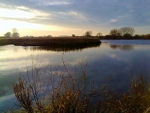
View of the Reinheimer ponds


The nature reserve forms the central part of the larger Natura 2000 areas "FFH area Untere Gersprenz" and "Vogelschutzgebiet Untere Gersprenzaue".
In the southern district of Ueberau there is the nature reserve Forstberg von Ueberau , a volcanic dome with species-rich rough meadows and orchards.
To the east of the hamlet of Dilshofen is the extensive natural monument "Lösswand on the footpath from the Georgenhausen - Zeilhard train station", a semi- arid lawn with rare plants (see list of natural monuments in Reinheim ).
Regular events
- first weekend in July: Reinheimer Markt (street festival)
- second weekend in September: curb
- October: Wine press festival

Houses of worship
- Evangelical Trinity Church in Reinheim
- Catholic parish church Corpus Christi Reinheim
- Reinheim cemetery chapel
- Evangelical Georgskirche Georgenhausen-Zeilhard
- Evangelical Lutheran Church Spachbrücken
- Evangelical Church Ueberau
- New Apostolic Church Reinheim and Georgenhausen-Zeilhard
- Old Synagogue Reinheim
Economy and Infrastructure
Land use
The municipal area covers a total area of 2770 hectares, of which in hectares are:
| Type of use | 2011 | 2015 | |
|---|---|---|---|
| Building and open space | 351 | 355 | |
| from that | Living | 254 | 255 |
| Business | 17th | 21st | |
| Operating area | 5 | 6th | |
| from that | Mining land | 1 | 0 |
| Recreation area | 35 | 37 | |
| from that | Green area | 19th | 20th |
| traffic area | 230 | 230 | |
| Agricultural area | 1965 | 1950 | |
| from that | moor | 0 | 0 |
| pagan | 0 | 0 | |
| Forest area | 132 | 134 | |
| Water surface | 33 | 39 | |
| Other use | 20th | 21st | |
traffic

The trains of the Odenwaldbahn ( RMV lines 80, 81, 82) to Darmstadt , Frankfurt as well as Erbach and Eberbach run from the Reinheim train station every one to two hours with densities during rush hour.
The StadtLandBus transport company is also based in Reinheim.
Companies
In addition to the small and medium-sized local businesses, three larger companies have a production facility in Reinheim: the branch of Merz Pharma Frankfurt, manufacturer of globally known drugs (Merz Spezial Dragees, Patentex, Axura) and cosmetic products (Tetesept) as well as those that are now part of Würth -Grass furniture fittings factory belonging to the group (formerly: Mepla - Alfit; Karl Lautenschläger KG). There is also the machine builder WEMO Automation GmbH and the robot specialists HAHN Robotics GmbH, Rethink Robotics and RobShare, all of which are subsidiaries of the HAHN Group , whose headquarters are in Rheinböllen . The robots, which are sold around the world, played a key role in their breakthrough in the world market thanks to the automated production of blank CDs.
education
- Dr. Kurt Schumacher School ( cooperative comprehensive school with special needs school )
- Gersprenzschule ( elementary school )
- Dilsbachschule, Spachbrücken (elementary school)
- Hirschbach School, Georgenhausen (primary school)
- Elementary school Ueberau
Sports facilities
The stadium complex consists u. a. from a type B competition facility with a large grass field and 400 m plastic circular track.
The plant became a sports center Reinheim expanded and it now has a modern artificial turf , a skating area and a beach volleyball Square. In September 2011 a sports hall was added. The sports field is located next to the Reinheim glider airfield .
Personalities

- Ernst Karl Büchner (* 1786 in Reinheim Odenwald; † 1861 in Darmstadt), doctor, father of Georg Büchner
- Julius Scriba (1848–1905), doctor and botanist, born in Reinheim
- Julius Scriba (pharmacist) (1866–1937), pharmacist, born in Reinheim
- Robert B. Goldmann (1921–2018), journalist, grew up in Reinheim, an honorary citizen of the city
- Karl von Willich called von Pöllnitz (1802–1875), landowner and member of the 2nd Chamber of the Estates of the Grand Duchy of Hesse
- Wilhelm von Willich called von Pöllnitz (1807–1887), administrative officer and member of the 1st and 2nd chambers of the state estates of the Grand Duchy of Hesse
- Rafet El Roman (* 1968), pop musician, lives in Reinheim
literature
- Literature about Reinheim in the Hessian Bibliography
- Literature by and about Reinheim in the catalog of the German National Library
Web links
- Website of the city of Reinheim
- City of Reinheim. In: Website of the Darmstadt-Dieburg district .
- Reinheim, Darmstadt-Dieburg district. Historical local dictionary for Hessen. In: Landesgeschichtliches Informationssystem Hessen (LAGIS).
- Information on the community of Reinheim. In: Hessisches Gemeindelexikon. HA Hessen Agentur GmbH , 2016.
- Link catalog on Reinheim at curlie.org (formerly DMOZ )
Individual evidence
- ↑ Hessian State Statistical Office: Population status on December 31, 2019 (districts and urban districts as well as municipalities, population figures based on the 2011 census) ( help ).
- ↑ Reinheimer Zeltkerb , History In: www.reinheimerzeltkerb.de. Accessed October 2018.
- ↑ Reinheim origin. In: website. City of Reinheim, January 1, 2006, accessed October 2018 .
- ↑ Thomas Steinmetz: The southwestern tip of the Dreieich Wildbann in the Odenwald - a contribution to the history of the upper Modau valley and Nieder-Modau Castle. In: Der Odenwald , Zeitschrift des Breuberg-Bund, 2014, No. 2, pp. 43–62
- ↑ Hof Illbach (formerly Eulbach / Ulbach) used to form its own court markings and was once the ancestral seat of an early extinct noble family of Eulbach / Ulbach. In the 2nd half of the 14th century (1368), the court settlement was probably bought by the Counts of Katzenelnbogen, who continuously enfeoff those of Eulbach / Ulbach / Illbach. Later it belonged to the von Willich family. In: Quarterly sheets of the historical association for the Grand Duchy of Hesse. 1921, VI. Volume, p. 424. Karl E. Demandt: Regesten der Grafen von Katzenelnbogen. No. 1388.
- ^ Karl E. Demandt, Regesten der Grafen von Katzenelnbogen, Part 1: 1060–1486, in publications of the Historical Commission for Nassau; 11.1, Wiesbaden: Historical Comm. For Nassau, 1953, No. 216
- ↑ a b c d Reinheim, Darmstadt-Dieburg district. Historical local lexicon for Hesse (as of May 24, 2018). In: Landesgeschichtliches Informationssystem Hessen (LAGIS). Hessian State Office for Historical Cultural Studies (HLGL), accessed on June 6, 2018 .
- ^ Ferdinand Dieffenbach: The Grand Duchy of Hesse in the past and present . Literary Institution, Darmstadt 1877, p. 254 ( online at google books ).
- ↑ a b c Hessen-Darmstadt state and address calendar 1791 . In the publishing house of the Invaliden-Anstalt, Darmstadt 1791, p. 123, 125 ( online in the HathiTrust digital library ).
- ^ M. Borchmann, D. Breithaupt, G. Kaiser: Kommunalrecht in Hessen . W. Kohlhammer Verlag, 2006, ISBN 3-555-01352-1 , p. 20 ( partial view on google books ).
- ^ A b c Georg Wilhelm Justin Wagner : Statistical-topographical-historical description of the Grand Duchy of Hesse: Province of Starkenburg . tape 1 . Carl Wilhelm Leske, Darmstadt October 1829, OCLC 312528080 , p. 196 ( online at google books ).
- ↑ Law on the reorganization of the districts of Darmstadt and Dieburg and the city of Darmstadt (GVBl. II 330–334) of July 26, 1974 . In: The Hessian Minister of the Interior (ed.): Law and Ordinance Gazette for the State of Hesse . 1974 No. 22 , p. 318 , § 9 ( online at the information system of the Hessian state parliament [PDF; 1.5 MB ]).
- ^ Federal Statistical Office (ed.): Historical municipality directory for the Federal Republic of Germany. Name, border and key number changes in municipalities, counties and administrative districts from May 27, 1970 to December 31, 1982 . W. Kohlhammer, Stuttgart / Mainz 1983, ISBN 3-17-003263-1 , p. 355 .
- ↑ a b main statute. (PDF; 162 kB) §; 6. In: Website. City of Reinheim, accessed June 2019 .
- ↑ a b Reinheim, Darmstadt-Dieburg district. Historical local dictionary for Hessen. (As of October 16, 2018). In: Landesgeschichtliches Informationssystem Hessen (LAGIS).
- ^ Michael Rademacher: German administrative history from the unification of the empire in 1871 to the reunification in 1990. State of Hesse. (Online material for the dissertation, Osnabrück 2006).
- ^ Grand Ducal Central Office for State Statistics (ed.): Contributions to the statistics of the Grand Duchy of Hesse . tape 1 . Großherzoglicher Staatsverlag, Darmstadt 1862, DNB 013163434 , OCLC 894925483 , p. 43 ff . ( Online at google books ).
- ↑ a b List of offices, places, houses, population. (1806) HStAD inventory E 8 A No. 352/4. In: Archive Information System Hessen (Arcinsys Hessen), as of February 6, 1806.
- ^ Population by nationality groups: Reinheim, Stadt. In: Zensus2011. Bavarian State Office for Statistics , accessed in May 2015 .
- ↑ Migration background in%: Reinheim, Stadt. In: Zensus2011. Bavarian State Office for Statistics , accessed in May 2015 .
- ^ Households by family: Reinheim, Stadt. In: Zensus2011. Bavarian State Office for Statistics , accessed in May 2015 .
- ↑ a b Hessen-Darmstadt state and address calendar 1800 . In the publishing house of the Invaliden-Anstalt, Darmstadt 1800, p. 125 ( online in the HathiTrust digital library ).
- ^ Ph. AF Walther : Alphabetical index of the residential places in the Grand Duchy of Hesse . G. Jonghaus, Darmstadt 1869, OCLC 162355422 , p. 72 ( online at google books ).
- ^ Local elections 1972; Relevant population of the municipalities on August 4, 1972 . In: The Hessian Minister of the Interior (ed.): State Gazette for the State of Hesse. 1972 No. 33 , p. 1424 , point 1025 ( online at the information system of the Hessian state parliament [PDF; 5.9 MB ]).
- ↑ Local elections 1977; Relevant population figures for the municipalities as of December 15, 1976 . In: The Hessian Minister of the Interior (ed.): State Gazette for the State of Hesse. 1976 No. 52 , p. 2283 , point 1668 ( online at the information system of the Hessian state parliament [PDF; 10.3 MB ]).
- ^ Local elections 1985; Relevant population of the municipalities as of October 30, 1984 . In: The Hessian Minister of the Interior (ed.): State Gazette for the State of Hesse. 1984 No. 46 , p. 2175 , point 1104 ( online at the information system of the Hessian state parliament [PDF; 5.5 MB ]).
- ↑ local elections 1993; Relevant population of the municipalities as of October 21, 1992 . In: The Hessian Minister of the Interior (ed.): State Gazette for the State of Hesse. 1992 No. 44 , p. 2766 , point 935 ( online at the information system of the Hessian state parliament [PDF; 6.1 MB ]).
- ↑ a b municipality data sheet : Reinheim. (PDF; 222 kB) In: Hessisches Gemeindelexikon. HA Hessen Agency GmbH
- ^ The population of the Hessian communities (June 30, 2005). In: Hessian State Statistical Office . Archived from the original .
- ^ The population of the Hessian communities (June 30, 2010). In: Hessian State Statistical Office . Archived from the original .
- ↑ Population figures : Reinheim, city. In: Zensus2011. Bavarian State Office for Statistics , accessed in May 2015 .
- ^ The population of the Hessian communities (June 30, 2015). In: Hessian State Statistical Office . Archived from the original .
- ↑ Religion: Reinheim, Stadt. In: Zensus2011. Bavarian State Office for Statistics , accessed in May 2015 .
- ↑ Tischner, Heinrich; Heimatbuch Georgenhausen, Zeilhard, Dilshofen; Lokay Druck, Georgenhausen, 1982.
- ↑ Spalt, Dr. Georg, From the history of Spachbrück, Festschrift 650 years of Spachbrücken, 1973.
- ↑ Jens Ulrich Klocksin: Communists in Parliament. The KPD in the governments and parliaments of the West German occupation zones and the Federal Republic of Germany (1945–1956). Verlag im Hof, Bonn 1993, ISBN 3-925689-04-4 , p. 378ff.
- ↑ Dieslhoffen. In: Karl E. Demandt: Regesten der Graf von Katzenelnbogen. No. 6095/13, August 1451-1452.
- ↑ Karl E. Demandt: Regesten der Graf von Katzenelnbogen. No. 6096/26 from 1454.
- ↑ a b Illbach, Darmstadt-Dieburg. Historical local lexicon for Hesse (as of February 17, 2014). In: Landesgeschichtliches Informationssystem Hessen (LAGIS). Hessian State Office for Historical Cultural Studies (HLGL), accessed on October 4, 2015 .
- ↑ Hof Illbach. In: Quarterly sheets of the historical association for the Grand Duchy of Hesse. 1921, VI. Volume, p. 424. Karl E. Demandt: Regesten der Grafen von Katzenelnbogen. No. 1388.
- ↑ Hofgut Illbach. (PDF) Flyer. In: www.hofgut-illbach.de. Accessed November 2019 .
- ^ Result of the municipal election on March 6, 2016. 432019 Reinheim, Stadt. Hessian State Statistical Office, accessed in April 2016 .
- ^ Result of the municipal election of March 27, 2011. 432019 Reinheim, Stadt. Hessian State Statistical Office, accessed in October 2019 .
- ^ Result of the municipal elections of March 26, 2006. 432019 Reinheim, St. Hessisches Statistisches Landesamt, accessed in October 2019 .
- ↑ Results of the municipal elections of 2001 and 1997. (No longer available online.) Hessian State Statistical Office, archived from the original ; accessed in October 2019 .
- ↑ Reinheimer Kreis. Website. In: reinheimer-kreis.de.
- ^ Reinheim coat of arms (HStAD inventory R 6 C No. 231) In: Archive Information System Hessen (Arcinsys Hessen), status: 1983.
- ↑ Heinz Reitz: The Reinheimer pond and its history. In: Der Odenwald, magazine of the Breuberg-Bund, 1983, issue 1.
- ↑ Reinheim pond. In: Darmstädter Echo, April 15, 2014, p. 19
- ↑ FFH area 6019-303 Untere Gersprenz , Natura 2000 - ordinance of the Darmstadt Regional Council.
- ↑ Bird sanctuary 6119-401 Untere Gersprenzaue . Natura 2000 - ordinance of the Darmstadt Regional Council.
- ↑ Horst Bathon, Georg Wittenberger: The natural monuments of the Darmstadt-Dieburg district with biotope tours , 2nd expanded and completely revised edition. In: Schriftenreihe Landkreis Darmstadt-Dieburg, (Ed.) District Committee of the District of Darmstadt-Dieburg - Lower Nature Conservation Authority, Darmstadt, 2016. ISBN 978-3-00-050136-4 . 243 pages. Pp. 149-153.
- ↑ Darmstädter Echo , Friday, September 11, 2015, p. 20
- ↑ Darmstädter Echo, Wednesday, October 2, 2019, p. 23.
- ↑ Reinheim Evangelical Church Community. In: www.kirche-reinheim.de.
- ^ Catholic parish group Reinheim-Groß-Bieberau. In: reinheim-gross-bieberau.bistummainz.de.
- ↑ Evangelical Church Community Georgenhausen - Zeilhard. Website. In: www.georgskirche.org.
- ↑ Evangelical Lutheran Parish Spachbrücken. Website. In: www.ev-kirche-spachbruecken.de.
- ↑ Protestant community Ueberau. Website. In: www.kircheueberau.de.
- ^ New Apostolic Church Reinheim. Website. In: nak- Bezirk-darmstadt.de.
- ↑ During the November pogroms, all synagogues in the district were destroyed - but some of them defied time. In: www.echo-online.de. Darmstädter Echo , November 4, 2017, accessed November 2019 .
- ↑ Hessisches Statistisches Informationssystem In: Statistics.Hessen.
- ↑ Brands. Retrieved April 22, 2020 .
- ↑ Department for the special focus on learning. Dr. Kurt Schumacher School Reinheim, accessed November 2019 .
- ↑ Herboldshausen, Schwalm-Eder district. Hessian biography. (As of August 3, 2019). In: Landesgeschichtliches Informationssystem Hessen (LAGIS).

Alsbach cockerel | Babenhausen | Bickenbach | Dieburg | Eppertshausen | Erzhausen | Fischbachtal | Griesheim | Groß-Bieberau | Groß-Umstadt | Large rooms | Messel | Modautal | Mühltal | Münster (Hesse) | Ober-Ramstadt | Otzberg | Pfungstadt | Reinheim | Rossdorf | Schaafheim | Seeheim-Jugenheim | Weiterstadt