
Modau
| Modau | ||
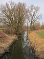
 The Modau in the city center of Ober-Ramstadt |
||
| Data | ||
| Water code | DE : 23962 | |
| location |
Front Odenwald
Bergstrasse
|
|
| River system | Rhine | |
| Drain over | Rhine → North Sea | |
| source | in the Odenwald on the Neunkircher Höhe 49 ° 43 ′ 57 ″ N , 8 ° 46 ′ 12 ″ E |
|
| Source height | approx. 490 m above sea level NHN | |
| muzzle | in the Stockstadt-Erfelder Altrhein of the Rhine Coordinates: 49 ° 48 '50 " N , 8 ° 27' 52" E 49 ° 48 '50 " N , 8 ° 27' 52" E |
|
| Mouth height | approx. 84 m above sea level NHN | |
| Height difference | approx. 406 m | |
| Bottom slope | approx. 9.2 ‰ | |
| length | 44 km | |
| Catchment area | 205.45 km² | |
| Discharge at the Eberstadt A Eo gauge : 90.6 km² Location: 15 km above the mouth |
NNQ (04.10.1992) MNQ 1956/2009 MQ 1956/2009 Mq 1956/2009 MHQ 1956/2009 HHQ (07/20/1965) |
107 l / s 274 l / s 777 l / s 8.6 l / (s km²) 9.91 m³ / s 21.2 m³ / s |
| Discharge A Eo : 203.85 km² at the mouth |
MNQ MQ Mq |
478 l / s 1.405 m³ / s 6.9 l / (s km²) |

The Modau is an approximately 44 km long tributary of the Rhine in the Darmstadt-Dieburg district , in the independent city of Darmstadt and in the Groß-Gerau district , southern Hesse ( Germany ).
geography
course
source
The Modau rises in the Odenwald within the Geo-Naturpark Bergstrasse-Odenwald . Its source is near Neunkirchen , a district of Modautal , on the northern slope of the Neunkircher Höhe ( 605 m above sea level ) at about 490 m above sea level; to this point, the referring Kilometrierung the Modau. The upper reaches of the Modau, close to the source, are approached by a 600 m long brook, which comes from the northeast slope of the Westergiebels ( 555 m ), a northerly knoll of the Neunkircher Höhe. Around 900 m southwest of the brook spring on the Neunkircher Höhe is the Gehrenstein ( 526.5 m ) near the summit , a north-western side knoll of the Neunkircher Höhe, another spring - the Modau spring . The stream that rises there flows into the Modau headwaters after a distance of almost 1000 m east above Brandau at river kilometer 42.5.
Upper course
Initially, the Modau flows west to and through the Modautaler district Brandau to thereafter immediately kinking about north. Then it runs through the Modautaler districts of Hoxhohl , where the Wurzelbach flows into, and through Ernsthofen . Thereafter the Modau flows in the urban area of Ober-Ramstadt through Modau with Ober-Modau , after which the Neutscher Bach flows in, and Nieder-Modau . Then it touches the Schloßberg ( 280 m ) to the west and takes on the Rohrbach. Shortly after flowing through the flood retention basin Ober-Ramstadt , the Modau passes under the federal highway 426 , which from now on runs parallel to the river in sections. Then she runs through the Ober-Ramstädter core town and is accompanied for a part by the Odenwaldbahn .
In Ober-Ramstadt the Modau bends to the west and then flows through Nieder-Ramstadt , a district of the municipality of Mühltal , which takes its name from the numerous mills in this section of the river. In the village it takes on the Waschenbach . The Beerbach joins a little further west .
Middle course
After this, the Modau flows into the Upper Rhine Plain , for example when it leaves the Bergstrasse-Odenwald Geo-Nature Park . It runs through Darmstadt-Eberstadt , takes up the Hetterbach and then crosses under a common section of the federal highways 426 and 3 , the federal motorway 5 and the Main-Neckar railway . Shortly afterwards the Sandbach branches off to the right . Then the river runs through Pfungstadt and passes under the federal highway 67 . After passing the Hahn district of Pfungstadt to the south , it crosses the Landgraben, then for the last time under the B 426 and, a little further west, the Bundesstraße 44 .
muzzle
After then crossing under the Mannheim – Frankfurt am Main (Riedbahn) railway line and recording the trench, the Modau makes a bend around the only village in the municipality of Stockstadt am Rhein and bends in a northerly direction. Then it flows near the north-western edge of the village on the eastern edge of the Kühkopf-Knoblochsaue European reserve at about 84 m above sea level in the Stockstadt-Erfelder Altrhein , an oxbow lake on the right side of the Rhine . Opposite the mouth is the Stockstadt farm group Guntershausen .

The Modau spring on the Neunkircher Höhe

Canalized Modau in Ober-Ramstadt
The Modau near Stockstadt am Rhein


Catchment area and tributaries
The catchment area of the Modau is 205.45 km²; according to other information it is 203.85 km². Their tributaries include, viewed downstream (according to the individual evidence mentioned in the table header):
| Surname | page | Length ( km ) |
Source | Muzzle | Estuarine location ( Location ) |
Stat. ( km ) |
EZG ( km² ) |
GKZ |
|---|---|---|---|---|---|---|---|---|
| height ( m above sea level ) | ||||||||
| Rauhestein stream | Left | 1.5 | 405 | 318 | Brandau (i) | 41.25 | ? | |
| Wurzelbach | Left | 3.7 | 365 | 275 | Hoxhohl (i) | 38.45 | 6.44 | 2396214 |
| Brook at the bottom of the water | right | 1.1 | 275 | 245 | Ernsthofen (o) | 35.8 | ? | 23962-1594 |
| Neutscher Bach | Left | 4.1 | 335 | 225 | Modau (i) | 32.05 | 5.47 | 23962-2 |
| Rohrbach | right | 2.6 | 255 | 215 | New Castle Mill (s) | 29.85 | ? | 23962-3118 |
| Black raft | Left | 4.1 | 250 | 205 | Ober-Ramstadt (i) | 28.55 | ? | 23962-3312 |
| Bach from Rödersberg | right | 1.1 | 235 | 199 | Ober-Ramstadt (i) | 27.45 | ? | 23962-3318 |
| Bach in / from Seesengrund / -berg | right | 1.3 | 230 | 199 | Ober-Ramstadt (i) | 26.55 | ? | 23962-3392 |
| Faulbach | Left | 0.9 | 220 | 195 | Ober-Ramstadt (u) | 26.15 | ? | 23962-3394 |
| Ohlebach (Traisaer Bach) | right | 2.6 | 219 | 180 | Nieder-Ramstadt (i) | 24.3 | ? | 23962-354 |
| Waschenbach | Left | 4.7 | 315 | 163 | Nieder-Ramstadt (i) | 22.85 | 6.37 | 23962-36 |
| Stettbach | right | 1.9 | 190 | 158 | Nieder-Ramstadt (n) | 22.2 | ? | 23962-392 |
| Beerbach (Mordach) | Left | 8.7 | 370 | ? | Angel Mill (o) | 20.35 | 11.99 | 23962-4 |
| Hetterbach | right | 1.8 | 195 | 147 | Darmstadt-Eberstadt (b) | ? | ? | 23962-516 |
| Trench | Left | 19.1 | 375 | 87 | Stockstadt am Rhein (g) | 2.85 | 76.59 | 23962-8 |
| Entrance ditch | Left | 4th | 86 | 85 | Stockstadt am Rhein (g) | 0.65 | ? | 23962-4 |
| Abbreviations (position) : o = above from, i = im, u = below from, b = at, n = near the mouth | ||||||||

Flood retention basin and branch
Above Ober-Ramstadt, the Modau flows through the Ober-Ramstadt flood retention basin , which is not only intended to absorb inflow during floods and thereby reduce the flow of the Modau below, but also in which the Modau reservoir, which is usually around 3 hectares in size, remains permanently dammed.
In addition to its numerous tributaries, the Modau also has a branch, the Sandbach , which flows off the Modau to the right in the Upper Rhine Plain between Eberstadt and Pfungstadt. The Sandbach was artificially created centuries ago - it was first mentioned in a document in 1441 in connection with Pfungstadt - in order to divert part of the water masses during the flood of the Modau and to counteract the backflow of the Rhine into the old Neckar bed. The flowing water is called Schwarzbach in the lower reaches. It flows into the Stockstadt-Erfelder Altrhein between Stockstadt am Rhein and Goddelau .
Localities
The Modau flows through the following localities from its source in the Odenwald to its confluence with the Old Rhine:
- Modautal - Brandau
- Modautal- Hoxhohl
- Modautal- Ernsthofen
- Ober-Ramstadt- Modau ( Ober-Modau and Nieder-Modau )
- Ober-Ramstadt (core city)
- Mühltal - Nieder-Ramstadt
- Mühltal-In the Mordach
- Darmstadt-Eberstadt
- Pfungstadt (core city)
- Pfungstadt- Hahn
- Stockstadt on the Rhine
fishes
The following fish species are found in the Modau: perch , river perch , chub , aitel , roach , loach , brown trout , stickleback , bitterling , barbel , asp and gudgeon .
Mills


There were once numerous mills on the Modau and its tributaries. About 70 are attested, a large part of them, about 30, in the middle part of the Modau. This is why the municipality of Mühltal got its name. The economic and social structure was shaped here by the milling and bakery trades. The numerous bakers in Nieder-Ramstadt and Traisa earned their living with the production and regional and national trade of baked goods. Wealthy millers were called Bach princes because of their economic success and high reputation .


The buildings along the Modau, still known today as mills, include:
- Neumühle in Brandau
- The first mill after the Modau spring was a flour mill. Today electricity is generated with a water wheel with a diameter of 7.6 m.
- Old mill in Ernsthofen
- Former flour mill.
- Old castle mill below Nieder-Modau
- Former flour mill that can still be visited as a foam mill.
- New castle mill above Ober-Ramstadt
- Operates as a large flour mill.
- Hammer mill in the center of Ober-Ramstadt
- Former iron hammer and flour mill. There is a restaurant in the mill wing. Mill wheel and grain grinder can be visited.
- 4 Schachenmühlen in Ober- and Nieder-Ramstadt
- Former flour mills. Before the Thirty Years War they all belonged to Nieder-Ramstadt, later only the 4th. The industrial company Wacker und Dörr was located on the site from 1900. Today the "Wacker-Fabrik" houses handicrafts, businesses, restaurants and residential complexes.
- 3 Quicksmühlen in Nieder-Ramstadt
- Former flour mills, named after the miller Heinrich Quicke, later commercial operations.
- Bridge mill in Nieder-Ramstadt
- Former flour mill, later power station. The town hall and community center of Mühltal now stands in its place.
- Establishment mill, formerly Grünigsmühle in Nieder-Ramstadt
- Former flour mill that was operated by the Nieder-Ramstädter Diakonie from 1909 (hence the institution ). It burned down in 1970.
- 2 quarry mills in Nieder-Ramstadt
- Former flour mills, later farms, today residential and commercial properties.
- Paper mill in Nieder-Ramstadt
- Today Illig'sche paper factory, has been in operation as the oldest industrial company in the former Hesse-Darmstadt since 1695.
- Powder mill in Nieder-Ramstadt
- Former gunpowder mill (exploded in 1852) and later flour mill. The mill was restored by mill lovers in 2006. The water wheel is fully functional and is used to generate electricity.
- Grinding mill in Nieder-Ramstadt
- Former mirror glass grinding mill and later grain mill. It was separated from the old plank mill and is structurally connected to it. Today the building serves as a school (Christopherus School for curative education).
- Old plank mill in Nieder-Ramstadt
- Former flour mill. The name comes from a former owner: Heinrich von Bohlen zu Bohlendorf. Today it houses a craftsman's farm.
- New plank mill in the Mordach
- Former flour mill and later sawmill that was in operation until the interwar period. Today it houses a residential complex.
- Engelsmühle in the Eberstadt district
- Former flour mill on the Beerbach (Mordach) , shortly before it flows into the Modau
- Koppenmühle in the Eberstadt district
- Former flour mill, named after the miller Heinrich Kop. Today a turbine uses water power to generate electricity.
- Old and New Kaisermühle in the Eberstadt district
- Former flour mills.
- Obere and Untere Wiesenmühle at the entrance to Eberstadt
- Eschollmühle in Eberstadt
- Former flour mill.
- Hahnmühle in Pfungstadt
- Today it houses a farm and is the seat of several companies.
Historical floods
The largest recorded floods of the last centuries date to the years 1663, 1731, 1879, 1880, 1893, 1908, 1919, 1931, 1939, 1965. In 1919 a sudden storm with heavy hail led to the worst flood catastrophe within half an hour Modau in the last century. However, due to the canalization of the Modau after the last major flood, such floods are no longer to be expected.
Web links
- Level near Eberstadt on the HLUG side
- Water Framework Directive InfoBörse (wib): Pilot project Modau - management plan for a small catchment area. Archived from the original on February 13, 2013 ; accessed on October 28, 2016 . , from wrrl-kommunal.de
- Water profile and program of measures 23962.2 ( Memento from January 1, 2013 in the web archive archive.today ) ( Notes ) → Overview of all Hessian river systems (PDF, 1.7 MB) Upper Modau
- Water profile and program of measures 23962.1 ( Memento from January 1, 2013 in the web archive archive.today ) ( Notes ) → Overview of all Hessian river systems (PDF, 1.7 MB) Untere Modau
- Retention cadastre , Modau river basin code number: 23962 , on static.hlug.de (PDF file; 1.79 MB)
- Museum Ober-Ramstadt, history of technology, mills . Archived from the original onFebruary 11, 2013; accessed on October 28, 2016.
- Geo-Naturpark Bergstrasse-Odenwald, Mühltals Mühlen - Müller's Lust ( Memento from November 22, 2011 in the Internet Archive ), from geo-naturpark.net
References and comments
- ↑ a b c d Map services of the Federal Agency for Nature Conservation ( information )
- ↑ a b c d e f g h i j k Water map service of the Hessian Ministry for the Environment, Climate Protection, Agriculture and Consumer Protection ( information )
- ^ German Hydrological Yearbook Rhine Region, Part I 2009 State Institute for Environment, Measurements and Nature Conservation Baden-Württemberg, p. 139, accessed on January 22, 2016 (PDF, German, 1.85 MB).
- ↑ The Modau ("Muotdaha") is first mentioned in the Lorsch Codex in the year 804 (certificate 216)
- ↑ Retention cadastre river area Modau river area code number: 23962 (see web links )
- ↑ Stat. = Muzzle stationing
- ↑ orifice layer (at / near) the tributaries according to the flowing water kilometrage of Modau
- ↑ For a better overview and sorting downstream, a hyphen has been added for each river in the water code number (GKZ) after the number “23962”, which stands for the Modau .
- ^ Hetterbach: flows into a pond on the northeastern edge of Darmstadt-Eberstadt; flows through the sewer to the Modau; The position of the mouth in the Modau is unclear; The length given in the inflow table above refers to the section from the source to the mouth of the pond; The mouth height stands for this mouth, not for that into the Modau; The sewerage section is not recorded in terms of kilometers
- ↑ hunting pit: in the upper reaches only Balkhauser Bach , then the longest Landbach , partly tithe ditch called
- ↑ Georg Heil: There is a lot of water in the Ried - in the present and for millions of years ( Memento of October 13, 2007 in the Internet Archive ), accessed on October 13, 2007 at Internet Archive
- ↑ Results of the 2012 fish population survey . Archived from the original on February 21, 2016 ; accessed on October 28, 2016 . Hessian State Office for Nature Conservation, Environment and Geology (XLS), from hlnug.de
- ^ Karl-Heinrich Schanz, Volker Teutschländer: The valley of the mills. In: The Mühltal in the Odenwald: hiking according to Müller's desire. December 18, 2012, accessed October 15, 2019 .
- ^ Karl Dehnert, Volker Teutschländer: Flood of the Modau. In: The Mühltal in the Odenwald - history of Nieder-Ramstadt. November 21, 2012, accessed October 15, 2019 .
- ↑ Volker Teutschländer: The flood catastrophe of 1919. In: The Mühltal in the Odenwald: History of Nieder-Ramstadt. November 21, 2012, accessed October 15, 2019 .