List of natural monuments in the St. Johann im Pongau district
The list of natural monuments in the district of St. Johann im Pongau lists all objects designated as natural monuments in the district of St. Johann im Pongau in the state of Salzburg .
Natural monuments
| photo | Surname | ID | Location | description
|
surface | date |
|---|---|---|---|---|---|---|

|
Gletschermühle at the parking garage in Badgastein | NDM00195 |
Bad Gastein KG: Badgastein GrStNr: 106/11; 106/14; 106/9 location |
491 m² | March 16, 1984 | |
|
|
Glacier cuts on Böcksteinerstrasse | NDM00006 |
Bad Gastein KG: Badgastein GrStNr: 101/2 location |
0.2 ha | 10/20/1931 | |

|
Echo rocks | NDM00068 |
Bad Gastein KG: Badgastein GrStNr: 101 location |
80 m² | 03/21/1962 | |
| Glacier mill on the southern slope of the Pyrkerhöhe | NDM00002 |
Bad Gastein KG: Badgastein GrStNr: 820/1 location |
104 m² | 05/12/1931 | ||

|
Glacier mill in Badgastein | NDM00001 |
Bad Gastein KG: Badgastein GrStNr: 5/1 location |
The glacier pot created by a glacier mill has an oval shape of 4.5 × 5.5 m and a depth of 5–6 m. It is bordered on three sides by rock walls. | 154 m² | 05/12/1931 |
| Gadauner Gorge | NDM00154 |
Bad Hofgastein KG: Heissingfelding GrStNr: 128/13; 128/10; 128/4; 128.9 location |
1.62 ha | 06/16/1978 | ||
| Larch in the garden of the BG Bad Hofgastein | NDM00171 |
Bad Hofgastein KG: Hofgastein GrStNr: 238 location |
1.36 ha | 07/06/1979 | ||
| Rrain at the bird house in Badbruck | NDM00162 |
Bad Gastein KG: Remsach GrStNr: 228; 229/2 location |
450 m² | 06/30/1978 | ||
| Sinnhubschlössl peninsula | NDM00058 |
Bischofshofen KG: Winkl GrStNr: 5/2; 5/3 location |
1.24 ha | 03/13/1959 | ||
|
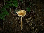
Götschenberg | NDM00090 |
Bischofshofen KG: Bischofshofen GrStNr: 589/22; 589/23; 595/7 location |
6.54 ha | 08/13/1969 | |
| Kreuzberg north of Bischofshofen | NDM00099 |
Bischofshofen KG: Winkl GrStNr: 933/3; 996; 12/1; 12/3; 23; 25; 26; 27/1; 45; 48/1; 48/2; 49; 16/3; 18. Location |
8.38 hectares | December 22, 1971 | ||

|
Gainfeld waterfall Laideregg | NDM00050 |
Bischofshofen KG: Bischofshofen GrStNr: 558; 576; Parts of 560/3; 575; 574/1; 577/1; 574/3; 583; 584 location |
The Gainfeld waterfall is formed by Gainfeldbach . It is 50 m below the Pongowe ruins and 50 m above the valley. It is accessed by a path and a bridge. The purpose of protection is to protect against disfigurement caused by buildings. | 1.86 ha | 11/18/1941 |
| Oak in Ausserfelden | NDM00043 |
Bischofshofen KG: Haidberg GrStNr: 304/1; 306/1; 383/1; Location |
The 500-1000-year-old oak is the only specimen in the area. | 51 m² | 02/19/1936 | |

|
Linden group at the inn "In der Fritz" | NDM00140 |
Eben im Pongau KG: Gasthof GrStNr: 3 location |
647 m² | 11/30/1976 | |
| 2 Swiss stone pines at the Oberhof farmer | NDM00178 |
Filzmoos KG: Neuberg GrStNr: 61; 72; 73; 86/1 location |
314 m² | 08/20/1980 | ||

|
Sycamore maple on a parcel of pasture belonging to the Judenhof farmer | NDM00005 |
Goldegg im Pongau KG: Goldegg GrStNr: 218 location |
51 m² | 06/20/1931 | |
| Summer linden u. Sycamore maple at the Untertaxbachgut | NDM00180 |
Goldegg im Pongau KG: Goldegg GrStNr: 1223; 1217/2; 1222/4 location |
0.13 ha | 01/22/1981 | ||
| Three beeches in Goldegg | NDM00004 |
Goldegg im Pongau KG: Goldegg GrStNr: 999 location |
150 m² | 06/20/1931 | ||

|
Sycamore maple on the Kogl in Goldegg | NDM00246 |
Goldegg im Pongau KG: Goldegg GrStNr: 400 location |
25 m² | 07/19/2001 | |
|
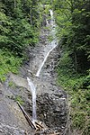
Waterfall on the lower reaches of the Klinglhubgraben | NDM00061 |
Grossarl KG: Unterberg GrStNr: 429 location |
The waterfall falls around 60 m. | 0.68 ha | 06/22/1959 |
| Book at the entrance to the Riedingtal | NDM00179 |
Mühlbach am Hochkönig KG: Mühlbach GrStNr: 676/42 location |
The two 140-year-old beeches with spherical crowns at the height of the Lettenalpshütte characterize the landscape. In 2015 only one of the two beech trees is standing, one fell victim to a snow break event. | 95 m² | October 23, 1980 | |

|
Mühlbachl in Pfarrwerfen | NDM00135 |
Pfarrwerfen KG: Dorfwerfen GrStNr: 88; 19/1; 62/1; 82/2; 64/1; 44 location |
The Mühlbachl has its origins in a meadow below the Perwein estate. It has an extraordinarily large gradient and was already used in the Middle Ages to drive 8 mills, 6 of which are still preserved. Considerable cultural value characterizes the landscape. | 0.18 ha | 05/26/1976 |
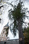
| Cedar at Feuerseng Gut | NDM00160 |
Pfarrwerfen KG: Grub GrStNr: 1281/1 location |
The 132-year-old cedar is unique in this area and shapes the landscape. The surrounding area is also protected with a radius of 15 m from the trunk. | 707 m² | 06/26/1978 | |
|
Larch trees in the shooting range | NDM00116 |
Radstadt KG: Radstadt GrStNr: 56/1 location |
0.16 ha | 07/12/1973 | |
| Swiss stone pine in the sports center in Radstadt | NDM00117 |
Radstadt KG: Radstadt GrStNr: 302/1 location |
707 m² | 12/12/1973 | ||

|
Loreto larches | NDM00121 |
Radstadt KG: Radstadt GrStNr: 262/1 location |
The Loreto larches are 17 larches, 1 spruce and 2 sycamore maples of unequal age at the foot of the alluvial mountain south of the Maria Loreto subsidiary church , some of which were probably planted by Count Ziurletti (died 1715). The surrounding area of 10 m radius per trunk is also protected. | 0.15 ha | December 27, 1973 |
|
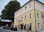
Linden trees with a city pond | NDM00147 |
Radstadt KG: Radstadt GrStNr: 40; 44/1 location |
Two linden trees, planted in 1875, stand at the gatekeeper , 18 and 20–22 m high, their chest height circumference was 3.45 to 3.50 m at the time of recording. The city pond has considerable cultural and historical value. | 0.3 ha | 08/30/1977 |

|
Wild woman hole | NDM00003 |
Radstadt KG: Löbenau location |
The Wilde Frauenloch is a fault gap in the so-called Wegerpalfen, around 100 m above the Wegerpalfenhütte . In the limestone rock there is a tunnel-like passage with a final shaft. | 3.41 ha | 06/19/1931 |
| Pond with Schernberg Castle Island | NDM00010 |
Schwarzach im Pongau KG: Schwarzach I GrStNr: 1747 location |
The pond and the island with the trembling aspen is located south of Schernberg Castle . | 707 m² | 04/12/1932 | |

|
Liechtenstein Gorge | NDM00051 |
St. Johann im Pongau KG: Plankenau location |
25.03 hectares | 09/22/1942 | |
| Oak group at the Wimmgut in St. Veit i. Pg | NDM00255 |
Sankt Veit im Pongau KG: Schwarzach II GrStNr: 901; 903 location |
0.12 ha | 05/04/2011 | ||
| Maple on the Postwiese in Untertauern | NDM00007 |
Untertauern KG: Untertauern GrStNr: 375/1 location |
51 m² | October 29, 1931 | ||
|
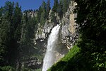
Johannes waterfall | NDM00008 |
Untertauern KG: Untertauern GrStNr: 578/2; 492; 493/1; 547/8 location |
The gorge of the Johannes waterfall, cut into the primary rock, falls over an approximately 130 m high rock step. The bed of the Taurach is also protected 100 m upstream and downstream and a 30 m wide strip of banks on both sides. | 1.2 ha | December 19, 1931 |

|
Sycamore maple in Lampersbach | NDM00146 |
Werfenweng KG: Werfenweng GrStNr: 1091; 1340 location |
707 m² | 08/30/1977 |
Notes / legend
| Photo: | Photography of the natural monument. Click the photo generates an enlarged view. There are also two symbols:
|
||||
| Surname: | Designation of the natural monument according to official sources | ||||
| ID | Identifier | ||||
| Location: | The municipality and, if available, the address are given. The cadastral community (KG) and the property number are listed below. By calling up the link Location , the location of the monument is displayed in various map projects. | ||||
| description | Brief description of the natural monument | ||||
| surface | Area of the natural monument in hectares (ha) | ||||
| date | Date or year of protection |
swell
- Natural monuments State of Salzburg. State of Salzburg, Geodata Infrastructure Unit, January 25, 2018, accessed on January 29, 2018 (License: Creative Commons Attribution 3.0 Austria ).
Web links
Commons : Natural monuments in the St. Johann im Pongau district - collection of images, videos and audio files
- Nature conservation book of the state of Salzburg
- Natural monuments of the State of Salzburg at data.gv.at