List of natural monuments in the Zell am See district
The list of natural monuments in the Zell am See district lists all objects designated as natural monuments in the Zell am See district in the state of Salzburg .
Natural monuments
| photo | Surname | ID | Location | description
|
surface | date |
|---|---|---|---|---|---|---|
| Linden tree near the church in Dienten | NDM00017 |
Dienten am Hochkönig KG: Dienten GrStNr: 46 location |
The summer lime tree ( Tilia platyphyllos ) had a height of 25 m and a breast height diameter of 1.70 m at the time of the investigation. With the linden tree, a surrounding ground strip with a 4 m radius from the trunk was placed under protection. | 51 m² | 01/10/1933 | |

|
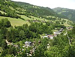
Hintersee in the Felbertal | NDM00021 |
Mittersill KG: Felbertal GrStNr: 283/4; 287 location |
The Hintersee is a mountain lake at an altitude of 1313 m at the head of the Felbertal. It is around 300 m long, 200 m wide and was created in 1495 by a landslide. It is fed by meltwater and rainwater from the surrounding mountains and is drained by the Felberbach. | 632.86 hectares | 01/20/1933 |
|
Maple group at the Thumersbach Chapel | NDM00022 |
Zell am See KG: Thumersbach GrStNr: 560; 561 location |
At the time of the investigation, the maple group consisted of 30 sycamores, including eight to ten old trunks. One tree was cut down in 1988 . A base strip of 3 m radius per trunk was also protected with the trees. | 1 ha | 02/17/1933 |
| Hardwood stand next to the kettle fall | NDM00023 |
Kaprun KG: Kaprun GrStNr: 71/2; 71/11; 71/5; 71/8; 71/10 location |
The forest to the left of the Kapruner Ache is overgrown with beech, sycamore maple and mountain elm. Also Biogenetic Reserve Hardwood inventory when - with natural forest reserve deciduous forest at the Kesselfall ( NWR00006 , about 45 ha) |
79.3 ha | 02/23/1933 | |
|
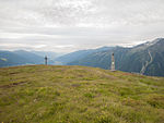
The summit of the Plattenkogel | NDM00024 |
Krimml KG: Krimml GrStNr: 434 location |
The dome-like primeval mountains were protected in a radius of 150 m from the Schwarzenberg monument. | 6.9 ha | 02/24/1933 |
|
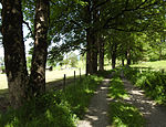
Maples around Kaprun Castle | NDM00025 |
Kaprun KG: Kaprun GrStNr: 1220/2 location |
The maple stock is in the north and east of Kaprun Castle. | 700 m² | 03/17/1933 |
| Kesselfall | NDM00032 |
Kaprun KG: Kaprun GrStNr: 1397 location |
The Kesselfall is accessed by a walkway and is framed by an old spruce stand. | 2.3 ha | 12/22/1933 | |
|
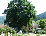
Oak at the Woferlgut in Bruck | NDM00035 |
Bruck an der Großglocknerstrasse KG: Bruck GrStNr: 207 location |
At the time of the investigation, the oak had a breast height diameter of 4.2 m. A radius of 4 m from the trunk was also protected. The tree was planted in memory of an executed ringleader during the Peasant War of 1525/26. | 51 m² | 12/22/1933 |

|
Sigmund-Thun-Gorge | NDM00037 |
Kaprun KG: Kaprun GrStNr: 1397; 345/2; 344/2; 344/1; 357/2 location |
5.38 hectares | 01/23/1934 | |

|
Krimml waterfalls | NDM00067 |
Krimml KG: Krimml GrStNr: 756; 382/2; 376/4; 376/2; 375/18; 375/19; 375/20; 377; 382/1; 726/1 ff. Location |
The Krimml Waterfalls are among the highest in the world, they fall in three stages 140 m, 100 m, and again more than 140 m in depth. They were awarded the European nature conservation diploma. The Krimmler Ache is protected from 100 m in front of the upper waterfall to 100 m after the lower waterfall and the area 200 m wide to the left and right of the Ache. | 57.75 hectares | 11/23/1961 |
| Sycamore maple above the Handlerhof in Hintermoos | NDM00112 |
Maria Alm am Steinernen Meer KG: Aberg GrStNr: 1152 location |
The sycamore maple ( Acer pseudoplatanus ) had a height of 30 m and a chest height circumference of 6.50 to 7 m, with a radius of 15 m also being protected. | 707 m² | 03/21/1973 | |
| Maple group in Maria Alm | NDM00115 |
Maria Alm am Steinernen Meer KG: Alm GrStNr: 1001/3 location |
The five, around 300-year-old maple trees stand next to the Almer Landesstraße and the Urslau . They were used to protect a base area with a 10 m radius from the trunk. | 0.11 ha | 07/02/1973 | |
|
Kratzenberg Lake | NDM00123 |
Hollersbach im Pinzgau KG: Hollersbach GrStNr: 356 location |
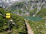
The Kratzenberg Lake is a high mountain lake at 2162 m above sea level. With it, a 250 m wide strip of land inland was placed under protection. | 95.99 ha | 09/02/1974 |
| Mitterkaser natural forest reserve | NDM00133 |
Weißbach bei Lofer KG: Oberweißbach GrStNr: 408; 412; 413; 417/1; 418; 415; 406/1; 406/2; 419; 455 location |
It is unique in its scope and structure for the Stone Sea . The natural forest reserve ( NWR00006 , approx. 90 ha) consists of larch, spruce, stone pine and mountain pine, and alpine wastelands are also part of the natural monument. Also extends into the municipality of Saalfelden . Also a biogenetic reserve ; mostly in ESG u. NSG Kalkhochalpen ( AT3211012 / 00009 / NSG00012 ), approx. 2 ha in NPK Weißbach ( Sbg.Nr. 3 ) |
425.51 hectares | 05/10/1976 | |

|
Seisenberg Gorge | NDM00138 |
Weißbach bei Lofer KG: Unterweißbach or Oberweißbach GrStNr: 422/1 or 463 location |
The Seisenbergklamm extends over a length of around 600 m and is up to 50 m deep. The surrounding rock is the Dachstein limestone from the Upper Triassic period. | 7.01 hectares | 11/23/1976 |

|
Lofer Bach | NDM00148 |
Lofer KG: Lofer GrStNr: 257/1; 220/1; 230/1; 230/2; 230/6; 230/8; 241/3 location |
3.61 ha | 09/16/1977 | |

|
Vorderkaserklamm | NDM00149 |
Sankt Martin bei Lofer KG: Obsthurn GrStNr: 15/1 location |
The 400 m long section of the Ödengraben consists of the main dolomite of the Upper Triassic period. There are fossilized calcareous algae, corals and remains of sea lilies. | 3.7 ha | October 18, 1977 |

|
Wasenmoos on the Thurn Pass | NDM00152 |
Mittersill KG: Pass Thurn GrStNr: 457; 463 location |
The Wasenmoos is located at around 1200 m above sea level in a flat-topped area. Here you will find dwarf birch (Betula nana), the bog king (Pedicularis palustris), butterwort (Pinguicula vulgaris) and sundew (Drosera sp.) As well as orchids (Orchis sp.), Swamp stendel (Epipactis palustris), fever clover (Menyanthes trifoliata and), peat mosses numerous sedge grass stocks. | 11.36 hectares | 06/16/1978 |

|
Sycamore maple in the Mayer wasteland | NDM00155 |
Kaprun KG: Kaprun GrStNr: 1319/2 location |
At the time of the investigation, the sycamore maple reached a height of 16 m, a crown width of 14 m and a breast height diameter of 1.4 m. A radius of 15 m from the trunk was also protected with the maple. | 707 m² | 06/16/1978 |

|
Untersulzbachfall | NDM00156 |
Neukirchen am Großvenediger KG: Sulzau GrStNr: 757; 301; 605/2; 618/1; 274; 275; 276 location |
The Untersulzbachfall is located at the exit of the Untersulzbach and represents a rock step over 100 m high. | 5.87 ha | 06/16/1978 |

|
Dust fall from toads | NDM00163 |
Unken KG: Gföll GrStNr: 642/1 location |
The fall of the Staubbach forms the border with Germany. The natural monument also extends to the course of the brook 50 m above the Staubfall and reaches as far as the confluence of the Staubbach and the Fischbach. A surrounding area with a 50 m radius was also protected. | 0.52 ha | 06/30/1978 |
| Thurnlöcher | NDM00164 |
Sankt Martin bei Lofer KG: Obsthurn or Wildenthal GrStNr: 222/1; 34; 39/4; 201/2; 29/1; 29/2; 202/5 or 400/2; 98/2 location |
3.84 ha | 06/30/1978 | ||
| Sycamore maple on the Mösernalpe | NDM00165 |
Unken KG: Gföll GrStNr: 1165/1 location |
The Sycamore increased above the base station of the double-lift Kammerköhr and dominates the landscape. At the time of the examination he had a diameter of 1.50 m at chest height. The surrounding area is also protected with a 15 m radius from the trunk. | 707 m² | 06/30/1978 | |

|
Hawthorn on the Niederhofberg | NDM00183 |
Bruck an der Großglocknerstraße KG: Reit GrStNr: 23/1 location |
The tree-like specimen of the common hawthorn had a height of 5 m at the time of the investigation, it grows on an unwooded pasture at an altitude of 1000 m and characterizes the landscape. The surrounding area is also protected with a radius of 5 m from the trunk. | 79 m² | 07/20/1981 |
| Mountain elm in the Stubach Valley | NDM00184 |
Uttendorf KG: Stubach GrStNr: 455/1 location |
This elm on a hillside is a specialty due to its age and shape, and, since the elm population in Pinzgau has decreased significantly, it is also a rarity. | 314 m² | 08/06/1981 | |

|
Sycamore maples in Weyer | NDM00187 |
Bramberg am Wildkogel KG: Bramberg GrStNr: 535/5 location |
At the time of the investigation, the two 150-year-old sycamores formed a common, powerful, spherical crown, each with a diameter of 1.2 m at chest height. Their height was 10 m. They shape the landscape, the surrounding area is also protected with a 3 m radius per trunk. | 29 m² | 11/24/1982 |
| Schößwendklamm in the Felbertal | NDM00189 |
Mittersill KG: Felberthal GrStNr: 254 location |
||||
| Linden tree at the Forsthof in Taxenbach | NDM00192 |
Taxenbach KG: Taxenbach location |
The 150 to 200 year old linden tree is on the western outskirts of Taxenbach. At the time of the examination, her diameter at breast height was 1.2 to 1.5 m, the crown diameter 10 to 12 m, and her height 20 m. From a height of 2 m, it divided into strong branches. It shapes the landscape. The surrounding area is also protected with a radius of 5 m from the trunk. | 79 m² | 02/01/1984 | |

|
Linde at the Kirchenwirt in St. Georgen | NDM00193 |
Bruck an der Großglocknerstrasse KG: St. Georgen location |
The Sommerlinde had the time of a height of 25 m, m a crown diameter of 16 m and a chest circumference of 7.2. It shapes the landscape. It was planted in 1732 when the Protestants were expelled. The surrounding area is also protected with a 3 m radius from the trunk. | 29 m² | 02/03/1984 |

|
Spruce at the ruins of the Weyer | NDM00194 |
Bramberg am Wildkogel KG: Bramberg GrStNr: 535/3 location |
The spruce, which stands on a hill, stands tall above a pasture and, together with the ruins of the Weyer, forms a good orientation point in the area. | 79 m² | 03/06/1984 |

|
Glacier pots on the Poschalm | NDM00200 |
Neukirchen am Großvenediger KG: Sulzau GrStNr: 686 location |
The two pots are at 1540 m above sea level on Obersulzbachtalstrasse; Diameter 3 m, depth 1.5 m; originated in the Würm Ice Age ; for the valley unique structures of geological past. | 157 m² | December 13, 1985 |
| Imperial linden tree in huts | NDM00201 |
Leogang KG: Sonnberg GrStNr: 132 Location |
The Kaiserlinde in Hütten is a 122-year-old winter linden . It was planted in 1898 on the occasion of the 50th anniversary of the reign of Emperor Franz Joseph I. At the time of the investigation, the tree branched at a height of around 1.10 m, the diameter of both trunks at breast height was over 1 m, the height 22 m, and the crown diameter 22 m. It shapes the landscape and has cultural and historical significance. The surrounding area is also protected with a radius of 5 m from the trunk. | 79 m² | 01/20/1986 | |
|
Gamseckfall in Obersulzbachtal | NDM00203 |
Neukirchen am Großvenediger KG: Sulzau location |
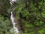
The Gamseckfall is one of the most beautiful natural spectacles in the Sulzbachtal, it is located about 100 m north-west of the Berndlalm guest house and shapes the landscape. The gorge area lies in the central gneiss of the Hohe Tauern, the stream bed is 3 to 4 m wide. The stream is protected over a length of 500 m with a strip of land on both sides, each 10 m wide. | 1.59 ha | 02/27/1986 |

|
Seebachfall in Obersulzbachtal | NDM00204 |
Neukirchen am Großvenediger KG: Sulzau location |
The Seebachfall is one of the most important natural monuments in the Obersulzbachtal, it is located about 100 m northwest of the Berndlalm guest house . At an altitude of 1400- 1500 m he flips over a 100 m high rock wall in the central gneiss. It shapes the landscape, and a 10 m wide strip of land on both sides is also protected. | 0.93 ha | 03/04/1986 |

|
Sycamore maples at Porsche Schüttgut | NDM00205 |
Zell am See KG: Bruckberg GrStNr: 307/1 location |
|||
| Haidnian Church in the Amertal | NDM00208 |
Mittersill location |
The massive, house-high gneiss block is part of a landslide debris field, it was said to have healing properties in the 18th century. The accessible gap probably got the name church from its dome-shaped overall impression. The different break points are very noticeable, the dome-like area is smooth, while the lower parts are slate-shaped. The upper side of the block is visible from the avalanche gallery on Felbertauern Straße ; it has a very advanced vegetation of Swiss stone pine, mountain pine, blueberries, sweet angel and goldenrod . | 0.28 ha | 04/22/1987 | |
| Prayer tree at the Schönbichlgut | NDM00214 |
Fusch an der Großglocknerstraße KG: Fusch GrStNr: 922/7 location |
||||
| Sycamore on the Saalalm | NDM00219 |
Saalbach-Hinterglemm KG: Hinterglemm GrStNr: 4 location |
||||
|
Birnbachloch in Leogang | NDM00222 |
Leogang KG: Ecking GrStNr: 600 location |
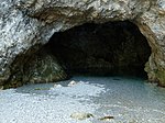
The Birnbachloch is a karst spring in the Leogang Steinberge at an altitude of 1291 m , its visual impression is determined by a 20 m wide, spacious entrance hall, in the background of which the Birnbach rises in a spring pot measuring around 5 m in diameter . The source pot gives the impression of an underground lake. A 30 m wide area is also protected on all sides of the Birnbach up to 150 m downstream of the source. | 0.79 ha | 08/16/1988 |
| Glacier pots on Grünsee | NDM00223 |
Uttendorf KG: Stubach GrStNr: 559/2 location |
||||
| Natural forest reserve Vorderweißtürchelwald | NDM00241 |
Rauris KG: Seidlwinkl GrStNr: 360. Location |
A spruce-larch-stone pine forest with blueberries, alpine currants and the like. a., merges into individual larch and pine fields, as well as an avalanche line (wasteland, 1.43 ha). Forest is a biogenetic reserve and a natural forest reserve ( NWR00006 , both 4.88 ha); in ESG and NPK core zone Hohe Tauern ( ESG AT3210001 / NP00001 ) |
6.45 ha | 04/06/1992 | |
| Hofrat-Breiteneder-spruce | NDM00242 |
Krimml KG: Krimml GrStNr: 596/3 location |
||||

|
Dripping in Maria Alm | NDM00247 |
Maria Alm am Steinernen Meer KG: Hinterthal GrStNr: 3/6; 29/5 location |
The "Triefen" is a water outlet over an impermeable rock layer, which is about 2-3 m above the Urslau flowing below . This creates a rain-like drip curtain of approx. 100 m length, which occurs regardless of the weather. The natural formation consists of the central part of a pending, very hard conglomerate body opened up by the Urslau. It is a Permian base conglomerate, a rock from the Variscan orogeny that looks like limestone towards the top. A continuous spring horizon runs horizontally through this conglomerate , which determines the hydrological peculiarity of the core area of the "Triefen". A tufa-like moss ceiling corridor formed over a large area. A total of 39 deciduous and 16 liverwort species as well as 96 fern and vascular plant species could be detected. The natural appearance of the "Triefen" is considered unique in the province of Salzburg in terms of its character, shape and extent and gives the landscape a special character. | 0.21 ha | 11/23/2001 |

|
Leitenkammerklamm | NDM00248 |
Krimml KG: Krimml GrStNr: 515/1, 522/2 location |
The Leitenkammerklamm is located in the Wildgerlostal at an altitude of around 1540 m . The geological subsoil is characterized by the appearance of eye and flaser gneiss with aplitic gneiss deposits. The Gerlosbach cut the gorge into a steep step in the valley. The immediate area of the gorge is approx. 100 m long and 5 to 20 m wide. The towering rock walls form gorges, forms of erosion such as washouts, whirlpool holes and pools structure the gorge, through which a footbridge leads. A hiking trail leads through the accompanying sub-alpine forest elements. Due to the pronounced forms of erosion, the gorge is also of scientific interest. A protective strip about 80 m wide is included on both sides of the natural monument. | 4.82 ha | 03/04/2002 |
Notes / legend
| Photo: | Photography of the natural monument. Click the photo generates an enlarged view. There are also two symbols:
|
||||
| Surname: | Designation of the natural monument according to official sources | ||||
| ID | Identifier | ||||
| Location: | The municipality and, if available, the address are given. The cadastral community (KG) and the property number are listed below. By calling up the link Location , the location of the monument is displayed in various map projects. | ||||
| description | Brief description of the natural monument | ||||
| surface | Area of the natural monument in hectares (ha) | ||||
| date | Date or year of protection |
swell
- Natural monuments State of Salzburg. State of Salzburg, Geodata Infrastructure Unit, January 25, 2018, accessed on January 29, 2018 (License: Creative Commons Attribution 3.0 Austria ).
Web links
Commons : Natural monuments in the Zell am See district - collection of images, videos and audio files
- Nature conservation book of the state of Salzburg
- Natural monuments of the State of Salzburg at data.gv.at
Individual evidence
- ↑ according to SAGIS, Gst.Nr. 207, KG Hohlwege, approx. 26.7 ha