
Grossarl
|
market community Grossarl
|
||
|---|---|---|
| coat of arms | Austria map | |
 |
|
|
| Basic data | ||
| Country: | Austria | |
| State : | Salzburg | |
| Political District : | St. Johann im Pongau | |
| License plate : | JO | |
| Surface: | 129.3 km² | |
| Coordinates : | 47 ° 13 ' N , 13 ° 11' E | |
| Height : | 924 m above sea level A. | |
| Residents : | 3,802 (January 1, 2020) | |
| Population density : | 29 inhabitants per km² | |
| Postal code : | 5611 | |
| Area code : | 06414 | |
| Community code : | 5 04 11 | |
| Address of the municipal administration: |
Marktplatz 1 5611 Grossarl |
|
| Website: | ||
| politics | ||
| Mayor : | Johann Rohrmoser ( ÖVP ) | |
|
Municipal Council : (Election year: 2019) (21 members) |
||
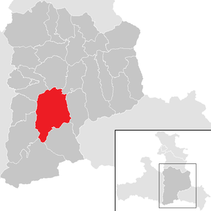
| Location of Großarl in the St. Johann im Pongau district | ||
  |
||
 Municipal Office |
||
| Source: Municipal data from Statistics Austria | ||

Großarl is a market town in the St. Johann im Pongau district in the south of the state of Salzburg (Austria) with 3802 inhabitants (as of January 1, 2020). The place is eponymous for the Grossarltal .
geography


Grossarl is located in the Pongau in the state of Salzburg, about 70 km south of the city of Salzburg . The Grossarltal is a branch of the Radstädter Tauern and separates the Hohe from the Niederen Tauern . It extends from the Arlscharte ( 2252 m ) over Hüttschlag ( 1030 m ), Großarl ( 924 m ) and the Liechtenstein Gorge. The main towns are Grossarl and Hüttschlag (Hohe Tauern National Park). The Großarltal is the easternmost Tauern valley and, along with the Gastein and Rauris valleys, is one of the longest Tauern valleys. The Grossarltal is 27 km long from the Keeskogel to the mouth of the Salzach.
Grossarl lies on a fog-free high altitude and is surrounded by mountains. The highest peak in the local area is the Gamskarkogel ( 2467 m above sea level ) on the southwestern municipal boundary. Its lowest point is in the Liechtenstein Gorge at 710 m above sea level. A.
Regarding its mouth, the Großarltal is a hanging valley that slopes down into the Salzach valley with an estuary that is over 200 meters high. The gradients of the road are accordingly. In the first 5 kilometers it overcomes a difference in altitude of 370 meters, in the second 5 kilometers it falls again by 120 meters and finally climbs almost 200 meters to the end of the valley. The road has many turns, from one old valley floor terrace to the other. Above the Stockergut the road is cut into the gorge limestone - it has to overcome the gorge limestone range of the Gölsenberg, which blocks the Grossarltal.
The Großarltal runs largely in a south-north direction and is drained from the Großarler Ache north to the Salzach . The valley of the Ellmaubach lies in the cadastral area of Großarl.
The local area is divided into the cadastral communities (from north to south) Au ( 850 m above sea level ), Schied ( 860 m ), Unterberg ( 900 m ), Grossarl ( 895 m ) and Eben and Bach ( 900 m ).
Geology of the Grossarl Valley

In the further course of the road, the repeated alternation between the gorge limestone and the slate limestone phyllite determines the course of the road. The ribs stretch across the valley and carry remains of old valley floors. From the protrusions, which always result from a gorge-lime crib, there is a view of the gorge. The bottom of the same can never be seen, however, mostly only the higher valley, formed by the Ice Age, into which the Grossarler Ache cut. A second limestone rib crosses the valley at Stegbachgraben. The abandoned tunnels are still reminiscent of calcite mining after the Second World War. The toll house "Alte Wacht" in the area of today's arch bridge on the Grossarler Landesstraße marks the border between St. Johann and Grossarl. On the western side is a bulge that came from a landslide.
At the Landstegbrücke, the road crosses the stream for the first time and from here on both run essentially parallel to the head of the valley. There are no valley steps worth mentioning, with the exception of one about 30 meters high at Oflegg between Grossarl and Hüttschlag. The most prominent mountain on the east side is the Saukarkopf ( 2048 m ). It rises from a plateau about 1800 m high. In the Ice Age, the ice flowed past about 100 meters below the summit. From the Landstegbrücke to the south, the valley is narrow again, it gives the impression of a notched valley. However, there are slopes on both sides that give the valley its current cross-section. The road climbs slightly through the alluvial cones of the Döppl and Schiedgraben. Due to the Schied- and the neighboring Augraben, the Großarler Landesstraße was mucked several times in the last decades and the valley was partially cut off from the outside world. To the south of the Hotel Schiederhof, the Radstädter Kalke come up to the Talaue on the left bank. After an expansion (by the Aubauer), block masses that pushed up to the stream on the east side and limestone rocks (with dolomite and dolomite breccia) on the west side caused a further narrowing of the valley floor (former quarry).
The districts of Großarl Markt and Unterberg are located on the largest and flattest floodplain in the Großarltal. Several stone ditches have deposited their alluvial cones in this flood plain - the Unterberggraben, opposite the Finsterleitgraben and the Ellmaubach. The largest side valley to the main valley was created through the Ellmaubach. The center of Grossarl stands on the alluvial cone of the Ellmau valley.
Around the Grossarl Plain, the mountains are somewhat rounded and wooded to below the peaks. The mountains in the south have a more distinctive shape. The pyramid of the Frauenkogel completes the view to the south. The geological subsoil becomes harder towards the south, chlorite slate, limestone mica slate and mica slate predominate. Here the valley is asymmetrical. On the east side, almost vertical walls of hard slate rise up, while the west slopes rise in bumps - despite the same subsoil. The Großarler Talaue ends at the valley level, on Oflegg. Here the Großarler Ache flows through the limestone mica schist that stands on both sides. On the right bank, a throwback knoll with a trained saddle pushes itself right up to the stream. In the following valley widening is the alluvial cone of the Tofernbach and you can see the neighboring village of Hüttschlag.
Vegetation and climate


Most of the Grossarltal's area is covered with coniferous wood. The local climate in Grossarl corresponds to the continental (low) montane altitude level with mild to hot summers and cold winters.
The annual average temperature is 8.1 ° C. The annual rainfall is 1298 millimeters. Most of the precipitation falls in July with an average of 191 millimeters, the least in February, March and November with an average of 70 millimeters.
Community structure
Grossarl has only consisted of a single village since 2018. The former villages of Au, Bach, Eben, Großarl, Schied and Unterberg are no longer considered separately. The community consists of the cadastral communities Au, Bach, Eben, Großarl, Schied and Unterberg.
On November 1, 2016, the community received new street names, which are named after the highest farm or after facilities such as school or church. For example: Schulgasse, Kirchgasse or Salzleckweg (after the most distant Salzleck farm on this street). The street names Au, Bach, Eben etc. are then no longer used. A total of over 1000 new addresses were assigned.
Neighboring communities
| St. Veit im Pongau | St. Johann im Pongau | Wagrain |
| Dorfgastein |
.svg)
|
Kleinarl |
| Bad Hofgastein | Hüttschlag | Kleinarl |
history
- Early history


The Grossarltal is not a historical ground like the Salzburg Basin or the Lungau. There are no prehistoric traces. Even the Romans left no evidence of their presence. There are no castle ruins in Grossarl. But tough farming families put their clearly legible stamp on the landscape. Everywhere you can still see how they penetrated the mountain forests and wrested the clod from the barren soil. In the 6th and 7th centuries, at the end of the Migration Period, the Bavarian people took possession of the land between the Danube and the Alps, but these peasant people found enough space in the foothills of the Alps and in the broader main valleys. The remote forest areas were only interesting for hunting. The Slavs advanced from the south and crossed the Tauern main ridge in some places, so that there were armed conflicts in which the Bavarians remained victorious. Some field names are still reminiscent of the losers.
- middle Ages
The Grossarl Valley area is first mentioned in an exchange document from Archbishop Adalbert II from 930. The pre-German brook name Arla (930), Arela (1074), Arula maiori (1306) gave the area between today's Großarl and Kleinarl valleys its name. The area was later named "Michel Arl", "Mehrer Arl" and finally Grossarl.
Around the year 1000, the Salzburg church took over the forest and pasture area under its land authority. The expansion of the Pongau up to the natural border of the Tauern main ridge and the use of the grasslands above the high forest border prompted the manor to develop the country early through large-scale clearing. At the beginning of the 12th century, farms were founded on the alluvial cones of the Großschwaigen valley, as well as on the lower slopes of the valley. The farmers who settled there had to pay in kind to the manor, especially cheese, live animals, butter and lard. "Normal goods" were built by further clearing up to the higher altitudes. These had to pay monetary contributions to the church in Salzburg. The agricultural expansion of Grossarltal was completed around the middle of the 12th century, the economy flourished in the mountain valley. In 1348/49 the valley was also ravaged by the plague. Many farms were considerably depopulated and deserted afterwards, and economic development was severely disrupted. At the "Kalichgruben" in the mouth of the Ellmaubach, where the stream did not freeze so much in winter due to the favorable location, the first commercial and craft businesses were founded. A village was probably soon built around this, as Archbishop Gregor granted the market rights for 5 free markets annually as early as 1399 . Around 1400 a separate parish was established, which included the whole of Grossarltal for pastoral care. A church is mentioned as early as 1339. Today's parish church - a single-nave hall structure - dates back to 1768/69. A larger chapel is said to have existed in the lifting goods area as early as 1050. The pastoral care before the establishment of a separate parish was incumbent on the parish of St. Veit im Pongau.
- Modern times
Mining in the rear Grossarl Valley since the beginning of the 15th century ushered in a new economic boom. In 1520, the most modern smelter for the time was put into operation in Hüttschlag. It had a precursor in the Auweil (today Wolfau), on the alluvial cone of the Hubalm stream. Here in Wolfau and other parts of the valley, Sölen (small-scale traders) were founded for down-to-earth miners and smelting works. They comprised residential houses, stables, gardens and pastures on the Freiberg mountains of the “high princely Frei”. The winter fodder was made by the farmers in the mowing of the mountains or during the harvest. The Kößlerhäusl is a typical facility here (halfway between Grossarl and Hüttschlag, still very original and therefore set up as a museum today). Around 1620 the archbishop's court chamber in Salzburg took over the mining trade on its own. A new period of prosperity began. In 1675 the pastoral care district of Grossarl and Hüttschlag was separated and in 1679 the baroque church was built.
In the 16th century, Grossarl had a special court staff, from 1562 officiating judges from Werfen and in 1672 its own regional court was established. In 1709 their own courthouse was even built. With the decline of mining in the sixties of the 19th century, the economy of the entire valley sank back to its rural and rural originality.
Lutheranism, presumably promoted by miners and preachers from Carinthia, quickly gained a foothold in Grossarltal. From 1575 farmers were banished from the country forever because of the new doctrine. In 1675, 96 people were expelled for the first time. At the beginning of the 18th century, the majority of the valley's population was Protestant and also professed the new teaching. In 1731/32, on the orders of the Prince Archbishop, 551 people moved out. Most of them were peasant families who emigrated to East Prussia leaving behind their belongings. With a population of 2324 (2223 of them rural), this was a severe "blood loss" from which the valley would find it difficult to recover in the period that followed. The secularization (1802) of the ecclesiastical prince-archbishopric of Salzburg (installation of a secular ruler) and the basic relief (1846) brought great economic hardship to the Grossarltal. The valley was spared the turmoil of the Napoleonic Wars, it was too remote for that. In the period that followed, earning opportunities in the valley were very low. Cattle breeding and the logging industry provided the majority of the families poorly with food, but the year-round migration was not very large. At times, however, people were looking for opportunities to earn money outside of the valley. Today, however, the situation has improved significantly and modest prosperity has moved in.
- 20th century
Subsequently, the two world wars at the beginning of the 20th century left deep wounds. Many people had to go to war and in Grossarl there was bitter hardship. Food was scarce and there was a lack of workers to farm the land. Grossarl recovered from this terrible time only slowly.
Caused by the development of traffic, motorization and mechanization, an increasing migration from agriculture began in 1960. Tourism, which was built up in Grossarl through a private initiative, brought an economic boom for the whole valley. However, this also brought great demands on the municipal administration. New schools, roads and sports facilities had to be built. The sewer system was expanded and the zoning plan redesigned. On June 17, 1962, Grossarl was elevated to market status and five years later the Grossarl mountain railways were founded and the first lift system was built. From 1971 the tourism industry rose by leaps and bounds. The merger with the Gastein Valley and the establishment of the Großarltal-Dorfgastein ski area initiated an upswing for the entire economy in Großarl. As a result, many improvements to the infrastructure could be achieved and many necessary facilities for the population were created. Since then, Grossarl has experienced rapid development - above all through tourism.
coat of arms
Grossarl got its coat of arms in 1965. It shows a green heraldic alder on a white background. The representation of the alder is said to allude to the unreadable pre-German place name “Arla” - in 930 “dua flumina Arla ad Pongowe” are called and in 1339 a valley in the “merern Arel” is mentioned. The alder mark indicates the great clearing activity from the 11th to the 13th century, which resulted in the settlement of the valley. The alder should also show the great importance of the valley's timber industry. Regarding the symbol itself, it should be said that the roots of the alder are meant to symbolize the valley dwellers' closeness to the ground and the leaves to symbolize Grossarl's large number of children.
Population development
| Resident population current territorial status |
|
|---|---|
| date | Residents |
| 1869 | 1685 |
| 1880 | 1682 |
| 1890 | 1623 |
| 1900 | 1585 |
| 1910 | 1732 |
| 1923 | 1728 |
| 1934 | 1994 |
| 1939 | 2040 |
| 1951 | 2326 |
| 1961 | 2574 |
| 1971 | 2915 |
| 1981 | 3043 |
| 1991 | 3376 |
| 2001 | 3634 |
| 2007 | 3728 |
Grossarl has experienced steady population growth since the mid-1930s. In the years from 1923 to 1934 alone, Grossarl gained 266 additional residents.
At the beginning of 2007 there were 3728 people in Grossarl. According to the last census in 2001 there were 3,634, of which 5% were not born in Austria. 4.5% of Grossarl are not Austrian citizens . 51 people are of Turkish origin and 57 people from the former Yugoslav countries Croatia , Bosnia-Herzegovina , Serbia and Slovenia . 32 residents have German citizenship .
politics
The community council has a total of 21 members.
- With the municipal council and mayoral elections in Salzburg in 2004, the municipal council had the following distribution: 12 ÖVP and 9 SPÖ.
- With the municipal council and mayoral elections in Salzburg in 2009 , the municipal council had the following distribution: 14 ÖVP and 7 SPÖ.
- With the municipal council and mayoral elections in Salzburg in 2014 , the municipal council had the following distribution: 12 ÖVP and 9 SPÖ.
- With the municipal council and mayoral elections in Salzburg 2019 , the municipal council has the following distribution: 13 ÖVP, and 8 SPÖ.
- mayor
- 1994–1998 Peter Hettegger (ÖVP)
- 1998–2011 Josef Gollegger (ÖVP)
- since 2012 Johann Rohrmoser (ÖVP)
economy
Over the years, many small and medium-sized businesses (carpentry, carpentry, earthworks and building construction companies, etc.) have settled in Großarl and have thus become important employers for the residents of the community.
Großarl is a very tourist-oriented municipality. The number of beds is now around 5500. Grossarl has hotels and accommodation providers in all categories. Particularly noteworthy is the density of four-star hotels in the valley. With almost 40 managed alpine pastures , Grossarl is also known as the “valley of the alpine pastures”.


In summer, hiking is the focus in Grossarltal. Around 400 km of marked hiking trails from easy to difficult are available. Other activities in Grossarl include mountain biking on approx. 140 km of signposted mountain bike trails, climbing and fishing. There is also a leisure center with an outdoor swimming pool, soccer field, multi-purpose field, beach volleyball court, mini-golf, tennis courts and the adventure playground Rucki Zucki's Gaudi-Alm. For some years now there has also been a cycle route through the valley, the Grossarltal cycle and walkway. This runs from the Landstegbrücke to the head of the valley, mostly along the banks of the Großarler Ache. It is mostly gravel, but is to be paved in Grossarl in the next few years.
The Großarltal is part of Ski amadé and with the Großarltal-Dorfgastein ski area in the area of the Fulseck and Kreuzkogel has around 80 kilometers of slopes and numerous lifts. Around 80% of the slopes can be technically snow-covered. There are also around 25 kilometers of cross-country skiing trails (classic and skating), 35 kilometers of cleared winter hiking trails and an illuminated, traffic-free toboggan run at the Hotel Lammwirt in Grossarl's Ellmautal, an ice rink, curling and horse-drawn sleigh rides for winter sports enthusiasts. Snowshoe hikes and ski tours away from the Grossarltal-Dorfgastein ski area are also possible.
Culture and sights

Anyone who has covered about half the way from St. Johann on Großarler Landesstraße used to have to drive through a house at the point where the 196 meter long bridge is now, called the "Stegenwacht" or "Alte Wacht". The name comes from the footbridge that led into the valley before the road was built into the rock and from a guard who once stood here. There was a care that Viktualien was not brought out of the valley to the detriment of the trading relatives . When the plague raged in 1655, the point was even manned by soldiers in order to avoid contact with "outsiders" as much as possible and thus to keep the risk of infection low. In the following century the "Alte Wacht" was closed several times in order to keep people away from the valley or not to let them out of the valley. Today the "Alte Wacht" is the oldest still preserved toll booth in the Salzburger Land. Opposite the “Alte Wacht” on the left side of the Großarler Ache are the “Heidenlöcher” in an almost vertical rock face. There are five more or less round rock holes. The opening of the two middle ones is so large that a person can stand comfortably in it. According to old popular belief, stubborn pagans withdrew here when they no longer felt safe enough among the predominantly Christian population. Further sights are the Liechtenstein Gorge , the alpine huts, some of which are several hundred years old, and the parish church in baroque style.
- Regular events
Every year the Cäcilia concert takes place in the parish church of Grossarl in honor of St. Cecilia .

The concert is organized by the Grossarl Trachtenmusikkapelle and is very popular with the residents of the valley and a considerable number of spectators every year.
The Salzburg Mountain Advent Grossarltal has been taking place for the first time since 2007 during Advent . 30 small wooden huts will be set up in the center of Großarl, where home-baked bread, arrangements, mulled wine, chestnuts and many other items suitable for Advent are sold. At the entrance to the Großarltal valley, by the old watch, there is a living nativity scene with four sheep and a donkey.
Other Events:
- International old scout meeting
- Lady ski week
- Krampus run in the center of Großarl
- Folk culture and clubs

The residents of Grossarltal attach great importance to customs and folk culture. There are many associations that maintain the traditional customs, including a. the traditional costume music band Grossarl, the Bauernschützen , the Klöcker and Herreiter, the Grossarltal Volktanzgruppe, the Grossarl Volunteer Fire Brigade , the Grossarl Mountain Rescue , the Grossarl Comradeship Association .
Alpine pastures in Grossarltal
There are around 40 managed alpine huts in Grossarltal, which is the highest density of managed alpine pastures in the province of Salzburg. The wealth of managed alpine pastures has earned the Grossarltal the nickname “The Valley of the Alpine Pastures”. Most of the alpine pastures are cultivated from mid-June to mid-September. The dairymen offer hikers bread, butter, cheese, bacon, sausage and schnapps from their own production. The alpine pastures can be reached either on hiking trails or along the forest roads.
education

- kindergarten
- since 2018 only one elementary school (formerly 2: VS Großarl, VS Au)
- secondary schools
- Polytechnic school
traffic
Coming from Vienna, Munich, Salzburg or Villach along the Tauern Autobahn A10 to the Bischofshofen exit. Then continue on the B311 to St. Johann / Pongau and from there on Großarler Landesstraße (L109) to Großarl.
On May 27, 2017 at around 5 p.m., a boulder fell on the abutment of a bridge on the L109 and into the Liechtenstein gorge in the area of the deep view. For investigations, the state road was closed with the bridge and - after damage to footbridges in the gorge - hikers were led out of the gorge via emergency paths.
The state road L 109 runs through Grossarltal. Grossarl does not have a stop on the Austrian rail network . However, there is an hourly bus from St. Johann / Pongau to Grossarl. The community is not affected by transalpine transit traffic, which means that there is only moderate traffic in Grossarltal.
Sports

- Skiing
The Grossarltal - Dorfgastein ski area , part of Ski amadé , has around 80 slopes with five gondolas, eight chair lifts and five drag lifts. It extends over the Kreuzkogel , from 885 m near Grossarl to an altitude of 2027 m , where the connection to the Gastein Valley to Dorfgastein is. In the future there are plans to build a second ski swing connection to Dorfgastein with three single-cable gondolas and a detachable chairlift in the Kieserl area ( 1953 m ). The transport capacity is around 29,000 people per hour. Every year numerous races of country Ski Salzburg held in Großarl.
Interesting is the valley region, with the national park community of Hüttschlag , even for hikers , cross country skiers and winter hikers , as the ski circus only focused on one area. A cross-country ski run runs from the southern end of the community of Unterberg along the Großarler Ache to Hüttschlag in the south and with a short break from Hüttschlag to the head of the valley.
- Soccer
The USV Großarl was founded in 1962 and plays in the 2010/11 season in the 2. Landesliga Süd, in the Salzburg lower house. In 1967 the club was registered with the Salzburg Football Association for the first time. The first championship title was won in the 1978/79 season. The result was promotion to 1st class south, but a little later the descent to second class took place again.
In the 2009/10 season, USV Grossarl was crowned champion in the 2nd class South-West with the same number of points and only two goals ahead of pursuers SK Lenzing.
With the introduction of the Salzburg League and the restructuring of the individual leagues, the USV Grossarl rose directly to the 2nd Regional South League.
A highlight of the season is the derby between USV Grossarl and USV Hüttschlag. This soccer game attracts soccer fans from all over the region and regularly has more than 1000 spectators.

- Section Head
- Josef Ammerer (1966–1971)
- Hubert Schwarz (1971–1972)
- Heinz Scheran (1972–1976)
- Erich Pichler (1976-1981)
- Dieter Klausner (1981-2011)
- Markus Diess (since 2011)
- successes
- Champion 2nd class south A 1979/80
- Champion 2nd class south-west 2009/10
Personalities
Sons and Daughters of the Church:
- Anton Sauter (1800–1881), botanist and physician, brother of Ferdinand Sauter , co-founder of the GSLK (Society for Salzburg Regional Studies)
- Ignatius Rieder (1858–1934), 1918–34 Archbishop of Salzburg
- Alois Rohrmoser (1932–2005), founder of the Atomic ski factory
- Ignaz "Lindy" Lindmoser (1934–2008), boxer, American and Canadian amateur state champion
- Matthias Christian (* 1941), philosopher
- Edmund Entacher (* 1949), retired chief of the General Staff D. of the Austrian Armed Forces
- Franz Wenger (* 1950), politician (ÖVP) and state official
- Wolfram Paulus (1957–2020), film director and screenwriter
- Silvester Gfrerer (* 1959), politician (ÖVP), Federal Councilor
People related to the municipality:
- Balthasar Linsinger (1902–1986), pastor in Grossarl from 1943 to 1954, Righteous Among the Nations
- Sepp Forcher (* 1930), TV presenter, 1955–59 hut landlord at the Berglandhaus in Grossarl
- Angelica Bäumer (* 1932), art critic, exhibition curator and author, survived the last year of the war as a submarine in Grossarl
- Johann Ganitzer (* 1961), politician (SPÖ), vice mayor and member of the state parliament
Web links
- 50411 - Grossarl. Community data, Statistics Austria .
Individual evidence
- ↑ Statistics Austria: Population on January 1st, 2020 by locality (area status on January 1st, 2020) , ( CSV )
- ↑ Note: The population figures in the table are based on the information provided by the Austrian statistical office and have been converted to the current territorial status. From 1869 onwards, censuses were held in Austria at ten-year intervals, although the civilian population still present was counted until 1923; the resident population only from 1934 to 1981. The figures from 1982 to 2001 show the annual average population. Since 2002, main residences have been used to determine the population on the basis of the central register of residents .
- ↑ Peter Hettegger . In: Salzburger Nachrichten : Salzburgwiki .
- ↑ Josef Gollegger . In: Salzburger Nachrichten : Salzburgwiki .
- ↑ Johann Rohrmoser . In: Salzburger Nachrichten : Salzburgwiki .
- ↑ The Heidenlöcher in Grossarl, legend
- ↑ Salzburg Travel Guide, Greetings Karl
- ↑ Landslide: Liechtensteinklamm evacuated orf.at, May 27, 2017, accessed May 27, 2017.
- ↑ Ski regions: Grossarltal-Dorfgastein ski area . Ski amadé
- ↑ Grossarl Valley . bergfex.at - with a piste map
- ^ Grossarl-Dorfgastein: New major investment - salzburg.ORF.at. October 15, 2015, accessed May 18, 2017 .
- ↑ Iganz Lindmoser. Vancouver, British Columbia. Retrieved July 27, 2018 .

Altenmarkt im Pongau | Bad Gastein | Bad Hofgastein | Bischofshofen | Dorfgastein | In the Pongau | Filzmoos | Flachau | Forstau | Goldegg im Pongau | Grossarl | Hüttau | Hüttschlag | Kleinarl | Mühlbach am Hochkönig | Parish throw | Radstadt | St. Johann im Pongau | St. Martin am Tennengebirge | St. Veit im Pongau | Schwarzach im Pongau | Untertauern | Wagrain | Throw | Werfenweng