
Parque Batlle


Parque Batlle is a district ( barrio ) of the Uruguayan capital Montevideo .
The district listed on the official map of the Uruguayan Statistics Institute together with the Barrio Villa Dolores is divided by the districts of Tres Cruces (west and northwest), La Blanqueada (north), Unión (north), Buceo (east) and Pocitos (south) surround. The boundaries are formed by the Avenida F. Rivera to the south and west of the Bulevar Artigas and the Avenida Italia . The latter in turn also represents the boundary to the north, while in the northeast the Bulevar Batlle y Ordonez serves as a dividing line. The area of Parque Batlle is assigned to the Municipio CH .
This is where the Estadio Centenario and the Monumento La Carreta, created by the artist José Belloni , are located . The latter is located in Parque Batlle y Ordoñez on Avenida Dr. Lorenzo Mérola . Hospital Británico is located on Avenida Italia in the northwest of the district .

Estadio Centenario

La Carreta Monument
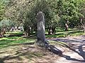
Monument in the Parque José Batlle y Ordóñez

Hospital Británico


Web links
Individual evidence
- ↑ Map of the Instituto Nacional de Estadística with the division of the barrios (PDF; 1.6 MB)
- ↑ La Carreta on montevideo.gub.uy ( Memento of the original from June 4, 2011 in the Internet Archive ) Info: The archive link was inserted automatically and has not yet been checked. Please check the original and archive link according to the instructions and then remove this notice.
- ^ Official website of the Hospital Británico

Aires Puros | Atahualpa | Bañados de Carrasco | Barrio Sur | Belvedere | Brazo Oriental | Buceo | Capurro - Bella Vista | Carrasco | Carrasco Norte | Casabó - Pajas Blancas | Casavalle | Castro Castellanos | Centro | Cerrito de la Victoria | Ciudad Vieja | Colón Centro y Noroeste | Conciliación | Colón Sureste - Abayubá | Cordón | Figurita | Flor de Maroñas | Ituzaingó | Jacinto Vera | Jardines del Hipódromo | La Aguada | La Blanqueada | La Comercial | La Paloma - Tomkinson | La Teja | Larrañaga | Las Acacias | Las Canteras | Lezica - Melilla | Malvín | Malvín Norte | Manga | Manga - Toledo Chico | Maroñas - Parque Guaraní | Mercado Modelo y Bolívar | Nuevo París | Palermo | Parque Batlle , Villa Dolores | Parque Rodó | Paso de la Arena | Paso de las Duranas | Peñarol - Lavalleja | Piedras Blancas | Pocitos | Prado - Nueva Savona | Punta Carretas | Punta de Rieles - Bella Italia | Punta Gorda | Reducto | Sayago | Tres Cruces | Tres Ombúes - Pueblo Victoria | Unión | Villa del Cerro | Villa Española | Villa García - Manga Rural | Villa Muñoz - Retiro
Coordinates: 34 ° 54 ′ S , 56 ° 9 ′ W