Wartmannstetten
|
market community Wartmannstetten
|
||
|---|---|---|
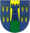
| coat of arms | Austria map | |
|
|
||
| Basic data | ||
| Country: | Austria | |
| State : | Lower Austria | |
| Political District : | Neunkirchen | |
| License plate : | NK | |
| Surface: | 21.58 km² | |
| Coordinates : | 47 ° 41 ' N , 16 ° 4' E | |
| Height : | 419 m above sea level A. | |
| Residents : | 1,623 (January 1, 2020) | |
| Population density : | 75 inhabitants per km² | |
| Postal code : | 2620 | |
| Area code : | 02635 | |
| Community code : | 3 18 44 | |
| NUTS region | AT122 | |
| Address of the municipal administration: |
Dorfstrasse 7 2620 Wartmannstetten |
|
| Website: | ||
| politics | ||
| Mayor : | Johann Gneihs ( ÖVP ) | |
|
Municipal Council : (2020) (19 members) |
||
| Location of Wartmannstetten in the Neunkirchen district | ||
| Source: Municipal data from Statistics Austria | ||
Wartmannstetten is a market town with 1623 inhabitants (as of January 1, 2020) in the Neunkirchen district in Lower Austria .
geography
Wartmannstetten is located in the industrial district in Lower Austria. The area of the market town covers 21.41 square kilometers. 54.0 percent of the area is forested.
Community structure
The municipal area comprises the following eight localities (population in brackets as of January 1, 2020):
- Diepolz (99)
- Gramatl (112)
- Hafning (135)
- Ramplach (438)
- Strasshof (158)
- Unter-Danegg (90)
- Wartmannstetten (565)
- Weibnitz (26)
The community consists of the cadastral communities Diepolz, Hafning, Ramplach, Straßhof, Unterdanegg and Wartmannstetten.
Neighboring communities
history
In ancient times, the area was part of the Noricum province .
Wartmannstetten was first mentioned in 1192 in the "Formbacher Traditionscodex". Early historical finds and excavations show that the settlement in the municipality goes back much further. The Wartmannstetter homeland researcher Michael Puhr has u. a. Finds from the Stone Age (fire drill), Bronze Age (copper smelting furnaces and pans in the Tobel near Hafning), the younger Iron Age (finds of remains of Celtic settlement sites) and the Roman Age (brick kilns) are documented.
Incorporations
On January 1, 1971, the communities Hafning, Ramplach, Straßhof and Unterdanegg were incorporated into Wartmannstetten.
Population development

religion
According to data from the 2001 census , 85.9% of the population are Roman Catholic and 2.6% Protestant . 2.3% are Muslims , 0.1% belong to Orthodox churches . 7.6% of the population have no religious denomination.
politics
The municipal council has 19 members.
- With the municipal council elections in Lower Austria in 1990, the municipal council had the following distribution: 15 ÖVP and 4 SPÖ.
- With the municipal council elections in Lower Austria in 1995, the municipal council had the following distribution: 13 ÖVP and 6 SPÖ.
- With the municipal council elections in Lower Austria in 2000, the municipal council had the following distribution: 13 ÖVP and 6 SPÖ.
- With the municipal council elections in Lower Austria in 2005 , the municipal council had the following distribution: 14 ÖVP and 5 SPÖ.
- With the municipal elections in Lower Austria in 2010 , the municipal council had the following distribution: 15 ÖVP and 4 SPÖ.
- With the municipal council elections in Lower Austria in 2015 , the municipal council had the following distribution: 16 ÖVP and 3 SPÖ.
- With the municipal council elections in Lower Austria 2020 , the municipal council has the following distribution: 15 ÖVP and 4 SPÖ.
- mayor
- until 2009 Franz Hubinger (ÖVP)
- since 2009 Johann Gneihs (ÖVP)
Culture and sights
- Catholic Marien-Dankes-Kirche Wartmannstetten
economy
In 2001 there were 46 non-agricultural workplaces, agricultural and forestry operations 93 according to the 1999 survey. According to the 2001 census, the number of people in employment at the place of residence was 804. The 2001 participation rate was 48.89 percent.
Web links
- Website of the market town of Wartmannstetten
- 31844 - Wartmannstetten. Community data, Statistics Austria .
Individual evidence
- ↑ Statistics Austria: Population on January 1st, 2020 by locality (area status on January 1st, 2020) , ( CSV )
- ^ Result of the local council election 1995 in Wartmannstetten. Office of the Lower Austrian State Government, March 30, 2000, accessed on October 1, 2019 .
- ^ Election result of the municipal council election 2000 in Wartmannstetten. Office of the Lower Austrian State Government, February 4, 2005, accessed on October 1, 2019 .
- ^ Election result of the municipal council election 2005 in Wartmannstetten. Office of the Lower Austrian State Government, March 4, 2005, accessed on October 1, 2019 .
- ^ Election result of the municipal council election 2010 in Wartmannstetten. Office of the Lower Austrian State Government, October 8, 2010, accessed on October 1, 2019 .
- ^ Election result of the 2015 municipal council election in Wartmannstetten. Office of the Lower Austrian state government, December 1, 2015, accessed on October 1, 2019 .
- ↑ Results of the municipal council election 2020 in Wartmannstetten. Office of the Lower Austrian State Government, January 26, 2020, accessed on January 26, 2020 .


