
Rastpfuhl

.jpg)
Rastpfuhl (in the local dialect Raschpuhl ) is a district in the north of the core city of Saarbrücken and belongs to the Malstatt district .
geography
The Rastpfuhl borders on a large, contiguous forest area to the north and west. In the west, Hubert-Müller-Strasse forms the border of the Rastpfuhl buildings; in the north, the forest itself is the border. In the east the Rastpfuhl borders on the Rußhütte district , which has developed along the Fischbach valley . There is no sharp border in the south. In general, however, the Rheinstrasse is viewed as the southern border. Formally, Trifelsstraße forms the border of District 126 (Rastpfuhl) in the southeast. The district covers an area of 159 hectares (1.59 km²).
The Rastpfuhl rises from the south from approx. 230 m above sea level. NN to the north continuously up to approx. 288 m above sea level. NN . The gradients in the upper Rastpfuhl are considerable. Therefore, in the 1960s, the Lebacher Landstrasse was "lowered", i. that is, a valley cut was created. The area around the “Rastpfuhl” street is in a small depression. To the east, the Rastpfuhl falls steeply into the Fischbach valley.
history
The Rastpfuhl has its origin in its current center, in the small depression around the street "Rastpfuhl". There was probably a resting place with a watering place ( pool ). The name Rastpfuhl appears for the first time in a ban map from 1763. Another interpretation says that the name of the former Rest bach derived. The Rastbachweg street still reminds of this today. The area of today's Rastpfuhl was initially completely forested. Only in today's center was a small courtyard.


The Rastpfuhl-Hof was originally a gatehouse on the wild fence of the Malstatter Forest. (The gatehouse on Ludwigsberg and the chair set house near Scheidt have the same origins.) In 1756, Prince Wilhelm Heinrich had the forest cut down and a courtyard laid out here. In addition, Wilhelm Heinrich bought the house of the Rastpfuhl goalkeeper and woodcutter König, which then served as the official residence of the manorial courtier. A sheep farm had already been established on the Rastpfuhl under Count Friedrich Ludwig , Wilhelm Heinrich's predecessor. The two farms were subsequently given to different tenants. In 1767 the Rastpfuhler Hof had 7 acres of courtyard ring and gardens, 50 acres of meadows, 306 acres of arable land and 127 acres of cut forest. 250 sheep and 300 mutton were kept in the sheep farm. Since 1776, the children of the former goalkeeper König laid out an inn on the Rastpfuhl. In 1843, 44 people lived on the Rastpfuhl and the nearby brickworks. At that time the plant had six houses. Only at the beginning of the 20th century, with the demolition of the half-timbered building of the princely tithe barn on the Rastpfuhl, the last testimony to the Rastpfuhler Hof was demolished.
At the beginning of the 20th century, the first other buildings outside of today's center appear in the city plans: a brickworks at the end of today's street “Im Knappenroth”, a few houses in today's Köllertalstraße and the Rastpfuhl hospital (now the Caritas clinic). With the construction of a number of standardized settlement houses in the 1930s, the Rastpfuhl expanded considerably to the north. However, the current size was only achieved after the Second World War .
Population and social structure
The population of the Rastpfuhl district is 5020 (as of January 31, 2018).
traffic
The main traffic axis of the Rastpfuhl is the federal road 268. In the north the B 268 merges into the A1 motorway . The first and so far only line of the Saarbrücken Stadtbahn (" Saarbahn ", line S1) runs on or along the B 268 . In the lower section the B 268 is called Lebacher Straße, in the upper section Lebacher Landstraße. The center of the Rastpfuhl is the section between Lebacher Strasse and Lebacher Landstrasse. Here the B 268 is called "Rastpfuhl".

The Lebacher Landstrasse divides the upper Rastpfuhl into two parts: the "similar Seid" and the "anner Seid". The assignment depends on the point of view. Hubert-Müller-Straße connects the Rastpfuhl and the A1 with the Burbach district. The Rußhütte district and the Fischbachtal can be reached via Rußhütter Strasse. The main east-west connection is the Rheinstrasse on the southern border of the Rastpfuhl.
Educational institutions
- Elementary school and all-day elementary school Rastpfuhl
- Saarland University of Technology and Economics (HTW) - University of Applied Sciences: Department of social work and childhood education
Churches


Catholic churches
- Catholic Church of St. Anthony of Padua (former Franciscan monastery church)
In 1920 the Franciscan order bought the house Rastpfuhl 12 at the end of the upper Malstatt at that time. In the following years today's church of St. Antonius of Padua and the monastery buildings were built. The inauguration took place in 1929. The Bishop of Trier, Franz Rudolf Bornewasser, set up the pastoral care district of St. Antonius without its own asset management, dependent on the mother parish of St. Josef in Malstatt. He entrusted the pastoral care of the young community on the Rastpfuhl to a member of the monastery. After war damage and changes in reconstruction, a parish home with a kindergarten was built in Lebacher Strasse in 1953. In 1954, St. Antonius was officially raised from a vicarie to a parish. In 1965 the Franciscans sold the monastery church and the monastery to the diocese of Trier and the parish and established a Franciscan educational facility in the nearby Rhönweg. The parish opens a kindergarten and a parish office. The parish home with kindergarten on Lebacher Strasse was rented to Caritas in 1981 and sold in 1997. As a result, extensive renovation work was initiated on the former monastery building and the Catholic University of Applied Sciences for Social Work began its activities here. The technical college was closed in 2008. The course was relocated to the University of Applied Sciences (HTW) Saarbrücken . In 1999 the Franciscan order gave up its educational establishment in the Rhönweg and ended its pastoral work in Saarbrücken. In 2002 the parish built a new meeting place for the parish on the Malstätter Rastpfuhl with the reconstruction of the parish office and parish rooms.
- St. Paulus (Rheinstrasse):
Since the Josefsbrücke, which connected the upper and lower Malstatt, was destroyed by the Second World War, a wooden barrack church was built for the parishioners of St. Josef in the upper Malstatt on Pariser Platz opposite today's St. Paulus Church. In 1959, on the initiative of Pastor Johannes Pütz (parish of St. Josef), the new parish of St. Paulus was formed from parts of the parish of St. Joseph, St. Antonius and Herz Jesu. The church should also serve as a pastoral care center for the Italian guest workers and their families. The modern church building was built between 1959 and 1961 according to the plans of the Trier architect Fritz Thoma. The large hall church, consciously based on the formal scheme of industrial architecture, was intended to remind of the working world of the people in the residential area. The unusually spacious church building was one of the first in Europe with a sagging prestressed concrete roof. As the building structure became very difficult over the years, the interior of the church was completely changed between 1978 and 1982 under Pastor Beils according to plans by the architect Van Stipelen. The originally light interior was bricked in to create a more inviting impression. The sagging flat roof was replaced by a tent roof. Due to other structural defects, the bell tower had to be demolished in 2006. The bells of St. Paulus were sold and ring today in Remagen. Instead of the bell tower, four church flags now draw attention to the church.
Protestant church
- Evangelical Community Center Knappenroth, Malstatt-Rastpfuhl
As early as the 1950s, the Protestant church had plans to build a Protestant community center on the site of a former brickworks in Knappenroth, which should include a church with a rectory, a kindergarten and a nurses' station with a sexton. Of these, the kindergarten (with a provisional church service and classroom in the basement) and the rectory in Hochwaldstrasse were built by 1960. In 1995 the kindergarten was expanded to include the current Protestant community center. The church service room is located in a rotunda and offers space for around 60 people.
hospital

Caritasklinik St. Theresia (formerly “Rastpfuhl Hospital”), Rheinstrasse
Sports
- Football club DJK 08 Rastpfuhl
- Football club FC Rastpfuhl
- Sports club DJK Saarbrücken-Rastpfuhl
Rastpfuhl-Carrée
On March 31, 2008 the “Rastpfuhl-Carée” was opened as a local supply center (NVZ). The buildings are on the site on which there was previously a low-rise building with a post office and savings bank and the former turning loop for trams and buses. Several shops, two cafés, a restaurant and the savings bank branch are housed in the buildings with a total area of over 3,000 m².
Industry and commerce (historical)
Ernst Hugo Sarg tar factory
The factory for asphalt and tar products "Ernst Hugo Sarg & Co" was founded in 1907. The main buyers of the products manufactured in the factory were the construction and road construction industries. The factory site was east of today's apartment blocks in Eifelstrasse and north of “Im Knappenroth”. After the almost complete destruction in World War II , the plant was rebuilt and in the mid-1950s had around 100 employees. The factory was in operation until the 1960s. Then the plant was demolished.
To this day, the site is considered to be contaminated with industrial pollution. However , the Saarbrücken environmental agency rules out harmful emissions and a risk to the groundwater .
In 1971 the investor Jürgen Gräßer bought the property for 5.2 million marks and wanted to build a supermarket with 8,000 m² of sales area. Contrary to original promises, the city of Saarbrücken increased the development costs to 4.5 million marks and refused the building permit . This was followed by the longest series of trials in the history of the Federal Republic. The legal costs ruined Jürgen Gräßer, and in 1976 the site was foreclosed .
The site of the former tar factory lies fallow to this day. On August 7, 2015, however, the city of Saarbrücken disclosed a planning project for the construction of five apartment buildings with 90 residential units in the western part of the area. On the problem of the legacy of the former tar factory, she has a soil report and a rehabilitation plan ready.
Pasteur chute

In 1922, the Pasteur shaft , named after the French chemist and microbiologist Louis Pasteur, was sunk on the Rastpfuhl . The mine was located in the forest east of the “Am Gilbenkopf” road and north of today's “Pasteurschacht” road. The Pasteur shaft, also known as the southern shaft, was part of the Von der Heydt mine and served as a weather shaft for mining the southern field of the Amelung seam. The round shaft had a diameter of 5 meters and was lined with brick. The depth was 203.25 m.
The shaft was in operation until 1932 and was backfilled in 1961. Apart from the street name “Pasteurschacht”, only the former porter's house, now used as a residential building, reminds of the complex.
Personalities
- Fritz Zolnhofer (1896–1965), painter, resident at the Rastpfuhl
- Roland Stigulinszky (born 1926), graphic artist, caricaturist and satirist, lives on the upper Rastpfuhl
Trivia
Meteoric event in 1826
In the Annals of Physics , the German natural scientist Chladni reports on a loud "meteoric" phenomenon that was observed on April 1, 1826 at the Rastpfuhl. It remains to be seen whether it was the decline of a meteor or a weather phenomenon.
Highest street in the core city of Saarbrücken
With its highest point of 285 m above sea level, the Wiltinger Weg is the highest street in the core city of Saarbrücken (urban area before the incorporations in 1974). The road was particularly snowy thanks to its high location. In the 1960s, the road together with the Siebenbürger Weg was temporarily designated as a toboggan road after snowfall and closed to through traffic.
Pictures from the resting place
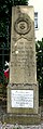
War memorial from 1884

All-day school on Knappenroth
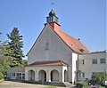
Church and monastery of St. Anthony

St. Paul Church

Evangelical Community Center Knappenroth
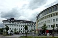
Caritasklinik St. Theresia (formerly "Rastpfuhl Hospital")

Caritasklinik (detail with dates)

Headquarters of Caritas Trägergesellschaft Saarbrücken mbH (Rhönstr.)

"Rastpfuhl-Carrée" (local supply center)


Web links
literature
- Commemorative publication from 1986 for the 50th anniversary of the Saarbrücken-Rastpfuhl e. V.
- The Rastpfuhl - history of a settlement area and its inhabitants. Publisher: Deutscher Siedlerbund Landesverband Saarland e. V., Siedlergemeinschaft Saarbrücken-Rastpfuhl e. V., Volkshochschule Stadtverband Saarbrücken. November 1999.
swell
- ↑ Braun, Edith u. Mangold, Max: Saarbrücker Dictionary. Saarbrücker Druckerei und Verlag, 1984, ISBN 3-921646-70-7 , p. 299.
- ↑ Statistical information on the homepage of the city of Saarbrücken
- ^ Albert Ruppersberg : History of the former county of Saarbrücken, history of the cities of Saarbrücken and St. Johann 1815–1909, the city of Malstatt-Burbach and the unified city of Saarbrücken until 1914, Volume III, Part 2, 2nd edition from 1914, Saarbrücken 1914, pp. 192-194.
- ↑ Numbers, data and facts. State capital Saarbrücken. State capital Saarbrücken, accessed on February 13, 2018 .
- ↑ St. Antonius, Catholic parish Saarbrücken-Rastpfuhl, 1937–1987, Rhenania Franciscana, family sheet of the Cologne Franciscan Province of the Three Kings, Supplement 6, ed. v. Otho Gimmnich (OFM) and Bernward Kliewer (OFM), Saarbrücken 1987.
- ↑ http://www.stjosef-saarbruecken.de/index.php?id=123
- ↑ http://www.stjosef-saarbruecken.de/index.php?id=124 , accessed on August 31, 2014.
- ↑ http://www.evangelischmalstatt.de/evangelisches_gemeindezentrum_knappenroth , accessed on September 2, 2014.
- ^ Schwingel, Karl: Title: Saarbrücken 1909 - 1959. Saarbrücken - 50 years of the city. Edited by Cultural Department of the City of Saarbrücken. Self-published by the city of Saarbrücken, 1959
- ↑ "Living with the poison in the ground". Saarbrücker Zeitung, 3./4. February 2007; S. C1
- ↑ "An Odyssey through the Instances". Die Welt, December 20, 2006. https://www.welt.de/print-welt/article703195/Odyssee-durch-die-Instanzen.html
- ↑ Development plan no. 126.13.00 "Im Knappenroth" of the city of Saarbrücken, online on their website (accessed on October 19, 2015)
- ↑ "City: Tar smell Im Knappenroth is harmless"; in: Life in Saarbrücken from the Saarbrücker Zeitung from December 23, 2013, online ( Memento of the original from December 28, 2015 in the Internet Archive ) Info: The archive link was inserted automatically and has not yet been checked. Please check the original and archive link according to the instructions and then remove this notice. (Accessed December 28, 2015)
- ↑ Ruth, Karl Heinz: Pits of the Royal Mining Inspection III, Von der Heydt. Tunnels and shafts in coal mining on the Saar (3). Supplement to the magazine "Saarberg" 1987, pp. 31–54 - Saarbrücken.
- ↑ Walter Schmeer: Fritz Zolnhofer, in: Saarheimat 9th year (1965), pp. 145–149.
- ↑ Saarbrücker Zeitung of August 19, 2015, page B5
- ↑ Chladni, EFF: "About a strange meteoric phenomenon, on April 1, 1826, not far from Saarbrücken" . Annalen der Physik, vol. 83 (year 1826), piece 3 / IX; P. 373ff. Website of the Thuringian University and State Library Jena. Retrieved December 1, 2013.
- ^ Saarbrücker Zeitung of April 16, 2004 and April 16, 1954.

1 Middle : Alt-Saarbrücken , Malstatt (with Rastpfuhl , Rußhütte and Rodenhof ), St. Johann (with Rabbit Mountain , Nauwieser Viertel and Rotenbühl ), Eschberg , Sankt Arnual (with Winterberg )
2 West : Gersweiler , Klarenthal , Altenkessel and Burbach (with Von der Heydt )
3 Dudweiler : Dudweiler , Jägersfreude , Herrensohr , Scheidt
4 Halberg : Schafbrücke , Bischmisheim , Ensheim , Brebach-Fechingen (with Neufechingen ), Eschringen , Güdingen , Bübingen
Coordinates: 49 ° 15 ′ 2 " N , 6 ° 57 ′ 48" E