Rombach (Liederbach)
|
Rombach Billbach |
||
|
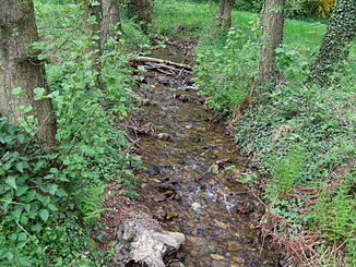
Shortly before the confluence with the Reichenbach |
||
| Data | ||
| Water code | DE : 24922 | |
| location | Germany | |
| River system | Rhine | |
| Drain over | Liederbach → Main → Rhine → North Sea | |
| source | in the Taunus , north of Königstein 50 ° 12 ′ 38 ″ N , 8 ° 26 ′ 7 ″ E |
|
| Source height | approx. 610 m above sea level NN | |
| confluence | near Königstein with the Reichenbach to the Liederbach Coordinates: 50 ° 10 '57 " N , 8 ° 27' 17" E 50 ° 10 '57 " N , 8 ° 27' 17" E |
|
| Mouth height | approx. 320 m above sea level NN | |
| Height difference | approx. 290 m | |
| Bottom slope | approx. 69 ‰ | |
| length | 4.2 km | |
| Catchment area | 4.433 km² | |
| Drain |
MQ |
44.5 l / s |
The Rombach is the 4 km long right source stream of the Liederbach .
Surname
The name part 'Rom' comes from Middle High German rone , ron Baumstumpf, Klotz.
course
The headwaters of the Rombach are located in the Taunus on the slope of the Romberg in the Oberen Ödung , a coniferous forest area north of Königstein , near the confluence of the Taunus-Hochstraße and Limburger Straße ( B 8 ).
Near the source of the Rombach, the Silberbach rises in the west and its tributary is the Kalbshecker Bach , the Emsbach in the north and the Reichenbach in the east.
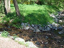
After crossing under the B 8, it flows through a deeply cut valley south of the donkey tail through the Untere Ödung . The Schmittröder Wiesen nature reserve is on the left . The tree population alternates between conifers and old beech and oak trees . At the Naturfreundehaus Königstein, the Rombach changes direction and now flows in a south-easterly direction past a drinking water protection zone south of it . The Rombach divides there. The southern part, also known as the Billbach natural stream, flows south in the valley. The northern part flows through a series of small fish ponds as a slope channel, possibly already created by the Romans. At the Billtalhöhe , it falls back into the valley in the (often dry) Billtal waterfall , a 50 m high waterfall with sliding steps. The main drop step is 9 m high. Shortly before the Billtal waterworks pumping station , the two streams come together again.
There is also the so-called Stoltze-Plätzi , a former residence of the poet Friedrich Stoltze with a memorial stone. The path of the Rombach leads west past the 540 m high Romberg and the Ölmühlquelle (Nepomuk spring). From there the narrow Rombachtal widens, and at the valley floor the forest gives way to a meadow landscape. Flowing south through the Billtal, the Rombach reaches the urban area of Königstein after crossing under the Ölmühlenweg . It flows east past the Bangert , and then joins the Reichenbach to the Liederbach north of the steel source .
- The waterfall then and now
geology
The lower Rombachtal is characterized by the remains of old river terraces . The subsoil consists mostly of phyllite on which Ranker and Ranker brown earths (e.g. near Romberg) have formed. In the case of aeolian sediment layers ( loess , Laacher Bimstuff ), brown soils formed, as did the alternating layers of clay , sand and gravel on the valley floor. In the meadow areas of Rombaches also come Nassgleye ago.
nature and environment
Water quality
The Rombach is characterized by its high water quality . At its upper reaches it has the water quality I / I-II and at the mouth of the grade II. His water structure is hydromorphologically -strukturell in good condition. In large areas it is still largely left in its natural state.
fauna
The Rombachtal is a species-rich biotope . There are various (partly also rare) butterflies , grasshoppers , amphibians , reptiles , birds and bats :
insects
- Butterflies : Golden Eight , Dark Blue Ants , Light Blue Ants and Elm Hairstreak
- Locusts : heather grasshopper
Amphibian
- Tail amphibians : fire salamander , mountain newt , pond newt and thread newt
- Frogs : common toad and common frog
Reptiles
- Sand lizard , forest lizard , slow worm and grass snake
Birds
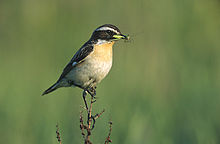
- Songbirds : Whinchat , Redstart , Skylark , Corn Bunting , dippers , Whitethroat , red-backed shrike and Tree Sparrow
- Woodpeckers : gray woodpecker , green woodpecker , middle woodpecker , small woodpecker and black woodpecker
- Owls : Owl and Tengmalm
- Birds of prey : red kite and tree falcon
- other birds: woodcock and kingfisher
Mammals
- Bats : Bechstein's bat , greater mouse-eared , Natterer's bat , brown long-eared , Gray long-eared , Noctule , pipistrelle and Daubenton's bat
- other small mammals : water shrew , field shrew , squirrel and brown hare
freetime and recreation
The Rombachtal is easily accessible by bike and hiking trails. The Romberg , the Bangert and the narrow valley on the upper reaches of the Rombach are ideal destinations for excursions .
Individual evidence
- ↑ Topographic map 1: 25,000 and Google Earth
- ↑ Topographic map 1: 25,000
- ↑ a b c Water map service of the Hessian Ministry for the Environment, Climate Protection, Agriculture and Consumer Protection ( information )
- ↑ see The names of the waters of the Main-Taunus area by Marieluise Petran-Belschner
- ↑ Schmittröder meadows and adjoining areas ( Memento of the original from January 14, 2016 in the Internet Archive ) Info: The archive link was automatically inserted and not yet checked. Please check the original and archive link according to the instructions and then remove this notice.
- ↑ Naturfreundehaus Billtalhoehe ( Memento of the original from August 22, 2013 in the Internet Archive ) Info: The archive link has been inserted automatically and has not yet been checked. Please check the original and archive link according to the instructions and then remove this notice.
- ↑ Billtal-Wasserwerk ( Memento from February 7, 2012 in the Internet Archive ) from denkmal-koenigstein.de
- ↑ Stoltze-Plaetzi.jpg
- ^ Romberg ( Memento of February 17, 2009 in the Internet Archive ) from denkmal-koenigstein.de
- ↑ a b c New construction of the B 8 bypass Königstein and Kelkheim (PDF; 1.6 MB) Explanatory report on the regional planning procedure, February 2006
Web links
- Rombachtal and on the Bangert near Königstein
- Schmittröder meadows and adjacent areas
- Romberg ( Memento from February 17, 2009 in the Internet Archive ) from denkmal-koenigstein.de
- Lohbach ( Memento from June 6, 2012 in the Internet Archive ) from denkmal-koenigstein.de


