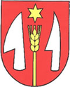
Sľažany
| Sľažany | ||
|---|---|---|
| coat of arms | map | |

|
|
|
| Basic data | ||
| State : | Slovakia | |
| Kraj : | Nitriansky kraj | |
| Okres : | Zlaté Moravce | |
| Region : | Nitra | |
| Area : | 16.274 km² | |
| Residents : | 1,685 (Dec 31, 2019) | |
| Population density : | 104 inhabitants per km² | |
| Height : | 200 m nm | |
| Postal code : | 951 71 | |
| Telephone code : | 0 45 | |
| Geographic location : | 48 ° 23 ' N , 18 ° 20' E | |
| License plate : | ZM | |
| Kód obce : | 500747 | |
| structure | ||
| Community type : | local community | |
| Structure of the municipality: | 2 parts of the community | |
| Administration (as of November 2018) | ||
| Mayor : | Jozef Magát | |
| Address: | Obecný úrad Sľažany Dlhá 90 951 71 Sľažany |
|
| Website: | obec-slazany.szm.com | |
| Statistics information on statistics.sk | ||
Sľažany (German Slasan , Hungarian Szelezsény ) is a municipality in the west of Slovakia , with a population of 1,685 (December 31, 2019) that the circle Okres Zlaté Moravce and District Nitriansky kraj belongs.
geography
The municipality is located in the northern part of the hilly Žitavská pahorkatina (part of the Slovak Danube lowlands ) in the valley of the Čerešňový potok . The Tribeč Mountains rise north of the village . The town center is at an altitude of 200 m nm and is five kilometers west of Zlaté Moravce .
history
Today's community was created in 1960 through the merger of the previously independent villages Dolné Sľažany (formerly "Veľké Sľažany;" German Großslasan , Hungarian Alsószelezsény ) and Horné Sľažany (formerly "Malé Sľažany"; German Kleinslasan , Hungarian Felsőszelezsény ).
Sľažany was first mentioned in writing in 1156 as Scelemsam .
population
Results after the 2001 census (1696 inhabitants):
|
By ethnicity:
|
By religion:
|
Buildings
- Church of the Most Holy Trinity in late Baroque style from 1776
- Renaissance-baroque country castle from 1691
