Topoľčianky
| Topoľčianky | ||
|---|---|---|
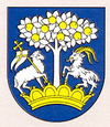
| coat of arms | map | |

|
|
|
| Basic data | ||
| State : | Slovakia | |
| Kraj : | Nitriansky kraj | |
| Okres : | Zlaté Moravce | |
| Region : | Nitra | |
| Area : | 26.217 km² | |
| Residents : | 2,642 (Dec. 31, 2019) | |
| Population density : | 101 inhabitants per km² | |
| Height : | 220 m nm | |
| Postal code : | 951 93 | |
| Telephone code : | 0 37 | |
| Geographic location : | 48 ° 25 ′ N , 18 ° 25 ′ E | |
| License plate : | ZM | |
| Kód obce : | 500828 | |
| structure | ||
| Community type : | local community | |
| Administration (as of November 2018) | ||
| Mayor : | Juraj Mesko | |
| Address: | Obecný úrad Topoľčianky Hlavná 114 95193 Topoľčianky |
|
| Website: | www.topolcianky.sk | |
| Statistics information on statistics.sk | ||
Topoľčianky (until 1927 in Slovak “Malé Topolčany” or “Topolčianky”; German Kleintopoltschan , Hungarian Kistapolcsány - until 1882 Kistapolcsán ) is a municipality in western Slovakia .
geography
It is located in the Danube hill country at the foot of the Tribeč and Pohronský-Inovec Mountains , about five kilometers north of Zlaté Moravce and about 32 kilometers northeast of Nitra .
history
The place was first mentioned in writing in 1293. From 1614 to 1708 it was the seat of Persch County . In the interwar period Topoľčianky was the summer residence of Czechoslovak President Tomáš Garrigue Masaryk .
Today, it is for the castle Topoľčianky , for the "national stud farm ," his Lipizzaner - and Huzule Horse Owning and for the breeding of bison known.
Culture
See also: List of listed objects in Topoľčianky
Sons and daughters
- Jozef Zlatňanský (1927–2017), Roman Catholic clergyman, Curia Bishop
Web links
Commons : Topoľčianky - collection of images, videos and audio files

