
Sonterswil
| Sonterswil | ||
|---|---|---|
 |
||
| State : |
|
|
| Canton : |
|
|
| District : | Kreuzlingen | |
| Political community : | Waldi | |
| Postal code : | 8564 | |
| former BFS no. : | 4703 | |
| Coordinates : | 723 336 / 275915 | |
| Height : | 530 m above sea level M. | |
| Area : | 3.23 km² | |
| Residents: | 131 (December 31, 2018) | |
| Population density : | 41 inhabitants per km² | |
 Sonterswil with the agricultural consumer cooperative |
||
| map | ||
|
||

Sonterswil is a village in the municipality of Wäldi in the Kreuzlingen district of the canton of Thurgau in Switzerland .
From 1803 to 1994 Sonterswil was a municipality of the former municipality of Wäldi. On January 1, 1995 , the local parishes of Sonterswil, Engwilen , Lipperswil and Wäldi merged to form the political municipality of Wäldi.
geography
The village lies on a terrace on the ridge between Müllheim and Tägerwilen . The hamlets of Gunterswilen (formerly Gunterswil) and Hohenrain (or Hohrain, from 1812) as well as Sonterswil belonged to the local community of Sonterswil.
history
Ceramics from the Bronze and Hallstatt Ages were found in Hohenrain .
→ see also section Prehistoric Settlement Hohenrain in the article Wäldi
Sonterswil was first mentioned in a document in 1296 as Sundratswile . The Bishop of Constance sold a farm in Sonterswil to the Feldbach monastery in 1296. From 1460 to 1798 Sonterswil was subject to the Thurgau governor as a so-called High Court .
Until 1859, the reformed Sonterswil was part of the church after Wigoltingen , since then it has belonged to the parish of Lipperswil. Gunterswilen and Hohrain moved from the parish of Ermatingen to that of Wäldi in 1949 . From 1801 to 2004 Sonterswil owned a school which it shared with Hefenhausen from 1845 and with Engwilen from 1853. Sonterswil has been part of the Wigoltingen primary school community since 2005 .
Arable farming in the three-row system lasted until the 19th century, while fruit and meadow cultivation and dairy farming were also carried out. Around 1835, the Ebinger brothers' embroidery department in Sonterswil had ten employees.
coat of arms

The coat of arms shows the lions of the Feldbach monastery and the Landvogtei Thurgau and bears the colors of the Bishop of Constance .
population
| year | 1850 | 1900 | 1950 | 1990 | 2010 | 2018 |
| Local parish | 233 | 182 | 207 | 171 | ||
| Locality | 115 | 131 | ||||
| source | ||||||
Of the total of 131 inhabitants in Sonterswil in 2018, 28 or 21.4% were foreign nationals. 56 (42.7%) were Protestant Reformed and 33 (25.2%) were Roman Catholic.
Attractions

From 1829 to 1855 there was an observation tower near Hohenrain, the construction of which is said to have been initiated by Louis Napoleon . The 40 meter high Napoleon Tower has stood in almost the same place since 2017 .
photos
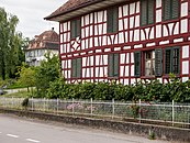
Schulstrasse, left the «Schlössli»
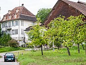
«Schlössli», Höhenweg 10

Farmhouse Gunterswilerstrasse 1


Web links
Individual evidence
- ↑ Swiss land use statistics. Completed on July 1, 1912. Published by the Federal Statistical Bureau. ( Memento from April 12, 2016 in the Internet Archive )
- ↑ a b c d Localities and their resident population. Edition 2019 . On the website of the Statistical Office of the Canton of Thurgau (Excel table; 0.1 MB), accessed on April 28, 2020.
- ↑ a b National map of Switzerland 1: 25,000, sheet number 1053, 1978 (online)
-
↑ a b c d e
Erich Trösch: Sonterswil. In: Historical Lexicon of Switzerland .
These sections are largely based on the entry in the Historical Lexicon of Switzerland (HLS), which, according to the HLS's usage information, is under the Creative Commons license - Attribution - Share under the same conditions 4.0 International (CC BY-SA 4.0). - ↑ History & Coat of Arms. On the website of the municipality of Wäldi, accessed on February 1, 2020
- ↑ Locations and Settlements Directory. Canton of Thurgau, 2012 edition. On the website of the Statistical Office of the Canton of Thurgau (PDF; 3.4 MB), accessed on May 11, 2020.
Remarks
- ↑ with outside courtyards
Altnau | Bottigh furnace | Ermatingen | Love God | Güttingen | Kemmental | Kreuzlingen | Langrickenbach | Lengwil | Münsterlingen | Raperswilen | Salenstein | Tägerwilen | Waldi
Former parishes: Alterswilen | Altishausen | Dippishausen-Oftershausen | Dot night | Dünnershaus | Egelshofen | Ellighausen | Emmishofen | Engwilen | Fruthwilen | Hattenhausen-Hefenhausen | Manor | Hugelshofen | Illighausen | Kurzrickenbach | Land battle | Lipperswil | Lippoldswilen | Mannenbach | Neuwilen | Oberhofen near Kreuzlingen | Joking | Schönenbaumgarten | Siegershausen | Sonterswil | Triboltingen | Zuben
Canton of Thurgau | Districts of the Canton of Thurgau | Municipalities of the Canton of Thurgau