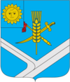
Stara Synjawa
| Stara Synjawa | ||
| Стара Синява | ||

|
|
|
| Basic data | ||
|---|---|---|
| Oblast : | Khmelnytskyi Oblast | |
| Rajon : | Stara Synjawa district | |
| Height : | no information | |
| Area : | 13.75 km² | |
| Residents : | 5,581 (2014) | |
| Population density : | 406 inhabitants per km² | |
| Postcodes : | 31400 | |
| Area code : | +380 3850 | |
| Geographic location : | 49 ° 36 ' N , 27 ° 37' E | |
| KOATUU : | 6824455100 | |
| Administrative structure : | 1 urban-type settlement | |
| Mayor : | Mykola Mykolaiowytsch Mowchan | |
| Address: | вул. І.Франка 8 31400 смт Стара Синява |
|
| Statistical information | ||
|
|
||
Stara Synjawa (Ukrainian Стара Синява ; Russian Старая Синява / Staraja Sinjawa ; Polish Sieniawa Stara ) is an urban-type settlement in the east of the Ukrainian Oblast Khmelnyzkyj and the administrative center of the raion of the same name with around 5,500 inhabitants (2014).
Stara Synjawa is located on the Ikwa ( Іква ), a 56 km long tributary of the southern bow . The village is located 65 km northeast of the Oblast capital Khmelnytskyi .
The village, founded in the first half of the 16th century, was granted city rights in 1543. In 1956, the village received urban-type settlement status.
Rajon
The Stara Synjawa district, the administrative center of which is the locality, is located in the east of the oblast. It has an area of 662 km² and a population of about 21,000 inhabitants. The population density is 32 inhabitants per km².
Web links
- Site about the village (Ukrainian)
- Sieniawa Stara . In: Filip Sulimierski, Władysław Walewski (eds.): Słownik geograficzny Królestwa Polskiego i innych krajów słowiańskich . tape 10 : Rukszenice – Sochaczew . Walewskiego, Warsaw 1889, p. 558 (Polish, edu.pl ).
Individual evidence
- ↑ Cities in Ukraine at pop-stat.mashke.org, last accessed on October 3, 2014

