Chemerivtsi
| Chemerivtsi | ||
| Чемерівці | ||

|
|
|
| Basic data | ||
|---|---|---|
| Oblast : | Khmelnytskyi Oblast | |
| Rajon : | Chemerivtsi Raion | |
| Height : | 278 m | |
| Area : | 5.61 km² | |
| Residents : | 5,314 (2014) | |
| Population density : | 947 inhabitants per km² | |
| Postcodes : | 31600 | |
| Area code : | +380 3859 | |
| Geographic location : | 49 ° 1 ' N , 26 ° 21' E | |
| KOATUU : | 6825255100 | |
| Administrative structure : | 1 urban-type settlement | |
| Mayor : | Serhiy Yaroslavovych Mutka | |
| Address: | вул. Центральна 40 31600 смт Чемерівці |
|
| Website : | http://chemsilrada.ucoz.ua/ | |
| Statistical information | ||
|
|
||
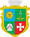
Tschemeriwzi ( Ukrainian Чемерівці ; Russian Чемеровцы Tschemerowzy , Polish Czemerowce ) is an urban-type settlement in the Ukrainian Oblast of Khmelnitskyi and the administrative center of the raion of the same name with about 5,300 inhabitants (2014).
Chemerivzi lies on the Schwantschyk , a 107 km long tributary of the Dniester 82 km southwest of the Oblast capital Khmelnyzkyj .
The town, first mentioned in 1518, received town charter in 1797 and urban-type settlement status in 1959.
Rajon
The Chemerivtsi Raion, the administrative center of which is the village, is located in the southwest of the oblast. It has an area of 928 km² and a population of about 42,000 inhabitants. The population density is 46 inhabitants per km².
Web links
- Czemerowce . In: Filip Sulimierski, Władysław Walewski (eds.): Słownik geograficzny Królestwa Polskiego i innych krajów słowiańskich . tape 1 : Aa-Dereneczna . Sulimierskiego and Walewskiego, Warsaw 1880, p. 792 (Polish, edu.pl ).
Individual evidence
- ↑ Cities in Ukraine at pop-stat.mashke.org, last accessed on October 3, 2014


