Tōkai (Aichi)
| Tōkai-shi 東海 市 |
||
|---|---|---|
| Geographical location in Japan | ||
|
|
||
| Region : | Chūbu | |
| Prefecture : | Aichi | |
| Coordinates : | 35 ° 1 ' N , 136 ° 54' E | |
| Basic data | ||
| Surface: | 43.36 km² | |
| Residents : | 113,678 (June 1, 2019) |
|
| Population density : | 2622 inhabitants per km² | |
| Community key : | 23222-0 | |
| Symbols | ||
| Flag / coat of arms: | ||
| Tree : | Camphor tree | |
| Flower : | Rhododendron indicum | |
| Color : | green | |
| town hall | ||
| Address : |
Tōkai City Hall 1 - 1 Chūō-machi Tōkai -shi Aichi 476-8601 |
|
| Website URL: | www.city.tokai.aichi.jp | |
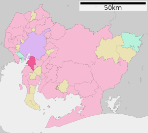
| Location Tōkais in Aichi Prefecture | ||
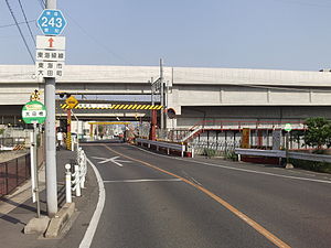
Tōkai ( Japanese 東海 市 , -shi ) is a city in Aichi Prefecture in Japan . It is located south of Nagoya on the Chita Peninsula.
geography
Tōkai is located south of Nagoya on Ise Bay .
history
Tōkai was created on April 1, 1969 from the merger of the two communities Ueno ( 上 野 町 , -chō ) and Yokosuka ( 横須賀 町 , -chō ) of the district of Chita . The main inner belt asteroid (2478) Tokai was named after the city.
traffic
- Train:
- Nagoya Railway Tokoname Line
- Nagoya Railway Kōwa Line
- Street:
- National road 155,247,302
sons and daughters of the town
- Yutaka Banno (* 1961), politician
- Yūya Miura (* 1989), football player
Neighboring cities and communities
Web links
Commons : Tōkai - collection of images, videos and audio files
Individual evidence
- ^ Lutz D. Schmadel : Dictionary of Minor Planet Names . Fifth Revised and Enlarged Edition. Ed .: Lutz D. Schmadel. 5th edition. Springer Verlag , Berlin , Heidelberg 2003, ISBN 978-3-540-29925-7 , pp. 186 (English, 992 pp., Link.springer.com [ONLINE; accessed on August 14, 2019] Original title: Dictionary of Minor Planet Names . First edition: Springer Verlag, Berlin, Heidelberg 1992): “11981 JC. Discovered 1981 May 4 by T. Furuta at Tokai. "


