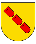
Rueyres-Treyfayes
| Rueyres-Treyfayes | ||
|---|---|---|
| State : |
|
|
| Canton : |
|
|
| District : | Gruyère | |
| Municipality : | Sâles | |
| Postal code : | 1626 | |
| former BFS no. : | XXXX | |
| Coordinates : | 563 869 / 166 638 | |
| Height : | 842 m above sea level M. | |
| Residents: | 128 (2002) | |
| map | ||
|
|
||
Rueyres-Treyfayes ( Freiburg Patois ) is a village and formerly independent municipality in the district Greyerz the canton of Friborg in Switzerland . On January 1, 2001, Rueyres-Treyfayes was incorporated into Sâles .
geography
Rueyres-Treyfayes is 842 m above sea level. M. , eight and a half kilometers west-northwest of the district capital Bulle ( linear distance ). The farming village extends on the gently sloping south-west slope of the range of hills of Mont Gibloux , in a panoramic position above the valley of the Neirigue and the Molasse plateau of the south-west Freiburg Central Plateau . The former municipality area was around 2.6 km². The area reached from the valley low of the Neirigue northwards over the slope of Rueyres to the forest height of Les Verraux ( 976 m above sea level ).
population
With 128 inhabitants (2002), Rueyres-Treyfayes was one of the smallest municipalities in the canton of Friborg before the merger with Sâles. The community consisted of the village of Rueyres ( 842 m above sea level ) and the hamlet of Treyfayes ( 851 m above sea level ).
economy
Rueyres-Treyfayes is still today a predominantly agricultural village. The livestock and dairy industry have an important role in the employment structure of the population. In the last few decades the village has also developed into a residential community. Some workers are therefore commuters who work in the Bulle region and in Romont .
traffic
The village is very well developed in terms of traffic, although it is away from the major thoroughfares. The next connection to the A12 motorway , which has been open continuously from Bern to Vevey since 1981 , is around five kilometers from the town center. On July 1, 1868, the railway line from Romont to Bulle was inaugurated with a station in Rueyres-Treyfayes.
history
The first written mention of the place took place in 1316 under the name Ruery Treiffay . The place name Rueyres is derived from the Latin word roboretum (oak grove). Treiffay means three beeches . In the Middle Ages , Rueyres-Treyfayes formed its own small lordship, which in the 15th century came into the possession of the Esseiva family, originally from Maules , and later to the Gottrau family.
In 1536 the village came under the rule of Friborg and was assigned to the Bailiwick of Romont . After the collapse of the Ancien Régime (1798), Rueyres-Treyfayes belonged to the then Bulle district during the Helvetic and the subsequent period until 1848, before it was incorporated into the Gruyères district. With effect from January 1, 2001, the previously independent municipalities of Rueyres-Treyfayes, Maules and Romanens were incorporated into Sâles.
Attractions
Ecclesiastically, Rueyres-Treyfayes belonged to the parish Vuisternens-devant-Romont until 1663, and since then to the parish of Sâles. The Saint-Félix chapel, built shortly after 1600, is located in Rueyres.
Web links
- Marianne Rolle: Rueyres-Treyfayes. In: Historical Lexicon of Switzerland .


