Ohníč
| Ohníč | ||||
|---|---|---|---|---|
|
||||
| Basic data | ||||
| State : |
|
|||
| Region : | Ústecký kraj | |||
| District : | Teplice | |||
| Area : | 707.7543 ha | |||
| Geographic location : | 50 ° 35 ' N , 13 ° 51' E | |||
| Height: | 195 m nm | |||
| Residents : | 733 (Jan. 1, 2019) | |||
| Postal code : | 417 65 | |||
| License plate : | U | |||
| traffic | ||||
| Street: | Hostomice - Žalany | |||
| Railway connection: | Trmice – Bílina | |||
| structure | ||||
| Status: | local community | |||
| Districts: | 5 | |||
| administration | ||||
| Mayor : | Lenka Brandtnerová (as of 2018) | |||
| Address: | Ohníč 30 417 65 Ohníč |
|||
| Municipality number: | 567761 | |||
| Website : | www.ohnic.cz | |||
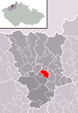
| Location of Ohníč in the Teplice district | ||||

|
||||
Ohníč ([ ˈɔɦɲiːt͡ʃ ]) (German Wohontsch ) is a municipality in the Czech Republic . It is located six kilometers south of the city center of Teplice and belongs to the Okres Teplice .
geography
Geographical location
Ohníč is located on the right bank of the Bílina in its breakthrough valley through the northwestern foothills of the Bohemian Central Uplands . The Pohradická hora (419 m) rises to the south . The Ústí nad Labem – Úpořiny – Bílina railway runs along the left bank of the river .
Community structure
The community Ohníč consists of the districts Dolánky ( Dollanken ), Křemýž ( Kremusch ), Němečky ( Nemetschken ), Ohníč ( Wohontsch ) and Pňovičky ( Kniebitschken ). Basic settlement units are Dolánky, Křemýž, Ohníč I, Ohníč II and Pňovičky. The municipality is divided into the cadastral districts of Křemýž and Ohníč.
Neighboring communities
Neighboring towns are Pytlíkov, Dolánky and Hradiště in the northeast, Bžany in the east, Mošnov, Lhenice and Kostomlaty pod Milešovkou in the southeast, Úpoř and Štrbice in the south, Světec in the southwest, Hostomice in the west and Křemýž in the northwest.
history
Ohníč was first mentioned in a document in 1404.
After the abolition of patrimonial Ohníč formed from 1850 a district of the municipality Křemýž / Krzemusch in the Teplice district. At the end of the 19th century it was assigned to the Duchcov district . After the Munich Agreement , the village was added to the German Reich as part of Kremusch and belonged to the Bilin district from 1939 to 1945 . After the end of the Second World War, the place came back to Czechoslovakia and was part of the Křemýž part of the Okres Bílina. In the course of the territorial reform of 1960, the municipality Ohníč was created on January 1, 1961 and was assigned to the Okres Teplice.
Culture and sights
- Křemýž Castle , built in 1669, was given its current appearance in the years 1880–1805 as part of a renovation for Klement August Ledebur-Wicheln
- Tuchlov Castle, the empire-style hunting lodge, was built by August von Ledebur-Wicheln in 1821
- Church of St. Peter and Paul in Křemýž, built in 1706
Web links
Individual evidence
- ↑ http://www.uir.cz/obec/567761/Ohnic
- ↑ Český statistický úřad - The population of the Czech municipalities as of January 1, 2019 (PDF; 7.4 MiB)
- ↑ http://www.uir.cz/casti-obce-obec/567761/Obec-Ohnic
- ↑ http://www.uir.cz/zsj-obec/567761/Obec-Ohnic
- ↑ http://www.uir.cz/katastralni-uzemi-obec/567761/Obec-Ohnic


