Zádub-Závišín
| Zádub-Závišín | ||||
|---|---|---|---|---|
|
||||
| Basic data | ||||
| State : |
|
|||
| Region : | Karlovarský kraj | |||
| District : | Cheb | |||
| Area : | 632.1054 ha | |||
| Geographic location : | 49 ° 58 ' N , 12 ° 45' E | |||
| Height: | 760 m nm | |||
| Residents : | 338 (Jan 1, 2019) | |||
| Postal code : | 353 01 - 354 84 | |||
| License plate : | K (old CH) | |||
| structure | ||||
| Status: | local community | |||
| Districts: | 3 | |||
| administration | ||||
| Mayor : | Jitka Otradovcová (as of 2018) | |||
| Address: | Zádub 92 353 01 Mariánské Lázně 1 |
|||
| Municipality number: | 539431 | |||
| Website : | www.zadubzavisin.cz/clanky/oznameni/ | |||
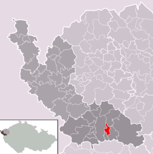
| Location of Zádub-Závišín in the Cheb district | ||||

|
||||
Zádub-Závišín (German Hohendorf-Abaschin ) is a municipality in Okres Cheb , Czech Republic .
geography
Community structure
The community Zádub-Závišín consists of the districts and cadastral districts Milhostov ( garbage jam or Millestau ), Zádub ( Hohendorf ) and Závišín ( Abaschin ).
history
From 1850 Hohendorf and Abashin belonged to the judicial district of Tepl and were added to the judicial district of Marienbad in 1888 .
Culture and sights
Green spaces and recreation
- Hot springs nature reserve (přírodní rezervace Prameniště Teplé)
literature
- Hohendorf near Marienbad. A place in the Tepler highlands. Marienbader Schriften Nr. 11, 1989. Publisher: Marienbader Heimatverband Stadt und Land e. V. With contributions by Josef Fischer, Karl Wach, Alois Eckert and Michel Fischer.
Individual evidence
- ↑ http://www.uir.cz/obec/539431/Zadub-Zavisin
- ↑ Český statistický úřad - The population of the Czech municipalities as of January 1, 2019 (PDF; 7.4 MiB)
- ↑ http://www.uir.cz/zsj-obec/539431/Obec-Zadub-Zavisin
- ↑ http://www.uir.cz/katastralni-uzemi-obec/539431/Obec-Zadub-Zavisin
Web links
Commons : Zádub-Závišín - collection of pictures, videos and audio files


