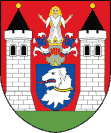
Dolní Žandov
| Dolní Žandov | ||||
|---|---|---|---|---|
|
||||
| Basic data | ||||
| State : |
|
|||
| Region : | Karlovarský kraj | |||
| District : | Cheb | |||
| Area : | 4,133.4611 ha | |||
| Geographic location : | 50 ° 1 ' N , 12 ° 33' E | |||
| Height: | 540 m nm | |||
| Residents : | 1,240 (Jan 1, 2019) | |||
| Postal code : | 354 93 | |||
| License plate : | K (old CH) | |||
| traffic | ||||
| Railway connection: | Plzeň – Cheb | |||
| structure | ||||
| Status: | local community | |||
| Districts: | 5 | |||
| administration | ||||
| Mayor : | Ing.Eliška Stránská (status: 2018) | |||
| Address: | Dolní Žandov 36 350 02 Cheb 2 |
|||
| Municipality number: | 554502 | |||
| Website : | www.dolnizandov.cz | |||
| Location of Dolní Žandov in the Cheb district | ||||

|
||||
Dolní Žandov (German Unter Sandau , formerly also Sandau, Sanda, Sandawa, Zandow, Zanda and Zandaw ) is a municipality in the Czech Republic.
Community structure
The municipality Dolní Žandov consists of the districts Dolní Žandov ( Untersandau ), Horní Žandov ( Obersandau ), Podlesí ( Markusgrün ), Salajna ( Konradsgrün ) and Úbočí ( Amonsgrün ). Basic settlement units are Brtná ( Zeidlweid ), Dolní Žandov, Dolní Žandov-u nádraží, Horní Žandov, Podlesí, Salajna and Úbočí.
The municipality is divided into the cadastral districts of Brtná u Dolního Žandova, Dolní Žandov, Horní Žandov, Podlesí u Dolního Žandova, Salajna and Úbočí u Dolního Žandova. Until 1946 Obersandau, which is now called Horni Zandov, was an elongated farming village, through which the Tillenbach flowed in its entire extent. The Eger-Pilsen railway separated the village into the lower and upper village, which was followed by the Ödhäuser district. In Obersandau there were only free-standing farms and houses.
history
The first settlement was by the Celts . The place was founded by German-speaking colonists before the 12th century.
1197 gave Heinrich Břetislav III. the village to the newly founded monastery Teplá . Later, on the hill next to the village, the fortified church of St. Michael was built. In 1347, during the wars between Charles IV and Ludwig the Bavarian , the village was destroyed. In 1374, Charles IV. Boreš von Ossegg gave permission to tear down the ruins and found a new town. In 1464 the place got permission to brew beer.
In 1799 Johann Geiger founded the factory for the production of the then famous paper cans and tobacco boxes "Sander". From the middle of the 19th century, the village formed a municipality in the judicial district of Bad Königswart .
After the Munich Agreement , the place was added to the German Reich and until 1945 belonged to the district of Marienbad in the Reichsgau Sudetenland , administrative district of Eger .
Incorporations
On April 1, 1942, the town of Unter Sandau was merged with the neighboring communities of Ober Sandau and Zeidlweid to form the new community of Sandau (near Marienbad) .
Population development
Until 1945 Unter Sandau was predominantly populated by German Bohemia , which were expelled.
| year | Residents | Remarks |
|---|---|---|
| 1847 | 1,537 | in 206 houses |
| 1900 | 1,411 | German residents |
| 1930 | 1,594 | |
| 1939 | 1,467 |
economy
The community is an agricultural village. In Dolní Žandov there is horse breeding as well as agriculture and silviculture.
Culture and sights
- Church of St. Michael - The originally Gothic church was rebuilt in 1682 in Baroque style. The main altar dates from 1697 based on the original by Q. Renni.
- A listed sculpture of St. John of Nepomuk from 1705.
- Ruins of Boršengrýn Castle from the 14th century
literature
- v. P .: Sandau and the Sandauer family . In: Communications of the Association for the History of Germans in Böhmen , Volume 12, 1873, pp. 82–83 .
- Johann Gottfried Sommer : The Kingdom of Bohemia; Represented statistically and topographically . Volume 15: Elbogner Kreis , Prague 1847, pp. 283–284 .
Web links
- Homepage of the municipality (Czech)
- Sandau
- Borschengrün ruin from 1347 (Czech)
- genealogy
Individual evidence
- ↑ http://www.uir.cz/obec/554502/Dolni-Zandov
- ↑ Český statistický úřad - The population of the Czech municipalities as of January 1, 2019 (PDF; 7.4 MiB)
- ↑ http://www.uir.cz/casti-obce-obec/554502/Obec-Dolni-Zandov
- ↑ http://www.uir.cz/zsj-obec/554502/Obec-Dolni-Zandov
- ↑ http://www.uir.cz/katastralni-uzemi-obec/554502/Obec-Dolni-Zandov
- ↑ v. P .: Sandau and the Sandauer family . In: Communications of the Association for the History of Germans in Böhmen , Volume 12, 1873, p. 82 .
- ^ Meyer's Large Conversational Lexicon . 6th edition, Volume 8, Leipzig and Vienna 1907, p. 538, item 3) .
- ^ A b Michael Rademacher: German administrative history from the unification of the empire in 1871 to the reunification in 1990. Marienbad district. (Online material for the dissertation, Osnabrück 2006).


